Announcement

Collapse
No announcement yet.

Louisiana: Assumption Parish Bayou Corne Sinkhole 2012-2015

Collapse
X
 
  • Filter
  • Time
  • Show
Clear All
new posts

  • #46
    Re: Louisiana: Assumption Parish Bayou Corne Sinkhole 2012 (Update: Crosstex to move butane)

    The sinkhole seems to be kind of quiet for the last few days. The only news I've found about it is that another bubble site appeared earlier this week, bringing the total to 13.


    *************************

    Here's a report detailing all of the actions the various departments are doing to keep on top of the situation

    Ramping up operations:


    *********************

    The companies that are reporting daily to the DNR and their current activity as of their Aug 22/23 reports. They are also doing various monitoring


    ** Acadian Gas Pipeline – Pontchartrain No 1 (La Serial No 971444)
    operating as usual

    ** Chevron Pipe Line Company
    NS1 cavern natural gas
    Aug 16 - NS1 Blocked in and isolated; blocking maintains integrity and stability
    Aug 17/19 - Preparing to begin water injection into the cavern
    Aug 22 - Within 24 hours, begin hydrotesting water supply lines that will be used for injection into the NS1 cavern.

    ** Crosstex:
    Aug 10 - Well # 1: 18,408 bbls of isobutane (moving/emptying as of Aug 10)
    Well # 2: 934,893 bbls of normal butane (continuing normal operations)
    Aug 19 - Well #1 empty, Well #2: 950,521 bbls of normal butane Movements to the well halted
    Aug 23 - well # 1 - 11,767 bbls normal butane, well # 2- 930,390 bbls normal butane... Transferring well # 2 butane to off-site customer and to well # 1.

    ** Dow:
    Aug 10- 23: continuing normal operations

    ** K/D/S Promex:
    Promix operates a total of 5 wells with 3 of the five being used on a daily basis for the storage and withdrawal of produced liquid hydrocarbon products from the fractionation of natural gas liquids. The other two are empty of hydrocarbons, but full of saturated brine water and are continuously monitored.

    Plans are to continue injection and withdrawal of products from the 3 active wells. The two inactive wells will remain out of service and full of brine for the foreseeable future

    ** Occidental Incident:
    PB Energy is the onsite Manager of the Occidental Chemical Corp Brine wells at the Napoleonville salt Dome.
    Aug 9-20: We are conducting normal operations at the Brine production facility.

    ** Texas Brine
    Surface water/salinity sampling locations


    3 maps showing locations of water samples/wells/property lines, air monitoring and the 6 trees they are monitoring in various locations around the sinkhole


    Replacing the boom that was lost with the last sinkhole expansion.

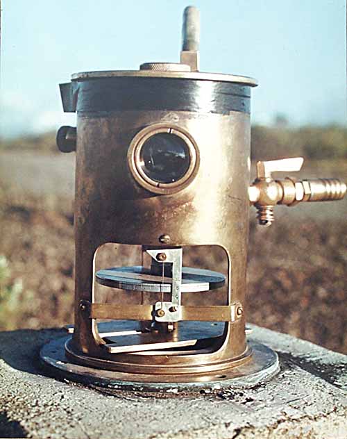
    Installing tilt meters at 4 locations: 2 on the brine tanks and 2 between the sinkhole and Bayou Corne. see map here http://dnr.louisiana.gov/assets/OC/B...P_08222012.pdf

    Wikipedia:A tiltmeter is an instrument designed to measure very small changes from the horizontal level, either on the ground or in structures. [1] A similar term, in less common usage, is the inclinometer. Tiltmeters are used extensively for monitoring volcanoes, the response of dams to filling, the small movements of potential landslides, the orientation and volume of hydraulic fractures, and the response of structures to various influences such as loading and foundation settlement.


    **********************************

    Texas Brine is really going to incur some steep costs before this is over. Their estimated total cost for drilling to date is $566,661.11 (from the DNR link); plus the money they are giving to assist the evacuees. And now this possible fine. A point to consider with these expenses is...what if Texas Brine is not at fault?
    Louisiana Commissioner of Conservation James Welsh announced today that Texas Brine may face fines of up to $5,000 a day, or take further enforcement action, if the company does not indicate its intention to cooperate with the enforcement order issued last week requiring immediate payment of assistance to Bayou Corne residents under an evacuation order, including retroactive payments dating back to the original evacuation order.
    The salvage of human life ought to be placed above barter and exchange ~ Louis Harris, 1918

    Comment


    • #47
      Re: Louisiana: Assumption Parish Bayou Corne Sinkhole 2012 (Update: Crosstex to move butane)

      A point to consider with these expenses is...what if Texas Brine is not at fault?
      If the article is correct, the contract TB signed obligates them to pay for evacuation costs if a sinkhole opens up near their cavern without proof that their operation caused it. It's a good thing the contract was written that way.

      I haven't read anything yet that describes an incident like this that wasn't due to human activities, but there could certainly be a second player here with either a leaking gas cavern, or migration from an operating or recently plugged extraction well.

      I think in the Hutchinson, KS explosions that gas migrated for over many miles from a leaking cavern with an inadequate pressure gauge mechanism before coming up through shutdown brine and other wells.

      Here's an article about gas migration from extraction:

      http://stateimpact.npr.org/pennsylva...-foot-geysers/

      I'm afraid they will have to continue the evacuation order until the drilling is completed due to the unknowns about the gas.

      http://techetoday.com/bookmark/19871388-Baja-St-Martin
      Baja St. Martin
      by Linda Cooke
      4 days ago | 114 views | 0 0 comments | 2 2 recommendations
      [snip]
      As I understand it, this ?relief? well will be drilled starting late this week, and I don?t know how long it will take to get down that far. Nor what will happen when they get there. It will be interesting.

      I have some friends who have evacuated their home in Bayou Corne and are now living in their RV a few miles away. The husband recently had five heart bypasses, and they?re not too happy about the whole situation.
      [snip]
      Students going to Assumption High from Pierre Part have to drive or ride the bus along Highway 70 right past the sinkhole area. The only other route is through Plaquemine and around to Donaldsonville then to Napoleonville or through Morgan City to Napoleonville...

      Read more: TecheToday.com - Baja St Martin
      _____________________________________________

      Ask Congress to Investigate COVID Origins and Government Response to Pandemic.

      i love myself. the quietest. simplest. most powerful. revolution ever. ---- nayyirah waheed

      "...there’s an obvious contest that’s happening between different sectors of the colonial ruling class in this country. And they would, if they could, lump us into their beef, their struggle." ---- Omali Yeshitela, African People’s Socialist Party

      (My posts are not intended as advice or professional assessments of any kind.)
      Never forget Excalibur.

      Comment


      • #48
        Re: Louisiana: Assumption Parish Bayou Corne Sinkhole 2012 (Update: Crosstex to move butane)

        From Friday night's public meeting:

        Aug 25 By: Deborah Dupre
        Sinkhole engineer: Little can be done if cavern is fractured

        ?If it?s a cavern fracture, failure, whatever, there?s little that you can do,? Department of Natural Resources' (DNR) civil engineer who is coordinating the science group studying the sinkhole, Chris Knotts told the crowd at the public meeting Friday night in Pierre Part, Louisiana.
        ...
        ?If it?s as simple as a casing, yes (it can be fixed),? Knotts said.
        ...
        It is now known that radiation is 15 times the state's acceptable level in the sinkhole area.
        ...
        Louisiana's crises team has been activated for the impending Tropical Storm Isaac.


        ****************

        Article referenced above:

        August 24, 2012 By: Deborah Dupre
        Sinkhole radiation 15 times over limit, residents urged to record health signs

        Stanley Waligora, a New Mexico-based radiation protection consultant and leading authority on health risks of naturally occurring radioactive material (NORM) has confirmed that radium levels at Bayou Corne's sinkhole are not within safe limits, but instead, roughly 15 times higher than the state's acceptable level, according to one of the nation's leading environmental attorney's Stuart Smith.
        ...
        "Waligora said officials with the Louisiana Department of Environmental Quality need to launch immediate additional testing to ensure that the hazardous radium is not leaking into nearby groundwater and posing a threat to human health as well as livestock," Smith has stated Friday.
        ...
        Waligora's recommendations come two days after Smith's blog first reported that analysis of DEQ test results from Bayou Corne, posted by the LEANouisiana Environmental Action Network (LEAN), revealed elevated radium levels and airborne chemicals associated with highly volatile butane stored by Crosstex in a cavern near the sinkhole.

        Full, long article: http://www.examiner.com/article/sink...d-health-signs
        The salvage of human life ought to be placed above barter and exchange ~ Louis Harris, 1918

        Comment


        • #49
          Re: Louisiana: Assumption Parish Bayou Corne Sinkhole 2012 (Update: Crosstex to move butane)

          August 10, 2012 By: Deborah Dupre
          Sinkhole cavern is not gas bubbles source, environmentalists say

          The two non-government organizations (Louisiana Environmental Action Network and Lower Mississippi Riverkeeper) list three reasons they think the sinkhole is unrelated to Texas Brine’s cavern issues in the close vicinity of the expanding sinkhole:
          1. The collapsed cavern was never used to store gas.
          2. The bubble sites are quite a distance from the sinkhole; some on the other side of a number of other brine and storage caverns from the collapsed cavern.
          3. There has been no apparent change to the bubbling throughout the collapse incident.


          *********************

          Looking at the bubble sites on this DNR map, I can understand why the sinkhole as a source is being questioned.

          Orange triangles are bubble sites; there are a couple more on the bottom right side, not shown on my screen cap of the map

          These are seen when zooming in on the original:
          Blue circles are water wells
          Pink circles are oil and gas wells
          Red rectangles are seismic monitor sites


          Click image for larger version

Name:	Bubble Map Bayou Corne 1.jpg
Views:	1
Size:	175.9 KB
ID:	659852
          The salvage of human life ought to be placed above barter and exchange ~ Louis Harris, 1918

          Comment


          • #50
            Re: Louisiana: Assumption Parish Bayou Corne Sinkhole 2012 (Update: Crosstex to move butane)

            <TABLE align=center><TBODY><TR><TD><TABLE align=center><TBODY><TR><TH colSpan=4 align=center>Governor's Office of Homeland Security and Emergency Preparedness
            State of Louisiana
            www.ohsep.louisiana.gov


            </TH></TR><TR><TD colSpan=4 align=center>
            Frequently Asked Questions About Bayou Corne Sinkhole Incident


            </TD></TR><TR><TD width="5%" noWrap align=left>For Release On:


            </TD><TD colSpan=3 align=left>August 23, 2012


            </TD></TR><TR height=8><TD></TD></TR><TR><TD colSpan=4 align=left>Baton Rouge: The following questions represent the most frequently asked questions and issued submitted to AskGOHSEP@la.gov about the Bayou Corne sinkhole incident. This document was compiled using information from the responding local and state agencies.

            SINKHOLE

            Has the bubbling gas been compared with the gas from brine mining caverns adjacent to the one considered breached?

            Yes, isotopic analysis of gas samples collected in the area is being conducted to match the gas back to operations occurring in the Bayou. The kind of testing takes several weeks and results are not yet available.

            Are measurements being taken? How big is the sinkhole?

            Yes, the sinkhole is being monitored regularly. As expected, the surface of the sinkhole that has formed in Bayou Corne has grown over the past few days as the land on the outer edge of the area is sloughing off into the sinkhole. This natural growth of the sinkhole was expected and could continue.

            Last week, the sinkhole was 476 feet (from the northeast to the southwest) by 640 feet (from the northwest to the southeast). State and local officials monitoring the situation will continue with regular overflights throughout the duration of the incident.

            Is the elevation of the land between highway 70 and the sinkhole being measure to see if there is any change in the land and how fast the change is taken place?

            Yes, the size of the sinkhole is being monitored regularly.

            Will the sinkhole continue to grow?

            Yes, experts expect that the sinkhole will continue to grow. It is still smaller than the maximum size scientists predict it could grow to. Even at that maximum size, it is not to expect homes, which are about a half a mile from the site where the incident is occurring.

            BRINE CAVERN / SALT DOME INTEGRITY

            Who is responsible for testing and monitoring the salt dome in its entirety? What is being done?

            Ensuring the stability of the salt dome and the surface support and studying any potential events that could impact that stability are top concerns for the state?s emergency response effort in the area, and the subject of ongoing monitoring and study by our partners with the U.S. Geological Survey and other member organizations in the science team that has been organized to assist in the response to this ongoing event.

            At the same time, staff with DNR/Office of Conservation are reviewing operations records of sites within the dome and maintaining communications with operators as they closely monitor the pressures and other aspects involved in their operations in the salt dome. In addition the operators in the salt dome area have been ordered by DNR/Office of Conservation to take all necessary precautions actions to prevent any threats to human safety or the environment.

            RELIEF WELL:

            Is the well being drilled really a relief well?

            The name "relief well" has been used because it is a term that is often used to get across the concept of drilling a new well to deal with an potential problem in an existing well. A more accurate description would be "investigatory well."

            Why is a new well going to be drilled? What will it do?

            The primary initial purpose of the well is to gain direct access to the interior of the abandoned brine cavern so that equipment can be sent down the wellbore to determine the stability, internal pressure and contents of the cavern. The top of the cavern lies about 3,400 feet below the surface, leaving no option but a new well to realistically have any chance to determine the exact condition of the cavern.

            Conditions in the cavern may be such that action such as venting natural gas are a part of the plan to deal with the cause of the sinkhole and natural gas bubbling in the area, and the new well would be a critical part of any such plan.

            Is the erosion of the salt cavern being monitored?

            Ongoing monitoring of cavern pressures and integrity was conducted during the productive period of the cavern?s operations prior to its having been plugged and abandoned, which indicated that the cavern was structurally sound. Part of the purpose of the investigatory well currently being drilled is to determine the current status of the cavern and its contents.

            If you relieve pressure on the carven then will the bubbles stop and reverse the other way and drain Bayou Corne?

            Generally speaking, surface water under the pressure of simple gravity does not move as easily between underground formations as deep natural gas under the influence of geologic pressure does. However, the scientific team gathered in response to the ongoing situation will be consulted on what surface effects could be
            expected from the reduction of any areas of underground pressure if they are found in the ongoing study of the event and its causes.

            Once the process for the drilling begins in Bayou Corne for the relief well, will the parish enforce a forced evacuation and/or road closure?

            The mandatory evacuation remains in place, but it has not yet been a forced one. Should conditions warrant a forced evacuation, the parish will notify those residents living in the area. Right now, a road closure is not in place, but officials from the Department of Transportation and Development continues to monitor the roads in the area and, at this time, has no concerns related to the integrity of its state roads, specifically La. 70 in Assumption parish. DOTD would like to remind motorists to practice caution while driving on La. 70 in Assumption Parish, as there may be heavy truck traffic entering and exiting the roadway.

            BUTANE STORAGE CAVERN

            How far from the Texas Brine storage cavern is the underground butane storage cavern operated by Crosstex? How much butane is contained in the cavern?

            Crosstex operates storage cavern that contains 940,000 barrels of butane, which is located 1,600 feet from the sinkhole.

            What is the company and the state doing to monitor this cavern while the drilling happens?

            Crosstex is continuing operations and is continuously monitoring the well pressures, conducting mechanical integrity checks for all piping, performing hourly visual checks at each well and manning its facility 24 hours a day, seven days a week.

            The company is already under an emergency order issued by the Department of Natural Resources on August 3, which directs it and other operators to take all necessary steps to protect their operations against damage due to the subsidence event in the Grand Bayou/Bayou Corne area. DNR has also required daily reports from Crosstex and continues to review seismic reports in the area of the Crosstex cavern that are being collected by USGS. These reports are also being sent to a science advisory group who are working closely with DNR to verify and monitor Crosstex?s efforts.

            What would the impact area be if one or more of the caverns storing LPG and Natural Gas near the Texas Brine Cavern #180708 were to explode?

            After reviewing an updated plan from Crosstex, the state believes that the cavern poses little-to-no threat to the population living in Grand Bayou/Bayou Corne area. Last week, at DEQ?s request, Crosstex Energy Services re-evaluated their worst case scenario analysis. Their initial analysis was based on the concept of a failure of the pipeline at the surface. Based on that analysis, the impact radius calculated was broken windows at 0.3 miles. It was noted that the quantity of butane was doubled for this calculation in order to be more protective of human health. At the state?s request, Crosstex modified their worst-case scenario to consider that their butane-filled cavern was akin to an underground storage tank and calculations should be based on any failure of that system.

            An important factor to understand is that the butane in this cavern is stored more than a half-mile below ground surface. At this depth and pressure, the butane is a liquid. The only way to get it to the surface is to pump salt
            water, which is heavier than butane, into the cavern in order to displace the butane to the surface. A failure of the cavern or piping would not cause this material to free-flow upward to the surface.

            Concerns have been expressed regarding the possibility of the sink hole somehow expanding into the cavern holding the butane. It should be noted that the cavern containing the butane liquid is more than a half-mile underground and deep in the stable salt dome. The sink hole, at the deepest depth known to this point, is several hundred feet.

            While it is easy to simply convert the known quantity of butane into a blast scenario, that does not mean this scenario is possible. A blast scenario of the liquid butane stored at the pressure and depth at which it is stored in the absence of oxygen is not possible. If the piping failed, some vapors could come to the top of the well head. If there was an ignition source, there could be slow burn at the wellhead. Lacking pressure or some other driving force to push it rapidly to the surface, it would not be expected to create a violent reaction such as an explosion. If the salt dome were to fracture and cause the casing for the storage of the liquid butane to crack, the liquid butane would flow into the cracks of the salt dome and not come to the surface.

            How far will we be impacted if the butane cavern explodes does Napoleonville have anything to worry about or will feel anything or should we evacuate?

            The state has reviewed the worst case scenario analysis on the butane cavern done by Crosstex, the company that operates the cavern, and both the departments of Environmental Quality and Natural Resources agree with Crosstex?s calculations that the cavern poses little-to-no threat to the population near where a slurry hole appeared in early August.

            Last week, at DEQ?s request, Crosstex Energy Services re-evaluated their worst case scenario analysis. Their initial analysis was based on the concept of a failure of the pipeline at the surface. Based on that analysis, the impact radius calculated was broken windows at 0.3 miles. To see Crosstex?s letter explaining the calculations and the worst case scenario, go to www.deq.louisiana.gov.

            Will this butane cavern be vacated during the drilling process. If not, why not?

            Out of an abundance of caution, Crosstex is moving butane to another cavern 1,000 feet away from the original cavern. The departments of Environmental Quality and Natural Resources have reviewed Crosstex Entergy Services? updated risk management plan for its storage cavern in Assumption Parish. Both agencies agree with Crosstex?s calculations that the cavern poses little-to-no threat to the population near where a slurry hole appeared in early August.

            PUBLIC UTILITIES AND INFRASTRUCTURE

            I am concerned about the public utilities which pass thru the area of Bayou Corne/Grand Bayou. Is an alternate plan in the works for rerouting at this time if necessary?

            All utility companies that provide services to this area (Grand Bayou/Bayou Corne) have been contacted and all service companies have plans in place should a disruption of any service take place due to the operations currently taking place in Bayou Corne.

            At this time, no such disruption is anticipated; however, plans have been developed and local service utility representatives are kept abreast of daily operations of the site.

            What kind of monitoring is being done to make sure the roads are safe to drive on?

            The Department of Transportation and Development continues to monitor the roads in the area and, at this time, has no concerns related to the integrity of its state roads, specifically La. 70 in Assumption parish. DOTD would like to remind motorists to practice caution while driving on La. 70 in Assumption Parish, as there may be heavy truck traffic entering and exiting the roadway.

            Out of an abundance of caution, DOTD engineers are continuously monitoring the state road system in this area -- 24 hours a day with roving patrols and frequent surveys. If conditions change, DOTD crews are prepared to close roads immediately to ensure public safety and will announce appropriate detours. DOTD engineers are measuring elevation levels weekly using GPS technology at four locations along La. 70 - one on Highway 70 perpendicular to the site, and at the Bayou Choupique, Grand Bayou and Bayou Corne bridges. So far, no changes in elevation have been found at these locations.

            Has DOTD put together a plan to reroute La. 70 if it would be closed? What is the plan for where the detour would occur?

            DOTD, at this time, has no concerns related to the integrity of its state roads, specifically La. 70 in Assumption Parish. However, out of an abundance of caution, DOTD engineers are continuously monitoring the state road system in this area -- 24 hours a day with roving patrols and frequent surveys. If conditions change, DOTD crews are prepared to close the roads immediately to ensure public safety and will announce appropriate detours. The Department of Transportation and

            Development is monitoring LA 70 from the Bayou Corne Bridge east to LA 996. The Department is also monitoring a one-half mile stretch of LA 69 from its intersection with LA 70. In the event conditions develop that would make the road network unusable or unsafe, we have planned the detour to be as follow:
            ? Traffic traveling to Pierre Part and points south: Will be directed to LA 1 south to la 398 west, to LA 662 west, to Hwy 90 west to LA 70.
            ? Traffic traveling from Pierre Part and points south: Will be directed to US 90 east to LA 662 east, to LA 398 east, to LA 1 north to LA 70.
            ? Local traffic (passenger vehicles and trucks below the posting of the bayou pigeon bridge (15/25)) will be able to take LA 997 to LA 75 to LA 404 to LA 69.

            If the order is given to close the road our crews will install trailblazing signs to notify drivers of the detour. We will also install Variable Message Signs (VMS) at LA 70 at LA 1 and LA 70 at LA 69. We will notify District 03 and they will install a VMS on LA 70 just north of Morgan City.

            SCENARIOS

            I?m hearing a lot of conflicting information such as the risk of catastrophic explosions, excessive radiation and other alarming scenarios. How do I know what to believe?

            The situation is being monitored around the clock by involved state agencies and, so far, extensive testing by the state Department of Environmental Quality has shown no harmful environmental releases. All of DEQ?s data was reviewed by the state Department of Health and Hospitals, which certified in multiple letters to Assumption parish that no public health threats have been present so far.

            The agencies participating in monitoring for harmful conditions must meet state and federal laws and regulations to make sure the testing results are of high quality. Official state samples have to meet rigorous checks and balances before they can become official, validated results that the scientists and others studying this incident can use as clues to solve the problem. A team of qualified scientists from state and federal agencies, academia and private industry are working together to make sure that sound science is being used to monitor this situation and to determine if the public is safe.

            There are many factors that play a role in collecting the proper water, air and/or soil sample.

            All state samples have to have the proper chain of custody and have to meet quality assurance and quality control requirements. To increase transparency, state agencies are publishing their results online. If you want to view the validated samples, are available to the public through a variety of different Websites, including deq.louisiana.gov.

            Is it true that wells are releasing gas that isn?t visible to the eye, but shows up on an infrared camera?

            The Department of Environmental Quality used its infrared camera in July to assist the Department of Natural Resources to check abandoned wells for possible releases of gasses, which are not visible to the human eye. While in the process of checking the wells, DEQ scientists also used the infrared camera to visually observe the bubbles in Bayou Corne.

            There were no gasses visible through the camera coming from the bubbles because any gas that was being emitted was at such low levels it could not be seen. However, we do know there is an industrial supply well on private property that was venting natural gas and that the slurry hole was also venting natural gas.

            Isotopic samples, which are highly specialized, were taken at the venting well and the bubbles in the water in an effort to identify that gas to see if it was coming natural or industrial sources. And, if the gas is industrial, this isotopic analysis may help us try to pinpoint the source.

            The DEQ also has sampled more than 95 homes looking for flammability as well as a variety of pollutants. None of the samples at any of the private properties have shown any sources of concern. The bubbles in the bayou were also tested for these same parameters. Low levels of methane were detected coming from the bubbling area. However, explosive levels of methane are in the 10,000 parts per million range and the levels DEQ detected were less than 1,000 ppm.
            Daily, DEQ scientists conduct at least two air-monitoring runs in the nearby community. This person is conducting roving monitoring with a handheld monitor. If this person smells something, or picks up a hit on the monitor, then a canister is taken for further analysis. Odors and hits on the monitoring equipment do not mean there are pollutants at a level of concern.
            However, either one may mean additional sampling is needed. Out of
            an abundance of caution, DEQ personnel are instructed to take the canister sample. While odors have been detected, there have been no health risk levels of any pollutant. That does not mean the odors will not bother someone. People handle odors differently. Scientifically, it means the pollution levels are below health risk values.

            The DEQ Mobile Air Monitoring Laboratory pulls two air canister samples daily between the slurry hole and the community.

            All samples have been below health risk values.

            Is it true that there is excessive radiation coming out of the slurry hole?

            Rumors of radiation were addressed when the Department of Environmental Quality went to the slurry hole and used handheld monitors to take continuous readings for naturally occurring radioactive material. Scientists also took water and slurry samples. All surface sampling for NORM came back at background levels.
            NORM only poses a risk when it is ingested or inhaled at increased levels over an extended period of time. DEQ scientists did not see NORM as a health risk because the levels were background and there was no identifiable exposure pathway.

            I?ve heard the water is incredibly polluted. Is that true?

            Water samples in the slurry hole did show high salinity (salt) and elevated levels of pollutants related to diesel. These would pose a health risk if ingested ? but only if someone went to the slurry hole and drank the water. However, they do not pose a health risk for the nearby community.

            Can you tell me if it is likely that the butane cavern will explode?

            The state required a nearby facility, Crosstex, which stores liquid butane, to provide an updated worst-case scenario to the DEQ. This information was studied by DEQ, DNR and others before being made public for everyone?s review. It was deemed that the liquid butane posed no threat at its current location and under the vapor pressure it was being stored. However, Crosstex has said it will move the liquid butane to another storage area further away to allay residents? fears.

            LONG TERM IMPACTS

            What kind of ecological impact can we expect if this cavern has collapsed as we feared? Will we be able to contain a hole that is 400 feet deep? Can we expect dead vegetation, dead trees, fish kills, etc?
            Natural gas is not toxic, so fish kills or dying trees are not expected. There are Diesel-like fluids in the slurry pool, which has affected some of the smaller vegetation. That impact is very localized to the slurry pool and the Diesel is being contained in the slurry area by oil booms. DEQ scientists have looked for salt water associated with the bubbling in the bayou and not found any. The slurry pool water is slightly elevated salinity (1 part per thousand) but not enough to kill trees or fish. There have been no observed fish kills. All DEQ data is posted online at deq.louisiana.gov.

            PUBLIC INFORMATION / MEETINGS

            Who is representing Assumption parish residents at the Unified Command Group meetings?

            The parish is well represented by the Police Jury President, the Sheriff and the director of the parish Office of Emergency Preparedness. Unified Command Group meetings are conducted to detail future planning and coordinating tasks and responsibilities for the operational period. The attendees are state agencies and local officials with technical responsibilities in controlling the situation.

            What is the best Website to find upcoming meeting information?

            The parish has been posting updates on its blog, assumptionla.wordpress.com and also online at http://www.assumptionla.com/bayoucorne. Texas Brine is also posting information online: http://www.texasbrine.com/response/

            In addition, there are other resources available online from state agencies:
            GOHSEP:
            http://www.gohsep.la.gov/
            Assumption parish:
            http://assumptionla.com/bayoucorne
            Department of Natural Resources:
            http://dnr.louisiana.gov/index.cfm?md=pagebuilder&tmp=home&pid=939&pnid=0&n id=172
            Department of Environmental Quality:
            http://www.deq.louisiana.gov/portal/bayoucorne.aspx

            What is being done to educate people about risks that may be associated with this type of work?

            State and local officials involved in the response to this incident have been making regular statements to the public via the press and are sharing a significant amount of information online. In addition, the parish is sharing information about the incident with those most directly affected by using its emergency alert text messaging system.


            </TD></TR></TBODY></TABLE></TD></TR><!--<tr><td> --><TR><TD colSpan=4><TABLE><TBODY><TR><TD colSpan=4></TD></TR><TR><TD width="20%" noWrap>Homeland Security and Emergency Preparedness</TD><TD colSpan=3>http://www.gohsep.la.gov/agencyrelated/A skGOHSEP_commonquestions_August22.pdf</TD></TR></TBODY></TABLE>http://wwwprd1.doa.louisiana.gov/LaN...=3204&Rec_ID=0</TD></TR></TBODY></TABLE>
            "Safety and security don't just happen, they are the result of collective consensus and public investment. We owe our children, the most vulnerable citizens in our society, a life free of violence and fear."
            -Nelson Mandela

            Comment


            • #51
              Re: Louisiana: Assumption Parish Bayou Corne Sinkhole 2012

              All of Assumption Parish went under mandatory evacuation for Hurricane Isaac.

              http://assumptionla.wordpress.com/

              The Advocate reports that Texas Brine suspended drilling and all workers were gone by some time Monday. New booms had been installed around the sinkhole.

              http://theadvocate.com/home/3742940-...churns-in-gulf

              The parish also reported that the results of the EPA flyover on August 25th were non-detect.

              Photos of EPA plane in action:

              http://www.flickr.com/photos/assumpt...57630330363084
              http://www.flickr.com/photos/assumpt...7630330363084/
              http://www.flickr.com/photos/assumpt...7630330363084/
              http://www.flickr.com/photos/assumpt...7630330363084/

              Advocate article about EPA gas-detecting plane:
              http://theadvocate.com/csp/mediapool...0088&preview=y
              _____________________________________________

              Ask Congress to Investigate COVID Origins and Government Response to Pandemic.

              i love myself. the quietest. simplest. most powerful. revolution ever. ---- nayyirah waheed

              "...there’s an obvious contest that’s happening between different sectors of the colonial ruling class in this country. And they would, if they could, lump us into their beef, their struggle." ---- Omali Yeshitela, African People’s Socialist Party

              (My posts are not intended as advice or professional assessments of any kind.)
              Never forget Excalibur.

              Comment


              • #52
                Re: Louisiana: Assumption Parish Bayou Corne Sinkhole 2012

                DNR 30pg PDF with good maps

                Ongoing Investigation and Response

                Click image for larger version

Name:	Distance Between Salt Caverns a.jpg
Views:	1
Size:	29.3 KB
ID:	659857

                Direct link:
                EDSuite specializes in marketing cities for economic development. We help cities clearly communicate their story through their brand, website and digital marketing to attract businesses and talent.


                For the above link and other departmental links to the slides state agencies presented at the Public Meeting held on Friday, August 24, 2012: , go to
                The salvage of human life ought to be placed above barter and exchange ~ Louis Harris, 1918

                Comment


                • #53
                  Re: Louisiana: Assumption Parish Bayou Corne Sinkhole 2012

                  Office of Conservation, DEQ Announce Results of EPA Aerial Survey of Bayou Corne Area

                  EPA analysis finds no evidence of detectable concentrations of natural gas or elevated radiation levels near sinkhole

                  Sunday, September 2, 2012

                  Louisiana Commissioner of Conservation James Welsh and Louisiana Department of Environmental Quality (DEQ) Secretary Peggy Hatch today announced that the U.S. Environmental Protection Agency (EPA) has returned a report on last week?s aerial survey of the Bayou Corne area, with findings indicating no detectable concentrations of natural gas or other chemicals in the atmosphere and no elevated radiation levels related to cavern operations.

                  The EPA, at the request of the Office of Conservation and DEQ, deployed to the Bayou Corne area its Airborne Spectrophotometric Environmental Collection Technology (ASPECT) airplane, equipped to detect natural gas, processed chemicals and radioactive sources in the atmosphere or on the surface of land or water.

                  ?Though DEQ has maintained an ongoing program of air and water quality monitoring in the area since the initial reports of natural gas bubbling around Bayou Corne in early June, we joined with the Office of Conservation asking that the EPA deploy its state-of-the-art ASPECT plane to add an extra layer of observation and monitoring to ensure we are doing everything possible to protect public safety,? Hatch said.

                  The ASPECT plane was used to conduct the survey on Aug. 25, making 17 passes over the Bayou Corne area and nearby Napoleonville Salt Dome to detect and quantify any significant levels of natural gas, chemical or radiological releases to the atmosphere from the sinkhole, from other salt dome operations or from nearby land and waters.

                  ?We are appreciative of the EPA?s assistance in our combined effort to use the best science and equipment available to determine exactly what is happening at the surface and how it may or may not be impacting the community, as we also work to get a clear picture of what the below-ground causes for these events may be,? Welsh said.

                  According to the EPA report on the findings of that survey, the ASPECT equipment did not detect concentrations of methane (natural gas) or other petrochemical releases anywhere in the survey area, including no chemical signatures or plumes emitted from the sinkhole. Any concentration of those substances great enough to present a hazard to public safety would have been detectable to the ASPECT survey. Additionally, the survey found no indication of elevated radiation levels linked to or near cavern operations, and that all portions of the survey area were within normal radiation levels.

                  The ASPECT flight did pick up the diesel sheen that remains on the surface of the slurry area, likely accounting for reports from the area of a continued diesel odor, but showed no detectable emissions from the area in concentrations great enough to represent a public hazard. As DEQ has noted in past reports, while natural gas is bubbling from Bayou Corne, Grand Bayou and the slurry area, it is mostly composed of methane and is not toxic. The amount of methane emitted has been measured by laboratory analyses as very slight and diffuses so quickly that it is difficult to capture with visible spectra, such as the infrared technology used by the ASPECT plane. Not only is natural gas not toxic, but the amount being emitted is so small that the situation could not possibly cause health concerns from air pollution.

                  Click this link - to see the EPA report on the survey.

                  The mission of the Department of Energy and Natural Resources is to ensure and promote sustainable and responsible use of the natural resources of our state so that they are available for the enjoyment and benefit of our citizens now and in the future.
                  "Safety and security don't just happen, they are the result of collective consensus and public investment. We owe our children, the most vulnerable citizens in our society, a life free of violence and fear."
                  -Nelson Mandela

                  Comment


                  • #54
                    Re: Louisiana: Assumption Parish Bayou Corne Sinkhole 2012

                    Three new bubbling locations have emerged in waterways near a large sinkhole in Assumption Parish and near other bubbling sites where natural gas has been percolating up from the water, parish officials said Tuesday.
                    ...

                    On Monday, the company said in a statement drillers were installing 10 3/4-inch diameter casing inside the well and planning to cement it into place. Once the casing cement has cured, the company begins to turn the bore hole and drill diagonally toward the top to the salt dome at 3,400 feet deep, the company said.

                    The salvage of human life ought to be placed above barter and exchange ~ Louis Harris, 1918

                    Comment


                    • #55
                      Re: Louisiana: Assumption Parish Bayou Corne Sinkhole 2012
                      • Crosstex estimates project will cost $20-25 million
                      • Crosstex says closing section of pipeline near sinkhole is causing a loss of $250,000 to $300,000 a month
                      • Crosstex Energy reported to be investigating recovering its losses from the ?responsible parties and insurance coverage.?


                      http://theadvocate.com/news/3785388-...-pipeline-near
                      Crosstex to relocate pipeline near Bayou Corne sinkhole

                      BY TED GRIGGS

                      Advocate business writer

                      September 04, 2012
                      _____________________________________________

                      Ask Congress to Investigate COVID Origins and Government Response to Pandemic.

                      i love myself. the quietest. simplest. most powerful. revolution ever. ---- nayyirah waheed

                      "...there’s an obvious contest that’s happening between different sectors of the colonial ruling class in this country. And they would, if they could, lump us into their beef, their struggle." ---- Omali Yeshitela, African People’s Socialist Party

                      (My posts are not intended as advice or professional assessments of any kind.)
                      Never forget Excalibur.

                      Comment


                      • #56
                        Re: Louisiana: Assumption Parish Bayou Corne Sinkhole 2012

                        New water well part of effort to determine extent of potential natural gas presence in Mississippi River Alluvial Aquifer
                        Wednesday, September 5, 2012

                        BATON ROUGE – Louisiana Commissioner of Conservation James Welsh announced today that the Office of Conservation has obtained a landowner agreement allowing access to drill an observational water well between the Napoleonville Salt Dome and the Bayou Corne community, clearing the way to move forward with the project.

                        The Office of Conservation has selected a contractor to drill the new water well, which is intended to test for concentrations of natural gas present in the Mississippi River Alluvial Aquifer between the western side of the salt dome and the Bayou Corne Community.

                        Scientific staff with the Office of Conservation’s Ground Water Resources Program selected the site from a standpoint of public safety, because it lies between the salt dome and the community, and as a likely gathering point for any natural gas that might be found in the aquifer.

                        The Office of Conservation has contracted with Walker-Hill Environmental to do the drilling, and the Office of Conservation will be on hand to observe the drilling and testing of the water, coordinating any sampling and testing activities with the state Department of Environmental Quality.

                        The driller is expected to move equipment on site next week and begin drilling, pending equipment availability.

                        The findings from the drilling and water sampling associated with the observational well will determine the next steps in the process of investigating the condition of the aquifer. Public safety remains DNR’s top priority and the findings will be made public as information is received.

                        The mission of the Department of Energy and Natural Resources is to ensure and promote sustainable and responsible use of the natural resources of our state so that they are available for the enjoyment and benefit of our citizens now and in the future.
                        The salvage of human life ought to be placed above barter and exchange ~ Louis Harris, 1918

                        Comment


                        • #57
                          Re: Louisiana: Assumption Parish Bayou Corne Sinkhole 2012

                          Here's how the Kansas State Geological Survey found the gas pockets in Hutchinson, Kansas in 2001:

                          http://www.geotimes.org/oct01/feature_kansas.html
                          [snip]
                          Finding the gas pathways
                          Rick Miller and his geophysical crew ran a four-mile-long seismic reflection line from north to south between the Yaggy field and the city. Altogether, 60 gigabytes of data were collected and shipped in batches to the survey offices for expeditious processing by Jianghai Xia. Susan Nissen, working with Xia and Watney, identified two anomalous zones, 150 feet and 200 feet wide respectively. They were defined by weaker signals relative to the adjacent areas; one also had an underlying bright spot.

                          KGas drilled both seismic anomalies and both found gas at the predicted locations and depths. Both wells were among the largest gas producers of all the vent wells eventually drilled. It appeared to the public that we had solved the mystery...
                          They go onto describe that the geology of how the gas traveled was never fully explained, but using seismic reflection was a very productive method for locating concentrated escaped gas pools underground for venting. If the effort had relied on just drilling holes where gas was expected to be found, they would have not found the most dangerous pockets of escaped gas.

                          After the venting was done, NASA/JPL/University of Wisconsin ran flights over the area pioneering 2 new methane gas detection technologies:
                          • High-resolution spectral Imaging Spectrometer
                          • Airborne Emissions Spectrometer


                          Mission photos here.

                          Possibly the EPA plane used one of these techniques, but I think they will only find gas currently in the air, not underground. The seismic reflection done by KGS was needed to find the underground gas. I wonder if it's possible to do that in the terrain around Bayou Corne. There's a technical paper here.

                          The whole Hutchinson story, including some very dramatic photos, is described by KGS in PDF formant:

                          http://www.kgs.ku.edu/Hydro/Hutch/gsa_kc_03/gsa1.pdf

                          There's a new article by the Advocate about the Bayou Corne evacuees' limbo-like existence:

                          http://theadvocate.com/home/3840373-125/sinkhole-exacting-a-very-real

                          By David J. Mitchell
                          River Parishes bureau
                          September 10, 2012

                          Sinkhole exacting real toll on Bayou Corne families
                          _____________________________________________

                          Ask Congress to Investigate COVID Origins and Government Response to Pandemic.

                          i love myself. the quietest. simplest. most powerful. revolution ever. ---- nayyirah waheed

                          "...there’s an obvious contest that’s happening between different sectors of the colonial ruling class in this country. And they would, if they could, lump us into their beef, their struggle." ---- Omali Yeshitela, African People’s Socialist Party

                          (My posts are not intended as advice or professional assessments of any kind.)
                          Never forget Excalibur.

                          Comment


                          • #58
                            Re: Louisiana: Assumption Parish Bayou Corne Sinkhole 2012

                            From Emily's Advocate link:

                            Since Aug. 20, eight new bubble locations, including two close to the Bayou Corne community, have been found, bringing the total to 25 on Bayou Corne, Grand Bayou, Triche Canal and a bay near Triche Canal, parish officials said.

                            Twelve sites are bunched in one area on Bayou Corne over a pipeline corridor.

                            The four latest bubble streams were found Thursday and Friday...

                            By Friday afternoon, drillers reached 1,403 feet underground, well into the salt dome and about 40 percent of the way to the cavern?s roof at a depth of 3,400 feet, parish officials said Saturday.

                            Drillers are expected to break through the cavern roof on Sept. 26...

                            *******************************
                            This is a short blog post stating that seismic activity NW of the sink hole has increased and is being constantly monitored by USGS.

                            There has been reported increased seismic activity in the Bayou Corne/Grand Bayou area. This activity is not the sharp tremors that were occurring prior to the development of the sinkhole; however,…


                            ******************

                            Press Release: Contractors Beginning Work to Test Aquifer in Assumption Parish

                            BATON ROUGE ? Louisiana Commissioner of Conservation James Welsh announced today that operators contracted by the Office of Conservation will start Wednesday on work to probe the Mississippi River Alluvial Aquifer and the soils that lie over it to test for the presence of natural gas and establish venting sites, if needed, between the west side of the Napoleonville Salt Dome and the Bayou Corne community in Assumption Parish.

                            The mission of the Department of Energy and Natural Resources is to ensure and promote sustainable and responsible use of the natural resources of our state so that they are available for the enjoyment and benefit of our citizens now and in the future.
                            The salvage of human life ought to be placed above barter and exchange ~ Louis Harris, 1918

                            Comment


                            • #59
                              Re: Louisiana: Assumption Parish Bayou Corne Sinkhole 2012

                              1:50 p.m. Sonic Rig Drilling Stopped
                              September 14, 2012 //

                              The drilling performed by the sonic rig, on Dugas & LeBlanc property on the south side of LA-70, has been halted. We have been advised that gas was encountered at 90 feet. We have no additional details at this time. Parish officials and state agencies are currently at the site. We will advise further once information is available.

                              The drilling performed by the sonic rig, on Dugas & LeBlanc property on the south side of LA-70, has been halted. We have been advised that gas was encountered at 90 feet. We have no additional…


                              ********************

                              58 thumbnail pics taken during the 8-25 flyover; click to enlarge each one.

                              For a complete report of the EPA Flyover that was performed on August 25, 2012 can be accessed at: www.edsuite.com/proposals/proposals_280/epa_bayou_corne_f...


                              **************************

                              YouTube flyover video from 9-13:

                              <iframe width="560" height="315" src="http://www.youtube.com/embed/GXSegIya6lU" frameborder="0" allowfullscreen></iframe>
                              The salvage of human life ought to be placed above barter and exchange ~ Louis Harris, 1918

                              Comment


                              • #60
                                Re: Louisiana: Assumption Parish Bayou Corne Sinkhole 2012

                                They aren't having any trouble locating gas - it seems to be everywhere they drill!
                                http://theadvocate.com/home/3897904-...ch-for-natural
                                State orders search for natural gas in aquifer
                                By David J. Mitchell
                                River Parishes bureau
                                September 16, 2012
                                GONZALES — Louisiana Conservation Commissioner James Welsh on Friday ordered the seven companies operating on the Napoleonville Dome in Assumption Parish to determine if natural gas is contained in the groundwater and the salt dome caprock beneath their installations.

                                Welsh directed the companies to capture, vent or flare any gas that is found and analyze potential effects on groundwater in the Mississippi River Alluvial Aquifer, Louisiana Department of Natural Resources officials said in a news release...
                                The article says that Welsh's order is called a“formal declaration of emergency and directive" and followed the three instances of gas being located while exploratory drilling or trying to set up a seismic monitor. (See the article for details.) They are having to move to heavier duty rigs and supplies to deal with the gas safely.


                                Leanweb has some videos on it's site about Bayou Corne and interviews with current and former Grand Bayou residents that give a historical overview of what has been going on in the area over the past couple of decades.

                                Videos here:
                                http://leanweb.org/our-work/communit...inkhole-videos
                                Last edited by Emily; March 12, 2013, 03:04 PM. Reason: Clarification; Removed Youtube link that no longer works; Updated Leanweb link
                                _____________________________________________

                                Ask Congress to Investigate COVID Origins and Government Response to Pandemic.

                                i love myself. the quietest. simplest. most powerful. revolution ever. ---- nayyirah waheed

                                "...there’s an obvious contest that’s happening between different sectors of the colonial ruling class in this country. And they would, if they could, lump us into their beef, their struggle." ---- Omali Yeshitela, African People’s Socialist Party

                                (My posts are not intended as advice or professional assessments of any kind.)
                                Never forget Excalibur.

                                Comment

                                Working...
                                X