• FluTrackers.com Inc. does not provide medical advice. Information on this web site is collected from various internet resources, and the FluTrackers board of directors makes no warranty to the safety, efficacy, correctness or completeness of the information posted on this site by any author or poster. The information collated here is for instructional and/or discussion purposes only and is NOT intended to diagnose or treat any disease, illness, or other medical condition. Every individual reader or poster should seek advice from their personal physician/healthcare practitioner before considering or using any interventions that are discussed on this website. By continuing to access this website you agree to consult your personal physican before using any interventions posted on this website, and you agree to hold harmless FluTrackers.com Inc., the board of directors, the members, and all authors and posters for any effects from use of any medication, supplement, vitamin or other substance, device, intervention, etc. mentioned in posts on this website, or other internet venues referenced in posts on this website.
  • We are not asking for any donations. Do not donate to any entity who says they are raising funds for us.

US - Hurricane Milton - October 5+


NWS Miami

@NWSMiami


Taken by Greg Travers on SR80 a few minutes ago! **Please take the Tornado Warnings we are issuing as fast as we can seriously!** This is a very favorable environment for quick-moving and dangerous Tornadoes.

image.png - Click image for larger version  Name:	image.png Views:	1 Size:	197.1 KB ID:	998322


p_BBsv8h_mini.jpg

NWS Miami
@NWSMiami
·
1h
Ongoing TORNADO on the ground just to the west of Clewiston SEEK SHELTER NOW!​

9:25 AM · Oct 9, 2024​​​
 
. 2:00 Update Public Advisory:
Excerpt:
WATCHES AND WARNINGS
--------------------
CHANGES WITH THIS ADVISORY:

The Storm Surge Watch has been discontinued north of Altamaha
Sound Georgia to Edisto Beach South Carolina
. https://www.nhc.noaa.gov/text/refresh/MIATCPAT4+shtml/091755.shtml


Hurricane Milton Tropical Cyclone Update
NWS National Hurricane Center Miami FL AL142024
300 PM EDT Wed Oct 09 2024

...MULTIPLE TORNADO WARNINGS IN EFFECT ACROSS FLORIDA PENINSULA...
...TROPICAL-STORM-FORCE WINDS MOVING ONSHORE THE WEST COAST OF
FLORIDA...

Tropical-storm-force winds are now moving onshore the west coast of
Florida. There are also multiple tornado warnings in effect across
the Florida peninsula.

If a tornado warning is issued for your area, be ready to shelter
quickly, preferably away from windows and in an interior room not
prone to flooding.

The next update will be at 400 PM EDT (2000 UTC).

SUMMARY OF 300 PM EDT...1900 UTC...INFORMATION
-----------------------------------------------
LOCATION...26.6N 83.7W
ABOUT 110 MI...180 KM W OF FT. MYERS FLORIDA
ABOUT 120 MI...195 KM SW OF TAMPA FLORIDA
MAXIMUM SUSTAINED WINDS...130 MPH...215 KM/H
PRESENT MOVEMENT...NE OR 35 DEGREES AT 16 MPH...26 KM/H
MINIMUM CENTRAL PRESSURE...948 MB...27.99 INCHES

https://www.nhc.noaa.gov/text/refresh/MIATCUAT4+shtml/091859.shtml
 
Hurricane Milton Tropical Cyclone Update
NWS National Hurricane Center Miami FL AL142024
400 PM EDT Wed Oct 09 2024

...TROPICAL-STORM-FORCE WINDS AND HEAVY RAINFALL ONGOING...
...MULTIPLE TORNADO WARNINGS IN EFFECT ACROSS FLORIDA PENINSULA...

Heavy rainfall with tropical-storm force winds are spreading inland
across the Florida peninsula. A recent wind gust of 68 mph (109
km/h) was recorded at a mesonet site located in Fort Myers Beach.

There are also multiple tornado warnings in effect across the
Florida peninsula. If a tornado warning is issued for your area, be
ready to shelter quickly, preferably away from windows and in an
interior room not prone to flooding.

The next update will be with the full advisory package at 500 PM EDT
(2100 UTC).

SUMMARY OF 400 PM EDT...2000 UTC...INFORMATION
-----------------------------------------------
LOCATION...26.9N 83.5W
ABOUT 100 MI...160 KM WNW OF FT. MYERS FLORIDA
ABOUT 100 MI...155 KM SW OF TAMPA FLORIDA
MAXIMUM SUSTAINED WINDS...125 MPH...205 KM/H
PRESENT MOVEMENT...NE OR 35 DEGREES AT 17 MPH...28 KM/H
MINIMUM CENTRAL PRESSURE...950 MB...28.05 INCHES​

https://www.nhc.noaa.gov/text/refresh/MIATCUAT4+shtml/091957.shtml
 
5 min ago
Naples mayor is concerned about the tide rising as the storm surge comes

From Steve Almasy The high tide is coming in the southwest Florida city of Naples and officials are concerned, Mayor Teresa Heitmann told CNN.

“As the (storm) surge comes and the high tide arrives, we know we’re about to get hit with a major, serious storm,” she said, saying they also were concerned about the strong winds that would go into the night.

“It’s concerning because this feels like Ian all over again,” referring to the 2022 hurricane that devastated the area.

According to the National Oceanic and Atmospheric Administration, high tide in Naples should come just before 7:30 p.m. Wednesday and again just after 4 a.m. Thursday.

The mayor said the city was able to get its storm water and sewage systems pumped out after Hurricane Helene and before Milton.

The city has a curfew that begins at 4 p.m. But a lot of people have stayed in Naples, she said.​

https://www.cnn.com/weather/live-news/hurricane-milton-florida-10-09-24/index.html
 
15 min ago
Milton is now a dangerous Category 3 hurricane

From CNN Meteorologist Mary Gilbert Milton’s peak wind speeds decreased this afternoon, and the hurricane now has sustained winds of 125 mph, making it a Category 3 hurricane.

The hurricane’s category change isn’t going to lessen its impacts. Heavy rain, strong winds and a prolific tornado outbreak are underway in Florida with worse conditions and life-threatening storm surge to come.

Hurricane-force winds will start to batter the coast later today ahead of Milton’s landfall tonight. The hurricane’s most torrential rainfall will also get underway for areas north of its center ahead of landfall.​

https://www.cnn.com/weather/live-news/hurricane-milton-florida-10-09-24/index.html
 
Mesoscale Precipitation Discussion: #1099
(Issued at 422 PM EDT Wed Oct 09 2024 )
MPD Selection
[TABLE="border: 0"]
[TR]
[TD]
[/TD]
[/TR]
[TR]
[TD] [/TD]
[/TR]
[TR]
[TD]
[/TD]
[/TR]
[TR]
[TD]
mcd1099.gif

Mesoscale Precipitation Discussion 1099
NWS Weather Prediction Center College Park MD
422 PM EDT Wed Oct 09 2024


Areas affected...central FL Peninsula

Concerning...Heavy rainfall...Flash flooding likely


Valid 092018Z - 092345Z

SUMMARY...Numerous areas of flash flooding are expected through
00Z across the central FL Peninsula, including the I-4 corridor
between Tampa and Orlando, and eastward toward Cape Canaveral.
Rainfall rates of 2 to 3+ in/hr along with 3-hr rainfall totals of
3 to 6 inches are likely.


DISCUSSION...Hurricane Milton continued to approach the west coast
of FL at 20Z, located about 100 miles SW of Tampa per the 20Z
update from NHC. Dry air wrapping around from the west into the
southern side of the circulation has contributed to relatively
warmer cloud tops on IR imagery in the southern semicircle.
Reflectivity data from KTBW confirmed this with a lack of higher
dBZ values south of the center. Meanwhile, several bands of heavy
rain have been merging into a broader area of torrential rainfall
between the eye and the southern portion of Tampa Bay. To the
east, an impressive and long-lived outer rain band was located
from eastern Lake Okeechobee into the I-4 corridor, near a remnant
frontal boundary which extended west-east across the central
Peninsula between roughly a SRQ to MLB line with the elevated
portion of this convergence axis just north. The low level
convergence axis delineated MLCAPE values of 500-1500 J/kg to its
south from values less than 500 J/kg to its north. Aloft, water
vapor imagery inferred strongly diffluent/divergent flow aloft
over the Peninsula between a strong jet max over the Mid-Atlantic
coast and Milton.

As Milton continues to approach the coast, while gradual weakening
is still anticipated, an axis of very heavy rain is likely to set
up just north of the center from the Tampa Bay vicinity, eastward
toward Orlando and Cape Canaveral, following the low level
convergence axis.
This is confirmed via experimental WoFS output
showing 50-80 percent probabilities of exceeding 5 inches from the
19Z cycle over Pinellas County, and 40-60 percent probabilities
farther east into Polk County through 00Z. Rainfall rates within
this axis are expected to peak in the 2 to 3 in/hr range within
areas of training but with localized hourly totals in excess of 3
inches possible along with 3-hour totals in the 3-6 inch range.
Given the expected location of this heavy rainfall axis
overlapping high density population centers including Tampa and
Orlando, significant areas of flash flooding with life-threatening
impacts will be possible.
[/TD]
[/TR]
[/TABLE]
https://www.wpc.ncep.noaa.gov/metwatch/metwatch_mpd_multi.php?md=1099&yr=2024
 
000
WTNT44 KNHC 092056
TCDAT4

Hurricane Milton Discussion Number 19
NWS National Hurricane Center Miami FL AL142024
500 PM EDT Wed Oct 09 2024


WSR-88D radar images from Tampa and Key West show that Milton is a
sheared hurricane, with the heaviest precipitation to the north of
the center, and the eye open on the south side.
This structure was
confirmed by a recent Air Force Reserve Hurricane Hunter mission,
where the eyewall was reported open to the southwest. The plane
reported that the pressure has risen during the past few hours, with
the latest center drop supporting a minimum pressure of 948 mb.
Based on this pressure, and the reduction of measured flight-level
winds, the intensity is estimated to be 105 kt. The highest
Doppler velocities from the Tampa radar have been between 100 and
105 kt.

Milton's recent motion has been northeastward (035 degrees) at
about 15 kt. Track model guidance continues to insist that the
hurricane will slow down a bit and turn more to the right very
soon, taking the center near or just south of Tampa Bay later this
evening. Milton's center is then expected to cross central Florida
and turn east-northeastward as it emerges over the western Atlantic.


Milton is likely to be right near the threshold of a major
hurricane when it reaches the west-central coast of Florida this
evening. Milton has grown in size today,
particularly in the extent
of 34- and 50-kt winds to the northwest of the center, and the
northern eyewall appears most severe at the moment due to
southwesterly shear. As a result, significant wind impacts are
likely to occur north of the center, as well as to the south,
regardless of the exact intensity at landfall.
There will likely be
a noticeable gradient of surge heights to the north of the landfall
location, however, the risk of devastating storm surge still
exists across much of the west-central and southwest coast of
Florida given the size of the storm.


Earlier scatterometer data suggested that Milton is already
beginning to interact with a frontal boundary, and global model
guidance suggests that the cyclone will become extratropical in
about 36 hours over the western Atlantic. This is reflected in the
new NHC forecast.


Key Messages:

1. A large area of destructive storm surge, with highest
inundations of 10 ft or greater, is expected along a portion of the
west-central coast of the Florida Peninsula.
Near the coast the
surge will be accompanied by damaging waves. Water levels will rise
rapidly as the eye approaches, and strong onshore winds on the
backside of the hurricane will also cause a rapid rise in water as
the center makes landfall.

2. Devastating hurricane-force winds are expected along portions of
the west coast of Florida within the Hurricane Warning area.

Life-threatening hurricane-force winds, especially in gusts, are
expected to spread inland across the peninsula and to portions of
the Florida east coast within the Hurricane Warning area tonight and
early Thursday. Residents should be prepared to take shelter in an
interior room, away from windows, as the core of the hurricane moves
across the central Florida Peninsula.

3. The risk of strong tornadoes will continue into the evening
hours across the southern and central portions of the Florida
Peninsula. Be prepared to take immediate shelter in an interior
room if a Tornado Warning is issued for your area.

4. Heavy rainfall across the Florida Peninsula through Thursday
brings the risk of catastrophic and life-threatening flash and urban
flooding
along with moderate to major river flooding, especially in
areas where coastal and inland flooding combine to increase the
overall flood threat.


FORECAST POSITIONS AND MAX WINDS

INIT 09/2100Z 26.9N 83.4W 105 KT 120 MPH
12H 10/0600Z 28.0N 81.8W 80 KT 90 MPH...INLAND
24H 10/1800Z 28.9N 79.1W 60 KT 70 MPH...OVER WATER

36H 11/0600Z 29.2N 76.0W 55 KT 65 MPH...POST-TROP/EXTRATROP
48H 11/1800Z 29.3N 73.2W 50 KT 60 MPH...POST-TROP/EXTRATROP
60H 12/0600Z 29.4N 70.4W 40 KT 45 MPH...POST-TROP/EXTRATROP
72H 12/1800Z 29.9N 67.7W 35 KT 40 MPH...POST-TROP/EXTRATROP
96H 13/1800Z 31.2N 61.4W 30 KT 35 MPH...POST-TROP/EXTRATROP
120H 14/1800Z 33.1N 55.3W 25 KT 30 MPH...POST-TROP/EXTRATROP

$$
Forecaster Berg​

https://www.nhc.noaa.gov/text/refresh/MIATCDAT4+shtml/092056.shtml?

-------------------------------------------
image.png - Click image for larger version  Name:	image.png Views:	1 Size:	495.1 KB ID:	998343


https://www.nhc.noaa.gov/refresh/graphics_at4+shtml/152731.shtml?key_messages#contents
--------------------------------------------

image.png - Click image for larger version  Name:	image.png Views:	1 Size:	495.1 KB ID:	998343

https://cdn.star.nesdis.noaa.gov/GOES16/ABI/SECTOR/gm/13/1000x1000.jpg

-----------------------------------------
image.png - Click image for larger version  Name:	image.png Views:	1 Size:	495.1 KB ID:	998343


https://cdn.star.nesdis.noaa.gov/GOES16/ABI/SECTOR/gm/GEOCOLOR/1000x1000.jpg
 
Hurricane Milton plows across Florida, pounding cities and whipping up tornadoes. At least 4 dead

BY TERRY SPENCER AND KATE PAYNE
Updated 7:01 AM CST, October 10, 2024
...
The storm tracked to the south in the final hours and made landfall as a Category 3 storm Wednesday night in Siesta Key, about 70 miles (112 kilometers) south of Tampa. While it caused a lot of damage and water levels may continue to rise for days, Gov. Ron DeSantis said it was not “the worst case scenario.”

The deadly storm surge feared for Tampa appears not to have materialized, though the situation in the area was still a major emergency. The storm brought up to 18 inches (45 centimeters) of rain to some parts of the area, according to the governor.
...
“We will better understand the extent of the damage as the day progresses,” he said. “The storm was significant but thankfully, this was not the worst case scenario.”
...
Before Milton even made landfall, heavy rain and tornadoes lashed parts of southern Florida Wednesday morning, with conditions deteriorating throughout the day.
...
The Spanish Lakes Country Club near Fort Pierce, on Florida’s Atlantic Coast, was hit particularly hard, with homes destroyed and some residents killed.

Four people were killed in tornadoes there, the St. Lucie County Sheriff’s Office said.
...

https://apnews.com/article/hurricane-milton-tampa-florida-5f6a112986eb6e21720f0f17c504afe8​

-----------------------------------------

image.png - Click image for larger version  Name:	image.png Views:	1 Size:	170.3 KB ID:	998363

https://www.nhc.noaa.gov/refresh/graphics_at4+shtml/091546.shtml?radii#contents

-----------------
image.png - Click image for larger version  Name:	image.png Views:	1 Size:	2.04 MB ID:	998364


https://cdn.star.nesdis.noaa.gov/GOES16/ABI/SECTOR/gm/GEOCOLOR/1000x1000.jpg
 
Tampa -

Hurricane Information


Updated: 10/14/2024
Contact Information

Office of Emergency Management
Tampa Fire Rescue
808 E. Zack Street
Tampa, FL. 33602

Phone
813-274-7011

Fax
813-274-7144​

...
Prepare, Recover, and Rebuild After the Storm


RETURNING HOME
  • If you do not have a re-entry hangtag and need to return after the evacuation, please have your ID and proof of residency or business ownership ready. This ensures a safe and orderly return, while protecting unattended properties from potential looting.
  • Check for downed power lines/trees before entering your home.
  • Wear waterproof boots, gloves, and masks to avoid exposure to contaminants or mold.
  • Avoid walking, driving, or playing in floodwaters.
  • Have a professional inspect your gas/electrical systems before turning them back on.
  • Check on your neighbors that may be in need of extra home.
DOCUMENTING DAMAGE
  • Inspect your property & take photos/videos of any damage.
  • Create a list of everything that was damaged or destroyed.
  • Complete the Resident Damage Self Reporting Form at https://tampa.gov/selfreport.
  • Protect your home from further damage, if you can (e.g., covering holes in your roof with a tarp).
FILING A CLAIM
  • Contact your insurance company to begin the claims process.
  • Submit your damage photos/videos, along with your list of damaged items.
  • Keep receipts for anything you buy to help with cleanup & recovery.
DOWNED TREES
  • If a downed tree is blocking a roadway, call our Tampa's Emergency Hotline at 833-872-4636 to report it.
  • If a downed tree is in contact with a downed power line, report it to TECO directly at 877-588-1010.
  • If the downed tree is on public property and not affecting a power line or blocking a roadway and/or right-of-way, it is the responsibility of the property owner to address.
CLEANING UP
  • Use a pump to remove water from your home as soon as it's safe.
  • Open windows & use fans, dehumidifiers, and wet/dry vacs to speed up drying.
  • Remove & discard anything soaked by floodwater as soon as you can (carpet, mattresses, furniture, etc.).
  • Disinfect walls, floors & other surfaces to prevent mold.
  • If you already have mold, hire a professional to remove it.
  • Place debris curbside in three separate piles (vegetive storm debris, household debris, and construction debris).
  • Visit www.tampa.gov/solid-waste to check for details on the debris pick up schedule.
REPAIRING & REBUILDING
  • Have a professional inspect your foundation, walls, & roof before making repairs.
  • Hire a licensed contractor-don't fall victim to scams.
  • Use https://myfloridalicense.com to verify licenses & report unlicensed activity.
CARING FOR YOURSELF AND FAMILY
  • Sign up for AlertTampa to stay up to date on resources for food, water, shelter, or FEMA assistance, by texting TAMPAREADY to 888-777 (TAMPALISTA to 888-777 for Spanish).
  • If you're experiencing emotional distress, call the Disaster Distress Helpline (DDH) for 24/7 support:
    1-800-985-5990.
  • Visit floridahealth.gov for mental health resources provided by the Florida Department of Health.
Points of Distribution Sites

RESOURCES AVAILABLE: Two drive-through points of distribution sites are open now -- to provide Tampa residents with water, ice, meals & supplies.
  • Gandy Boat Ramp (5108 W Gandy Blvd)
  • Al Lopez Park (4810 N Himes Ave)
Open daily from 7am-7pm until further notice.

Full details: bit.ly/4h5ODlI

Regular Solid Waste Collection and Storm Debris Collection


Regular trash & recycling pickup resumes on October 14. See more Solid Waste updates at tampa.gov/solid-waste.

VEGETATIVE DEBRIS DROP-OFF SITES

Have vegetative debris and able to transport it? Drop it off at two new sites:
  • 22nd Street Park (7801 N 22nd St)
  • Gadsden Park (6901 S MacDill Ave)
Open Monday - Saturday 7am - 5pm until further notice.

Bring ID verifying you reside in Tampa city limits.

City of Tampa Garages

To aid residents experiencing hardships from loss of power and fuel, Mayor Jane Castor has extended the deadline to pickup cars for free from City of Tampa garages to Sunday, October 13th at 12pm. If you picked up your car before that time and paid a fee already, you will be reimbursed. If you were charged a fee, email parking@tampagov.net.

Tampa's Emergency Hotline


Tampa's Emergency Hotline is activated to answer residents' questions regarding Hurricane-related issues. Call 1 (833) TPA-INFO(872-4636). The Emergency Hotline will be open 10/14/2024 from 8 to 5 again.

Open Businesses


The City of Tampa is here to help you find open local businesses after Hurricane Milton. We understand that supporting small businesses is important to our community, especially during times of recovery. Here is a list of businesses that are currently open and ready to serve customers.

FEMA Assistance Available


FEMA assistance now available to City of Tampa residents who experienced damages/losses due to Hurricane Helene and Hurricane Milton - financial help for temporary lodging, basic home repairs and other disaster-caused expenses. Apply online at DisasterAssistance.gov, the FEMA app or 1-800-621-3362. If you use a relay service, such as video relay service (VRS), captioned telephone service or others, give FEMA the number for that service.

FEMA has opened a Disaster Recovery Center in Hillsborough County. Residents can receive one-on-one help from FEMA representatives, where they can ask questions, get help with applying for assistance, etc.

Center Location:
Hillsborough Community College - The Regent
6437 Watson Rd.
Riverview, FL 33578

See DisasterAssistance.gov for updated hours.


FEMA Inspecting Homes After Hurricane Helene

After Floridians apply for FEMA assistance following Hurricane Helene, a home inspection may be necessary to help determine whether the home is safe, sanitary and livable. Inspectors do not make decisions regarding eligibility for assistance. Information gathered during the inspection is part of several criteria used by FEMA to determine if applicants are eligible for federal assistance. Inspectors will make an appointment with the applicant before coming. They will already have the applicant’s FEMA application number. They carry photo identification. For security reasons, federal identification may not be photographed or recorded. Inspectors will never ask for, or accept, money. Their service is free.

Be Alert to Fraud After Hurricane Helene

FEMA personnel working in areas impacted by Hurricane Helene carry official photo identification. FEMA representatives never charge applicants for disaster assistance, inspections or help in filling out applications. Don't believe anyone who promises a disaster grant in return for payment. Don't give your banking information to a person claiming to be a FEMA housing inspector. FEMA inspectors are never authorized to collect your personal financial information. If you believe you are the victim of a scam, report it immediately to your local police or sheriff's department or contact Florida’s Office of the Attorney General by calling 866-9-NO-SCAM (866-966-7226) or visit myfloridalegal.com. To file a fraud complaint, go online to Scam Report (myfloridalegal.com).

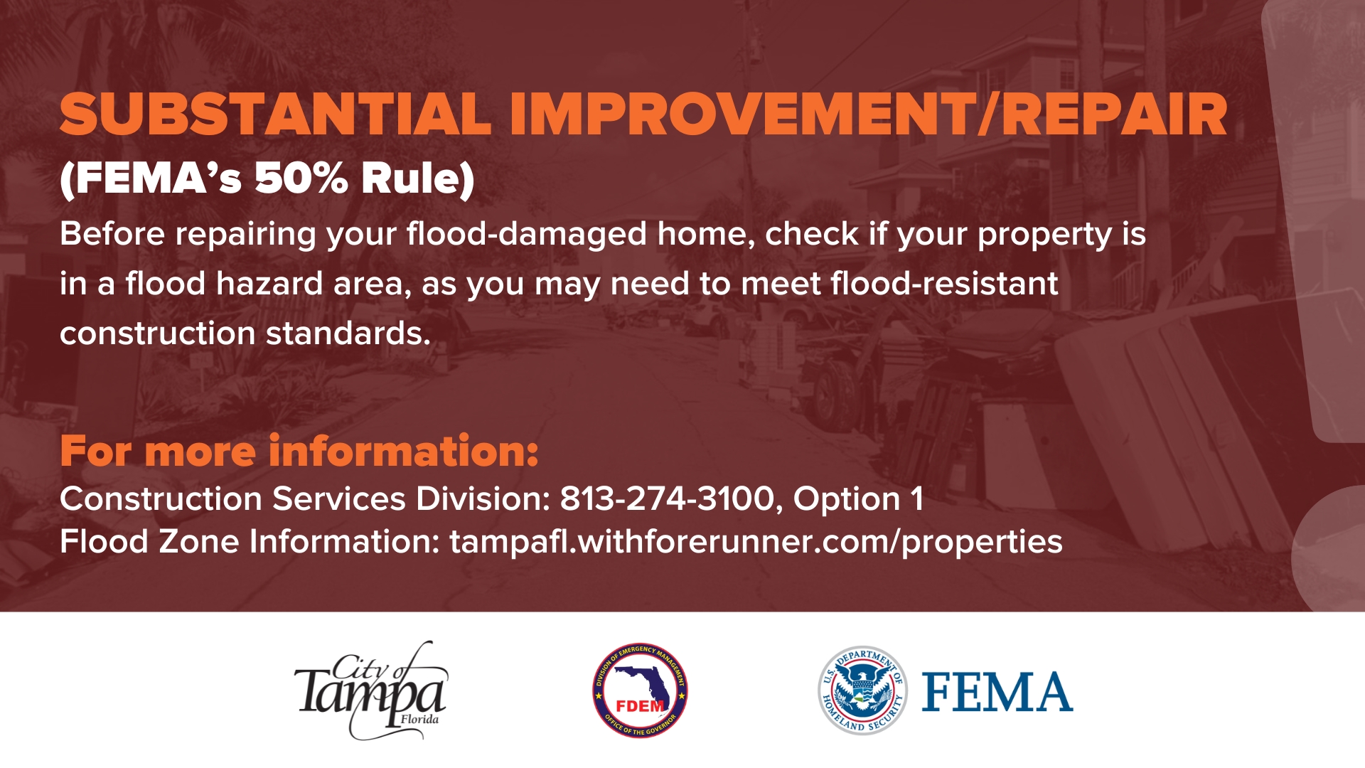
FEMA's 50% Rule


fema-50-rule-2.jpg


Before you perform repairs to your flood-damaged home, please note that if your property is located in a flood hazard area (Flood Zone AE, Coastal A, and VE)*, you may be required (by FEMA and State of Florida requirements incorporated and applied by the City of Tampa) to rebuild to Florida Building Code flood-resistant construction standards. This determination/requirement is based on whether the required improvements/repairs are deemed a “substantial improvement” or “repairs of substantial damage,” which generally means that the improvements/repairs exceed 50% of the structure’s depreciated value pre-flood damage as listed on the Hillsborough County Property Appraiser’s listing for your property.

For answers to questions about whether your improvements/repairs are “substantial”, please contact the City’s Construction Services Division at: 813-274-3100, Option 1.

To learn more about your property’s location and relevant flood information please visit https://tampafl.withforerunner.com/properties

PLEASE NOTE: You should also contact your insurance carrier(s) and mortgage lender before making improvements/repairs, as they may have other applicable requirements.

Beware of Contractor Scams


After a disaster, qualified contractors are usually in high demand. Scammers or unqualified out-of-state workers may take advantage of Floridians in need of expert service.

If you have been approached to have work done on or at your home, you can check if that individual is licensed through the Department of Business and Professional Regulation (DBPR) or by going to myfloridalicense.com.

If property is damaged from the storm, the Florida Attorney General’s Office offers these tips when hiring a contractor:
  • Insurance evaluation - Ensure repair work will be covered under your insurance policy. Have an insurance company evaluate damage before arranging repairs.
  • Estimates – Obtain at least three written, itemized estimates on bids or repairs
  • Bogus offers - Watch out for unsolicited offers or contractors claiming to perform repairs at a discount with leftover supplies from another job
  • Do your research – To check on a company’s reputation, look for references online or ask a friend. Also check to see if a company is properly licensed, insured, and if there are any consumer complaints filed against a licensed contractor at Florida Department of Business & Professional Regulation or by calling the Florida Attorney General’s Office at (866) 9NO-SCAM.
  • Bonded - Make sure a contractor is bonded and verified with a bonding agency
    Read the fine print – Although it may be daunting, read the entire contract before signing to ensure it includes the required buyer’s right to cancel language. Understand penalties that may be imposed for cancellation.
  • Liens - Insist on releases of any liens that could be placed on the property from all subcontractors prior to making final payments. Homeowners may unknowingly have liens placed against their properties by suppliers or subcontractors who have not been paid by the contractor. If the contractor fails to pay them, the liens will remain on the title.
  • Deposits and final payment - Never pay the full amount of a repair expense upfront and be wary before providing large deposits. Do not sign a certificate of completion or make final payment until satisfied with the work performed.
Safety Tips for After a Flood
  • Return home only when officials have declared the area safe. Use caution before entering your home: look outside for loose power lines, damaged gas lines, foundation cracks and other damage.
  • If power lines are down outside your home, do not step in puddles or standing water. Report them to the power company.
  • If you smell natural or propane gas or hear a hissing noise, leave immediately and call the fire department.
  • Cleaning products, paint, batteries and fuel containers have the potential to be hazardous. Please check with local authorities for assistance with disposal.
  • Keep an eye out for animals such as snakes, possums and raccoons that may have moved into your evacuated home, as they often look for relief from floodwaters.
  • If you drive an electric vehicle and there are floodwaters around your home, do not drive through it. If water gets into the battery, it could potentially cause a fire.
Dealing with Damage in your home
  • As soon as it's safe to return home, contact your insurance agent or company to file a claim. Photograph and list all damaged items including their age and value.
  • Insurance adjusters will need evidence of damage to prepare an estimate, so take photos of water in your house, including structural, personal property and floodwater levels. You can also record serial numbers of large appliances and collect receipts for damaged items.
Prepare a Proof of Loss
  • Your insurance adjuster will help you prepare a Proof of Loss, which is a sworn statement of the amount you're claiming. You'll need to file this with your insurance company within 60 days of the flood.
  • You can take measures to mitigate further damage, such as tarping, but don't repair damage before your adjuster visits.
Resident Damage Self Report Form


Residents can self-report damages to help prioritize the City of Tampa's damage assessment operations using the Resident Damage Self Reporting Form. If it is an emergency situation residents should always call 9-1-1, but for other non-life-threatening damages, residents can enter the information in the form. Go to tampa.gov/SelfReport to access the form.

Florida Small Business Emergency Bridge Loan Program


The Florida Small Business Emergency Bridge Loan Program is now open! Loans up to $50,000 are now available to businesses across Hillsborough County that were impacted by Hurricane Helene. The Emergency Bridge Loan program provides short-term, zero-interest working capital loans that are intended to bridge the gap between the time a disaster impacts a business and when a business has secured longer-term recovery funding, such as federally or commercially available loans, insurance claims, or other resources. Visit floridacommerce.my.site.com/RebuildFloridaBusinessLoanFund to learn more about the program, view the lending guidelines, and required documentation, and complete an application by the Nov. 24, 2024, deadline. More information is available by calling (833) 832-4494 Monday through Friday from 8 a.m. to 5 p.m.

U.S. Small Business Administration Disaster Loans


U.S. Small Business Administration disaster loans are available for homeowners, renters, nonprofits, and businesses of all sizes affected by Hurricane Helene. There are three types:
  • Home Disaster Loans: Loans to homeowners or renters to repair or replace disaster-damaged real estate and personal property, including automobiles.
  • Business Physical Disaster Loans: Loans to businesses to repair or replace disaster-damaged property owned by the business, including real estate, inventories, supplies, machinery and equipment. Businesses of any size are eligible. Private, non-profit organizations such as charities, churches, private universities, etc., are also eligible.
  • Economic Injury Disaster Loans (EIDL): Working capital loans to help small businesses, small agricultural cooperatives, small businesses engaged in aquaculture, and most private, non-profit organizations of all sizes meet their ordinary and necessary financial obligations that cannot be met as a direct result of the disaster. These loans are intended to assist through the disaster recovery period.
Community Partners


The City of Tampa recommends the following community organizations that are providing resources to those in need:
Food Resources


Feeding Tampa Bay is operational and distributing food from their Causeway Center. Stay tuned to their Facebook Page for details and additional pop-up sites.

Florida's Price Gouging Hotline


Attorney General Ashley Moody has activated Florida’s Price Gouging Hotline. Anyone who suspects price gouging can report it at MyFloridaLegal.com or calling 1(866) 9NO-SCAM.
...
https://www.tampa.gov/emergency-management/hurricane-information

 
FEMA employee removed from role after telling relief team to skip houses with Trump signs after Florida hurricane

By Mary Kay Mallonee, CNN
Updated 11:50 PM EST, Fri November 8, 2024

A Federal Emergency Management Agency employee has been removed from her role after she advised her disaster relief team to avoid homes with signs supporting President Donald Trump while canvassing in Florida in the aftermath of Hurricane Milton, the agency said Friday.

A FEMA spokesperson told CNN in a statement the agency is “deeply disturbed by this employee’s actions” and the incident is under investigation. The agency did not identify the employee.
...
The agency is currently investigating how many houses were passed over by the canvassing team as part of the incident that occurred on October 27, the spokesperson told CNN. The agency on Friday deployed a new team to knock on doors in the affected area in an effort to make contact with those who may not have been previously reached.
...

https://www.cnn.com/2024/11/08/politics/fema-employee-trump-florida-hurricane/index.html
 
Back
Top