• FluTrackers.com Inc. does not provide medical advice. Information on this web site is collected from various internet resources, and the FluTrackers board of directors makes no warranty to the safety, efficacy, correctness or completeness of the information posted on this site by any author or poster. The information collated here is for instructional and/or discussion purposes only and is NOT intended to diagnose or treat any disease, illness, or other medical condition. Every individual reader or poster should seek advice from their personal physician/healthcare practitioner before considering or using any interventions that are discussed on this website. By continuing to access this website you agree to consult your personal physican before using any interventions posted on this website, and you agree to hold harmless FluTrackers.com Inc., the board of directors, the members, and all authors and posters for any effects from use of any medication, supplement, vitamin or other substance, device, intervention, etc. mentioned in posts on this website, or other internet venues referenced in posts on this website.
  • We are not asking for any donations. Do not donate to any entity who says they are raising funds for us.

Tropical storm Andrea forms in the Gulf of Mexico - Warning issued for parts of the Florida West

Pathfinder

Editor, Senior Moderator
Tropical disturbance in Gulf of Mexico heading for Florida, eventually up East Coast?

By Brian McNoldy, Published: June 4, 2013 at 3:27 pm

An area of unsettled weather in the southern Gulf of Mexico has been churning and festering for a week now, and computer models have continued to show a tropical or subtropical system emerging from the region. Today, though still disorganized, it appears slightly more impressive in satellite images than it has in recent days, and could be heading for Florida later this week.

It?s not out of the question it brings an enhanced period of rain to the Mid-Atlantic, including the D.C. area late Friday into Saturday.
...
Models are still indicating that this disturbance will develop further, and head generally northeast toward northern Florida. It should make ?landfall? on Thursday night into Friday morning. I put landfall in quotes because it may be a broad disorganized system that will not look like the classic symmetric tropical cyclone.
...
While it is very unlikely that it will become anything more than a tropical depression or low-grade (sub)tropical storm, even weak storms are capable of producing extremely heavy rain which inevitably leads to flooding issues.
...
http://www.washingtonpost.com/blogs...heading-for-florida-eventually-up-east-coast/


-----------------------------------------------------------------------------------------

two_atl.gif

<TABLE><TBODY><TR><TD width=565 align=right>GIS data: .shp</TD></TR></TBODY></TABLE>
...
http://www.nhc.noaa.gov/gtwo_atl.shtml
 
Re: Tropical disturbance in Gulf of Mexico heading for Florida

Re: Tropical disturbance in Gulf of Mexico heading for Florida

Posted on Wednesday, 06.05.13

Storm to cause heavy rain on Fla.'s Gulf Coast

By TAMARA LUSH
Associated Press

<!-- end /production/story/credit_line_format.comp -->ST. PETERSBURG, Fla. -- People along Florida's west coast can expect torrential downpours, flooding and possibly a tornado because of a low-pressure system in the Gulf of Mexico starting on Wednesday.

Rodney Wynn, a meteorologist at the National Weather Service, said some areas will get 3 to 5 inches of rain over the next two or three days.

"It's going to be along the coastal regions," Wynn said. "We can't say any one county's going to get more."

The National Weather Service has issued flood watches Wednesday from Lee County in southwest Florida to Levy County on the northern Gulf Coast. There is a 50 percent chance that the system will develop into a tropical or subtropical cyclone by Friday, Wynn said.
...
Read more here:
http://www.miamiherald.com/2013/06/05/3434464/storm-brewing-in-gulf-to-cause.html

----------------------------------------------------------------------------------

rb-animated.gif


http://www.ssd.noaa.gov/goes/east/gmex/rb-animated.gif
 
Re: Tropical storm Andrea forms in the Gulf of Mexico - Warning issued for parts of the Florida West

Tropical Storm ANDREA Public Advisory

000
WTNT31 KNHC 052159
TCPAT1

BULLETIN
TROPICAL STORM ANDREA SPECIAL ADVISORY NUMBER 1
NWS NATIONAL HURRICANE CENTER MIAMI FL AL012013
600 PM EDT WED JUN 05 2013

...TROPICAL STORM FORMS IN THE EAST-CENTRAL GULF OF MEXICO...
...TROPICAL STORM WARNING ISSUED FOR PARTS OF THE FLORIDA WEST
COAST...


SUMMARY OF 600 PM EDT...2200 UTC...INFORMATION
----------------------------------------------
LOCATION...25.3N 86.5W
ABOUT 310 MI...500 KM SW OF TAMPA FLORIDA
ABOUT 320 MI...510 KM SSW OF APALACHICOLA FLORIDA
MAXIMUM SUSTAINED WINDS...40 MPH...65 KM/H
PRESENT MOVEMENT...N OR 360 DEGREES AT 3 MPH...6 KM/H
MINIMUM CENTRAL PRESSURE...1002 MB...29.59 INCHES


WATCHES AND WARNINGS
--------------------
CHANGES WITH THIS ADVISORY...

A TROPICAL STORM WARNING HAS BEEN ISSUED FOR THE WEST COAST OF
FLORIDA FROM BOCA GRANDE TO OCHLOCKONEE RIVER.

A TROPICAL STORM WATCH HAS BEEN ISSUED FOR THE U.S. EAST COAST FROM
FLAGLER BEACH FLORIDA TO SURF CITY NORTH CAROLINA.

SUMMARY OF WATCHES AND WARNINGS IN EFFECT...

A TROPICAL STORM WARNING IS IN EFFECT FOR...
* THE WEST COAST OF FLORIDA FROM BOCA GRANDE TO OCHLOCKNEE RIVER

A TROPICAL STORM WATCH IS IN EFFECT FOR...
* FLAGLER BEACH FLORIDA TO SURF CITY NORTH CAROLINA

A TROPICAL STORM WARNING MEANS THAT TROPICAL STORM CONDITIONS ARE
EXPECTED SOMEWHERE WITHIN THE WARNING AREA WITHIN 36 HOURS.

A TROPICAL STORM WATCH MEANS THAT TROPICAL STORM CONDITIONS ARE
POSSIBLE WITHIN THE WATCH AREA...GENERALLY WITHIN 48 HOURS.

FOR STORM INFORMATION SPECIFIC TO YOUR AREA...INCLUDING POSSIBLE
INLAND WATCHES AND WARNINGS...PLEASE MONITOR PRODUCTS ISSUED BY
YOUR LOCAL NATIONAL WEATHER SERVICE FORECAST OFFICE.


DISCUSSION AND 48-HOUR OUTLOOK
------------------------------
AT 600 PM EDT...2200 UTC...THE CENTER OF TROPICAL STORM ANDREA WAS
LOCATED NEAR LATITUDE 25.3 NORTH...LONGITUDE 86.5 WEST. ANDREA IS
MOVING TOWARD THE NORTH NEAR 3 MPH...6 KM/H. A NORTHEASTWARD MOTION
AT A FASTER FORWARD SPEED IS EXPECTED ON THURDAY AND THAT GENERAL
MOTION SHOULD CONTINUE THROUGH FRIDAY. THE CENTER OF ANDREA
IS FORECAST TO REACH THE COAST OF THE FLORIDA BIG BEND ON
THURSDAY AFTERNOON OR EVENING...AND MOVE OVER SOUTHEASTERN GEORGIA
AND EASTERN SOUTH CAROLINA THURSDAY NIGHT AND FRIDAY.

MAXIMUM SUSTAINED WINDS ARE NEAR 40 MPH...65 KM/H...WITH HIGHER
GUSTS. LITTLE CHANGE IN STRENGTH IS FORECAST DURING THE NEXT 48
HOURS.

TROPICAL STORM FORCE WINDS EXTEND OUTWARD UP TO 140 MILES...
220 KM...MAINLY TO THE EAST AND SOUTHEAST OF THE CENTER.

THE ESTIMATED MINIMUM CENTRAL PRESSURE BASED ON RECONNAISSANCE
AIRCRAFT DATA IS 1002 MB...29.59 INCHES.


HAZARDS AFFECTING LAND
----------------------
WIND...TROPICAL STORM CONDITIONS ARE EXPECTED TO FIRST REACH THE
COAST WITHIN THE WARNING AREA BY THURSDAY AFTERNOON...MAKING OUTSIDE
PREPARATIONS DIFFICULT OR DANGEROUS.

STORM SURGE...THE COMBINATION OF A STORM SURGE AND THE TIDE WILL
CAUSE NORMALLY DRY AREAS NEAR THE COAST TO BE FLOODED BY RISING
WATERS. THE WATER COULD REACH THE FOLLOWING HEIGHTS ABOVE GROUND
IF THE PEAK SURGE OCCURS AT THE TIME OF HIGH TIDE...

TAMPA BAY NORTHWARD TO APALACHICOLA...2 TO 4 FT
FLORIDA WEST COAST SOUTH OF TAMPA BAY...1 TO 2 FT

THE DEEPEST WATER WILL OCCUR ALONG THE IMMEDIATE COAST NEAR AND TO
THE SOUTH OF THE LANDFALL LOCATION. SURGE-RELATED FLOODING DEPENDS
ON THE RELATIVE TIMING OF THE SURGE AND THE TIDAL CYCLE...AND CAN
VARY GREATLY OVER SHORT DISTANCES. FOR INFORMATION SPECIFIC TO
YOUR AREA...PLEASE SEE PRODUCTS ISSUED BY YOUR LOCAL NATIONAL
WEATHER SERVICE OFFICE.

RAINFALL...ANDREA IS EXPECTED TO PRODUCE TOTAL RAIN ACCUMULATIONS OF
3 TO 6 INCHES OVER MUCH OF THE FLORIDA PENINSULA...EASTERN PARTS OF
THE FLORIDA PANHANDLE...AND SOUTHEASTERN GEORGIA...WITH ISOLATED
MAXIMUM AMOUNTS OF 8 INCHES POSSIBLE. TOTAL RAIN ACCUMULATIONS OF
2 TO 4 INCHES ARE ALSO EXPECTED OVER EASTERN SOUTH CAROLINA AND
EASTERN NORTH CAROLINA.

TORNADOES...ISOLATED TORNADOES ARE POSSIBLE OVER THE FLORIDA
PENINSULA LATE TONIGHT THROUGH THURSDAY.


NEXT ADVISORY
-------------
NEXT INTERMEDIATE ADVISORY...800 PM EDT.
NEXT COMPLETE ADVISORY...1100 PM EDT.

$$
FORECASTER BROWN/BRENNAN

http://www.nhc.noaa.gov/text/refresh/MIATCPAT1+shtml/052159.shtml

------------------------------------------------------------------------------------

Tropical Storm ANDREA Forecast Discussion

000
WTNT41 KNHC 052203
TCDAT1

TROPICAL STORM ANDREA SPECIAL DISCUSSION NUMBER 1
NWS NATIONAL HURRICANE CENTER MIAMI FL AL012013
600 PM EDT WED JUN 05 2013

THE AIR FORCE RESERVE RECONNAISSANCE AIRCRAFT INVESTIGATING THE
LARGE AREA OF DISTURBED WEATHER OVER THE EASTERN GULF OF MEXICO HAS
FOUND A CIRCULATION CENTER LOCATED NEAR THE WESTERN EDGE OF THE
LARGE MASS OF THUNDERSTORMS. THIS CENTER APPEARS TO HAVE FORMED
VERY RECENTLY SO THE INITIAL MOTION ESTIMATE IS UNCERTAIN.
THE AIRCRAFT MEASURED AN EXTRAPOLATED SURFACE PRESSURE OF 1002
MB...PEAK 1000 FT FLIGHT-LEVEL WINDS OF 47 KT...AND BELIEVABLE
BIAS-CORRECTED SFMR SURFACE WINDS OF AROUND 35 KT. THESE DATA
SUPPORT AN INITIAL INTENSITY OF 35 KT. STRONG SOUTHWESTERLY SHEAR
IS EXPECTED TO CONTINUE DURING THE NEXT COUPLE OF DAYS AND
SIGNIFICANT STRENGTHENING APPEARS UNLIKELY. THE INTENSITY FORECAST
SHOWS LITTLE OVERALL CHANGE IN STRENGTH...EVEN AFTER THE SYSTEM
BECOMES EXTRATROPICAL IN 2 TO 3 DAYS.

ANDREA IS FORECAST TO MOVE SLOWLY NORTHWARD TONIGHT...THEN
ACCELERATE NORTHEASTWARD ON THURSDAY AHEAD OF A MID- TO UPPER-LEVEL
TROUGH MOVING INTO THE SOUTHEASTERN UNITED STATES. THE GLOBAL
MODELS ARE IN GOOD AGREEMENT ON THIS GENERAL SCENARIO...ALTHOUGH
THEY ALSO SUGGEST THE POSSIBILITY OF JUMPS OR REFORMATIONS OF THE
CENTER DURING THE NEXT 24 HOURS. LANDFALL ALONG THE COAST OF THE
FLORIDA BIG BEND ON THURSDAY AFTERNOON OR EVENING IS EXPECTED.
AFTER THAT...THE SYSTEM IS FORECAST TO ACCELERATE NORTHEASTWARD
ALONG THE COAST OF THE SOUTHEAST UNITED STATES. THERE WILL BE SOME
BAROCLINIC FORCING BY THAT TIME...BUT IT IS UNCLEAR WHEN ANDREA
WILL BECOME POST-TROPICAL. THE NHC FORECAST SHOWS ANDREA REMAINING
A TROPICAL CYCLONE THROUGH 48 HOURS...BUT THE TRANSITION TO A
POST-TROPICAL CYCLONE COULD OCCUR SOONER.

THE CURRENT FORECAST REQUIRES THE ISSUANCE OF A TROPICAL STORM
WARNING ALONG THE WEST COAST OF THE FLORIDA PENINSULA AND A
TROPICAL STORM WATCH ALONG THE SOUTHEAST UNITED STATES COAST. THE
PRIMARY EFFECTS FROM ANDREA ARE EXPECTED TO BE HEAVY RAINFALL
ACROSS MUCH OF THE FLORIDA PENINSULA...STORM SURGE FLOODING ALONG
PORTIONS OF THE WEST COAST OF FLORIDA...AND ISOLATED TORNADOES LATE
TONIGHT AND THURSDAY ACROSS THE FLORIDA PENINSULA.

THE PRONUNCIATION OF THIS NAME IS ANN- DREE UH.

FORECAST POSITIONS AND MAX WINDS

INIT 05/2200Z 25.3N 86.5W 35 KT 40 MPH
12H 06/0600Z 26.5N 86.4W 35 KT 40 MPH
24H 06/1800Z 28.3N 85.0W 40 KT 45 MPH
36H 07/0600Z 31.0N 82.0W 40 KT 45 MPH...INLAND
48H 07/1800Z 34.5N 78.5W 40 KT 45 MPH...INLAND
72H 08/1800Z 43.0N 67.5W 40 KT 45 MPH...POST-TROP/EXTRATROP
96H 09/1800Z 45.0N 48.0W 40 KT 45 MPH...POST-TROP/EXTRATROP
120H 10/1800Z 47.0N 25.0W 40 KT 45 MPH...POST-TROP/EXTRATROP

$$
FORECASTER BROWN

http://www.nhc.noaa.gov/text/refresh/MIATCDAT1+shtml/052203.shtml?

 
Re: Tropical storm Andrea forms in the Gulf of Mexico - Warning issued for parts of the Florida West

Andrea (Atlantic/Gulf of Mexico)
06.06.13


<!--Promo date and doctitle ends--><!--June 06, 2013

-->
754055main_20130605-ANDREA-TRMM-226.jpg

? Larger image
NASA's TRMM satellite flew directly above tropical storm Andrea on June 5 at 2234 UTC (6:34 p.m. EDT) just an hour after the National Hurricane Center named the storm. The heaviest rainfall of 124.5 mm per hour (~4.9 inches per hour) was found on Andrea's southeast side. Credit: NASA/SSAI, Hal Pierce

754062main_GOES-STILL-IMAGE-Andrea-226.jpg

? Larger image
NASA?s Terra satellite passed over Tropical Storm Andrea on June 5 at 16:25 UTC (12:25 p.m. EDT) and the MODIS instrument captured this visible image of the storm. Andrea?s clouds had already extended over more than half of Florida. Credit: NASA Goddard MODIS Rapid Response Team

NASA Sees Heavy Rainfall in Tropical Storm Andrea

NASA?s TRMM satellite passed over Tropical Storm Andrea right after it was named, while NASA?s Terra satellite captured a visible image of the storm?s reach hours beforehand. TRMM measures rainfall from space and saw that rainfall rates in the southern part of the storm was falling at almost 5 inches per hour.

NASA?s Terra satellite passed over Tropical Storm Andrea on June 5 at 16:25 UTC (12:25 p.m. EDT) and the Moderate Resolution Imaging Spectroradiometer or MODIS instrument, captured a visible image of the storm. At that time, Andrea?s clouds had already extended over more than half of Florida.

At 8 p.m. EDT on Wednesday, June 5, System 91L became the first tropical storm of the Atlantic Ocean hurricane season. Tropical Storm Andrea was centered near 25.5 North and 86.5 West, about 300 miles (485 km) southwest of Tampa, Fla. At the time Andrea intensified into a tropical storm, its maximum sustained winds were near 40 mph (65 kph).

NASA's Tropical Rainfall Measuring Mission or TRMM satellite flew directly above tropical storm Andrea on June 5 at 2234 UTC (6:34 p.m. EDT) just an hour after the National Hurricane Center named the storm. A rainfall analysis from TRMM's Microwave Imager and Precipitation Radar (PR) instruments showed that moderate to heavy rain was wrapping around the eastern side of the storm. The heaviest rainfall of 124.5 mm per hour (~4.9 inches per hour) from TRMM PR data was found on Andrea's southeast side.

NASA?s GOES Project at NASA?s Goddard Space Flight Center in Greenbelt, Md. created an animation that shows the development of System 91L into Tropical Storm Andrea, and its progression over June 4, 5 and 6, as it heads for a landfall in Florida.

On June 6, at 8am EDT, Tropical Storm Andrea was located near 27.7 north and 85.1 west. That's about 160 miles (255 km) west of Tampa, Fla. and 140 miles (225 km) south of Apalachicola. Andrea's maximum sustained winds were near 60 mph (95 kph) and she was moving north-northeast at 14 mph (22 kph). Minimum central pressure is 997 millibars.


<TABLE width=600><TBODY><TR><TD><IFRAME height=400 src="http://www.youtube.com/embed/w3JuqpJcSC8" frameBorder=0 width=600 allowfullscreen></IFRAME>This NOAA GOES-East satellite animation shows the development of System 91L into Tropical Storm Andrea over the course of 3 days from June 4 to June 6, just after Andrea was officially designated a tropical storm. Credit: NASA's GOES Project.
</TD></TR></TBODY></TABLE>​

A Tropical Storm Warning is in effect for the west coast of Florida from Boca Grande to Indian Pass, from Flagler Beach, Fla. to Cape Charles Light, Va., the Pamlico and Albemarle Sounds, and the lower Chesapeake Bay south of New Point Comfort, Va. For the most up to date forecasts, visit the National Hurricane Center web page at: www.nhc.noaa.gov.

Text credit: Rob Gutro
NASA?s Goddard Space Flight Center

http://www.nasa.gov/mission_pages/hurricanes/archives/2013/h2013_Andrea.html
 
Re: Tropical storm Andrea forms in the Gulf of Mexico - Warning issued for parts of the Florida West

Tropical Storm ANDREA Public Advisory

000
WTNT31 KNHC 061453
TCPAT1

BULLETIN
TROPICAL STORM ANDREA ADVISORY NUMBER 4
NWS NATIONAL HURRICANE CENTER MIAMI FL AL012013
1100 AM EDT THU JUN 06 2013

...TROPICAL STORM CONDITIONS BEGINNING TO MOVE ONSHORE THE WEST
COAST OF FLORIDA...


SUMMARY OF 1100 AM EDT...1500 UTC...INFORMATION
-----------------------------------------------
LOCATION...28.2N 84.3W
ABOUT 110 MI...180 KM W OF TAMPA FLORIDA
ABOUT 110 MI...180 KM SSE OF APALACHICOLA FLORIDA
MAXIMUM SUSTAINED WINDS...60 MPH...95 KM/H
PRESENT MOVEMENT...NE OR 35 DEGREES AT 15 MPH...24 KM/H
MINIMUM CENTRAL PRESSURE...997 MB...29.44 INCHES


WATCHES AND WARNINGS
--------------------
CHANGES WITH THIS ADVISORY...

NONE

SUMMARY OF WATCHES AND WARNINGS IN EFFECT...

A TROPICAL STORM WARNING IS IN EFFECT FOR...
* THE WEST COAST OF FLORIDA FROM BOCA GRANDE TO INDIAN PASS
* FLAGLER BEACH FLORIDA TO CAPE CHARLES LIGHT VIRGINIA
* PAMLICO AND ALBEMARLE SOUNDS
* LOWER CHESAPEAKE BAY SOUTH OF NEW POINT COMFORT

A TROPICAL STORM WARNING MEANS THAT TROPICAL STORM CONDITIONS ARE
EXPECTED SOMEWHERE WITHIN THE WARNING AREA WITHIN 36 HOURS.

FOR STORM INFORMATION SPECIFIC TO YOUR AREA...INCLUDING POSSIBLE
INLAND WATCHES AND WARNINGS...PLEASE MONITOR PRODUCTS ISSUED BY
YOUR LOCAL NATIONAL WEATHER SERVICE FORECAST OFFICE.


DISCUSSION AND 48-HOUR OUTLOOK
------------------------------
AT 1100 AM EDT...1500 UTC...THE CENTER OF TROPICAL STORM ANDREA WAS
LOCATED NEAR LATITUDE 28.2 NORTH...LONGITUDE 84.3 WEST. ANDREA IS
MOVING TOWARD THE NORTHEAST NEAR 15 MPH...24 KM/H. A NORTHEASTWARD
ACCELERATION IS EXPECTED DURING THE NEXT 48 HOURS. ON THE FORECAST
TRACK...THE CENTER OF ANDREA WILL REACH THE COAST OF THE BIG BEND
AREA OF FLORIDA LATER TODAY...AND THEN MOVE NORTHEASTWARD NEAR THE
EAST COAST OF THE UNITED STATES THROUGH SATURDAY.

MAXIMUM SUSTAINED WINDS ARE NEAR 60 MPH...95 KM/H...WITH HIGHER
GUSTS. NO SIGNIFICANT CHANGE IN STRENGTH IS EXPECTED BEFORE THE
CENTER REACHES THE COAST LATER TODAY. SOME WEAKENING IS FORECAST
TONIGHT AND EARLY FRIDAY WHILE THE CENTER OF ANDREA MOVES OVER
LAND. ANDREA SHOULD LOSE TROPICAL CHARACTERISTICS IN ABOUT 36 TO
48 HOURS.

TROPICAL STORM FORCE WINDS EXTEND OUTWARD UP TO 140 MILES...220 KM
TO THE EAST OF THE CENTER. THE STRONGEST WINDS ARE LIKELY OCCURRING
IN A BAND OF THUNDERSTORMS THAT IS MOVING ONSHORE THE WEST COAST
OF FLORIDA. A WIND GUST TO 48 MPH...78 KM/H WAS RECENTLY REPORTED
AT ST. PETERSBURG FLORIDA.

THE ESTIMATED MINIMUM CENTRAL PRESSURE IS 997 MB...29.44 INCHES.


HAZARDS AFFECTING LAND
----------------------
STORM SURGE...THE COMBINATION OF A STORM SURGE AND THE TIDE WILL
CAUSE NORMALLY DRY AREAS NEAR THE COAST TO BE FLOODED BY RISING
WATERS. THE WATER COULD REACH THE FOLLOWING HEIGHTS ABOVE GROUND
IF THE PEAK SURGE OCCURS AT THE TIME OF HIGH TIDE...

TAMPA BAY NORTHWARD TO APALACHICOLA...2 TO 5 FT
FLORIDA WEST COAST SOUTH OF TAMPA BAY...1 TO 2 FT
FLAGLER BEACH NORTH TO CAPE CHARLES LIGHT...1 TO 2 FT

THE DEEPEST WATER WILL OCCUR ALONG THE IMMEDIATE COAST NEAR AND TO
THE SOUTH OF THE FLORIDA LANDFALL LOCATION. SURGE-RELATED FLOODING
DEPENDS ON THE RELATIVE TIMING OF THE SURGE AND THE TIDAL CYCLE...
AND CAN VARY GREATLY OVER SHORT DISTANCES. FOR INFORMATION SPECIFIC
TO YOUR AREA...PLEASE SEE PRODUCTS ISSUED BY YOUR LOCAL NATIONAL
WEATHER SERVICE OFFICE.

RAINFALL...ANDREA IS EXPECTED TO PRODUCE TOTAL RAIN ACCUMULATIONS OF
3 TO 6 INCHES OVER MUCH OF THE FLORIDA PENINSULA...EASTERN PARTS OF
THE FLORIDA PANHANDLE...SOUTHEASTERN GEORGIA...AND EASTERN SOUTH
CAROLINA...WITH ISOLATED MAXIMUM AMOUNTS OF 10 INCHES POSSIBLE.
TOTAL RAIN ACCUMULATIONS OF 2 TO 4 INCHES ARE ALSO EXPECTED OVER
EASTERN NORTH CAROLINA AND SOUTHEASTERN VIRGINIA.

WIND...TROPICAL STORM CONDITIONS ARE LIKELY BEGINNING ALONG THE WEST
COAST OF FLORIDA. THESE CONDITIONS WILL GRADUALLY SPREAD NORTHWARD
ALONG THE UNITED STATES EAST COAST DURING THE NEXT 24 TO 36 HOURS.

TORNADOES...A FEW TORNADOES ARE POSSIBLE OVER THE FLORIDA PENINSULA
TODAY.


NEXT ADVISORY
-------------
NEXT INTERMEDIATE ADVISORY...200 PM EDT.
NEXT COMPLETE ADVISORY...500 PM EDT.

$$
FORECASTER BERG/BEVEN

http://www.nhc.noaa.gov/text/refresh/MIATCPAT1+shtml/061453.shtml

---------------------------------------------------------


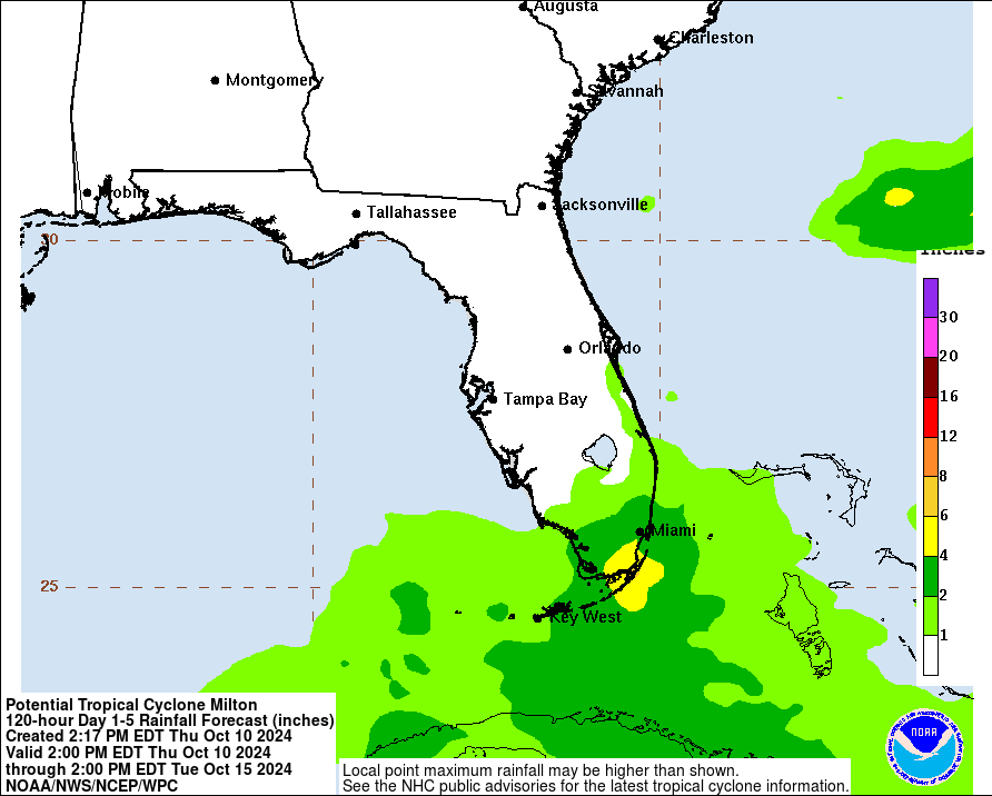
Rainfall_Days_1-5.gif


http://www.nhc.noaa.gov/refresh/graphics_at1+shtml/150929.shtml?radii#contents
 
Re: Tropical storm Andrea forms in the Gulf of Mexico - Warning issued for parts of the Florida West

Tropical storm Andrea forms, strengthens, and targets Florida, East Coast

By Brian McNoldy, Published: June 6, 2013 at 11:43 am<!-- .entry-meta --></HEADER><!-- .entry-header --><!-- UTILITY BAR --><!--
-->

Since forming Wednesday afternoon, tropical storm Andrea?s appearance has grown much more impressive on satellite, signaling a strengthening storm. As of 11 a.m. EDT, Andrea?s peak winds have increased to 60 mph. But copious rains will be Andrea?s most significant impact, as it charges up the East Coast.

The storm?s center is presently located 110 miles west of Tampa, and its outer bands are lashing the Florida peninsula and south Georgia with heavy rains and gusty winds. Radar imagery shows a nascent eyewall coming into view and approaching the Florida coast. (To help track the coverage and structure of the rainfall, see the long radar loops available I?ve made available).

Flood watches cover huge parts of Florida, Georgia, South Carolina, and North Carolina. These will inevitably be extended northward with time.
In addition to the heavy rain threat, tornadoes are also possible within a few hundred miles of the storm?s center. Presently, the majority of the Florida peninsula is under a tornado watch. Six tornadoes have already touched in the Sunshine State, says The Weather Channel?s Greg Forbes.
Sustained tropical storm winds of 40-60 mph, with some locally higher gusts, are possible near the center of Andrea?s track.

More...
http://www.washingtonpost.com/blogs...s-strengthens-and-targets-florida-east-coast/

-------------------------------------------------------------------

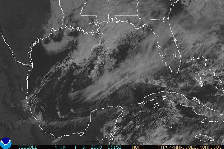
GULFVS.JPG


http://www.goes.noaa.gov/GIFS/GULFVS.JPG

Andrea_06-07Jun13_southeast.gif


http://andrew.rsmas.miami.edu/bmcnoldy/tropics/andrea13/Andrea_06-07Jun13_southeast.gif
 
Back
Top Bottom