• FluTrackers.com Inc. does not provide medical advice. Information on this web site is collected from various internet resources, and the FluTrackers board of directors makes no warranty to the safety, efficacy, correctness or completeness of the information posted on this site by any author or poster. The information collated here is for instructional and/or discussion purposes only and is NOT intended to diagnose or treat any disease, illness, or other medical condition. Every individual reader or poster should seek advice from their personal physician/healthcare practitioner before considering or using any interventions that are discussed on this website. By continuing to access this website you agree to consult your personal physican before using any interventions posted on this website, and you agree to hold harmless FluTrackers.com Inc., the board of directors, the members, and all authors and posters for any effects from use of any medication, supplement, vitamin or other substance, device, intervention, etc. mentioned in posts on this website, or other internet venues referenced in posts on this website.
  • We are not asking for any donations. Do not donate to any entity who says they are raising funds for us.

NOAA Observations Indicate a Small Portion of Light Oil Sheen Has Entered the Loop Current

Pathfinder

Editor, Senior Moderator
Scientist: Oil spill could hit Loop Current within 24 hours

TBO.com
Published: May 3, 2010
Updated: 28 min. ago

TAMPA - A University of Miami scientist says the Gulf oil spill could get into what's called the Loop Current within a day, eventually carrying oil south along the Florida coast and into the Florida Keys.

But the risk to Florida's pristine, white west coast beaches continues to be low from the growing and menacing blob of oil in the Gulf of Mexico.


...

Read more at:
http://www2.tbo.com/content/2010/ma...ooze-our-beaches-usf-prof-says/news-breaking/
 
Re: Scientist: Oil spill could hit Loop Current within 24 hours

Re: Scientist: Oil spill could hit Loop Current within 24 hours

Does anyone have a map of the loop current?
 
Re: Scientist: Oil spill could hit Loop Current within 24 hours

Re: Scientist: Oil spill could hit Loop Current within 24 hours

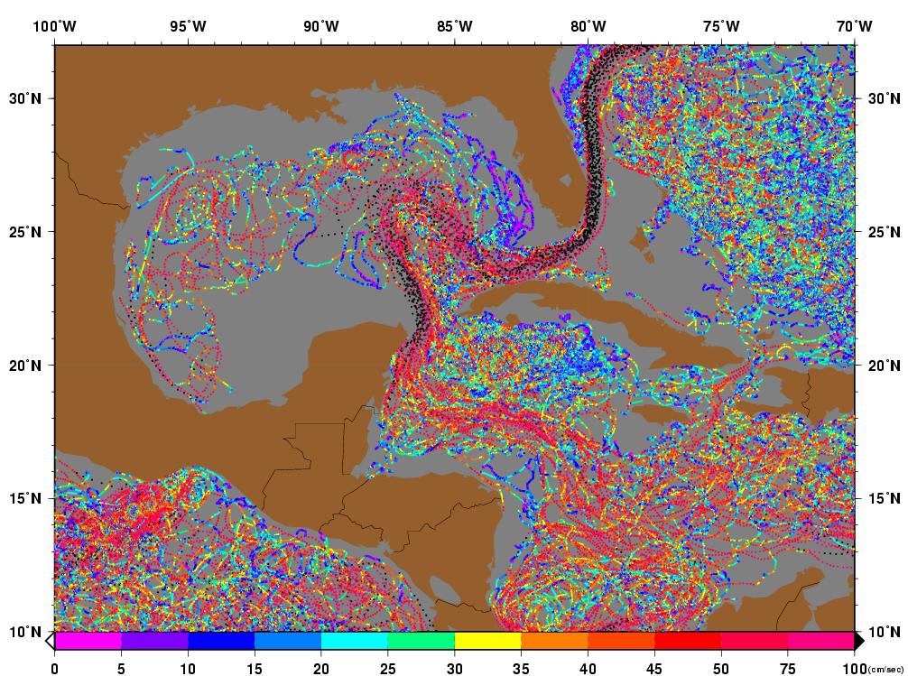
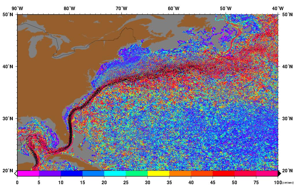
Loop Current is an ocean current that transports warm Caribbean water through the Yucatan Channel between Cuba and Mexico. The current flows northward into the Gulf of Mexico, then loops southeastward through the Florida Keys (where it is called the Florida Current), and into the Bahamas. Here, the waters of the Loop Current flow northward along the U.S. coast and become the Gulf Stream. With current speeds of about 0.8 m/s, the Loop Current is one of the fastest currents in the Atlantic Ocean. The current is about 200-300 km (125-190 miles) wide, and 800 meters (2600 feet) deep, and is present in the Gulf of Mexico about 95% of the time. During summer and fall, the Loop Current provides a deep (80-150 meter) layer of vary warm water that can provide a huge energy source for any lucky hurricanes that might cross over.

loopcurrent.gif

Figure 1. The Loop Current flow northwards into the Gulf of Mexico. Every 6-11 months, a bulge in the current cuts off into a clockwise-rotating eddy that then drifts slowly west-southwestward towards Texas. Image credit: NOAA.
The Loop Current commonly bulges out in the northern Gulf of Mexico and sometimes will shed a clockwise rotating ring of warm water that separates from the main current (Figure 1). This ring of warm water slowly drifts west-southwestward towards Texas or Mexico at about 3-5 km per day. This feature is called a "Loop Current Ring", "Loop Current Eddy", or "Warm Core Ring", and can provide a key source of energy to fuel rapid intensification of hurricanes that cross the Gulf, in addition to the Loop Current itself. The Loop Current pulsates in a quasi-regular fashion and sheds rings every 6 to 11 months. When a Loop Current Eddy breaks off in the Gulf of Mexico at the height of hurricane season, it can lead to a dangerous situation where a vast reservoir of energy is available to any hurricane that might cross over. This occurred in 2005, when a Loop Current Eddy separated in July, just before Hurricane Katrina passed over and "bombed" into a Category 5 hurricane. The eddy remained in the Gulf and slowly drifted westward during September. Hurricane Rita passed over the same Loop Current Eddy three weeks after Katrina, and also explosively deepened to a Category 5 storm.
So, a key question each hurricane season is: when will the next Loop Current Eddy break off, creating a ready-made high-octane energy source for any hurricane that might pass by? A good way to answer this question is to study the behavior of the Loop Current over the past year. This can be viewed at Navy Research Lab's web site, including a large movie (51 Mb) of the past year's currents. This movie has arrows showing the direction of the current, plus a color coding that represents the height of the sea surface above mean level. The higher the height, the warmer the water (since warm water expands and thus raises the sea level where it is at).
We've also saved a copy of this animation covering the period October 2005-October 2006. One can see at the beginning of the animation the Loop Current Eddy that fueled Katrina and Rita sitting in the Gulf of Mexico south of Louisiana. This eddy moves slowly west-southwest to a point off the Texas coast by November, where it gradually dissipates. A small Loop Current Eddy breaks off eight months later in March, and a large one just four months later, in July. The July 2006 eddy gets temporarily re-absorbed in September, then breaks free again by October.
The Navy web site offers a 1-month forecast of the Loop Current in the Gulf of Mexico. However, according to an interesting February 2004 article published by offshore-engineer.com, reliable forecasts of these currents and eddies are not available yet. Keep in mind that currents are driven by winds, and wind forecasts are not reliable out more than about 10 days. For more information: A 1998 paper published in the Journal of Physical Ocenaography titled, Loop Current Eddy Paths in the Western Gulf of Mexico provides some technical information on Loop Eddies. Horizon Marine, Inc. tracks and forecasts Loop Eddies and provides a pay service for this. Louisiana State University has a nice series of images showing the passages of Ivan, Katrina and Rita over Loop Current Eddies.
:tiphat:http://www.wunderground.com/hurricane/loopcurrent.asp
 
Re: Scientist: Oil spill could hit Loop Current within 24 hours

Re: Scientist: Oil spill could hit Loop Current within 24 hours

Loop Current

From Wikipedia, the free encyclopedia


Jump to: navigation, search
<!-- start content -->This article is about the oceanic phenomenon. For the electrical signaling schemes, see Current loop.

Gulf Stream currents (1943 map).


Part of the Gulf Stream, the Loop Current is a warm ocean current in the Gulf of Mexico that flows northward between Cuba and the Yucat?n peninsula, moves north into the Gulf of Mexico, loops west and south before exiting to the east through the Florida Straits.
A related feature is an area of warm water called an "Eddy" or "Loop Current ring" that separates from the Loop Current, somewhat randomly. These rings then drift to the west at speeds of about 5 cm/s (0.18 km/h or 0.11 mph) and bump into the coast of Texas or Mexico.
Around 1970, it was believed that the Loop Current exhibited an annual cycle in which the Loop feature extended farther to the north during the summer. Further study over the past few decades, however, has shown that the extension to the north (and the shedding of eddies) does not have a significant annual cycle.
The Loop Current and its eddies may be detected by measuring sea surface level. Sea surface level of both the Eddies and the Loop on September 21, 2005 was up to 60 cm (24 in) higher than surrounding water, indicating a deep area of warm water beneath them.<SUP id=cite_ref-0 class=reference>[1]</SUP> On that day, Hurricane Rita passed over the Loop current and intensified into a Category 5 storm with the help of the warm water.

Hurricane Katrina encountering the Gulf Loop Current and Eddy Vortex.:tiphat:http://en.wikipedia.org/wiki/Loop_Current
 
Re: Scientist: Oil spill could hit Loop Current within 24 hours

Re: Scientist: Oil spill could hit Loop Current within 24 hours

#1: "Weisberg and Shay agree that once the oil enters the Loop Current, it continue east into the Gulf Stream likely will end up in the Keys and ."


preserving the well, and polute the whole Central Atlantic ocean Gulf Stream areas ...


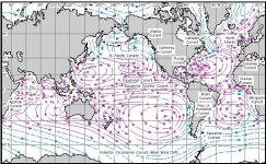
http://www.waterencyclopedia.com/images/wsci_03_img0381.jpg
 

Attachments

  • wsci_03_img0381.jpg
    wsci_03_img0381.jpg
    67.5 KB · Views: 0
Re: Scientist: Oil spill could hit Loop Current within 24 hours

Re: Scientist: Oil spill could hit Loop Current within 24 hours

NEW ORLEANS, May 5, 2010

Oil Spill Close to Shore, Satellite Images Show

Images Shows Spill Drifting toward South; Current Could Carry Oil toward Florida, Keys

Excerpt:

Two satellite images taken Wednesday morning indicate oil has reached the Mississippi Delta and the Chandeleur Islands off the coast of Louisiana.
It's not clear whether the oil is on shore, but it's very close, said Hans Graber, director of the University of Miami's satellite sensing facility.

U.S. Coast Guard Lt. James McKnight said crews remained at the Chandeleurs on Wednesday after officials got a report of oil coming ashore, but they have not located it.

"They're sitting there, basically, waiting for the first signs of any kind of a sheen to touch the islands," he said.

Graber said the images also show oil drifting south, toward the Loop Current, which scientists say could carry it toward Florida and the Florida Keys. The northern edge of the current may have already picked up some oil.

.../

http://www.cbsnews.com/stories/2010/05/05/national/main6462581.shtml
 
Re: Scientist: Oil spill could hit Loop Current within 24 hours

Re: Scientist: Oil spill could hit Loop Current within 24 hours

Gulf currents carry fate of coasts

<script type="text/javascript">var collab_title = 'Gulf currents carry fate of coasts';</script><!-- /HEADLINE --><!-- MAIN PHOTO -->


<!-- /MAIN PHOTO --><!-- BYLINE -->
By Kate Spinner
Published: Thursday, May 6, 2010 at 1:00 a.m.
Last Modified: Wednesday, May 5, 2010 at 11:25 p.m.
( page all of 4 )
<!-- /PUBDATE -->

SARASOTA COUNTY - As a growing oil slick looms in the Gulf of Mexico, the health of Florida's coastline depends on the weather and the currents.

The oil will reach land somewhere. It's a matter of where and when
scientists say, with strong winds and powerful ocean currents determining the destination.

"It's not going to go away anytime soon. It's going to persist out there until it comes to land somewhere," said Ian MacDonald, an oceanography professor at Florida State University who also studies natural oil seepage.

Most scientists agree that currents will probably sweep some or most of the slick to the Atlantic, shielding Southwest Florida from the brunt of the calamity.

But that forecast could change, in the unlikely event that strong winds push the slick farther east.

snip

....

More at:
http://www.heraldtribune.com/article/20100506/ARTICLE/5061057/2416/NEWS?p=all&tc=pgall
 
Re: Scientist: Oil spill could hit Loop Current within 24 hours

Re: Scientist: Oil spill could hit Loop Current within 24 hours

USF Scientist: Oil Spill Now Three Times Size of Lake Okeechobee

<SMALL itxtvisited="1">May 6, 2010 By Vickie Chachere</SMALL>

Excerpt:

Hu?s work is one part of the multi-layered effort to track the effort through USF?s Ocean Circulation Group, which has created a series of complex models over the course of the past two weeks to follow the flow of oil.

Led by Physical Oceanographer Robert Weisberg, the research has been instrumental in showing both the public and policy makers what will happen should the oil reach the Loop Current, which circulates in the gulf and then flows around the Florida Keys and up the Atlantic coast.

Click the ?play? button on this model to see how Weisberg?s analysis shows the currents would move oil spilled in the north central gulf. And this model shows projections for the Deep Horizon spill.

<!-- additional info -->Provided by University of South Florida

http://www.physorg.com/news192387552.html
 
Scientist: Oil may be entering Gulf Loop current

Scientist: Oil may be entering Gulf Loop current

Scientist: Oil may be entering Gulf Loop current, could reach Palm Beach County

By Adam Playford The Palm Beach Post
May 16, 2010
Oil may be on its way.

New satellite images show oil starting to enter the Gulf Loop current, which would pull it through the Florida Keys, into the Gulf Stream and up to Palm Beach County, according to a scientist tracking the oil spewing into the gulf.

The new images, taken Saturday by NASA's Jet Propulsion Laboratory, "clearly [show] that the oil is being pulled into the Loop current," according to a release from Mitch Roffer, an oceanographer who runs Roffer's Ocean Fishing Forecasting Service and has been providing daily updates on the spill's movement.

"We still don't know how long it's going to take to get around to the Keys and then the east coast of Florida - it just remains to be seen," Roffer said Saturday.

That process, which is difficult to predict, would take at least a week, and possibly several, scientists say.

snip

http://www.sun-sentinel.com/sfl-oil-reaching-palm-beach-county051610,0,471618.story
 
Re: Scientist: Oil may be entering Gulf Loop current

Re: Scientist: Oil may be entering Gulf Loop current

Worry that Gulf oil spreading into major current

By JEFFREY COLLINS and JASON DEAREN, Associated Press Writers Jeffrey Collins And Jason Dearen, Associated Press Writers ? <ABBR class=recenttimedate title=2010-05-17T04:38:11-0700>40 mins ago</ABBR>

Excerpts:

"A researcher told The Associated Press that computer models show the oil may have already seeped into a powerful water stream known as the loop current, which could propel it into the Atlantic Ocean. A boat is being sent later this week to collect samples and learn more.

"This can't be passed off as 'it's not going to be a problem,'" said William Hogarth, dean of the University of South Florida's College of Marine Science. "This is a very sensitive area. We are concerned with what happens in the Florida Keys."

---------------------------

"Hogarth said a computer model shows oil has already entered the loop current, while a second shows the oil is 3 miles from it ? still dangerously close. The models are based on weather, ocean current and spill data from the U.S. Navy and the National Oceanic and Atmospheric Administration, among other sources.

Hogarth said it's still too early to know what specific amounts of oil will make it to Florida, or what damage it might do to the sensitive Keys or beaches on Florida's Atlantic coast. He said claims by BP that the oil would be less damaging to the Keys after traveling over hundreds of miles from the spill site were not mollifying.

Damage is already done, with the only remaining question being how much more is to come, said Paul Montagna, from the Harte Research Institute for Gulf of Mexico Studies at Texas A&M University.

"Obviously the quicker they plug this the better, but they are already having a tremendous effect on the environment," he said. "In the end, we have to figure out how much is actually pouring into the Gulf."

Full text at:

http://news.yahoo.com/s/ap/20100517/ap_on_bi_ge/us_gulf_oil_spill
 
Re: Scientist: Oil may be entering Gulf Loop current

Re: Scientist: Oil may be entering Gulf Loop current

<TABLE class=full cellSpacing=0 cellPadding=0><TBODY><TR><TD class=full>Dr. Jeff Masters' WunderBlog


</TD><TD></TD></TR></TBODY></TABLE>
Last Updated: 7:47 PM GMT on May 17, 2010 ? Last Comment: 8:52 PM GMT on May 17, 2010
<TABLE class=full cellSpacing=0 cellPadding=0><TBODY><TR class=vaT><TD class=full><TABLE class=blueTop cellSpacing=0 cellPadding=0><TBODY><TR><TD class=hLeft>
headerBlue-left.gif
</TD><TD class=hCenter>Oil enters the Loop Current and is headed to the Florida Keys</TD><TD class=hRight>
headerBlue-right.gif
</TD></TR><TR><TD class=sLeft>
subBlue-left.gif
</TD><TD class=sCenter></TD><TD class=sRight>
subBlue-right.gif
</TD></TR></TBODY></TABLE><TABLE class=full cellSpacing=0 cellPadding=0><TBODY><TR><TD class=full>Posted by: JeffMasters, 7:38 PM GMT on May 17, 2010</TD></TR></TBODY></TABLE>
Satellite imagery today from NASA's MODIS instrument confirms that a substantial tongue of oil has moved southeast from the Deepwater Horizon oil spill and entered the Gulf of Mexico's Loop Current. The Loop Current is an ocean current that transports warm Caribbean water through the Yucatan Channel between Cuba and Mexico. The current flows northward into the Gulf of Mexico, then loops southeastward just south of the Florida Keys (where it is called the Florida Current), and then along the west side of the western Bahamas. Here, the waters of the Loop Current flow northward along the U.S. coast and become the Gulf Stream. Once oil gets into the Loop Current, the 1 - 2 mph speed of the current should allow the oil to travel the 500 miles to the Florida Keys in 10 - 20 days. Portions of the Loop Current flow at speed up to 4 mph, so the transport could be just 4 - 5 days. It now appears likely that the first Florida beaches to see oil from the spill will be in the Lower Florida Keys, not in the Panhandle.

may17.jpg

Figure 1. Satellite image of the oil spill taken at 12:40 EDT Monday May 17, 2010. The location of the Loop Current is superimposed. Image credit: University of Wisconsin and NASA.

<B><BIG>Why is oil getting into the Loop Current?</B></BIG>
The winds over the oil spill location are offshore out of the northwest today, and offshore winds will continue intermittently through Wednesday, which should allow a substantial amount of oil to enter the Loop Current. The major reason oil is moving southwards is because of the instability of the currents in the Gulf of Mexico. The Loop Current is not a stable feature, and tends to surge northwards and southwards in a chaotic fashion, and in response to changes in the prevailing winds. Over the past week, chaotic behavior of the Loop Current and a clockwise-rotating eddy just to its north, just south of the oil spill location, have combined to bring a current of southward-moving surface water to the oil spill location. As strong on-shore winds from the southeast slackened this past weekend, oil has been drawn southward into the Loop Current. The latest NOAA trajectory forecasts failed to anticipate the movement of the oil into the Loop Current. The latest surface current forecasts from NOAA's HYCOM model show that oil could continue pouring into the Loop Current for most of the rest of the week. It is highly uncertain how diluted the oil might get on its voyage to northwestern Cuba and the Florida Keys this week, but the possibility for a major ecological disaster in the fragile Keys ecosystem cannot be ruled out. Southeast to east winds of 10 - 15 knots are expected to develop late this week and extend into early next week, which may be strong enough to impose a surface current that will shut off the flow of oil into the Loop Current by Friday or Saturday.

may17_current_forecast.png

Figure 2. Forecast made at 8pm EDT Sunday May 16, 2010, of the Gulf of Mexico currents by NOAA's HYCOM model. A persistent southward flowing surface current is predicted to occur this week between the oil spill location (red dot) and the Loop Current. Image credit: NOAA.

<B><BIG>Likely areas of impact</B></BIG>
Based on a study of 194 floating probes released into the Northeast Gulf of Mexico during a 1-year study in the 1990s (Figure 3), the west coast of Florida from Tampa Bay southwards to the Everglades is at minimal risk of receiving oil from surface currents. There is a "forbidden zone" off the southwest Florida coast where the shape of the coast, bottom configuration, and prevailing winds all act to create upwelling and surface currents that tend to take water away from the coast. This study implies that the greatest risk of land impacts by surface oil caught in the Loop Current is along the ocean side of the Florida Keys, and along the coast of Southeast Florida from Miami to West Palm Beach. Eddies breaking away from the Gulf Stream would also likely bring oil to northwest Cuba, the western Bahamas, and the U.S. East Coast as far north as Cape Hatteras, North Carolina, though at lesser concentrations. Southwest Florida cannot rest entirely, though--the "forbidden zone" is only true for surface waters, and there is onshore flow below the surface. Since recent ship measurements have detected substantial plumes of oil beneath the surface, southwest Florida might be at risk if one of these plumes gets entrained into the Loop Current. These subsurface plumes were also detected by current probes launched into the oil spill on May 8 by one of NOAA's hurricane hunter aircraft, according to one scientist I spoke to at last week's AMS hurricane conference. There are plans for the Hurricane Hunters to go out again tomorrow and drop more probes into the spill to attempt to get a better handle on where the oil is and where the currents are taking it.


</TD></TR></TBODY></TABLE>
.../

Full text at:

http://www.wunderground.com/blog/JeffMasters/show.html

 
Re: Scientist: Oil may be entering Gulf Loop current

Re: Scientist: Oil may be entering Gulf Loop current

UPDATE 1-US Coast Guard prepares for oil in south Florida


Mon May 17, 2010 5:24pm EDT


Oil getting closer to "Loop Current"

* Authorities preparing for impact on southern Florida
* Offshore drilling chief to step down (Adds details, quotes)
By Tom Doggett and Ayesha Rascoe
WASHINGTON, May 17 (Reuters) - The U.S. Coast Guard is preparing for the possibility that tar balls from the massive Gulf Coast oil spill might be swept up in a current and reach the southern Florida coast, a top official said on Monday.
Rear Admiral Peter Neffenger, deputy national incident commander with the Coast Guard, said in testimony before a Senate committee that the government was closely watching whether the oil would be swept up into the "loop current" that moves around Florida.
"Currently it shows to be somewhere in the neighborhood of 40-50 miles (65-80 km) from the southern edge of the spill," Neffenger said of the current that could sweep the oil down to the Florida Keys and even up the U.S. East Coast.
"We are watching that carefully and as a result of that we are preparing for potential impact on the southern Florida coast and impacts around the southern Florida coast," he told the Senate Homeland Security and Governmental Affairs Committee at a hearing on the oil spill.
He said the oil would likely be in the form of tar balls that are a "little easier to manage" when they come ashore.
"This is not to say this is a good thing," he said. "I think it will be a more manageable piece than what we're currently looking at in the Gulf."
CURRENT PROTECTED LIKE COASTLINE
Homeland Security Secretary Janet Napolitano also said the government was monitoring the loop current very closely and were treating it as if it were a coastline.

snip


:tiphat:http://www.reuters.com/article/idUSN1710251220100517
 
Re: Scientist: Oil may be entering Gulf Loop current

Re: Scientist: Oil may be entering Gulf Loop current

May 18, 2010, 8:10 am <!-- date updated --><!-- <abbr class="updated" title="2010-05-18T08:37:52+00:00">— Updated: 8:37 am</abbr> --><!-- Title -->
The Oil and the Loop Current


<!-- Byline --><ADDRESS class="byline author vcard">By JOHN COLLINS RUDOLF</ADDRESS><!-- The Content -->
loop1-blogSpan.jpg
Institute for Optical Oceanography, College of Marine Science, University of South Florida The oil spill in the Gulf of Mexico as observed from space on Monday.

An article today in The Times examines the prospect that oil from the gulf spill could reach the so-called loop current, which could carry it into the Florida Keys and the Atlantic Ocean.
Satellite images shed light on the trajectory of the oil and the current.

The one above shows the oil spill as observed from space by the NASA satellites Terra and Aqua on Monday. Using an array of sensors, these satellites detect the spectral reflection of the ocean, allowing a wide variety of observations on things like water temperature and surface features like the oil spill.

The oil spill is pictured in outline, revealing a long tail of oil being dragged away from the site of the Deepwater Horizon oil rig by ocean currents.

Responsible for the current is a giant eddy, also known as a cyclone, about 150 miles wide from east to west. It has spun off the much larger loop current, a powerful and unpredictable ocean feature that transports warm water in a clockwise motion from the Yucat?n Peninsula into the northern Gulf of Mexico, then south to the Florida Keys and out into the Atlantic.

The thickness of the oil in the tail is unknown. Federal officials have characterized it as a light sheen, while some independent scientists believe it to be considerably thicker. That the tail of oil is easily visible from space is one indication that it may be thicker than a light sheen.

?It?s highly visible in our imagery,? said Nan Walker, an oceanographer with the Earth Scan Laboratory at Louisiana State University, where a separate analysis of the satellite images is being done. ?It?s unmistakable. And oil spills, to my mind, aren?t usually that easy to track.?

The next two images show the ocean temperature in the gulf, with an outline of the oil spill overlaid. The dark red bulb directly below the oil spill is the loop current; above it is the cooler and less distinct cyclone.

The first image shows the oil spill, upper left, in relation to the loop current on May 6-7.
image2-blogSpan.jpg
Institute for Optical Oceanography, College of Marine Science, University of South Florida

The following image shows the oil spill on Monday, with a long tongue of oil snaking out to sea.
(All three images were created by Chuanmin Hu of the Institute for Optical Oceanography at the University of South Florida.)
image3-blogSpan.jpg
Institute for Optical Oceanography, College of Marine Science, University of South Florida

http://green.blogs.nytimes.com/2010/05/18/the-oil-and-the-loop-current/
 
Re: Scientist: Oil may be entering Gulf Loop current - Tar balls wash up at Key West beaches

Re: Scientist: Oil may be entering Gulf Loop current - Tar balls wash up at Key West beaches

Tar balls wash up at Key West beaches; surveys continue today


Palm Beach Post Staff Report
<script type="text/javascript">/* <![CDATA[ */jQuery('.authorContact').click(function() {var emailLink = jQuery(this).attr('href');popupWin(emailLink, '', '', 'false', 'false', 'false', 'false', 'false', 'true');});/* ]]> */</script>Updated: 9:11 a.m. Tuesday, May 18, 2010
Posted: 11:23 p.m. Monday, May 17, 2010


KEY WEST — The U.S. Coast Guard and marine scientists will be surveying shorelines in the Keys Tuesday morning to see if they find more tar balls after many were found today on Key West beaches.

Park rangers at Fort Zachary Taylor State Park found tarballs throughout the day - about three an hour - at the park and nearby Navy beach at Truman annex, according to a Coast Guard news release late tonight.

The balls were 3-to-8 inches in diameter.

snip


In the meantime, Coast Guard officials say not to pick up any tar balls you find and to report them at (800) 424-8802. Oiled shorelines can be reported to (866) 448-5816.

http://www.palmbeachpost.com/news/tar-balls-wash-up-at-key-west-beaches-693727.html
 
Re: Scientist: Oil may be entering Gulf Loop current - Tar balls wash up at Key West beaches

Re: Scientist: Oil may be entering Gulf Loop current - Tar balls wash up at Key West beaches

DATE: May 19, 2010 09:43:07 CST

Florida Keys tar balls not linked to Deepwater Horizon/BP oil spill

KEY WEST, Fla. - The Coast Guard Marine Safety Laboratory in New London, Conn. analyzed a sampling of tar balls discovered on Florida Keys shoreline Tuesday and determined that none of the collected samples are from the Deepwater Horizon/BP oil spill.

A sampling of tar balls discovered on beaches at Fort Zachary Taylor State Park, Fla., Smathers Beach in Key West, Big Pine Key, Fla., and Loggerhead Key in the Dry Tortugas National Park, Fla. were flown by a Coast Guard HU-25 Falcon jet based in Miami, Fla., to New London, Conn. Tuesday for testing and analysis.

The results of those tests conclusively show that the tar balls collected from Florida Keys beaches do not match the type of oil from the Deepwater Horizon/BP oil spill in the Gulf of Mexico. The source of the tar balls remains unknown at this time.

Capt. Pat DeQuattro, commanding officer of Sector Key West, authorized the use of the Oil Spill Liability Trust Fund Tuesday to commence cleanups of any oil pollution on Florida Keys shoreline and established a Unified Command comprised of members from the Coast Guard, the National Oceanic and Atmospheric Administration, the Department of the Interior, the Florida Department of Environmental Protection and Monroe County to manage the Florida Keys Tar Ball Incident response.

"The conclusion that these tar balls are not from the Deepwater Horizon oil spill incident in no way diminishes the need to continue to aggressively identify and clean up tar ball-contaminated areas in the Florida Keys," DeQuattro said. "We will continue to operate as a Unified Command and utilize funding through the Oil Spill Liability Trust Fund until we have successfully identified any additional tar balls on the shoreline and completed cleanup efforts."

Coast Guard pollution investigators from Sector Key West responded to a report of twenty tar balls found on the beach at Fort Zachary Taylor State Park in Key West Monday. Coast Guard Sector Key West received notification from the Florida Park Service around 5:15 p.m. Monday of twenty tar balls ranging in size from approximately three to eight inches in diameter. Park rangers conducted a shoreline survey of Fort Zachary Taylor and the adjacent Navy beach at Truman Annex and recovered the tar balls at a rate of nearly three tar balls an hour throughout the day, with the heaviest concentration found at high tide, around 12:30 p.m.

Tuesday, Coast Guard Sector Key West received notification from the National Response Center at approximately 8 a.m. of tar balls on the beach in Big Pine Key, followed by a 9 a.m. report of tar balls on Loggerhead Key in the Dry Tortugas National Park. The report of tar balls on Smathers Beach came via telephone to watchstanders at Sector Key West at approximately 8:20 a.m.

The public is asked to report the sighting of any tar balls to the U.S. Coast Guard at 1 (800) 424-8802. Any oiled shorelines can be reported to 1 (866) 448-5816.

The public is reminded that tar balls are a hazardous material, which while not dangerous to most people can cause an allergic reaction and should only be retrieved by trained personnel. All beaches on the Florida Keys remain open.

For information about the response effort, visit www.deepwaterhorizonresponse.com.

http://www.deepwaterhorizonresponse.com/go/doc/2931/554455/
 
NOAA Observations Indicate a Small Portion of Light Oil Sheen Has Entered the Loop Current

DATE: May 19, 2010 14:44:51 CST

NOAA Observations Indicate a Small Portion of Light Oil Sheen Has Entered the Loop Current


NOAA's latest observations indicate that a small portion of the oil slick has reached the Loop Current in the form of light to very light sheens.

In the time it would take for oil to travel to the vicinity of the Florida Straits, any oil would be highly weathered and both the natural process of evaporation and the application of chemical dispersants would reduce the oil volume significantly. However, the oil may get caught in a clockwise eddy in the middle of the gulf, and not be carried to the Florida Straits at all.

Oil entrained in the Loop Current would require persistent onshore winds or an eddy on the edge of the Loop Current for it to reach the Florida shoreline. If this were to occur, the weathered and diluted oil would likely appear in isolated locations in the form of tar balls.

The Coast Guard has confirmed that the tar balls collected yesterday in the Florida Keys did not originate with the BP oil spill.

Both the location of the Loop Current and location of the oil slick are dynamic and constantly changing. NOAA tracks the location of the surface oil daily through analysis of satellite imagery, observer over flights with helicopters and fixed wing aircraft, as well as advanced sensing technology on aircraft.

The Loop Current is an area of warm water that comes up from the Caribbean, flowing past the Yucatan Peninsula and into the Gulf of Mexico. From there, it generally curves east across the Gulf and then flows south parallel to the west Florida Coast, as it flows between Florida and Cuba it becomes the Florida Current as it moves through the Florida Straits, where it finally joins the Gulf Stream as it travels up the Atlantic Coast.

We also continue to assess the contingency plans in potentially impacted areas, and we are working with our state and local partners, as well as BP, as the responsible party, to pre-stage boom and other resources as we have been from the beginning of this response.
For information about the response effort, visit www.deepwaterhorizonresponse.com.

http://www.deepwaterhorizonresponse.com/go/doc/2931/555703/
 
Re: NOAA Observations Indicate a Small Portion of Light Oil Sheen Has Entered the Loop Current

Wednesday, May 19, 2010

Computer forecast shows oil reaching Florida Keys in five days, Miami in 10

U.S. Senator Bill Nelson's office released the following advisory at 1:15 p.m. today:


WASHINGTON, D.C. ? A new oil-spill tracking forecast, prepared by four experts relying on five computer models, says part of the slick from the Deepwater Horizon may reach the Florida Keys in five-to- six days and Miami just five days after that.<o:p></o:p>


Those grim prospects are contained in preliminary results of new spill-tracking research [ slides 11-13, attached pdf ] e-mailed late last night to various officials including U.S. Sen. Bill Nelson. It was prepared on the <st1:place w:st="on">Gulf of Mexico</st1:place>'s loop current by experts at the University of South Florida College of Marine Science who sent their research out via e-mail. <o:p></o:p>

snip


http://keysnews.com/node/23407
 
Re: NOAA Observations Indicate a Small Portion of Light Oil Sheen Has Entered the Loop Current

For the Keys, oil spill could be a real mess

kevin lollar • klollar@news-press.com • May 20, 2010

With computer models showing the Deepwater Horizon oil spill possibly riding the Loop Current into the Florida Keys this weekend, scientists don’t know how incoming petrochemicals would affect the aquatic environment.

At the same time, commercial fishermen are worried about the future of Monroe County’s fishing industry.

“It’s hard to predict how the spill, if it gets here, will impact our different habitats,” said Sean Morton, superintendent of the Florida Keys National Marine Sanctuary. “Not every oil spill is the same. The effects depend on the condition of the oil. If it’s bunker oil in direct contact with the coral reef, the effect is different from weathered tar balls.”

snip

http://www.marcoislandflorida.com/a...5/For-the-Keys-oil-spill-could-be-a-real-mess
 
Back
Top