• FluTrackers.com Inc. does not provide medical advice. Information on this web site is collected from various internet resources, and the FluTrackers board of directors makes no warranty to the safety, efficacy, correctness or completeness of the information posted on this site by any author or poster. The information collated here is for instructional and/or discussion purposes only and is NOT intended to diagnose or treat any disease, illness, or other medical condition. Every individual reader or poster should seek advice from their personal physician/healthcare practitioner before considering or using any interventions that are discussed on this website. By continuing to access this website you agree to consult your personal physican before using any interventions posted on this website, and you agree to hold harmless FluTrackers.com Inc., the board of directors, the members, and all authors and posters for any effects from use of any medication, supplement, vitamin or other substance, device, intervention, etc. mentioned in posts on this website, or other internet venues referenced in posts on this website.
  • We are not asking for any donations. Do not donate to any entity who says they are raising funds for us.

Nicole dissipates over the Straits of Florida - Large area of heavy rains persists

Pathfinder

Editor, Senior Moderator
<H5 class=storyPublishDate>Posted on Tuesday, 09.28.10</H5>

Soggy weather, possible tropical storm coming to South Florida


BY TRENTON DANIEL AND CURTIS MORGAN


tdaniel@MiamiHerald.com

<!-- end /production/story/credit_line_format.comp -->Don the galoshes, grab the umbrella -- or stay indoors. Stormy weather, flooding and possibly a tropical storm or worse is coming to South Florida.​

A massive but disorganized wave south of Cuba strengthened overnight and was on the verge of becoming at least a tropical depression, the National Hurricane Center said at 5 a.m. Forecasters gave the system an 80 percent chance of becoming a depression or tropical storm, which would be named Nicole, over the next two days.​

Its projected path would move across west central Cuba and toward the Florida Keys and South Florida.​

``We have a potential for heavy rain across South Florida, especially from Tuesday to Wednesday,'' said Dan Gregoria, a meteorologist with the National Weather Service in Miami. ``That's our main concern -- the increase in flood potential as we get more and more rainfall.''​

.../​


Re: Soggy weather, possible tropical storm coming to South Florida

Re: Soggy weather, possible tropical storm coming to South Florida

Atlantic Graphical TWO Area 1 closeup


<HR align=left width="100%" noShade><!-- Content here -->


1. SATELLITE AND SURFACE OBSERVATIONS INDICATE THE LARGE LOW PRESSURESYSTEM LOCATED OVER THE NORTHWESTERN CARIBBEAN SEA IS CONTINUING TOSTRENGTHEN AND THUNDERSTORM ACTIVITY IS BECOMING BETTER ORGANIZED.SURFACE PRESSURES ARE FALLING AND SUSTAINED WINDS HAVE NOWINCREASED TO NEAR TROPICAL-STORM-FORCE. ENVIRONMENTAL CONDITIONSARE BECOMING MORE FAVORABLE FOR DEVELOPMENT...AND ONLY A LITTLE MOREORGANIZATION OF THE ASSOCIATED THUNDERSTORM ACTIVITY IS NEEDED FORTHIS SYSTEM TO BECOME A TROPICAL DEPRESSION OR A TROPICAL STORMAT ANY TIME. THERE IS A HIGH CHANCE...80 PERCENT... OF THIS SYSTEMBECOMING A TROPICAL CYCLONE DURING THE NEXT 48 HOURS. INTERESTS INCUBA...THE CAYMAN ISLANDS...THE FLORIDA KEYS...AND THE CENTRAL ANDSOUTHERN FLORIDA PENINSULA SHOULD MONITOR THE PROGRESS OF THISSYSTEM. FOR ADDITIONAL INFORMATION... CONSULT STATEMENTS FROM YOURNATIONAL WEATHER SERVICE FORECAST OFFICE OR NATIONAL METEOROLOGICALSERVICE.


</PRE>

http://www.nhc.noaa.gov/gtwo/gtwo_atl_sub.shtml?area1#contents


</PRE>
 
Last edited:
Re: Soggy weather, possible tropical storm coming to South Florida

Re: Soggy weather, possible tropical storm coming to South Florida

at201096_model.gif

View Tropical Weather View Hurricane Archive

http://www.wunderground.com/tropical/tracking/at201096_model.html#a_topad

<TABLE id=mapTable class=sm cellSpacing=0 cellPadding=3><TBODY><TR><TD class=full>Image Updated: 12:18 PM GMT on September 28, 2010</TD><SCRIPT language=javascript> var prefix="at201096_sat"; var zoom=3; var suffix = ".jpg"; var zoomtext; if (zoom != 3) zoomtext= "_"+ zoom; else zoomtext=""; function zoom_sat(dir) { if (dir=="in") zoom--; else zoom++; if (zoom < 0) zoom = 3; if (zoom > 3) zoom = 0; if (zoom != 3) zoomtext= "_"+ zoom; else zoomtext=""; document.getElementById('tropicalmap').src="http://icons-pe.wunderground.com/data/images/"+prefix+zoomtext+suffix; return; } function anim_sat() { if (suffix==".jpg") { suffix="_anim.gif"; document.getElementById("anim_button").src = "http://icons-ecast.wxug.com/graphics/pause_12x12.gif"; document.getElementById("anim_text").innerHTML = "Stop"; } else { suffix=".jpg"; document.getElementById("anim_button").src = "http://icons-ecast.wxug.com/graphics/play_12x12.gif"; document.getElementById("anim_text").innerHTML = "Animate"; } document.getElementById('tropicalmap').src="http://icons-pe.wunderground.com/data/images/"+prefix+zoomtext+suffix; return; } </SCRIPT><TD></TD><TD class=nobr>Animate</TD><TD></TD><TD style="WIDTH: 75px" class=nobr>Zoom Out</TD><TD></TD><TD class=nobr>Zoom In</TD></TR></TBODY></TABLE>
at201096_sat.jpg

View Tropical Weather View Hurricane Archive

http://www.wunderground.com/tropical/tracking/at201096_sat.html#a_topad
 
Tropical depression forms over the northwestern Caribbean sea - Watches and Warning in effect

Tropical depression forms over the northwestern Caribbean sea - Watches and Warning in effect

Tropical Depression SIXTEEN Public Advisory

000
WTNT31 KNHC 281456
TCPAT1
BULLETIN
TROPICAL DEPRESSION SIXTEEN ADVISORY NUMBER 1
NWS TPC/NATIONAL HURRICANE CENTER MIAMI FL AL162010
1100 AM EDT TUE SEP 28 2010

...TROPICAL DEPRESSION FORMS OVER THE NORTHWESTERN CARIBBEAN SEA...


SUMMARY OF 1100 AM EDT...1500 UTC...INFORMATION
-----------------------------------------------
LOCATION...20.6N 82.5W
ABOUT 180 MI...290 KM S OF HAVANA CUBA
ABOUT 390 MI...625 KM SSW OF MIAMI FLORIDA
MAXIMUM SUSTAINED WINDS...35 MPH...55 KM/HR
PRESENT MOVEMENT...NNE OR 20 DEGREES AT 10 MPH...17 KM/HR
MINIMUM CENTRAL PRESSURE...1001 MB...29.56 INCHES


WATCHES AND WARNINGS
--------------------
CHANGES WITH THIS ADVISORY...

THE GOVERNMENT OF THE CAYMAN ISLANDS HAS ISSUED A TROPICAL STORM
WARNING FOR ALL OF THE CAYMAN ISLANDS.

THE GOVERNMENT OF CUBA HAS ISSUED A TROPICAL STORM WARNING FOR THE
CUBAN PROVINCES FROM MANTANZAS EASTWARD TO CIEGO DE AVILA.

THE GOVERNMENT OF THE BAHAMAS HAS ISSUED A TROPICAL STORM WARNING
FOR THE NORTHWESTERN AND CENTRAL BAHAMAS. THIS WARNING INCLUDES
THE ABACOS...ANDROS ISLAND... BERRY ISLANDS...BIMINI...
ELEUTHERA...GRAND BAHAMA ISLAND...NEW PROVIDENCE...CAT ISLAND...
THE EXUMAS...LONG ISLAND...RUM CAY...AND SAN SALVADOR.

A TROPICAL STORM WARNING HAS BEEN ISSUED FOR THE FLORIDA COAST FROM
JUPITER INLET SOUTHWARD TO EAST CAPE SABLE...AND FOR ALL OF THE
FLORIDA KEYS...INCLUDING FLORIDA BAY AND THE DRY TORTUGAS.

A TROPICAL STORM WATCH HAS BEEN ISSUED FOR THE WEST COAST OF FLORIDA
FROM NORTH OF EAST CAPE SABLE TO CHOKOLOSKEE AND FOR THE EAST COAST
OF FLORIDA FROM NORTH OF JUPITER INLET TO SEBASTIAN INLET.

SUMMARY OF WATCHES AND WARNINGS IN EFFECT...

A TROPICAL STORM WARNING IS IN EFFECT FOR...
* THE CAYMAN ISLANDS
* THE PROVINCES OF CUBA FROM MATANZAS EASTWARD TO CIEGO DE AVILA
* THE NORTHWESTERN AND CENTRAL BAHAMAS
* JUPITER INLET SOUTHWARD TO EAST CAPE SABLE AND FLORIDA BAY
* THE FLORIDA KEYS

A TROPICAL STORM WATCH IN IN EFFECT FOR...
* NORTH OF JUPITER INLET TO SEBASTIAN INLET FLORIDA
* NORTH OF EAST CAPE SABLE TO CHOKOLOSKEE FLORIDA

A TROPICAL STORM WARNING MEANS THAT TROPICAL STORM CONDITIONS ARE
EXPECTED SOMEWHERE WITHIN THE WARNING AREA WITHIN 36 HOURS.

A TROPICAL STORM WATCH MEANS THAT TROPICAL STORM CONDITIONS ARE
POSSIBLE WITHIN THE WATCH AREA...GENERALLY WITHIN 48 HOURS.

FOR STORM INFORMATION SPECIFIC TO YOUR AREA IN THE UNITED
STATES...INCLUDING POSSIBLE INLAND WATCHES AND WARNINGS...PLEASE
MONITOR PRODUCTS ISSUED BY YOUR LOCAL NATIONAL WEATHER SERVICE
FORECAST OFFICE. FOR STORM INFORMATION SPECIFIC TO YOUR AREA OUTSIDE
THE UNITED STATES...PLEASE MONITOR PRODUCTS ISSUED BY YOUR NATIONAL
METEOROLOGICAL SERVICE.


DISCUSSION AND 48-HOUR OUTLOOK
------------------------------
AT 1100 AM EDT...1500 UTC...THE CENTER OF TROPICAL DEPRESSION
SIXTEEN WAS LOCATED NEAR LATITUDE 20.6 NORTH...LONGITUDE 82.5 WEST.
THE DEPRESSION IS MOVING TOWARD THE NORTH-NORTHEAST NEAR 10 MPH...17
KM/HR. A GENERALLY NORTH-NORTHEASTWARD MOTION WITH SOME INCREASE IN
FORWARD SPEED IS EXPECTED OVER THE NEXT DAY OR TWO. ON THE
FORECAST TRACK THE CENTER OF THE TROPICAL CYCLONE WILL CROSS CUBA
TONIGHT AND BE NEAR SOUTHEASTERN FLORIDA BY WEDNESDAY AFTERNOON.
HOWEVER...IN THIS CASE MOST OF THE STRONG WINDS AND HEAVY RAINS ARE
OCCURING A COUPLE HUNDRED MILES TO THE EAST AND SOUTHEAST OF THE
CENTER.

MAXIMUM SUSTAINED WINDS ARE NEAR 35 MPH...55 KM/HR...WITH HIGHER
GUSTS. SOME STRENGTHENING IS FORECAST DURING THE NEXT DAY OR SO AND
THE DEPRESSION IS EXPECTED TO BECOME A TROPICAL STORM LATER
TODAY...BEFORE MERGING WITH A FRONTAL ZONE ON THURSDAY.

ESTIMATED MINIMUM CENTRAL PRESSURE IS 1001 MB...29.56 INCHES.


HAZARDS AFFECTING LAND
----------------------
RAINFALL...THE DEPRESSION IS EXPECTED TO PRODUCE TOTAL RAIN
ACCUMULATIONS OF 5 TO 10 INCHES OVER THE CAYMAN ISLANDS...
JAMAICA...AND CUBA. ISOLATED MAXIMUM AMOUNTS OF 20 INCHES ARE
POSSIBLE OVER THE HIGHER ELEVATIONS OF CUBA AND JAMAICA. THESE
RAINS COULD CAUSE LIFE-THREATENING FLASH FLOODS AND MUD SLIDES.
RAIN ACCUMULATIONS OF 4 TO 8 INCHES ARE POSSIBLE OVER PORTIONS OF
EXTREME SOUTHERN FLORIDA AND THE FLORIDA KEYS.

WIND...TROPICAL STORM CONDITIONS WILL BE AFFECTING THE WARNING AREAS
IN THE CARIBBEAN TODAY AND SPREAD INTO THE BAHAMAS AND PORTIONS OF
SOUTH FLORIDA ON WEDNESDAY.


NEXT ADVISORY
-------------
NEXT INTERMEDIATE ADVISORY...200 PM EDT.
NEXT COMPLETE ADVISORY...500 PM EDT.

$$
FORECASTER PASCH

http://www.nhc.noaa.gov/text/refresh/MIATCPAT1+shtml/281456.shtml?
 
Re: Tropical depression forms over the northwestern Caribbean sea - Watches and Warnings in effect

Re: Tropical depression forms over the northwestern Caribbean sea - Watches and Warnings in effect

Tropical Depression SIXTEEN Public Advisory

000
WTNT31 KNHC 290242
TCPAT1
BULLETIN
TROPICAL DEPRESSION SIXTEEN ADVISORY NUMBER 3
NWS TPC/NATIONAL HURRICANE CENTER MIAMI FL AL162010
1100 PM EDT TUE SEP 28 2010

...CENTER OF THE DEPRESSION APPROACHING THE SOUTH COAST OF CUBA...


SUMMARY OF 1100 PM EDT...0300 UTC...INFORMATION
-----------------------------------------------
LOCATION...21.9N 81.9W
ABOUT 95 MI...155 KM SSE OF HAVANA CUBA
ABOUT 290 MI...465 KM SSW OF MIAMI FLORIDA
MAXIMUM SUSTAINED WINDS...35 MPH...55 KM/HR
PRESENT MOVEMENT...NE OR 35 DEGREES AT 8 MPH...13 KM/HR
MINIMUM CENTRAL PRESSURE...997 MB...29.44 INCHES


WATCHES AND WARNINGS
--------------------
CHANGES WITH THIS ADVISORY...

NONE.

SUMMARY OF WATCHES AND WARNINGS IN EFFECT...

A TROPICAL STORM WARNING IS IN EFFECT FOR...
* THE CAYMAN ISLANDS
* THE PROVINCES OF CUBA FROM MATANZAS EASTWARD TO CIEGO DE AVILA
* THE NORTHWESTERN AND CENTRAL BAHAMAS
* JUPITER INLET SOUTHWARD TO EAST CAPE SABLE AND FLORIDA BAY
* THE FLORIDA KEYS

A TROPICAL STORM WATCH IN IN EFFECT FOR...
* NORTH OF JUPITER INLET TO SEBASTIAN INLET FLORIDA
* NORTH OF EAST CAPE SABLE TO CHOKOLOSKEE FLORIDA

A TROPICAL STORM WARNING MEANS THAT TROPICAL STORM CONDITIONS ARE
EXPECTED SOMEWHERE WITHIN THE WARNING AREA WITHIN 36 HOURS.

A TROPICAL STORM WATCH MEANS THAT TROPICAL STORM CONDITIONS ARE
POSSIBLE WITHIN THE WATCH AREA...GENERALLY WITHIN 48 HOURS.

FOR STORM INFORMATION SPECIFIC TO YOUR AREA IN THE UNITED
STATES...INCLUDING POSSIBLE INLAND WATCHES AND WARNINGS...PLEASE
MONITOR PRODUCTS ISSUED BY YOUR LOCAL NATIONAL WEATHER SERVICE
FORECAST OFFICE. FOR STORM INFORMATION SPECIFIC TO YOUR AREA OUTSIDE
THE UNITED STATES...PLEASE MONITOR PRODUCTS ISSUED BY YOUR NATIONAL
METEOROLOGICAL SERVICE.


DISCUSSION AND 48-HOUR OUTLOOK
------------------------------
AT 1100 PM EDT...0300 UTC...THE CENTER OF TROPICAL DEPRESSION
SIXTEEN WAS LOCATED NEAR LATITUDE 21.9 NORTH...LONGITUDE 81.9 WEST.
THE DEPRESSION IS MOVING TOWARD THE NORTHEAST NEAR 8 MPH...13
KM/HR...AND THIS GENERAL MOTION IS EXPECTED TO CONTINUE WITH AN
INCREASE IN FORWARD SPEED DURING THE NEXT 24 TO 36 HOURS. ON THE
FORECAST TRACK...THE CENTER OF THE TROPICAL CYCLONE WILL CROSS CUBA
TONIGHT AND BE NEAR OR OVER SOUTHEASTERN FLORIDA BY WEDNESDAY
EVENING.

MAXIMUM SUSTAINED WINDS ARE NEAR 35 MPH...55 KM/HR...WITH HIGHER
GUSTS...MAINLY IN BANDS WELL TO THE EAST AND SOUTHEAST OF THE
CENTER. SOME STRENGTHENING IS FORECAST DURING THE NEXT 12 TO 24
HOURS AND THE DEPRESSION IS EXPECTED TO BECOME A TROPICAL STORM
TONIGHT OR WEDNESDAY...BEFORE MERGING WITH A FRONTAL ZONE ON
THURSDAY.

ESTIMATED MINIMUM CENTRAL PRESSURE IS 997 MB...29.44 INCHES.


HAZARDS AFFECTING LAND
----------------------
RAINFALL...THE DEPRESSION IS EXPECTED TO PRODUCE TOTAL RAIN
ACCUMULATIONS OF 5 TO 10 INCHES OVER THE CAYMAN ISLANDS...
JAMAICA...AND CUBA. ISOLATED MAXIMUM AMOUNTS OF 20 INCHES ARE
POSSIBLE OVER THE HIGHER ELEVATIONS OF CUBA AND JAMAICA. THESE
RAINS COULD CAUSE LIFE-THREATENING FLASH FLOODS AND MUD SLIDES.
RAIN ACCUMULATIONS OF 4 TO 8 INCHES ARE POSSIBLE OVER PORTIONS OF
EXTREME SOUTHERN FLORIDA AND THE FLORIDA KEYS.

WIND...TROPICAL STORM CONDITIONS WILL BE AFFECTING THE WARNING AREAS
IN THE CARIBBEAN TONIGHT...AND SPREAD INTO THE BAHAMAS AND PORTIONS
OF SOUTH FLORIDA ON WEDNESDAY.

TORNADOES...ISOLATED TORNADOES ARE POSSIBLE OVER SOUTHEASTERN
FLORIDA AND THE FLORIDA KEYS TONIGHT AND WEDNESDAY.


NEXT ADVISORY
-------------
NEXT INTERMEDIATE ADVISORY...200 AM EDT.
NEXT COMPLETE ADVISORY...500 AM EDT.

$$
FORECASTER BEVEN

http://www.nhc.noaa.gov/text/refresh/MIATCPAT1+shtml/290242.shtml
 
Re: Tropical depression forms over the northwestern Caribbean sea - Watches and Warnings in effect

Re: Tropical depression forms over the northwestern Caribbean sea - Watches and Warnings in effect

Tropical Storm Force Wind Speed Probabilities - 120 Hours
Select a Future Forecast Time Below:
0 12 24 36 48 60 72 84 96 108 120 hours Loop


Click image to zoom in – Download GIS data: 0.1 degree .shp 0.5 degree .shp


Click Here for a Printer Friendly Graphic

http://www.nhc.noaa.gov/refresh/graphics_at1+shtml/024214.shtml?tswind120#contents

Surface Wind Field

Click image to zoom in – Download GIS data


Click Here for a Printer Friendly Graphic

http://www.nhc.noaa.gov/refresh/graphics_at1+shtml/024214.shtml?5-daynl#contents
 
Last edited:
Tropical depression turns South Florida streets dangerous

Tropical depression turns South Florida streets dangerous

Tropical depression turns South Florida streets dangerous

BY CURTIS MORGAN AND TRENTON DANIEL

<!-- begin /production/story/credit_line_format.comp -->cmorgan@MiamiHerald.com

<!-- end /production/story/credit_line_format.comp -->
South Floridians slogged to work and school through a wet and heavy blanket delivered by a massive tropical depression moving on a path that would take it pretty much right up Interstate 95 later Wednesday.

There was standing water in the region but no early reports of widespread flooding. Public schools in Miami-Dade, Broward and Monroe counties opened as planned. Florida Power & Light reported ``not much of an impact'' from the storm.

At 8 a.m., the National Hurricane Center said the system, tropical depression No. 16, remained disorganized but could still become Tropical Storm Nicole before it crosses the Florida Straits and makes landfall in the Upper Keys, then somewhere in south Miami-Dade County. Around 7 a.m., wind gusts there had reached 40 mph.

But the window for strengthening was brief, forecasters said, and the chief concern remained rain, not wind -- particularly for commuters navigating slick and in some cases, already flooded roads.

Forecasters expected four to eight inches overall, steady for much of the day but coming down in two-inches-an-hour torrents when the system's strongest cells roll through.

Official rainfall totals in Miami, Hollywood and Fort Lauderdale were less than an inch early Wednesday but much of the storm's heaviest rain remained to come...


Full text and photos:


http://www.miamiherald.com/2010/09/...t_id=1847135&asset_type=gallery#ixzz10vNbFOV5
 
Tropical Storm Nicole moving toward the northeast- Tropical storm warning for Cayman Islands, Cuba, Bahamas

Tropical Storm Nicole moving toward the northeast- Tropical storm warning for Cayman Islands, Cuba, Bahamas

Tropical Storm NICOLE Public Advisory

000
WTNT31 KNHC 291452
TCPAT1
BULLETIN
TROPICAL STORM NICOLE ADVISORY NUMBER 5
NWS TPC/NATIONAL HURRICANE CENTER MIAMI FL AL162010
1100 AM EDT WED SEP 29 2010

...DEPRESSION BECOMES A TROPICAL STORM...CENTER STILL NEAR CENTRAL
CUBA...


SUMMARY OF 1100 AM EDT...1500 UTC...INFORMATION
-----------------------------------------------
LOCATION...22.6N 80.6W
ABOUT 120 MI...195 KM ESE OF HAVANA CUBA
ABOUT 260 MI...420 KM SW OF NASSAU
MAXIMUM SUSTAINED WINDS...40 MPH...65 KM/HR
PRESENT MOVEMENT...NE OR 40 DEGREES AT 9 MPH...15 KM/HR
MINIMUM CENTRAL PRESSURE...996 MB...29.41 INCHES


WATCHES AND WARNINGS
--------------------
CHANGES WITH THIS ADVISORY...

ALL TROPICAL STORM WARNINGS AND WATCHES FOR FLORIDA HAVE BEEN
DISCONTINUED.


SUMMARY OF WATCHES AND WARNINGS IN EFFECT...

A TROPICAL STORM WARNING IS IN EFFECT FOR...
* THE CAYMAN ISLANDS
* THE PROVINCES OF CUBA FROM MATANZAS EASTWARD TO CIEGO DE AVILA
* THE NORTHWESTERN AND CENTRAL BAHAMAS


FOR STORM INFORMATION SPECIFIC TO YOUR AREA IN THE UNITED
STATES...INCLUDING POSSIBLE INLAND WATCHES AND WARNINGS...PLEASE
MONITOR PRODUCTS ISSUED BY YOUR LOCAL NATIONAL WEATHER SERVICE
FORECAST OFFICE. FOR STORM INFORMATION SPECIFIC TO YOUR AREA
OUTSIDE THE UNITED STATES...PLEASE MONITOR PRODUCTS ISSUED BY YOUR
NATIONAL METEOROLOGICAL SERVICE.


DISCUSSION AND 48-HOUR OUTLOOK
------------------------------
AT 1100 AM EDT...1500 UTC...THE CENTER OF TROPICAL STORM NICOLE WAS
LOCATED NEAR LATITUDE 22.6 NORTH...LONGITUDE 80.6 WEST. NICOLE IS
MOVING TOWARD THE NORTHEAST NEAR 9 MPH...15 KM/HR. A MOTION TO THE
NORTHEAST ACCOMPANIED BY A GRADUAL INCREASE IN FORWARD SPEED IS
EXPECTED DURING THE NEXT 24 HOURS. ON THE FORECAST TRACK...THE
CENTER OF NICOLE WILL MOVE OVER THE FLORIDA STRAITS LATER THIS
AFTERNOON...AND MOVE NEAR OR OVER THE NORTHWESTERN BAHAMAS TONIGHT.

MAXIMUM SUSTAINED WINDS ARE NEAR 40 MPH...65 KM/HR...WITH HIGHER
GUSTS. LITTLE CHANGE IN STRENGTH IS EXPECTED DURING THE NEXT 24
HOURS...BEFORE NICOLE IS ABSORBED BY AN EXTRATROPICAL LOW ON
THURSDAY.

TROPICAL STORM FORCE WINDS EXTEND OUTWARD UP TO 345 MILES...555 KM
FROM THE CENTER.

THE MINIMUM CENTRAL PRESSURE BASED ON SURFACE REPORTS FROM CUBA IS
996 MB...29.41 INCHES.


HAZARDS AFFECTING LAND
----------------------
RAINFALL...NICOLE IS EXPECTED TO PRODUCE TOTAL RAIN ACCUMULATIONS OF
5 TO 10 INCHES OVER THE CAYMAN ISLANDS...JAMAICA...AND CUBA.
ISOLATED MAXIMUM AMOUNTS OF 20 INCHES ARE POSSIBLE OVER THE HIGHER
ELEVATIONS OF CUBA AND JAMAICA. THESE RAINS COULD CAUSE
LIFE-THREATENING FLASH FLOODS AND MUD SLIDES. RAIN ACCUMULATIONS
OF 4 TO 8 INCHES ARE POSSIBLE OVER PORTIONS OF SOUTHERN
FLORIDA...THE FLORIDA KEYS...AND THE CENTRAL AND NORTHWEST BAHAMAS.

WIND...TROPICAL STORM CONDITIONS ARE EXPECTED IN THE WARNING
AREAS TODAY AND TONIGHT.

TORNADOES...ISOLATED TORNADOES ARE POSSIBLE ALONG THE IMMEDIATE
COAST OF SOUTHEASTERN FLORIDA AND THE FLORIDA KEYS TODAY.


NEXT ADVISORY
-------------
NEXT INTERMEDIATE ADVISORY...200 PM EDT.
NEXT COMPLETE ADVISORY...500 PM EDT.

$$
FORECASTER BROWN/PASCH

http://www.nhc.noaa.gov/text/refresh/MIATCPAT1+shtml/291452.shtml
 
Nicole dissipates over the Straits of Florida - Large area of heavy rains persists

Tropical Storm NICOLE

ZCZC MIATCPAT1 ALL
TTAA00 KNHC DDHHMM
BULLETIN
TROPICAL STORM NICOLE ADVISORY NUMBER 6
NWS TPC/NATIONAL HURRICANE CENTER MIAMI FL AL162010
500 PM EDT WED SEP 29 2010

...NICOLE DISSIPATES OVER THE STRAITS OF FLORIDA...LARGE AREA OF
HEAVY RAINS PERSISTS...


SUMMARY OF 500 PM EDT...2100 UTC...INFORMATION
----------------------------------------------
LOCATION...24.5N 80.0W
ABOUT 175 MI...285 KM ENE OF HAVANA CUBA
ABOUT 165 MI...270 KM W OF NASSAU
MAXIMUM SUSTAINED WINDS...40 MPH...65 KM/HR
PRESENT MOVEMENT...NNE OR 20 DEGREES AT 12 MPH...19 KM/HR
MINIMUM CENTRAL PRESSURE...996 MB...29.41 INCHES


WATCHES AND WARNINGS
--------------------
CHANGES WITH THIS ADVISORY...

THE GOVERNMENTS OF CUBA...GRAND CAYMAN...AND THE BAHAMAS HAVE
DISCONTINUED ALL TROPICAL STORM WARNINGS.

SUMMARY OF WATCHES AND WARNINGS IN EFFECT...

NONE

FOR STORM INFORMATION SPECIFIC TO YOUR AREA IN THE UNITED
STATES...INCLUDING POSSIBLE INLAND WATCHES AND WARNINGS...PLEASE
MONITOR PRODUCTS ISSUED BY YOUR LOCAL NATIONAL WEATHER SERVICE
FORECAST OFFICE. FOR STORM INFORMATION SPECIFIC TO YOUR AREA OUTSIDE
THE UNITED STATES...PLEASE MONITOR PRODUCTS ISSUED BY YOUR NATIONAL
METEOROLOGICAL SERVICE.


DISCUSSION AND 48-HOUR OUTLOOK
------------------------------
AIRCRAFT AND SURFACE OBSERVATIONS INDICATE THAT THE CIRCULATION OF
NICOLE HAS DEGENERATED INTO AN ELONGATED AREA OF LOW PRESSURE.

AT 500 PM EDT...2100 UTC...TROPICAL STORM NICOLE HAS DISSIPATED
NEAR LATITUDE 24.5 NORTH...LONGITUDE 80.0 WEST. THE REMNANTS OF
NICOLE WERE MOVING TOWARD THE NORTH-NORTHEAST NEAR 12 MPH...19
KM/HR.

MAXIMUM SUSTAINED WINDS ARE NEAR 40 MPH...65 KM/HR...WITH HIGHER
GUSTS. WINDS ASSOCIATED WITH THE REMNANTS OF NICOLE SHOULD
GRADUALLY SUBSIDE...BUT A STRONG NON-TROPICAL LOW PRESSURE SYSTEM
WITH GALE FORCE WINDS IS EXPECTED TO DEVELOP NEAR THE SOUTHEAST
U.S. COAST TONIGHT.

TROPICAL STORM FORCE WINDS EXTEND OUTWARD UP TO 345 MILES...555 KM
TO THE SOUTHEAST OF THE CENTER.

ESTIMATED MINIMUM CENTRAL PRESSURE IS 996 MB...29.41 INCHES.


HAZARDS AFFECTING LAND
----------------------
RAINFALL...NICOLE IS EXPECTED TO PRODUCE TOTAL RAIN ACCUMULATIONS OF
5 TO 10 INCHES OVER THE CAYMAN ISLANDS...JAMAICA...AND CUBA.
ISOLATED MAXIMUM AMOUNTS OF 20 INCHES ARE POSSIBLE OVER THE HIGHER
ELEVATIONS OF CUBA AND JAMAICA. THESE RAINS COULD CAUSE
LIFE-THREATENING FLASH FLOODS AND MUD SLIDES. STORM TOTAL RAIN
ACCUMULATIONS OF 5 TO 10 INCHES ARE POSSIBLE OVER PORTIONS OF
SOUTHERN FLORIDA...THE FLORIDA KEYS...AND THE CENTRAL AND
NORTHWEST BAHAMAS.

WIND...WINDS TO TROPICAL STORM FORCE ARE POSSIBLE OVER EASTERN
CUBA...THE CENTRAL AND NORTHWEST BAHAMAS...AND ADJACENT WATERS
TONIGHT.


NEXT ADVISORY
-------------
THIS IS THE LAST PUBLIC ADVISORY ISSUED BY THE NATIONAL HURRICANE
CENTER ON THIS SYSTEM. ALTHOUGH NICOLE HAS DISSIPATED...THE
HYDROMETEOROLOGICAL PREDICTION CENTER IN WASHINGTON DC IS ISSUING
STORM SUMMARIES ON THE DEVELOPING NON-TROPICAL LOW UNDER AWIPS
HEADER NFDSCCNS5 AND WMO HEADER ACUS45 KWBC. ADDITIONAL
INFORMATION CAN ALSO BE FOUND IN HIGH SEAS FORECASTS ISSUED BY THE
NATIONAL WEATHER SERVICE... UNDER AWIPS HEADER NFDHSFAT1 AND WMO
HEADER FZNT01 KWBC.

$$
FORECASTER BROWN/PASCH

http://www.nhc.noaa.gov/archive/2010/al16/al162010.public.006.shtml?


Tropical Storm NICOLE


</PRE>

ZCZC MIATCDAT1 ALL
TTAA00 KNHC DDHHMM
TROPICAL STORM NICOLE DISCUSSION NUMBER 6
NWS TPC/NATIONAL HURRICANE CENTER MIAMI FL AL162010
500 PM EDT WED SEP 29 2010

SATELLITE...AIRCRAFT...AND SURFACE DATA SHOW THAT THE CIRCULATION OF
NICOLE HAS BECOME ELONGATED THIS AFTERNOON. THE CENTER...
WHICH WAS NEVER VERY WELL DEFINED...HAS BECOME UN-TRACKABLE AND
THIS WILL BE THE LAST NHC ADVISORY ON THIS SYSTEM. THE 12Z GFS AND
ECMWF MODELS ONCE AGAIN FORECAST THE DEVELOPMENT OF AN
EXTRATROPICAL LOW OFF THE SOUTHEAST COAST OF THE UNITED STATES
TONIGHT. THIS NEW LOW...NOT CONSIDERED TO BE THE REMNANT OF
NICOLE...IS FORECAST TO MOVE NORTHWARD ALONG THE EAST COAST OF THE
UNITED STATES AS A GALE CENTER DURING THE NEXT COUPLE OF DAYS.

HEAVY RAINFALL ASSOCIATED WITH THE REMNANTS OF NICOLE ARE LIKELY TO
CONTINUE AFFECTING PORTIONS OF EASTERN CUBA...JAMAICA...AND THE
CENTRAL AND NORTHWESTERN BAHAMAS DURING THE NEXT DAY OR SO.
RAINFALL IN FLORIDA SHOULD GRADUALLY DECREASE TONIGHT.

FORECAST POSITIONS AND MAX WINDS

INITIAL 29/2100Z 24.5N 80.0W 35 KT...POST-TROPICAL
12HR VT 30/0600Z...DISSIPATED

$$
FORECASTER BROWN


</PRE>

http://www.nhc.noaa.gov/archive/2010/al16/al162010.discus.006.shtml?


</PRE><!-- Set from archive.pl for LANA crossing 140W --><!-- END OF CONTENT -->
 
Re: Nicole dissipates over the Straits of Florida - Large area of heavy rains persists

Tropical Storm Nicole's Remnants Drenching East Coast From Carolinas to Maine


North Carolina's Governor Declares a State of Emergency


By LEEZEL TANGLAO, DARCY BONFILS, SARAH KUNIN and SABRINA PARISE

Sept. 30, 2010


Remnants of Tropical Storm Nicole triggered widespread flooding throughout the Carolinas as East Coast residents brace for heavy rainfall today.

The storm soaked Cuba Wednesday and caused mudslides and left at least two people dead in Jamaica.

For the eastern coastal region of the U.S., forecasters predict periods of heavy rainfall with up to 4 to 8 inches of rain through early Friday.

North Carolina Gov. Beverly Perdue declared a state of emergency...

http://abcnews.go.com/US/tropical-s...despread-flooding-carolinas/story?id=11763206
 
Re: Nicole dissipates over the Straits of Florida - Large area of heavy rains persists

<TABLE border=0 cellSpacing=0 cellPadding=0 width=800><TBODY><TR><TD><TABLE border=0 cellSpacing=0 cellPadding=0 width=800 bgColor=#ffffff><TBODY><TR><TD align=middle>NATIONAL WEATHER SERVICE
Significant River Flood Outlook
Click a region on the national map below to access more detailed RFC data.


</TD><TD align=right>
nwslogo1_trans.gif
</TD></TR></TBODY></TABLE></TD></TR><TR><TD align=left>[FONT=arial,helvetica]View the River Flood Outlook for Alaska[/FONT]


</TD></TR></TR></TBODY></TABLE>


<TABLE border=1 cellSpacing=0 cellPadding=0 width=684 bgColor=#ddffe8><TBODY><TR><TD colSpan=3 align=middle><MAP name=FPMap0><AREA href="http://www.nwrfc.noaa.gov/river/fop.cgi" shape=polygon coords="122, 54, 141, 59, 147, 55, 156, 53, 162, 51, 168, 48, 174, 49, 173, 55, 178, 54, 180, 47, 181, 41, 183, 34, 184, 28, 184, 24, 190, 32, 195, 40, 197, 43, 200, 52, 203, 59, 204, 66, 204, 73, 204, 81, 207, 91, 208, 95, 211, 101, 212, 113, 211, 120, 207, 125, 199, 122, 193, 126, 196, 133, 199, 138, 204, 144, 216, 151, 219, 155, 221, 159, 220, 167, 213, 169, 204, 169, 197, 170, 184, 171, 174, 173, 167, 175, 161, 173, 153, 173, 153, 167, 150, 162, 146, 155, 141, 155, 136, 154, 129, 156, 120, 155, 121, 147, 118, 138, 119, 131, 115, 126, 106, 131, 102, 137, 99, 139, 95, 134, 89, 128, 86, 124, 94, 117, 99, 109, 104, 100, 108, 96, 117, 79, 119, 70"><AREA href="http://www.cnrfc.noaa.gov/flood_outlook.php" shape=polygon coords="84, 129, 86, 132, 95, 136, 107, 136, 112, 129, 116, 135, 123, 142, 123, 149, 127, 151, 130, 153, 146, 155, 149, 162, 152, 167, 156, 175, 167, 170, 173, 181, 174, 188, 172, 194, 167, 200, 164, 206, 163, 214, 163, 216, 159, 218, 156, 226, 147, 232, 142, 236, 141, 243, 141, 252, 141, 255, 141, 262, 141, 264, 138, 269, 137, 280, 129, 282, 129, 290, 135, 297, 127, 290, 107, 288, 102, 278, 101, 269, 98, 262, 95, 258, 89, 255, 85, 250, 80, 245, 77, 241, 75, 229, 74, 218, 75, 210, 77, 201, 71, 194, 73, 180, 72, 170, 72, 159, 80, 148, 80, 141, 84, 133"><AREA href="http://www.cbrfc.noaa.gov/fop/fop.cgi" shape=polygon coords="170, 176, 175, 184, 174, 196, 167, 200, 163, 206, 163, 214, 159, 224, 157, 228, 144, 233, 143, 240, 142, 242, 146, 249, 146, 252, 146, 259, 140, 265, 138, 272, 136, 279, 135, 286, 132, 289, 132, 294, 132, 298, 172, 329, 193, 333, 199, 334, 205, 325, 205, 320, 208, 316, 210, 314, 216, 311, 220, 305, 220, 302, 214, 300, 212, 297, 216, 290, 218, 287, 218, 280, 218, 277, 221, 274, 227, 270, 229, 269, 238, 265, 242, 259, 239, 254, 237, 248, 234, 243, 248, 242, 250, 234, 251, 225, 256, 214, 256, 211, 250, 209, 248, 201, 246, 190, 246, 185, 244, 184, 240, 180, 234, 179, 232, 175, 227, 169, 226, 164, 225, 162, 222, 165, 220, 168, 214, 170, 206, 172, 199, 173, 194, 173, 187, 172"><AREA href="http://www.crh.noaa.gov/mbrfc/fop.php" shape=polygon coords="209, 84, 215, 83, 234, 87, 239, 85, 246, 85, 256, 89, 264, 90, 268, 92, 276, 93, 282, 93, 293, 101, 301, 105, 309, 112, 312, 117, 320, 125, 324, 119, 337, 125, 340, 133, 344, 141, 349, 147, 350, 156, 350, 160, 356, 163, 365, 172, 366, 173, 368, 178, 369, 184, 368, 189, 368, 194, 373, 202, 378, 206, 383, 211, 389, 210, 391, 215, 397, 221, 399, 229, 404, 235, 412, 237, 420, 240, 418, 243, 413, 244, 412, 248, 412, 250, 409, 259, 396, 260, 390, 266, 386, 259, 376, 255, 371, 251, 365, 245, 358, 242, 351, 243, 346, 245, 334, 243, 322, 244, 319, 244, 311, 243, 307, 243, 301, 241, 294, 239, 289, 237, 285, 232, 276, 230, 268, 229, 261, 231, 246, 234, 253, 222, 254, 214, 248, 209, 248, 195, 246, 188, 240, 181, 236, 176, 232, 169, 227, 161, 220, 156, 214, 142, 205, 139, 198, 130, 198, 121, 214, 124, 212, 116, 213, 109, 213, 102, 208, 87, 214, 85"><AREA href="http://www.srh.noaa.gov/abrfc/?n=abrfcfop" shape=polygon coords="254, 233, 266, 228, 275, 227, 293, 229, 305, 236, 310, 239, 321, 243, 337, 243, 358, 242, 368, 247, 389, 253, 392, 258, 385, 269, 385, 283, 403, 281, 406, 288, 408, 302, 402, 296, 392, 295, 388, 300, 389, 307, 389, 310, 382, 316, 373, 310, 366, 314, 360, 316, 352, 315, 345, 314, 338, 315, 330, 316, 327, 316, 317, 314, 306, 312, 301, 309, 295, 303, 290, 297, 283, 293, 268, 293, 264, 285, 252, 279, 256, 270, 262, 258, 260, 251, 254, 243"><AREA href="http://www.crh.noaa.gov/ncrfc/content/water/fop.php" shape=polygon coords="287, 90, 297, 87, 307, 94, 315, 98, 326, 99, 334, 97, 337, 102, 369, 104, 371, 101, 376, 106, 384, 107, 394, 111, 399, 111, 407, 112, 432, 112, 413, 115, 406, 118, 398, 125, 395, 133, 402, 127, 406, 128, 410, 126, 416, 123, 425, 122, 435, 126, 443, 126, 449, 126, 455, 126, 461, 130, 467, 137, 476, 137, 477, 150, 477, 155, 482, 149, 485, 157, 489, 165, 489, 168, 488, 182, 481, 185, 476, 186, 469, 192, 462, 198, 455, 201, 449, 208, 445, 210, 443, 215, 439, 222, 439, 225, 439, 236, 441, 248, 440, 256, 435, 251, 431, 249, 414, 257, 411, 253, 413, 247, 418, 240, 414, 237, 406, 231, 401, 224, 394, 215, 382, 209, 376, 201, 371, 185, 368, 173, 351, 159, 351, 149, 346, 141, 341, 125, 332, 123, 324, 122, 318, 115, 302, 104, 297, 103, 292, 96"><AREA href="http://www.erh.noaa.gov/er/ohrfc/fop.html" shape=polygon coords="488, 177, 480, 182, 462, 191, 457, 199, 442, 212, 441, 221, 441, 236, 441, 245, 441, 253, 448, 257, 456, 267, 474, 273, 485, 274, 487, 262, 499, 258, 503, 255, 511, 248, 521, 241, 525, 240, 530, 233, 537, 226, 538, 216, 539, 201, 539, 192, 539, 186, 540, 177, 543, 168, 542, 162, 539, 161, 532, 160, 527, 162, 522, 169, 515, 175, 500, 181, 487, 185, 486, 183, 486, 182"><AREA href="http://www.erh.noaa.gov/nerfc/fop.shtml" shape=polygon coords="531, 161, 538, 160, 545, 155, 550, 155, 557, 148, 564, 146, 571, 150, 574, 156, 578, 163, 584, 166, 593, 166, 600, 158, 605, 151, 609, 147, 617, 142, 610, 136, 605, 133, 601, 125, 603, 115, 611, 102, 615, 96, 618, 88, 613, 83, 604, 67, 600, 64, 588, 63, 585, 63, 582, 71, 587, 82, 588, 88, 587, 95, 585, 101, 579, 104, 571, 109, 564, 112, 556, 117, 544, 122, 541, 130, 546, 141, 537, 145, 531, 149, 527, 151, 525, 159"><AREA href="http://www.erh.noaa.gov/marfc/fop/" shape=polygon coords="533, 231, 536, 217, 539, 206, 541, 192, 541, 184, 539, 176, 541, 171, 543, 162, 548, 152, 564, 146, 569, 153, 580, 162, 585, 169, 586, 179, 586, 191, 587, 199, 585, 205, 584, 214, 582, 222, 575, 223, 570, 225, 565, 227, 542, 233, 538, 231"><AREA href="http://www.srh.noaa.gov/serfc/?n=fop" shape=polygon coords="536, 234, 547, 230, 573, 226, 585, 217, 594, 230, 595, 241, 595, 252, 586, 262, 577, 271, 573, 280, 568, 289, 556, 304, 554, 309, 548, 319, 548, 329, 552, 336, 564, 354, 572, 366, 588, 386, 587, 401, 587, 416, 580, 418, 576, 416, 567, 410, 562, 402, 556, 396, 550, 388, 540, 378, 540, 364, 530, 354, 521, 352, 516, 355, 507, 357, 492, 352, 487, 351, 475, 351, 470, 355, 467, 346, 461, 336, 454, 327, 448, 319, 447, 309, 444, 301, 452, 297, 468, 298, 474, 297, 483, 291, 491, 284, 497, 281, 511, 280, 517, 268, 532, 251, 537, 242, 537, 229"><AREA href="http://www.srh.noaa.gov/lmrfc/?n=fop" shape=polygon coords="358, 317, 367, 313, 371, 312, 381, 316, 386, 316, 388, 309, 389, 303, 397, 294, 404, 297, 407, 290, 404, 287, 397, 285, 387, 283, 386, 278, 389, 269, 397, 260, 405, 259, 417, 255, 433, 249, 442, 252, 450, 259, 456, 264, 463, 269, 465, 272, 475, 276, 486, 267, 494, 260, 501, 254, 522, 239, 535, 232, 538, 240, 528, 252, 527, 262, 517, 271, 511, 278, 506, 278, 493, 287, 484, 294, 475, 295, 470, 297, 457, 296, 453, 293, 447, 305, 450, 318, 455, 327, 461, 335, 468, 355, 455, 359, 451, 362, 448, 369, 456, 380, 444, 376, 433, 379, 428, 378, 423, 371, 415, 370, 408, 371, 402, 372, 397, 368, 396, 349, 398, 341, 385, 337, 382, 332, 369, 326, 363, 320, 361, 316, 363, 313, 369, 314, 370, 314, 377, 318, 383, 318, 384, 317"><AREA href="http://www.srh.noaa.gov/wgrfc/?n=wgrfcfop" shape=polygon coords=248,236,252,242,255,247,255,256,252,264,251,270,254,276,260,283,265,287,275,292,285,294,293,300,300,308,312,311,322,312,333,313,344,309,353,310,362,318,373,323,382,326,390,332,396,343,392,356,392,365,384,371,372,377,360,385,349,391,345,401,341,414,345,425,340,430,329,423,319,431,312,439,302,442,298,435,288,433,287,439,281,427,279,416,273,409,272,402,267,398,259,394,258,385,252,375,247,372,243,374,238,382,238,389,242,399,241,406,233,412,227,412,216,407,209,395,205,386,210,378,222,372,231,370,241,360,245,350,236,342,231,333,227,326,210,325,206,330,202,330,203,319,210,319,210,312,215,303,216,299,211,298,214,288,215,279,219,271,229,266,236,260,240,252,242,249,232,242,243,236><!--<area href="http://www.srh.noaa.gov/wgrfc/?n=wgrfcfop" coords="202, 332, 207, 324, 215, 314, 221, 304, 217, 299, 216, 291, 221, 278, 240, 262, 239, 243, 240, 240, 248, 238, 258, 245, 261, 257, 258, 270, 261, 283, 270, 295, 281, 296, 285, 305, 316, 315, 321, 317, 339, 317, 370, 315, 367, 318, 382, 332, 395, 344, 394, 358, 395, 360, 395, 375, 384, 377, 369, 385, 355, 398, 351, 406, 348, 419, 348, 428, 348, 433, 329, 432, 323, 418, 300, 407, 300, 390, 292, 375, 281, 369, 263, 379, 256, 370, 248, 354, 238, 338, 230, 330, 211, 330" shape="polygon">--><AREA href="http://www.nws.noaa.gov/oh/hic/Flood_Outlook/About.htm#Occurring/Imminent" shape=rect coords="9, 333, 134, 357"><AREA href="http://www.nws.noaa.gov/oh/hic/Flood_Outlook/About.htm#Likely" shape=rect coords="10, 360, 164, 381"><AREA href="http://www.nws.noaa.gov/oh/hic/Flood_Outlook/About.htm#Possible" shape=rect coords="10, 385, 199, 406"><AREA href="http://aprfc.arh.noaa.gov/maps/fop.html" shape=rect coords="208, 3, 524, 40"></MAP>

finalfop_nobounds.gif


</TD></TR><TR><TD align=middle><FORM style="DISPLAY: inline" name=togglebounds><INPUT onclick="showbound('no');" type=checkbox name=boundchoice> Show RFC Boundaries
</INPUT></FORM>

</TD></TR></TBODY></TABLE>​


Legend description:
  • Occurring or Imminent - Significant flooding is already occurring or is forecast to occur during the outlook period.
  • Likely - Hydrometeorological conditions indicate that significant flooding can be expected during the outlook period.
  • Possible - Hydrometeorological conditions indicate that significant flooding could occur. Such flooding is neither certain nor imminent.
<TABLE border=0 cellSpacing=0 cellPadding=0 width=800><TBODY><TR><TD width="7%"></TD><TD vAlign=top width="27%"></TD><TD width="33%" align=middle>About this graphic <TD width="30%"></TD></TD></TR></TBODY></TABLE><TABLE border=0 cellSpacing=0 cellPadding=0 width=800><TBODY><TR><TD width="7%"></TD></TR><TR><TD colSpan=2><CENTER>[FONT=arial,helvetica]River Flood Outlook Products in GIS Format[/FONT]</CENTER></TD></TR><TR><TD width="7%"></TD><TD>


[FONT=arial,helvetica]Notice: This Flood Outlook is intended to provide a general outlook for significant river flooding. It is not intended to depict all areas of minor flooding or small-scale events such as localized flooding and/or flash flooding. Please refer to products issued by local NWS offices for official river forecasts and warnings. For a list of NWS offices and their links go to:[/FONT] http://www.weather.gov/ahps/hic/WFOs/

</TD></TR></TBODY></TABLE>

 
Re: Nicole dissipates over the Straits of Florida - Large area of heavy rains persists

[FONT=Arial,Helvetica][SIZE=+2]Quantitative Precipitation Forecasts[/SIZE][/FONT] <HR width="96%">
whitespace.gif
<TABLE border=2 cellSpacing=5 cellPadding=5 width="75%" align=center><TBODY><TR><TD width="37%" align=middle>[FONT=Arial,Helvetica]Day 1[/FONT]</TD><TD width="37%" align=middle>[FONT=Arial,Helvetica]Days 1-2[/FONT]</TD><TD rowSpan=3 width="25%" align=middle>[FONT=Arial,Helvetica]5-day Total[/FONT]</TD></TR><TR><TD align=middle>[FONT=Arial,Helvetica]Day 2[/FONT]</TD><TD align=middle>[FONT=Arial,Helvetica]Days 1-3[/FONT]</TD></TR><TR><TD align=middle>[FONT=Arial,Helvetica]Day 3[/FONT]</TD><TD align=middle>[FONT=Arial,Helvetica]Days 4-5[/FONT]</TD></TR></TBODY></TABLE>


<CENTER>120 Hour Precipitation Total - Days 1-5

</CENTER>
p120i00.gif


http://www.hpc.ncep.noaa.gov/qpf/p120i00.gif
 
Re: Nicole dissipates over the Straits of Florida - Large area of heavy rains persists

TS Nicole aftermath: Death toll rises to 5 in Jamaican floods, slides


Posted: 4:19 PM
  • By DAVID McFADDEN, Associated Press Writer
KINGSTON, Jamaica - The death toll from floods and mudslides across Jamaica rose to five Thursday and was expected to increase further as searchers scoured muddy rivers and debris-clogged gullies for more victims of Tropical Storm Nicole.

The latest death toll includes two men who died early in the day when a house in a hilly neighborhood above Kingston collapsed in a slide triggered by rains on saturated ground, said Richard Thompson, deputy director-general of Jamaica's disaster management office.

"As we go through the day, the numbers will be going up, I'm sure," said Thompson in the soggy capital, Kingston, where rain continued to fall and residents were frustrated by flooded homes, rutted roads, and long lines for basic necessities.

.../
http://www.abcactionnews.com/dpp/we...th-toll-rises-to-5-in-Jamaican-floods,-slides
 
Re: Nicole dissipates over the Straits of Florida - Large area of heavy rains persists

TS Nicole aftermath: Heavy rains up and down Eastern Seaboard

Massive storm brings heavy rain from NC to Maine

Posted: 4:24 PM
  • By TOM BREEN, Associated Press Writer
WILMINGTON, N.C. - A massive rainstorm drenched the East Coast from the Carolinas to Maine on Thursday, washing out commutes and wiping away months of dry weather.

The storm flooded parts of coastal North Carolina, driving some people from their homes, and snarled train, air and car traffic in the Northeast. Tornado watches extended from the Outer Banks to New Jersey. But no deaths or major damage were reported.

The hardest rain fell in North Carolina, where Jacksonville picked up 12 inches of rain -- nearly a quarter of its typical annual rainfall -- in the six hours between 3:30 and 9:30 a.m.

.../
http://www.abcactionnews.com/dpp/we...ath:-heavy-rains-up-and-down-eastern-seaboard
 
Re: Nicole dissipates over the Straits of Florida - Large area of heavy rains persists

THE HYDROMETEOROLOGICAL PREDICTION CENTER

STORM SUMMARY MESSAGE

Storm summary number 08 for heavy rains across the mid atlantic
and northeast
nws hydrometeorological prediction center camp springs md
640 am edt fri oct 01 2010

...early fall storm continues to spread heavy rain and wind
northward across the mid-atlantic and northeast...

Flood and flash flood watches...warnings...and advisories remain
in effect from north carolina northward into the new england
states. High wind warnings have been issued for portions of the
northeast...from the new york city metro region northward to
southern vermont...as well as portions of east central maine.


For a detailed graphical depiction of the latest
watches...warnings and advisories...please see www.weather.gov

at 1000 am edt...a frontal boundary remained draped across the
east coast states from the outer banks of north carolina northward
into the northeast. Surface observations indicated two surface
lows over southern quebec with central pressures of 996 and 998
mb. Two more surface lows with pressures of 997 and 998 mb were
located over the delmarva peninsula and near virginia beach
respectively. National weather service radar and surface
observations indicated a large area of moderate to heavy rainfall
across the eastern u.s...extending from western maine southward to
the delmarva peninsula. Rainfall rates in excess of one inch per
hour were occurring in the areas of heaviest rain.

...selected storm total rainfall in inches from 800 am edt tue sep
28 through 400 am edt fri oct 01...

...connecticut...
Stamford 3 nw 3.35
winstead 3 nnw 3.09
danbury muni arpt 2.97
prospect 2 nw 2.93
union city 2.66
norwich 2.65
norfolk 2sw 2.42
colebrook river lake 2.41
hotchkissville 2.31
hartford-brainard arpt 1.41

...delaware...
Wilmington arpt 5.78
dover afb 3.43

...massachusetts...
Becket 2.76
huntington - westfield river 2.40
amherst 1wnw 1.88
pittsfield muni arpt 1.88
uxbridge 1.80
westfield/barnes muni arpt 1.79
orange muni arpt 1.62
north adams 1.52
westover afb/springfield 1.32

...maryland...
Patuxent river nas 12.64
pasadena 4 nne 8.45
lake riviera 8.22
solomons 8.00
annapolis - us naval academy 7.90
lynch point 1sw 7.68
park hall 7.53
st inigoes/webster field 6.50
baltimore/washington intl arpt 6.10
andrews afb/camp springs 4.20

...maine...
Turner brook raws 1.66
frenchville 1.42
van buren 1.32
caribou muni arpt 1.24

...new hampshire...
Lebanon muni arpt 2.57
keene/dillant-hopkins arpt 2.19
woodstock 1.77
whitefield 1.73
gorham 12ssw 1.53

...new jersey...
New brunswick 3se 2.76
andover/aeroflex arpt 2.67
teterboro airport 2.02
watchung 2.02
folsom 2.01
canoe brook 2e 1.97
sussex arpt 1.89
somerville 1.33
newark intl arpt 1.26

...new york...
Binghamton/broome 4.42
pulaski 2 ssw 4.10
fort drum/wheeler-sack aaf 3.80
elmira/corning rgnl arpt 3.49
fulton/oswego city arpt 3.44
albany wfo 3.30
massena/richards field 3.29
glens falls/warren co. Arpt 3.24
syracuse/hancock 2.78
new york city 1.36

...pennsylvania...
Allentown-bethlehem 7.08
mount pocono muni arpt 7.06
lancaster airport 6.37
reading/spaatz field 5.69
williamsport 4.89
pottstown limerick arpt 4.71
selinsgrove/penn valley arpt 3.96
wilkes-barre/scranton 3.96
york arpt 3.61
philadelphia/wings field 3.55

...virginia...
Wakefield muni arpt 11.52
norfolk nas 11.51
jones creek 9.68
marrowbone res 9.41
newport news 3 nnw 9.25
williamsburg 6 n 9.16
gwynns island 8.94
langley afb/hampton 8.88
richmond/byrd field 5.94
washington/dulles 5.04

...vermont...
Springfield 3.00
thetford 3.00
saint johnsbury 2.73
east dummerston 2.71
springfield/hartness state arpt 2.43
barre/montpelier 2.12
woodford 2.06
rutland state arpt 1.89
bennington/morse state arpt 1.59
burlington intl arpt 1.58

...selected storm total rainfall in inches where the event has
ended...

...north carolina...
Silver lake 1 ne 17.28
wilmington 4 sse 16.68
new bern/craven co. Arpt 12.14
perrytown 11.66
cherry point mcas 11.20
new river mcas 10.15
elizabeth city muni arpt 7.85
beaufort/smith field 7.74
windsor 7.01
raleigh/durham intl arpt 3.53

...south carolina...
Myrtle beach 5 w 10.33
mcclellanvile 8.75
murrells inlet 8.55
charleston 1 nnw 6.72
florence rgnl arpt 4.95
socastee 4.82
quinby 4.74
conway 4.42
kingstree 4.39
darlington 3.43

...west virginia...
Martinsburg rgnl arpt 3.35
shepherdstown 2.90
fort seybert 6e 2.54
frost 3ne 2.49
canaan valley 2.45
elkins/randolph field 1.88


the surface low over the delmarva peninsula will continue to lift
northward along the u.s. East coast through friday
morning...bringing more heavy rainfall to the northern
mid-atlantic coast and northeast. The heaviest rains are expected
to focus near the low pressure track and along the surface
boundary as deep moisture from the tropics surges northward. As
this surface low moves northward...rainfall should gradually come
to an end south of the low. Additional rainfall amounts of one to
three inches...with locally higher amounts...are possible across
much of the northern mid-atlantic coast and the northeast through
friday evening. Rainfall should gradually begin to taper off from
the south across the mid-atlantic coast by friday afternoon...and
across the northeast saturday night. Additionally...winds of 30 to
40 mph with gusts as high as 60 mph will also be possible through
friday morning across portions of new england as the main surface
low moves closer to the northeast.

The next storm summary will be issued by the hydrometeorological
prediction center at 500 pm edt. Please refer to your local
national weather service office for additional information on this
event.

Soltow

http://www.hpc.ncep.noaa.gov/discussions/nfdscc5.html
 
Re: Nicole dissipates over the Straits of Florida - Large area of heavy rains persists

East Coast downpour swamps roads, brings rescues

<!--startclickprintexclude--><!--endclickprintexclude-->From the CNN Wire Staff<SCRIPT type=text/javascript>cnnAuthor = "From the CNN Wire Staff";</SCRIPT>
<SCRIPT type=text/javascript>if(location.hostname.indexOf( 'edition.' ) > -1) {document.write('October 1, 2010 -- Updated 1355 GMT (2155 HKT)');} else {document.write('October 1, 2010 9:55 a.m. EDT');}</SCRIPT>October 1, 2010 9:55 a.m. EDTOctober 1, 2010 9:55 a.m. EDTOctober 1, 2010 9:55 a.m. EDT


Read more about this story from CNN affiliates WRAL and WAVY. Share your photos and videos on iReport.

(CNN) -- A massive storm system made its way up the Eastern Seaboard Friday, leaving flooded neighborhoods and rescues in its wake.

Forecasters envisioned flood-producing rain in the Northeast as a weakening tropical depression worked its way up from the Southeast.

Flood warnings and advisories were in place from North Carolina through Maine. High-wind warnings were in effect from Massachusetts to Maine, with southerly wind gusts up to 60 mph.

In Swansboro, North Carolina, eight people were rescued, an emergency management official said. That scene repeated itself in other North Carolina and Virginia communities.

Hundreds of roads in North Carolina were closed and about 150 people had been evacuated by Friday morning, said Patty McQuillan, communications officer for the state's Department of Crime Control and Public Safety.
<!--startclickprintexclude--><SCRIPT type=text/javascript> var currExpandable = "expand14"; if(typeof CNN.expandableMap === 'object') { CNN.expandableMap.push(currExpandable); } var currExpandableHeight = 360; </SCRIPT>

Five people died in weather-related incidents, she said.

As of 8 a.m. Friday, New York City had received almost 3 inches of rain. Mass transit was recovering from service suspensions and delays.

.../

Full story and video:
http://www.cnn.com/2010/US/10/01/east.coast.rain/index.html?iref=24hours
 
Re: Nicole dissipates over the Straits of Florida - Large area of heavy rains persists

THE HYDROMETEOROLOGICAL PREDICTION CENTER
STORM SUMMARY MESSAGE

STORM SUMMARY NUMBER 10 FOR HEAVY RAINS ACROSS THE MID ATLANTIC
AND NORTHEAST
NWS HYDROMETEOROLOGICAL PREDICTION CENTER CAMP SPRINGS MD
500 PM EDT FRI OCT 01 2010

...HEAVY RAINS BEGINNING TO COME TO AND ACROSS PORTIONS OF THE
NORTHEAST...

FLOOD WARNINGS REMAIN IN EFFECT FOR PORTIONS OF THE MID-ATLANTIC
STATES INTO NEW ENGLAND...INCLUDING PORTIONS OF NORTH CAROLINA AND
VIRGINIA NORTHWARD TO VERMONT AND NEW HAMPSHIRE. FLOOD WATCHES
REMAIN IN EFFECT FOR PORTIONS OF THE NORTHEAST. A HIGH WIND
WARNING REMAINS IN EFFECT FOR PORTIONS OF COASTAL MAINE.


FOR A DETAILED GRAPHICAL DEPICTION OF THE LATEST
WATCHES...WARNINGS AND ADVISORIES...PLEASE SEE WWW.WEATHER.GOV

AT 400 PM EDT...A FRONTAL BOUNDARY WAS DRAPED ACROSS EASTERN NEW
ENGLAND...WITH A FEW WAVES OF LOW PRESSURE RIDING ALONG THE FRONT.
ONE SURFACE LOW WITH A CENTRAL PRESSURE OF 1001 MB WAS CENTERED
OVER NORTHEASTERN MAINE. A SECOND SURFACE LOW WITH A CENTRAL
PRESSURE OF 999 MB WAS CENTERED OFF THE COAST NEAR
PORTLAND...MAINE. THE THIRD...AND STRONGEST SURFACE LOW WITH A
CENTRAL PRESSURE OF 998 MB WAS LOCATED JUST SOUTH OF LONG ISLAND.
NATIONAL WEATHER SERVICE RADAR AND SURFACE OBSERVATIONS INDICATED
AREAS OF MODERATE TO HEAVY RAIN ACROSS EASTERN NEW ENGLAND...FROM
COASTAL MASSACHUSETTS NORTHWARD INTO MAINE. ACROSS WESTERN NEW
ENGLAND...LIGHTER RAIN WAS OCCURRING. THE RAIN WAS BEGINNING TO
COME TO AN END ACROSS PORTIONS OF NEW YORK...NEW JERSEY AND
VERMONT.

...SELECTED STORM TOTAL RAINFALL IN INCHES FROM 800 AM EDT TUE SEP
28 THROUGH 200 PM EDT FRI OCT 01...

...CONNECTICUT...
DANBURY MUNI ARPT 5.66
HARTFORD/BRADLEY INTL ARPT 3.44
STAMFORD 3 NW 3.35
WINSTEAD 3 NNW 3.09
PROSPECT 2 NW 2.93
UNION CITY 2.66
NORWICH 2.65
NORFOLK 2SW 2.42
COLEBROOK RIVER LAKE 2.41
MERIDEN/MARKHAM MUNI ARPT 2.38

...MASSACHUSETTS...
WESTFIELD/BARNES MUNI ARPT 4.54
PITTSFIELD MUNI ARPT 4.42
NORTH ADAMS 4.19
WESTOVER AFB/SPRINGFIELD 3.69
ORANGE MUNI ARPT 3.53
WORCESTER MUNI ARPT 3.15
BECKET 2.76
HUNTINGTON - WESTFIELD RIVER 2.40
FITCHBURG 2.02
AMHERST 1WNW 1.88

...MAINE...
TURNER BROOK RAWS 2.46
CLAYTON LAKE 2.07
FRENCHVILLE 1.96
CARIBOU MUNI ARPT 1.65
GREENVILLE 2E 1.50
VAN BUREN 1.32

...NEW HAMPSHIRE...
LEBANON MUNI ARPT 4.96
KEENE/DILLANT-HOPKINS ARPT 4.10
WHITEFIELD 3.99
JAFFREY MUNI ARPT 2.88
MOUNT WASHINGTON 2.29
LACONIA MUNI ARPT 1.72

...NEW JERSEY...
LIBERTY TWP 1.0 S 7.52
ANDOVER/AEROFLEX ARPT 5.89
SOMERVILLE 4.75
SUSSEX ARPT 4.69
CALDWELL/ESSEX CO. ARPT 4.17
TRENTON/MERCER CO. ARPT 3.91
NEWARK INTL ARPT 3.62
TETERBORO AIRPORT 2.51
ATLANTIC CITY INTL ARPT 2.28

...NEW YORK...
GOSHEN 6.40
COLD SPRING 6.25
ALBANY WFO 5.68
GLENS FALLS/WARREN CO. ARPT 5.29
BINGHAMTON/BROOME 4.97
PULASKI 2 SSW 4.10
NEW YORK CITY 3.80
ELMIRA/CORNING RGNL ARPT 3.72
MASSENA/RICHARDS FIELD 3.29
SYRACUSE/HANCOCK 2.96

...VERMONT...
PITTSFORD 5.50
THETFORD 5.33
WALDEN 5.00
SPRINGFIELD/HARTNESS STATE ARPT 4.93
SAINT JOHNSBURY 4.76
BARRE/MONTPELIER 4.75
NASHVILLE 1E 4.53
RUTLAND STATE ARPT 4.28
BENNINGTON/MORSE STATE ARPT 3.85
BURLINGTON INTL ARPT 2.99

...SELECTED PEAK WIND GUSTS IN MILES PER HOUR EARLIER IN THE
EVENT...

...CONNECTICUT...
DANBURY 46

...MAINE...
VAN BUREN 52
EAST SANGERVILLE 51
SEDGWICK RIDGE 51

...NEW JERSEY...
TETERBORO 45

...NEW YORK...
BRONXVILLE 53
NEW YORK CITY/LA GUARDIA 51
FIRE ISLAND 50
SHINNECOCK HILLS 47

...SELECTED STORM TOTAL RAINFALL IN INCHES WHERE THE EVENT HAS
ENDED...

...DELAWARE...
NEWPORT 2.4 WNW 8.98
WILMINGTON 5.0 N 7.95
DOVER AFB 5.31

...MARYLAND...
PORTNEYS OVERLOOK 14.07
SOLOMONS 13.48
RIDGE 1.0 N 12.92
PATUXENT RIVER NAS 12.77
HOLLYWOOD 3.5 E 11.79
PASADENA 4 NNE 8.45
LAKE RIVIERA 8.22
ANNAPOLIS - US NAVAL ACADEMY 8.05
LYNCH POINT 1SW 7.68
PARK HALL 7.53
BALTIMORE/WASHINGTON INTL ARPT 6.12
ANDREWS AFB/CAMP SPRINGS 4.24

...NORTH CAROLINA...
SWANSBORO 3.3 NW 17.84
SILVER LAKE 1 NE 17.28
WILMINGTON 4 SSE 16.68
NEW BERN/CRAVEN CO. ARPT 12.14
PERRYTOWN 11.66
CHERRY POINT MCAS 11.20
NEW RIVER MCAS 10.15
ELIZABETH CITY MUNI ARPT 7.85
BEAUFORT/SMITH FIELD 7.74
WINDSOR 7.01
RALEIGH/DURHAM INTL ARPT 3.53

...PENNSYLVANIA...
ALLENTOWN-BETHLEHEM 8.35
MOUNT POCONO MUNI ARPT 7.06
LANCASTER AIRPORT 6.63
READING/SPAATZ FIELD 6.21
WILLIAMSPORT 5.22
POTTSTOWN LIMERICK ARPT 4.71
PHILADELPHIA/WINGS FIELD 4.25

...SOUTH CAROLINA...
MYRTLE BEACH 5 W 10.33
MCCLELLANVILE 8.75
MURRELLS INLET 8.55
CHARLESTON 1 NNW 6.72
FLORENCE RGNL ARPT 4.95
SOCASTEE 4.82
QUINBY 4.74
CONWAY 4.42
KINGSTREE 4.39
DARLINGTON 3.43

...VIRGINIA...
WAKEFIELD MUNI ARPT 11.52
NORFOLK NAS 11.51
JONES CREEK 9.68
MARROWBONE RES 9.41
NEWPORT NEWS 3 NNW 9.25
WILLIAMSBURG 6 N 9.16
GWYNNS ISLAND 8.94
LANGLEY AFB/HAMPTON 8.88
RICHMOND/BYRD FIELD 5.94
WASHINGTON/DULLES 5.04
WASHINGTON/NATIONAL 4.68

...WEST VIRGINIA...
MARTINSBURG RGNL ARPT 3.35
SHEPHERDSTOWN 2.90
FORT SEYBERT 6E 2.54
FROST 3NE 2.49
CANAAN VALLEY 2.45
ELKINS/RANDOLPH FIELD 1.88


THE SURFACE LOW OFF THE COAST OF LONG ISLAND WILL CONTINUE TO MOVE
NORTHEASTWARD...SKIRTING THE NEW ENGLAND COAST TONIGHT. ADDITIONAL
RAINFALL AMOUNTS OF LESS THAN ONE INCH CAN BE EXPECTED ACROSS MOST
OF NEW ENGLAND. ACROSS PORTIONS OF MAINE...AN ADDITIONAL ONE TO
TWO INCHES OF RAINFALL CAN BE EXPECTED. RAIN SHOULD CONTINUE TO
TAPER OFF FROM THE SOUTH AS THE SURFACE LOW MOVES NORTHEASTWARD.
RAIN IS EXPECTED TO COME TO AN END ACROSS MOST OF NEW ENGLAND
TONIGHT...AND ACROSS EASTERN MAINE SATURDAY MORNING.

THE NEXT STORM SUMMARY WILL BE ISSUED BY THE HYDROMETEOROLOGICAL
PREDICTION CENTER AT 1100 PM EDT. PLEASE REFER TO YOUR LOCAL
NATIONAL WEATHER SERVICE OFFICE FOR ADDITIONAL INFORMATION ON THIS
EVENT.

RYAN
QV

http://www.hpc.ncep.noaa.gov/discussions/nfdscc5.html
 
Re: Nicole dissipates over the Straits of Florida - Large area of heavy rains persists

Storm kills two in Quebec after flooding U.S. cities

<SCRIPT>if (screen.width> 850 + 20) var win_width1 = 850;else win_width1 = screen.width -20;if (screen.height > 679.0 + 20) var win_height1 = 679.0;else win_height1 = screen.height - 20;win_prop1 = "width="+win_width1+",height="+win_height1+",status=no,scrollbars=0,resizable=1,toolbar=no,left=1,screenX=1,screenY=0";//alert(win_prop1);</SCRIPT> View larger image
<STYLE>.topPhoto, .photo {width:440px;}</STYLE>
ImageShrinker
Dean Ward gestures for a motorist to slow down on a flooded section of road in Shallotte, S.C. on Thursday, Sept. 30, 2010. (AP / The Sun News, Randall Hill)

p.gif
<TABLE id=morePhotos><TBODY><TR><TD><SCRIPT>if (screen.width> 995.0 + 20) var win_width2 = 995.0;else win_width2 = screen.width -20;if (screen.height > 615.0 + 20) var win_height2 = 615.0;else win_height2 = screen.height - 20;win_prop2 = "width="+win_width2+",height="+win_height2+",status=no,scrollbars=0,resizable=1,toolbar=no,left=1,screenX=1,screenY=0";//alert(win_prop2);</SCRIPT> View larger image
ImageShrinker
West Albany firefighters check on residents of a flooded house in Colonie, N.Y., Friday, Oct. 1, 2010. (AP / Mike Groll)

ImageShrinker
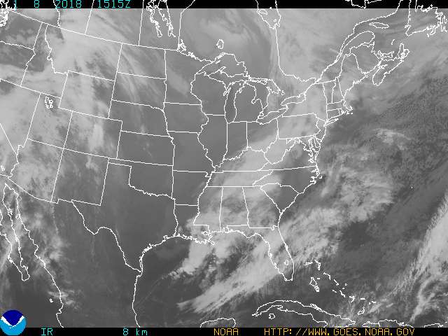
This Environment Canada satellite image shows the storm moving its way up the eastern seaboard of the United States toward southern Quebec. (Courtesy of Environment Canada).


</TD></TR></TBODY></TABLE>
Updated: Fri Oct. 01 2010 17:48:58

<SCRIPT language=javascript type=text/javascript> var byString = ""; var sourceString = "CTV.ca News Staff"; if ((sourceString != "") && (byString != "")) { document.write(byString + ", "); } else { document.write(byString); }</SCRIPT>CTV.ca News Staff

Heavy rains have finally stopped in much of Quebec after the remnants of tropical storm Nicole swept through the province on Friday, sparking flood watches and closing roads and contributing to at least two deaths.

The storm dumped 70 millimetres of rain on the Montreal area, while 90 mm fell on Sherbrooke, where high water levels forced roads to close.

A 66-year-old nun also died in Sherbrooke after falling from her roof, which she had been trying to repair. Horrified neighbours witnessed her fall.
In Saint-Calixte, north of Montreal, a 53-year-old man drowned while trying to unclog a culvert.

The rains also flooded countless basements.

"It was coming out of the toilet and the bath tub," said homeowner Annie Beauvais. "In 15 minutes the basement was full."

Qualinet, a Quebec company that cleans up after floods, said it had received about 350 calls on Friday -- more than 30 times the usual number.

Environment Canada had issued heavy rainfall warnings for a swath of southern Quebec stretching from the Eastern Townships to the Gaspe peninsula as the fading storm marched north through the U.S.

But Environment Canada said Quebec would not be quite so badly drenched as the U.S., predicting up to 80 millimetres of rain in the affected regions through Saturday morning.

.../
http://winnipeg.ctv.ca/servlet/an/l...Heads-North-101001/20101001/?hub=WinnipegHome
 
Re: Nicole dissipates over the Straits of Florida - Large area of heavy rains persists

Nun dies in Sherbrooke flooding

Roads closed, homes evacuated across Eastern Townships after heavy rains

Last Updated: Friday, October 1, 2010 | 5:37 PM ET


Torrential rain over the past two days has caused major flooding across Quebec's Eastern Townships, killing at least one person.​

More than 95 millimetres of rain have fallen in the region, which includes the city of Sherbrooke in the last 24 hours, causing nearby rivers to spill their banks.​

A 66-year-old Sherbrooke nun plunged to her death Friday morning while trying to track down a leak on her roof. The woman, who lived on ?vang?line Street, fell several metres from a ladder as she tried to climb down, according to eyewitnesses.​

About 100 people were forced out of their homes because of high water levels in the Saint-Fran?ois River, which rose to seven metres on Friday.​

...​

 
Back
Top Bottom