• FluTrackers.com Inc. does not provide medical advice. Information on this web site is collected from various internet resources, and the FluTrackers board of directors makes no warranty to the safety, efficacy, correctness or completeness of the information posted on this site by any author or poster. The information collated here is for instructional and/or discussion purposes only and is NOT intended to diagnose or treat any disease, illness, or other medical condition. Every individual reader or poster should seek advice from their personal physician/healthcare practitioner before considering or using any interventions that are discussed on this website. By continuing to access this website you agree to consult your personal physican before using any interventions posted on this website, and you agree to hold harmless FluTrackers.com Inc., the board of directors, the members, and all authors and posters for any effects from use of any medication, supplement, vitamin or other substance, device, intervention, etc. mentioned in posts on this website, or other internet venues referenced in posts on this website.
  • We are not asking for any donations. Do not donate to any entity who says they are raising funds for us.

Isaac weakens to a depression over northern Louisiana - All coastal warnings discontinued

Re: Tropical storm Isaac: U.S. Watches/Warnings In Effect

Re: Tropical storm Isaac: U.S. Watches/Warnings In Effect

000
WTNT34 KNHC 252050
TCPAT4

BULLETIN
TROPICAL STORM ISAAC ADVISORY NUMBER 19
NWS NATIONAL HURRICANE CENTER MIAMI FL AL092012
500 PM EDT SAT AUG 25 2012

...CENTER OF ISAAC MOVING ALONG THE NORTHERN COAST OF EASTERN
CUBA WITH LITTLE CHANGE IN STRENGTH...


SUMMARY OF 500 PM EDT...2100 UTC...INFORMATION
----------------------------------------------
LOCATION...21.3N 76.0W
ABOUT 120 MI...195 KM E OF CAMAGUEY CUBA
ABOUT 270 MI...435 KM SSE OF NASSAU
MAXIMUM SUSTAINED WINDS...60 MPH...95 KM/H
PRESENT MOVEMENT...NW OR 310 DEGREES AT 21 MPH...33 KM/H
MINIMUM CENTRAL PRESSURE...997 MB...29.44 INCHES


WATCHES AND WARNINGS
--------------------
CHANGES WITH THIS ADVISORY...

A TROPICAL STORM WATCH HAS BEEN ISSUED FOR THE FLORIDA WEST COAST
NORTH OF TARPON SPRINGS TO SUWANNEE RIVER.

THE GOVERNMENT OF THE DOMINICAN REPUBLIC HAS DISCONTINUED THE
TROPICAL STORM WARNING FOR THE DOMINICAN REPUBLIC.

SUMMARY OF WATCHES AND WARNINGS IN EFFECT...

A HURRICANE WARNING IS IN EFFECT FOR...
* THE FLORIDA KEYS INCLUDING THE DRY TORTUGAS
* THE WEST COAST OF FLORIDA FROM BONITA BEACH SOUTHWARD TO OCEAN
REEF
* FLORIDA BAY

A HURRICANE WATCH IS IN EFFECT FOR...
* THE FLORIDA EAST COAST FROM GOLDEN BEACH SOUTHWARD TO OCEAN REEF
* ANDROS ISLAND IN THE BAHAMAS

A TROPICAL STORM WARNING IS IN EFFECT FOR...
* HAITI
* CUBAN PROVINCES OF CIEGO DE AVILA...SANCTI SPIRITUS...VILLA
CLARA...CAMAGUEY...LAS TUNAS...GRANMA...HOLGUIN...SANTIAGO DE
CUBA...AND GUANTANAMO
* THE BAHAMAS
* TURKS AND CAICOS ISLANDS
* THE FLORIDA EAST COAST FROM SEBASTIAN INLET SOUTHWARD TO OCEAN
REEF
* LAKE OKEECHOBEE

A TROPICAL STORM WATCH IS IN EFFECT FOR...
* CUBAN PROVINCES OF MATANZAS AND CIENFUEGOS
* THE FLORIDA EAST COAST NORTH OF SEBASTIAN INLET TO FLAGLER BEACH
* THE FLORIDA WEST COAST NORTH OF BONITA BEACH TO SUWANNEE RIVER

A HURRICANE WARNING MEANS THAT HURRICANE CONDITIONS ARE EXPECTED
SOMEWHERE WITHIN THE WARNING AREA. A WARNING IS TYPICALLY ISSUED
36 HOURS BEFORE THE ANTICIPATED FIRST OCCURRENCE OF TROPICAL STORM
FORCE WINDS...CONDITIONS THAT MAKE OUTSIDE PREPARATIONS DIFFICULT
OR DANGEROUS. PREPARATIONS TO PROTECT LIFE AND PROPERTY SHOULD BE
RUSHED TO COMPLETION.

A HURRICANE WATCH MEANS THAT HURRICANE CONDITIONS ARE POSSIBLE
WITHIN THE WATCH AREA...IN THIS CASE WITHIN THE NEXT 24 TO 36 HOURS.

A TROPICAL STORM WARNING MEANS THAT TROPICAL STORM CONDITIONS ARE
EXPECTED SOMEWHERE WITHIN THE WARNING AREA WITHIN 36 HOURS.

A TROPICAL STORM WATCH MEANS THAT TROPICAL STORM CONDITIONS ARE
POSSIBLE WITHIN THE WATCH AREA...GENERALLY WITHIN 48 HOURS.

INTERESTS IN THE REMAINDER OF CUBA...THE REMAINDER OF FLORIDA...AND
ELSEWHERE ALONG THE NORTHERN GULF COAST SHOULD MONITOR THE PROGRESS
OF ISAAC.

FOR STORM INFORMATION SPECIFIC TO YOUR AREA IN THE UNITED
STATES...INCLUDING POSSIBLE INLAND WATCHES AND WARNINGS...PLEASE
MONITOR PRODUCTS ISSUED BY YOUR LOCAL NATIONAL WEATHER SERVICE
FORECAST OFFICE. FOR STORM INFORMATION SPECIFIC TO YOUR AREA OUTSIDE
THE UNITED STATES...PLEASE MONITOR PRODUCTS ISSUED BY YOUR NATIONAL
METEOROLOGICAL SERVICE.


DISCUSSION AND 48-HOUR OUTLOOK
------------------------------
AT 500 PM EDT...2100 UTC...THE CENTER OF TROPICAL STORM ISAAC WAS
LOCATED NEAR LATITUDE 21.3 NORTH...LONGITUDE 76.0 WEST. ISAAC IS
MOVING TOWARD THE NORTHWEST NEAR 21 MPH...33 KM/H...AND THIS
GENERAL MOTION IS EXPECTED TO CONTINUE DURING THE NEXT 48 HOURS.
ON THE FORECAST TRACK...THE CENTER OF ISAAC SHOULD MOVE NEAR OR
OVER EASTERN CUBA THIS EVENING...NEAR OR OVER CENTRAL CUBA
TONIGHT...AND MOVE NEAR OR OVER THE FLORIDA KEYS AND THE SOUTHERN
FLORIDA PENINSULA SUNDAY OR SUNDAY NIGHT.

MAXIMUM SUSTAINED WINDS ARE NEAR 60 MPH...95 KM/H...WITH HIGHER
GUSTS. STRENGTHENING IS FORECAST DURING THE NEXT 48 HOURS...AND
ISAAC IS EXPECTED TO BE AT OR NEAR HURRICANE STRENGTH WHEN IT
REACHES THE FLORIDA KEYS.

TROPICAL STORM FORCE WINDS EXTEND OUTWARD UP TO 205 MILES...335 KM
MAINLY TO THE NORTH OF THE CENTER.

THE ESTIMATED MINIMUM CENTRAL PRESSURE BASED ON HURRICANE HUNTER
AIRCRAFT AND CUBAN SURFACE OBSERVATIONS IS 997 MB...29.44 INCHES.


HAZARDS AFFECTING LAND
----------------------
RAINFALL...TOTAL RAINFALL ACCUMULATIONS OF 8 TO 12 INCHES...WITH
MAXIMUM AMOUNTS OF 20 INCHES...ARE POSSIBLE OVER HISPANIOLA. THESE
RAINS COULD CAUSE LIFE-THREATENING FLASH FLOODS AND MUD SLIDES.
TOTAL RAIN ACCUMULATIONS OF 4 TO 8 INCHES...WITH MAXIMUM AMOUNTS OF
12 INCHES...ARE POSSIBLE ACROSS JAMAICA...THE CENTRAL AND EASTERN
PORTIONS OF CUBA...THE FLORIDA KEYS AND THE SOUTHERN PENINSULA OF
FLORIDA. TOTAL RAIN ACCUMULATIONS OF 3 TO 5 INCHES ARE POSSIBLE
OVER THE CENTRAL AND SOUTHERN BAHAMAS.

WIND...TROPICAL STORM CONDITIONS ARE OCCURRING OVER PORTIONS OF THE
HAITI...EASTERN CUBA...THE CENTRAL AND SOUTHEASTERN BAHAMAS AND THE
TURKS AND CAICOS ISLANDS. TROPICAL STORM CONDITIONS ARE EXPECTED
OVER THE NORTHWESTERN BAHAMAS BY SUNDAY MORNING. HURRICANE
CONDITIONS ARE POSSIBLE ON ANDROS ISLAND ON SUNDAY. TROPICAL STORM
CONDITIONS ARE EXPECTED OVER CENTRAL CUBA TONIGHT. TROPICAL STORM
CONDITIONS ARE EXPECTED TO REACH NORTHWESTERN CUBA ON SUNDAY.

HURRICANE CONDITIONS ARE EXPECTED IN THE HURRICANE WARNING AREA IN
SOUTHWEST FLORIDA AND THE FLORIDA KEYS ON SUNDAY...WITH TROPICAL
STORM CONDITIONS EXPECTED BY EARLY SUNDAY. HURRICANE CONDITIONS ARE
POSSIBLE IN THE HURRICANE WATCH AREA IN SOUTHEAST FLORIDA ON
SUNDAY...WITH TROPICAL STORM CONDITIONS EXPECTED IN THE TROPICAL
STORM WARNING AREA IN FLORIDA BY EARLY SUNDAY. TROPICAL STORM
CONDITIONS COULD SPREAD NORTHWARD ALONG THE WEST COAST OF FLORIDA IN
THE WATCH AREA BY EARLY MONDAY.

STORM SURGE...THE COMBINATION OF A STORM SURGE AND THE TIDE WILL
CAUSE NORMALLY DRY AREAS NEAR THE COAST TO BE FLOODED BY RISING
WATERS. THE WATER COULD REACH THE FOLLOWING DEPTHS ABOVE GROUND IF
THE PEAK SURGE OCCURS AT THE TIME OF HIGH TIDE...

* SOUTHWEST FLORIDA COAST WITHIN HURRICANE WARNING AREA...5 TO 7 FT
* FLA WEST COAST WITHIN WATCH AREA INCLUDING TAMPA BAY...3 TO 5 FT
* SOUTHEAST FLORIDA COAST AND THE FLORIDA KEYS...1 TO 3 FT
* HISPANIOLA AND EASTERN CUBA...1 TO 3 FT
* THE BAHAMAS AND TURKS AND CAICOS...1 TO 3 FT

THE DEEPEST WATER WILL OCCUR ALONG THE IMMEDIATE COAST IN AREAS OF
ONSHORE FLOW. SURGE-RELATED FLOODING DEPENDS ON THE RELATIVE TIMING
OF THE SURGE AND THE TIDAL CYCLE...AND CAN VARY GREATLY OVER SHORT
DISTANCES. FOR INFORMATION SPECIFIC TO YOUR AREA...PLEASE SEE
PRODUCTS ISSUED BY YOUR LOCAL WEATHER SERVICE OFFICE. NEAR THE
COAST...THE SURGE WILL BE ACCOMPANIED BY DANGEROUS WAVES.

SURF...DANGEROUS SURF AND RIP CURRENT CONDITIONS WILL AFFECT
HISPANIOLA...THE BAHAMAS...THE TURKS AND CAICOS...EASTERN AND
CENTRAL CUBA...AND THE EAST COAST OF FLORIDA AND THE FLORIDA KEYS
DURING THE NEXT COUPLE OF DAYS. PLEASE CONSULT PRODUCTS FROM YOUR
LOCAL WEATHER OFFICE FOR MORE INFORMATION.


NEXT ADVISORY
-------------
NEXT INTERMEDIATE ADVISORY...800 PM EDT.
NEXT COMPLETE ADVISORY...1100 PM EDT.

$$
FORECASTER BEVEN
http://www.nhc.noaa.gov/text/refresh/MIATCPAT4+shtml/252050.shtml

 
Re: Tropical storm Isaac: U.S. Watches/Warnings In Effect

Re: Tropical storm Isaac: U.S. Watches/Warnings In Effect

NOAA :Tropical Storm Isaac Moves Faster To Florida


Saturday, August 25, 2012

MIAMI, Florida -- At 5 p.m. on August 25, 2012 Eastern Daylight Time, NOAA's National Hurricane Center in Miami, Florida, issued a tropical weather outlook public advisory due to the Atlantic Tropical Cyclone Activity of Tropical Storm Isaac in the Caribbean and another tropical wave off the coast of Africa.

The present movement of Tropical Storm Isaac has increased from 17 miles per hour to 21 miles per hour towards the northwest.

Florida Governor Declares State of Emergency

NOAA's National Hurricane Center stormtracker forecasts that Tropical Storm Isaac, predicted to become Hurricane Isaac on Monday, will take a more easterly track and arrive just off the coast of Pensacola, Florida Tuesday afternoon.

The northeast quadrant of Tropical Storm Issac, the most powerful area of a hurricane in the northern hemisphere, is predicted to be over Southwest Florida Sunday afternoon and Tampa Bay on Monday morning as Hurricane Isaac passes over the Florida Keys.

The majority of the spaghetti models predict that Hurricane Isaac will head north-northwest on Monday and make landfall as a Category 2 Hurricane on the U.S. Gulf Coast anywhere from as far west as New Orleans, Louisiana to as far south and east as West Palm Beach, Florida

More...
http://news.brevardtimes.com/2012/08/noaa-tropical-storm-isaac-moves-faster.html
 
Re: Tropical storm Isaac: U.S. Watches/Warnings In Effect

Re: Tropical storm Isaac: U.S. Watches/Warnings In Effect

Isaac leaves 2 dead in Haiti, moves on to Cuba and eventually Florida

By the CNN Wire Staff

updated 5:00 PM EDT, Sat August 25, 2012

As fervent preparations continue to be made from the Florida Keys all the way up the Gulf Coast, authorities in Haiti were busy Saturday assessing the damage that Isaac had already caused and braced for more potential problems.
...
"So far, I think we're faring reasonably well in our response," Kevin Kennedy told CNN on Saturday afternoon, referring to the efforts led by the Haitian government and assisted by U.N. agencies and non-governmental organizations.

Haitian radio reported that the worst damage was in the country's southeast.

Heavy rain and strong winds persisting into the morning hours caused visible damage to trees and houses in the city of Jacmel, on Haiti's southern coast, and knocked out power. As many as 1,500 of the city's residents took refuge in a school serving as a shelter.

Jacmel Mayor Hugues Paul confirmed at least one death on the outskirts of his city, voicing fears that more deaths will be reported.
...
Full text:
http://www.cnn.com/2012/08/25/us/tropical-storm-isaac/index.html
 
Re: Tropical storm Isaac: U.S. Watches/Warnings In Effect

Re: Tropical storm Isaac: U.S. Watches/Warnings In Effect

Mississippi -

Isaac brings back painful memories of Katrina

Latham uses experience to prepare for storm

UPDATED 12:23 PM CDT Aug 25, 2012

Seven years ago, Mississippi Emergency Management Executive Director Robert Latham headed up the response during the storm, and after a brief retirement, he's back leading the state's emergency operations.

"Katrina taught us something that we will never forget," Latham said.
...
Now, Latham has his eyes on Isaac. As the tropical storm gains strength and barrels toward the Gulf, Latham hopes mistakes made during Katrina aren't repeated. He regrets that more families weren't evacuated sooner.

"Some coastal residents didn't fear the storm until it was too late. And my fear is that we, you know, knowing the devastations these things can have, that we should take every one of these things seriously," Latham said.
...
"There's no need for anybody to lose their life in a hurricane, because we know it's coming," Latham said.

Read more: http://www.wapt.com/weather/Isaac-b...16266020/-/bgfstlz/-/index.html#ixzz24alIamm8
 
Re: Tropical storm Isaac: U.S. Watches/Warnings In Effect

Re: Tropical storm Isaac: U.S. Watches/Warnings In Effect

Sea_Surface_Temps-640x360.jpg


http://www.wwltv.com/weather/hurricane/maps?radar=94692959&img=3&c=y

Spaghetti_Plots-640x360.jpg

http://www.wwltv.com/weather/hurricane/maps?radar=94692959&img=2&c=y
<!-- image.mediaCaption --><!-- image {mediaTitle=Spaghetti Plots, mediaCaption=, mediaURL=http://belo.bimedia.net/WWL/weather/stills/Spaghetti_Plots-640x360.jpg, mediaLink=, mediaAltText=, mediaDesc=, mediaHeight=360, mediaGroup=Spaghetti_Plots, mediaPosition=, mediaWidth=640} --><!-- image.mediaCaption --><!-- image {mediaTitle=Gulf Sea Surface Temperatures, mediaCaption=, mediaLink=, mediaURL=http://belo.bimedia.net/WWL/weather/stills/Sea_Surface_Temps-640x360.jpg, mediaAltText=, mediaDesc=, mediaPosition=, mediaGroup=Car_Sea_Surface_Temps, mediaHeight=360, mediaWidth=640} -->
 
Re: Tropical storm Isaac: U.S. Watches/Warnings In Effect

Re: Tropical storm Isaac: U.S. Watches/Warnings In Effect


http://www.nhc.noaa.gov/refresh/graphics_at4+shtml/212841.shtml?50wind120#contents

----------------------------------------------------------------------------------

000
wtnt44 knhc 252102
tcdat4

tropical storm isaac discussion number 19
nws national hurricane center miami fl al092012
500 pm edt sat aug 25 2012

the center of isaac is currently moving along the north coast of
eastern cuba. The satellite appearance is somewhat disorganized...
With the main convective mass 50 n mi or more east of the low-level
center. An air force reserve hurricane hunter aircraft has
reported 850 mb flight-level winds of 56 kt to the northeast of the
center...with reliable-looking sfmr surface wind data near 50 kt.
Based on this...the initial intensity remains 50 kt. The central
pressure of 997 mb is based on a combination of aircraft data and
cuban surface observations.

The initial motion is now 310/18. Isaac is currently part of a
large low/mid-level low pressure system covering the northwestern
caribbean sea and the adjacent land and ocean areas. This low
pressure area has a second vorticity center between jamaica and the
cayman islands...and for the next 24-36 hr isaac and this center
will likely rotate around each other. Based on this expectation...
The forecast track shows isaac moving northwestward for 12 hr or
so...followed by a turn toward the west-northwest. It is possible
the storm could make a sharper turn than forecast...as the ukmet is
showing an almost due west motion between the florida keys and cuba
near the 36 hr point. The early part of the forecast track is
shifted a little to the left of the previous forecast...but still
lies to the right of the consensus models and the bulk of the
dynamical models. After 36 hr...isaac should break free of or
absorb the rest of the low...with the subtropical ridge to the east
becoming the dominant steering influence. this should allow the
storm to gradually turn toward the northwest and north over the
eastern and northern gulf of mexico...with an eventual landfall
along the northern gulf coast in 72-96 hr. Where this might occur
is still rather uncertain...with the track guidance spread between
southeastern louisiana and the central florida panhandle. This part
of the track forecast lies in the center of the guidance envelope
near the consensus models and is similar to the previous forecast.

a combination of light westerly vertical wind shear and land
interaction should at least slow intensification for the next 12
hr. After that...the shear should diminish while the cyclone
reaches open water. This should allow isaac to gradually strengthen
into a hurricane near the florida keys or over the southeastern
gulf of mexico. the new intensity forecast is similar to the
previous forecast and is near or a little above the intensity
consensus. it should be noted that the global models are
forecasting a very favorable pattern of upper-level winds over the
northern gulf of mexico by 72 hr. Should this verify and should
isaac establish an inner core...the cyclone could be significantly
stronger than currently forecast.

it is important not to focus on the exact track of isaac due to the
uncertainties in the forecast and the fact that isaac has a large
area of tropical storm force winds associated with it.


Forecast positions and max winds

init 25/2100z 21.3n 76.0w 50 kt 60 mph
12h 26/0600z 22.6n 78.0w 55 kt 65 mph
24h 26/1800z 24.1n 80.6w 60 kt 70 mph
36h 27/0600z 25.2n 82.7w 65 kt 75 mph
48h 27/1800z 26.5n 84.3w 75 kt 85 mph
72h 28/1800z 29.0n 86.0w 85 kt 100 mph
96h 29/1800z 31.5n 86.0w 55 kt 65 mph...inland
120h 30/1800z 33.5n 85.5w 25 kt 30 mph...inland

$$
forecaster beven
http://www.nhc.noaa.gov/text/refresh/MIATCDAT4+shtml/252102.shtml?
 
Re: Tropical storm Isaac: U.S. Watches/Warnings In Effect

Re: Tropical storm Isaac: U.S. Watches/Warnings In Effect

000
WTNT44 KNHC 260244
TCDAT4

TROPICAL STORM ISAAC DISCUSSION NUMBER 20
NWS NATIONAL HURRICANE CENTER MIAMI FL AL092012
1100 PM EDT SAT AUG 25 2012

SATELLITE AND RADAR DATA FROM CUBA SHOW THAT ISAAC IS MOVING
PARALLEL TO...BUT OFFSHORE OF...THE NORTHERN COAST OF CUBA.
THE HURRICANE HUNTER AIRCRAFT DID NOT FIND ANY STRONGER WINDS
DURING THE LATTER PORTION OF THE FLIGHT AND THE INITIAL WIND
SPEED REMAINS 50 KT. HOWEVER...THUNDERSTORM ACTIVITY HAS
INCREASED IN A BAND TO THE NORTH AND EAST OF THE CENTER DURING
THE PAST FEW HOURS AND ISAAC MAY BE ON THE VERGE OF STRENGTHENING.
THE NEXT RECONNAISSANCE FLIGHT IS EXPECTED TO BE IN THE CYCLONE
AROUND 0600 UTC.

THE INITIAL MOTION ESTIMATE IS 305/15 KT. ISAAC SHOULD CONTINUE ON
A WEST-NORTHWESTWARD TO NORTHWESTWARD MOTION DURING THE NEXT 24
HOURS OR SO BETWEEN A LARGE LOW/MID-LEVEL LOW PRESSURE SYSTEM OVER
THE NORTHWESTERN CARIBBEAN SEA AND A MID-LEVEL RIDGE OVER THE
WESTERN ATLANTIC. THE MODEL GUIDANCE IS TIGHTLY CLUSTERED DURING
THIS TIME AND SHOWS A TRACK OVER THE STRAITS OF FLORIDA AND NEAR OR
OVER THE FLORIDA KEYS. IN ABOUT 48 HOURS...ISAAC WILL BE NEARING
THE WESTERN PORTION OF THE RIDGE AND SHOULD MOVE IN A GENERAL
NORTHWESTWARD HEADING OVER THE EASTERN GULF OF MEXICO...BUT LARGE
DIFFERENCES EXIST BETWEEN THE LATEST ECMWF AND GFS MODELS AFTER
THAT TIME. THE ECMWF RECURVES ISAAC AHEAD OF A MID-LATITUDE
TROUGH OVER THE EASTERN UNITED STATES...WHILE THE GFS SLOWS ISAAC
DOWN AS THE TROUGH BYPASSES THE SYSTEM AND THE MODEL THEN TURNS
THE CYCLONE WESTWARD TO THE SOUTH OF A DEVELOPING MID- TO
UPPER-LEVEL RIDGE. THIS BIFURCATION IS ALSO SEEN IN THE MOST RECENT
ECMWF AND GFS ENSEMBLES WITH ABOUT AN EQUAL NUMBER OF MEMBERS
SHOWING RECURVATURE VERSUS A CONTINUE NORTHWESTERLY TRACK TOWARD
THE NORTHERN GULF COAST. SINCE THE UNCERTAINTY IS LARGE AND EITHER
OF THESE SCENARIOS ARE POSSIBLE AT THIS TIME...THE NHC FORECAST IS
LIES BETWEEN THEM. THE UPDATED TRACK IS VERY CLOSE TO THE PREVIOUS
ADVISORY THROUGH 36 HOURS. AFTER THAT TIME...THE TRACK HAS BEEN
ADJUSTED WESTWARD...BUT IT REMAINS EAST OF THE DYNAMICAL MODEL
CONSENSUS TO RETAIN SOME CONTINUITY WITH THE PREVIOUS FORECAST.

THE UPPER-LEVEL ENVIRONMENT IS EXPECTED TO BECOME MORE CONDUCIVE FOR
STRENGTHENING DURING THE NEXT COUPLE OF DAYS AS ISAAC MOVES OVER
THE WARM WATERS OF THE FLORIDA STRAITS AND EASTERN GULF. STEADY
STRENGTHENING IS EXPECTED AND ISAAC IS EXPECTED TO BE AT OR NEAR
HURRICANE STRENGTH WHEN THE CENTER REACHES THE FLORIDA KEYS.
ADDITIONAL STRENGTHENING IS LIKELY WHILE THE CYCLONE MOVES OVER THE
EASTERN GULF OF MEXICO. THE NEW INTENSITY FORECAST IS A LITTLE
HIGHER THAN THE PREVIOUS ADVISORY AND IS BETWEEN THE SHIPS/LGEM
GUIDANCE AND THE MORE AGGRESSIVE HWRF MODEL.

IT IS IMPORTANT NOT TO FOCUS ON THE EXACT FORECAST TRACK SINCE
SIGNIFICANT HAZARDS EXTEND WELL AWAY FROM THE CENTER. SINCE LARGE
UNCERTAINTIES REMAIN IN THE EXTENDED PORTION OF THE FORECAST...IT
IS TOO EARLY TO DETERMINE EXACTLY WHERE AND WHEN ISAAC WILL MAKE
LANDFALL ALONG THE GULF COAST.

FORECAST POSITIONS AND MAX WINDS

INIT 26/0300Z 22.1N 77.2W 50 KT 60 MPH
12H 26/1200Z 23.4N 79.4W 55 KT 65 MPH
24H 27/0000Z 24.6N 81.8W 65 KT 75 MPH...NEAR FLORIDA KEYS
36H 27/1200Z 25.8N 83.7W 75 KT 85 MPH
48H 28/0000Z 27.2N 85.2W 85 KT 100 MPH
72H 29/0000Z 29.5N 86.5W 90 KT 105 MPH
96H 30/0000Z 31.5N 86.5W 50 KT 60 MPH...INLAND
120H 31/0000Z 34.0N 86.0W 25 KT 30 MPH...INLAND

http://www.nhc.noaa.gov/text/refresh/MIATCDAT4+shtml/260244.shtml?
 
Re: Tropical storm Isaac: U.S. Watches/Warnings In Effect

Re: Tropical storm Isaac: U.S. Watches/Warnings In Effect

New Orleans Weather

Models shift west; official track still targets Fla. panhandle

PinPoint Weather Staff

Tropical Storm Isaac has winds of 60 mph winds at 10 pm. Isaac is about 340 ESE of Key West, FL moving NW 17 mph. Despite the spaghetti models clustering from SE LA to AL and none in FL as of the Saturday night run, the NHC didn't shift the official forecast track much. They may want to see another run of models to see if it is a trend and wanting to see the new European model overnight before making any changes to their official track. So basically, is this a trend with the shift of the models or another fluctuation back and forth? ...

http://www.wwltv.com/weather/Tropical-Update--Weather-Forecast-69340202.html
 
Re: Tropical storm Isaac: U.S. Watches/Warnings In Effect

Re: Tropical storm Isaac: U.S. Watches/Warnings In Effect

AL0912W5.gif
 
Re: Tropical storm Isaac: U.S. Watches/Warnings In Effect

Re: Tropical storm Isaac: U.S. Watches/Warnings In Effect

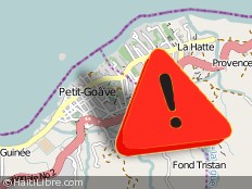
Haiti - Social : Petit-Go?ve waiting for help of all kinds...
26/08/2012 12:40:11

<TABLE border=0 cellSpacing=0 cellPadding=0 align=left><TBODY><TR><TD>
g-6483.jpg
</TD><TD>
tr.gif
</TD></TR></TBODY></TABLE>This Sunday, the town of Petit-Go?ve severely affected by the passage of Isaac Saturday, is found with many victims following the overflowing of rivers that have flooded the City center, Ti guinin, l'Acul, Rue Beno?t prolong?e, Marcorel, Desvignes, Regal, Mayoro, Diocann, Chabanne, Cap-Destre.

The municipal authorities and the office of Deputy Thimol?on have opened of Shelters and distributed food kits to IDPs. But these food kits are clearly insufficient in quantity given the large number of victims.

All the rivers of Petit-Go?ve : La Digue, Barette, Curtis, Benee, Figaro, Dlo piti, have overwhelmed and caused extensive damage : landslides, roads and houses damaged, gardens devastation especially in suburban and rural areas...

Other localities have decreed affected such as : Ti Guinin, l'Acul, Maro, Cap-Destre, Fond-Fab, Chabane, Curtis, Rue Beno?t, 12th section. To Vialet and its surroundings : Vieux Chodye, Officier, Nan bouzin...

... With regard to local authorities, they seemed overwhelmed by events, because the request came from all sides and the needs are many...

...
HL/ HaitiLibre / Guyto Mathieu (Correspondant Petit-Go?ve)

http://www.haitilibre.com/en/news-6483-haiti-social-petit-goave-waiting-for-help-of-all-kinds.html
 
Re: Tropical storm Isaac: U.S. Watches/Warnings In Effect

Re: Tropical storm Isaac: U.S. Watches/Warnings In Effect

Posted on Sunday, 08.26.12


Haiti: Death toll from Isaac climbs to 7

The Associated Press

PORT-AU-PRINCE, Haiti -- The death toll in Haiti from Tropical Storm Isaac has climbed to seven after an initial report of four deaths, the Haitian government said Sunday.
...
The number of people evacuated due to flooding also rose. More than 14,000 people have left their homes throughout the country and another 13,500 people were living in temporary shelters, the Civil Protection Office reported. Some 8,400 evacuees were in the country's western department, the most populous and where the capital of Port-au-Prince is located.

Full text:
http://www.miamiherald.com/2012/08/26/2969006/haiti-death-toll-from-isaac-climbs.html
 
Re: Tropical storm Isaac: U.S. Watches/Warnings In Effect

Re: Tropical storm Isaac: U.S. Watches/Warnings In Effect

Posted on Sunday, 08.26.12

Hurricane watch lifted for Miami-Dade; tornado watch still in effect for South Florida

BY CURTIS MORGAN, CAMMY CLARK and DANIEL CHANG The Miami Herald
<?xml:namespace prefix = fb /><fb:like colorscheme="light" href="http://www.miamiherald.com/2012/08/26/2968842/huricane-watch-lifted-for-miami.html#storylink=fbuser" action="like" show_faces="false" layout="button_count" font="arial"></fb:like>
...
Isaac’s outer bands are brushing South Florida with intermittent bursts of wind and rain as the storm chugs into the Florida Straits and heads toward the Keys, where it is expected to be at or near hurricane strength.

But in a sign of Isaac’s diminishing threat to Miami-Dade, the National Hurricane Center removed a hurricane watch for the county’s coastal communities.

A tornado watch and tropical storm warning remained in effect, however, as winds are expected to steadily worsen — spreading from the Keys north across Miami-Dade and Broward counties throughout the day and into early Monday morning.

Wind gusts of 55- to 60-miles-per hour began at about 6:30 a.m., felling trees and blowing debris that have knocked out power to thousands of homes in Miami-Dade and Broward counties.
...
Meteorologists expect the storm to be at or near Category 1 hurricane strength when it reaches the Florida Keys later Sunday.

Isaac is predicted to continue moving generally in a west-northwest direction through Monday. Though it is too early to determine exactly where Isaac will make landfall along the Gulf Coast, a hurricane watch was posted from Morgan City, La., west of New Orleans all the way east across to near Apalachicola on the northeastern Florida Panhandle.

Forecasters are predicting it will make landfall on Wednesday morning.

Full text:
http://www.miamiherald.com/2012/08/26/2968842/huricane-watch-lifted-for-miami.html
 
Re: Tropical storm Isaac: U.S. Watches/Warnings In Effect

Re: Tropical storm Isaac: U.S. Watches/Warnings In Effect

000
WTNT34 KNHC 261747
TCPAT4

BULLETIN
TROPICAL STORM ISAAC INTERMEDIATE ADVISORY NUMBER 22A
NWS NATIONAL HURRICANE CENTER MIAMI FL AL092012
200 PM EDT SUN AUG 26 2012

...ISAAC HAS NOT STRENGTHENED...


SUMMARY OF 200 PM EDT...1800 UTC...INFORMATION
----------------------------------------------
LOCATION...23.9N 81.5W
ABOUT 50 MI...85 KM SSE OF KEY WEST FLORIDA
ABOUT 75 MI...120 KM NE OF HAVANA CUBA
MAXIMUM SUSTAINED WINDS...60 MPH...95 KM/H
PRESENT MOVEMENT...WNW OR 300 DEGREES AT 18 MPH...30 KM/H
MINIMUM CENTRAL PRESSURE...994 MB...29.35 INCHES


WATCHES AND WARNINGS
--------------------
CHANGES WITH THIS ADVISORY...

NONE.

SUMMARY OF WATCHES AND WARNINGS IN EFFECT...

A HURRICANE WARNING IS IN EFFECT FOR...
* THE FLORIDA KEYS INCLUDING THE DRY TORTUGAS
* THE WEST COAST OF FLORIDA FROM BONITA BEACH SOUTHWARD TO OCEAN
REEF
* FLORIDA BAY

A HURRICANE WATCH IS IN EFFECT FOR...
* EAST OF MORGAN CITY LOUISIANA TO INDIAN PASS FLORIDA...INCLUDING
METROPOLITAN NEW ORLEANS AND LAKE PONTCHARTRAIN

A TROPICAL STORM WARNING IS IN EFFECT FOR...
* THE CUBAN PROVINCE OF VILLA CLARA
* THE NORTHWESTERN BAHAMAS
* THE FLORIDA EAST COAST FROM SEBASTIAN INLET SOUTHWARD TO OCEAN
REEF
* LAKE OKEECHOBEE
* THE FLORIDA WEST COAST AND THE FLORIDA PANHANDLE FROM NORTH OF
BONITA BEACH TO INDIAN PASS...INCLUDING TAMPA BAY

A TROPICAL STORM WATCH IS IN EFFECT FOR...
* THE CUBAN PROVINCES OF MATANZAS AND CIENFUEGOS
* THE FLORIDA EAST COAST NORTH OF SEBASTIAN INLET TO FLAGLER BEACH

A HURRICANE WARNING MEANS THAT HURRICANE CONDITIONS ARE EXPECTED
SOMEWHERE WITHIN THE WARNING AREA...IN THIS CASE WITHIN THE NEXT 24
HOURS. PREPARATIONS TO PROTECT LIFE AND PROPERTY SHOULD BE RUSHED
TO COMPLETION.

A HURRICANE WATCH MEANS THAT HURRICANE CONDITIONS ARE POSSIBLE
WITHIN THE WATCH AREA. A WATCH IS TYPICALLY ISSUED 48 HOURS
BEFORE THE ANTICIPATED FIRST OCCURRENCE OF TROPICAL-STORM-FORCE
WINDS...CONDITIONS THAT MAKE OUTSIDE PREPARATIONS DIFFICULT OR
DANGEROUS.

A TROPICAL STORM WARNING MEANS THAT TROPICAL STORM CONDITIONS ARE
EXPECTED SOMEWHERE WITHIN THE WARNING AREA WITHIN 36 HOURS.

A TROPICAL STORM WATCH MEANS THAT TROPICAL STORM CONDITIONS ARE
POSSIBLE WITHIN THE WATCH AREA...GENERALLY WITHIN 48 HOURS.

INTERESTS IN THE REMAINDER OF CUBA...THE REMAINDER OF FLORIDA...AND
THE REMAINDER OF THE NORTHERN GULF COAST SHOULD MONITOR THE PROGRESS
OF ISAAC.

FOR STORM INFORMATION SPECIFIC TO YOUR AREA IN THE UNITED
STATES...INCLUDING POSSIBLE INLAND WATCHES AND WARNINGS...PLEASE
MONITOR PRODUCTS ISSUED BY YOUR LOCAL NATIONAL WEATHER SERVICE
FORECAST OFFICE. FOR STORM INFORMATION SPECIFIC TO YOUR AREA OUTSIDE
THE UNITED STATES...PLEASE MONITOR PRODUCTS ISSUED BY YOUR NATIONAL
METEOROLOGICAL SERVICE.


DISCUSSION AND 48-HOUR OUTLOOK
------------------------------
AT 200 PM EDT...1800 UTC...THE CENTER OF TROPICAL STORM ISAAC WAS
LOCATED NEAR LATITUDE 23.9 NORTH...LONGITUDE 81.5 WEST. ISAAC IS
MOVING TOWARD THE WEST-NORTHWEST NEAR 18 MPH...30 KM/H. A WEST-
NORTHWESTWARD TO NORTHWESTWARD MOTION IS EXPECTED DURING THE NEXT
48 HOURS WITH A GRADUAL DECREASE IN FORWARD SPEED. ON THE FORECAST
TRACK...THE CENTER OF ISAAC IS EXPECTED TO MOVE NEAR OR OVER THE
LOWER FLORIDA KEYS LATER TODAY AND TONIGHT...AND MOVE INTO THE
EASTERN GULF OF MEXICO ON MONDAY.

MAXIMUM SUSTAINED WINDS ARE NEAR 60 MPH...95 KM/H...WITH HIGHER
GUSTS. SOME STRENGTHENING IS FORECAST DURING THE NEXT 48
HOURS...HOWEVER THE LIKELIHOOD OF ISAAC BECOMING A HURRICANE BEFORE
IT REACHES THE FLORIDA KEYS IS DECREASING.

TROPICAL STORM FORCE WINDS EXTEND OUTWARD UP TO 205 MILES...335 KM
FROM THE CENTER. A WIND GUST TO 55 MPH...89 KM/H...WAS RECENTLY
REPORTED AT VIRGINIA KEY.

THE MINIMUM CENTRAL PRESSURE BASED ON DATA FROM AN AIR FORCE
HURRICANE HUNTER AIRCRAFT IS 994 MB...29.35 INCHES.


HAZARDS AFFECTING LAND
----------------------
RAINFALL...TOTAL RAINFALL ACCUMULATIONS OF 4 TO 8 INCHES...WITH
MAXIMUM AMOUNTS OF 12 INCHES...ARE POSSIBLE ACROSS THE FLORIDA
KEYS...THE SOUTHERN PENINSULA OF FLORIDA AND PORTIONS OF CENTRAL AND
EASTERN CUBA. TOTAL RAIN ACCUMULATIONS OF 3 TO 6 INCHES ARE
POSSIBLE OVER THE CENTRAL AND SOUTHERN BAHAMAS.

WIND...TROPICAL STORM CONDITIONS ARE OCCURRING OVER PORTIONS OF
EASTERN AND CENTRAL CUBA AND THE BAHAMAS AND THE TURKS AND CAICOS
ISLANDS. TROPICAL STORM CONDITIONS ARE POSSIBLE IN PORTIONS OF
NORTHWESTERN CUBA BY LATE TODAY.

HURRICANE CONDITIONS ARE EXPECTED IN THE HURRICANE WARNING AREA IN
SOUTHWEST FLORIDA AND THE FLORIDA KEYS TODAY.

TROPICAL STORM CONDITIONS ARE OCCURRING IN THE TROPICAL
STORM WARNING AREA ALONG THE FLORIDA EAST COAST. TROPICAL STORM
CONDITIONS ARE EXPECTED TO SPREAD NORTHWARD ALONG THE WEST COAST OF
FLORIDA AND INTO THE EASTERN FLORIDA PANHANDLE IN THE TROPICAL
STORM WARNING AREA TONIGHT AND MONDAY.

HURRICANE CONDITIONS ARE POSSIBLE IN THE HURRICANE WATCH AREA ALONG
THE NORTHERN GULF COAST ON TUESDAY...WITH TROPICAL STORM CONDITIONS
POSSIBLE BY MONDAY NIGHT.

STORM SURGE...THE COMBINATION OF A STORM SURGE AND THE TIDE WILL
CAUSE NORMALLY DRY AREAS NEAR THE COAST TO BE FLOODED BY RISING
WATERS. THE WATER COULD REACH THE FOLLOWING DEPTHS ABOVE GROUND IF
THE PEAK SURGE OCCURS AT THE TIME OF HIGH TIDE...

* CRYSTAL RIVER THROUGH THE BIG BEND OF FLORIDA...4 TO 7 FT
* SOUTHWEST FLORIDA COAST WITHIN HURRICANE WARNING AREA...4 TO 6 FT
* FLORIDA WEST COAST FROM BONITA BEACH TO SOUTH OF CRYSTAL RIVER
INCLUDING TAMPA BAY...3 TO 5 FT
* SOUTHEAST FLORIDA COAST AND THE FLORIDA KEYS...1 TO 3 FT
* CENTRAL AND EASTERN CUBA...1 TO 3 FT
* THE BAHAMAS...1 TO 3 FT

THE DEEPEST WATER WILL OCCUR ALONG THE IMMEDIATE COAST IN AREAS OF
ONSHORE FLOW. SURGE-RELATED FLOODING DEPENDS ON THE RELATIVE TIMING
OF THE SURGE AND THE TIDAL CYCLE...AND CAN VARY GREATLY OVER SHORT
DISTANCES. FOR INFORMATION SPECIFIC TO YOUR AREA...PLEASE SEE
PRODUCTS ISSUED BY YOUR LOCAL WEATHER SERVICE OFFICE. NEAR THE
COAST...THE SURGE WILL BE ACCOMPANIED BY DANGEROUS WAVES.

TORNADOES...TORNADOES ARE POSSIBLE TODAY OVER CENTRAL AND SOUTHERN
FLORIDA...WITH THE GREATEST THREAT OVER SOUTHERN FLORIDA AND THE
KEYS.

SURF...DANGEROUS SURF AND RIP CURRENT CONDITIONS WILL CONTINUE TO
AFFECT THE CENTRAL AND NORTHWESTERN BAHAMAS...CENTRAL CUBA...THE
FLORIDA PENINSULA AND THE FLORIDA KEYS DURING THE NEXT COUPLE OF
DAYS. PLEASE CONSULT PRODUCTS FROM YOUR LOCAL WEATHER OFFICE FOR
MORE INFORMATION.


NEXT ADVISORY
-------------
NEXT COMPLETE ADVISORY...500 PM EDT.

$$
FORECASTER PASCH/ROBERTS
http://www.nhc.noaa.gov/text/refresh/MIATCPAT4+shtml/261747.shtml
 
Re: Tropical storm Isaac: U.S. Watches/Warnings In Effect

Re: Tropical storm Isaac: U.S. Watches/Warnings In Effect

Louisiana -

Plaquemines Parish delcares State of Emergency over possible Hurricane Isaac

wwltv.com
Posted on August 26, 2012 at 11:26 AM

Belle Chasse - At 9:00 a.m. on Sunday, August 26, 2012, Plaquemines Parish President Billy Nungesser Declared a State of Emergency because of the threat of Tropical Storm Isaac. Officials are working with GOHSEP, the Corps of Engineers, and local area leaders to prepare for the storm.

On the eastbank parish officials are lining newly raised levees with visqueen to ensure that areas with exposed dirt are protected. On the westbank additional Hesco baskets are being added to close gaps in low lying area of Hwy 23. Also, sandbags are being added to levees which are part of the hurricane protection system in Pointe-a-la-Hache.

Later today officials will meet with the Corps of Engineers to discuss plans for the barges currently pumping water into intakes in Port Sulphur and Pointe-a-la-Hache.
...
http://www.wwltv.com/news/local/pla...over-possible-Hurricane--Isaac-167474855.html
------------------------------------------------------------------------------------------
Jefferson Parish declares state of emergency

wwltv.com
Posted on August 26, 2012 at 1:20 PM
Updated today at 1:20 PM

Jefferson Parish President John Young has declared a State of Emergency for Jefferson Parish in anticipation of the effects of Tropical Storm Isaac.

Jefferson Parish Emergency Management is closely monitoring Tropical Storm Isaac. The National Weather Service reports Tropical Storm Isaac continues to strengthen and likely will continue a westward track in the Gulf of Mexico.

A Hurricane Watch currently is in effect for all areas of Southeast Louisiana, including areas of upper and lower Jefferson Parish.

All citizens are reminded to prepare now your families, homes, and property for this weather event.

The Southeast Louisiana Flood Protection Authority-West (SLFPA-W) will begin closing non-essential flood gates on the West Bank in anticipation of strong southerly winds and high tides associated with Tropical Storm Isaac. This is the first step in a process that will ensure implementation of the Authority?s flood protection program. As the storm progresses, there will be additional closures as the Flood Authority works with the U.S. Army Corps of Engineers.

Substantial rain, hurricane force winds, and tidal surge are expected as Isaac is expected to intensify to a Category 2 hurricane when it makes landfall, which at this point, is projected to be 7:00am CST Wednesday, August 29, 2012 near Biloxi, MS.

More:
http://www.wwltv.com/news/local/jef...sh-declares-state-of-emergency-167479655.html...
 
Re: Tropical storm Isaac: U.S. Watches/Warnings In Effect

Re: Tropical storm Isaac: U.S. Watches/Warnings In Effect

Louisiana -

Grand Isle issues mandatory evacuation order

wwltv.com
Posted on August 26, 2012 at 1:35 PM

GRAND ISLE, La. - Grand Isle has called for a mandatory evacuation of campers and tourists immediately (1:30 p.m.).

All island residents are required to leave by 9 a.m. Monday.

http://www.wwltv.com/news/local/jef...ues-mandatory-evacuation-order-167480495.html
 
Re: Tropical storm Isaac: U.S. Watches/Warnings In Effect

Re: Tropical storm Isaac: U.S. Watches/Warnings In Effect

MAYOR LANDRIEU, CITY OFFICIALS TO PROVIDE UPDATE ON STORM PREPARATION PLANS

NEW ORLEANS, LA--Today Mayor Mitch Landrieu and City officials will provide an update on the City's storm preparations in advance of Tropical Storm Isaac.
WHO: Mayor Mitch Landrieu
City officials

WHAT: Update on City's storm preparations
WHEN: TODAY, August 26, 2012
2:45PM
WHERE: City Hall
Mayor's Press Room
1300 Perdido Street
New Orleans, LA 70112
...

http://www.nola.gov/PRESS/City-Of-N...TO-PROVIDE-UPDATE-ON-STORM-PREPARATION-PLANS/
 
Re: Tropical storm Isaac: U.S. Watches/Warnings In Effect

Re: Tropical storm Isaac: U.S. Watches/Warnings In Effect

Mayor Landrieu, City officials to provide an update on storm preparation plans

Sunday, August 26 - NEW ORLEANS, LA--Today Mayor Mitch Landrieu and City officials will provide an update on the City's storm preparations in advance of Tropical Storm Isaac. You can view the press conference live at
http://www.nola.gov/HOME/Mayor-Landrieus-Live-Press-Conference/
external.png


As Hurricane Issac Approaches Southern United States, City Officials Encourage All New Orleans Citizens to Take Basic Preparedness Steps

August 26, 2012. In conjunction with state and national agencies, City of New Orleans officials are closely monitoring the progress of Tropical Storm Isaac as it moves inland, and will continue to post updates here at http://ready.nola.gov
external.png
external.png
.


Officials encourage all citizens to stay calm, and to take basic preparedness steps, including
  • bringing in or securing any loose objects outside homes or trailers
  • securing any boats for higher than expected tides
  • ensuring each citizen has at least one gallon of water on hand, per person, per day, for at least three days
  • visit the Gather Supplies section of http://ready.nola.gov for a list of all supplies needed for individuals' and families' emergency kits, including canned food and a can opener, batteries and flashlights, a battery-operated radio, phone chargers, copies of important papers and medicines
  • designate an out-of-town emergency contact that family members can call if they get separated
As always, we encourage all citizens to use the resources available here at http://ready.nola.gov
external.png
to get themselves and their families prepared for a storm at any point during hurricane season by making and reviewing their emergency plan, having up-to-date emergency kits, and knowing how they would evacuate if need be. Citizens can also sign up
external.png
for emergency alerts from the City of New Orleans, which provide accurate, immediate information to citizens via text, call, or email.


http://new.nola.gov/ready
 
Re: Tropical storm Isaac: U.S. Watches/Warnings In Effect

Re: Tropical storm Isaac: U.S. Watches/Warnings In Effect

Mayor Mitch Landrieu declares state of emergency in New Orleans

Published: Sunday, August 26, 2012, 3:06 PM
Updated: Sunday, August 26, 2012, 3:09 PM

By Dennis Persica, The Times-PicayuneThe Times-Picayune

Surrounded by other city officials and City Council members, Landrieu said he declared the emergency "so that everybody in the city of new orleans can begin to prepare."

"It is important to be on high alert," the mayor said, noting that the city is about 36 hours away from a direct hit from Isaac according to current track predictions.
...

http://www.nola.com/hurricane/index.ssf/2012/08/mayor_mitch_landrieu_declares.html
 
Back
Top Bottom