Follow along with the video below to see how to install our site as a web app on your home screen.
Note: This feature may not be available in some browsers.
FluTrackers.com Inc. does not provide medical advice. Information on this web site is collected from various internet resources, and the FluTrackers board of directors makes no warranty to the safety, efficacy, correctness or completeness of the information posted on this site by any author or poster.
The information collated here is for instructional and/or discussion purposes only and is NOT intended to diagnose or treat any disease, illness, or other medical condition. Every individual reader or poster should seek advice from their personal physician/healthcare practitioner before considering or using any interventions that are discussed on this website.
By continuing to access this website you agree to consult your personal physican before using any interventions posted on this website, and you agree to hold harmless FluTrackers.com Inc., the board of directors, the members, and all authors and posters for any effects from use of any medication, supplement, vitamin or other substance, device, intervention, etc. mentioned in posts on this website, or other internet venues referenced in posts on this website.
We are not asking for any donations. Do not donate to any entity who says they are raising funds for us.
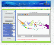
The National Spatial Information System (sisn) is the Coordinating Agency for Survey and National Charting in Indonesia. This agency has an interactive java map (in Indonesian) showing the names and boundaries of various administrative units, from Provinsi, Kabupaten, Kecamatan, to Desa. Layers and labels can be turned on and off and it is possible to zoom in and out for all layers.