• FluTrackers.com Inc. does not provide medical advice. Information on this web site is collected from various internet resources, and the FluTrackers board of directors makes no warranty to the safety, efficacy, correctness or completeness of the information posted on this site by any author or poster. The information collated here is for instructional and/or discussion purposes only and is NOT intended to diagnose or treat any disease, illness, or other medical condition. Every individual reader or poster should seek advice from their personal physician/healthcare practitioner before considering or using any interventions that are discussed on this website. By continuing to access this website you agree to consult your personal physican before using any interventions posted on this website, and you agree to hold harmless FluTrackers.com Inc., the board of directors, the members, and all authors and posters for any effects from use of any medication, supplement, vitamin or other substance, device, intervention, etc. mentioned in posts on this website, or other internet venues referenced in posts on this website.
  • We are not asking for any donations. Do not donate to any entity who says they are raising funds for us.

Hurricane Ian

sharon sanders

Editor-in-Chief & President
000
WTNT34 KNHC 262100 CCA
TCPAT4
BULLETIN
Hurricane Ian Advisory Number 15...Corrected
NWS National Hurricane Center Miami FL AL092022
500 PM EDT Mon Sep 26 2022
Corrected header and next advisory time
...IAN CONTINUES TO QUICKLY INTENSIFY...
...CONDITIONS IN WESTERN CUBA TO DETERIORATE THIS EVENING AND TONIGHT WITH SIGNIFICANT WIND AND STORM SURGE IMPACTS EXPECTED...
SUMMARY OF 500 PM EDT...2100 UTC...INFORMATION
---------------------------------------- LOCATION...20.3N 83.2W
ABOUT 155 MI...250 KM SE OF THE WESTERN TIP OF CUBA
MAXIMUM SUSTAINED WINDS...100 MPH...155 KM/H
PRESENT MOVEMENT...NNW OR 330 DEGREES AT 13 MPH
...20 KM/H MINIMUM CENTRAL PRESSURE...972 MB...28.71 INCHES WATCHES AND WARNINGS

-------------------- CHANGES WITH THIS ADVISORY:
A Hurricane Warning has been issued for the Dry Tortugas.
A Storm Surge Warning has been issued for Anclote River southward to Flamingo, including Tampa Bay.
A Storm Surge Watch has been issued for Altamaha Sound to the Flagler/Volusia County Line, including the St. Johns River.
The Tropical Storm Watch has been upgraded to a Tropical Storm Warning from Englewood southward to Flamingo. A Hurricane Watch has been issued from Bonita Beach to Englewood.
The Hurricane Watch from Englewood to the Anclote River, including Tampa Bay, has been upgraded to a Hurricane Warning. A Hurricane Watch has been issued from the Anclote River to the Suwannee River.
A Tropical Storm Watch has been issued from the Suwannee River to Indian Pass, and from Jupiter Inlet to Altamaha Sound.
The government of the Cayman Islands has discontinued the Tropical Storm Warning for Grand Cayman and the Tropical Storm Watch for Little Cayman and Cayman Brac.

SUMMARY OF WATCHES AND WARNINGS IN EFFECT:
A Hurricane Warning is in effect for... * Cuban provinces of Isla de Juventud, Pinar del Rio, and Artemisa * Englewood to the Anclote River, including Tampa Bay * Dry Tortugas A Storm Surge Warning is in effect for... * Anclote River southward to Flamingo * Tampa Bay
A Tropical Storm Warning is in effect for...
* Cuban provinces of La Habana, Mayabeque, and Matanzas
* Lower Florida Keys from Seven Mile Bridge westward to Key West
* Flamingo to Englewood
A Storm Surge Watch is in effect for...
* Florida Keys from the Card Sound Bridge westward to Key West
* Dry Tortugas
* Florida Bay
* Aucilla River to Anclote River
* Altamaha Sound to Flagler/Volusia County Line
* Saint Johns River A Hurricane Watch is in effect for...
* North of Anclote River to the Suwannee River
* Bonita Beach to Englewood
A Tropical Storm Watch is in effect for...
* Florida Keys from Seven Mile Bridge to the Channel 5 Bridge
* Lake Okeechobee * North of the Suwannee River to Indian Pass
* Jupiter Inlet to Altamaha Sound
A Hurricane Warning means that hurricane conditions are expected somewhere within the warning area, in this case within 24 to 36 hours. Preparations to protect life and property should be rushed to completion.
A Tropical Storm Warning means that tropical storm conditions are expected somewhere within the warning area within 36 hours. A Storm Surge Warning means there is a danger of life-threatening inundation, from rising water moving inland from the coastline, during the next 36 hours in the indicated locations.
For a depiction of areas at risk, please see the National Weather Service Storm Surge Watch/Warning Graphic, available at hurricanes.gov. This is a life-threatening situation. Persons located within these areas should take all necessary actions to protect life and property from rising water and the potential for other dangerous conditions. Promptly follow evacuation and other instructions from local officials.
A Storm Surge Watch means there is a possibility of life- threatening inundation, from rising water moving inland from the coastline, in the indicated locations during the next 48 hours. For a depiction of areas at risk, please see the National Weather Service Storm Surge Watch/Warning Graphic, available at hurricanes.gov.
A Hurricane Watch means that hurricane conditions are possible within the watch area. A watch is typically issued 48 hours before the anticipated first occurrence of tropical-storm-force winds, conditions that make outside preparations difficult or dangerous.
A Tropical Storm Watch means that tropical storm conditions are possible within the watch area, generally within 48 hours.
Interests in central Cuba, the remainder of the Florida Keys, and the Florida peninsula should monitor the progress of Ian.
For storm information specific to your area, please monitor products issued by your national meteorological service.

DISCUSSION AND OUTLOOK ---------------------- At 500 PM EDT (2100 UTC), the center of Hurricane Ian was located near latitude 20.3 North, longitude 83.2 West. Ian is moving toward the north-northwest near 13 mph (20 km/h). A turn toward the north with a slightly slower forward speed is expected on Tuesday. A turn toward the north-northeast with a further reduction in forward speed is forecast on Wednesday. On the forecast track, the center of Ian is expected to move near or over western Cuba tonight and early Tuesday. Ian will then emerge over the southeastern Gulf of Mexico on Tuesday, pass west of the Florida Keys late Tuesday, and approach the west coast of Florida on Wednesday into Thursday. Maximum sustained winds have increased to near 100 mph (155 km/h) with higher gusts. Rapid strengthening is expected during the next day or so, and Ian is forecast to become a major hurricane tonight or early Tuesday when it is near western Cuba and remain a major hurricane over the southeastern Gulf of Mexico on Wednesday. Hurricane-force winds extend outward up to 35 miles (55 km) from the center and tropical-storm-force winds extend outward up to 115 miles (185 km). The estimated minimum central pressure is 972 mb (28.71 inches).

HAZARDS AFFECTING LAND ---------------------- Key messages for Ian can be found in the Tropical Cyclone Discussion under AWIPS header MIATCDAT4 and WMO header WTNT44 KNHC and on the web at hurricanes.gov/text/MIATCDAT4.shtml.

STORM SURGE: The combination of storm surge and the tide will cause normally dry areas near the coast to be flooded by rising waters moving inland from the shoreline. The water could reach the following heights above ground somewhere in the indicated areas if the peak surge occurs at the time of high tide...
*Anclote River to Middle of Longboat Key, FL including Tampa Bay...5-10 ft
*Suwannee River to Anclote River...5-8 ft
*Middle of Longboat Key, FL to Englewood, FL...5-8 ft
*Englewood, FL to Bonita Beach, FL including Charlotte Harbor... 4-7 ft
*Bonita Beach, FL to East Cape Sable, FL...3-5 ft
*Flagler/Volusia County Line, FL to Altamaha Sound including St. Johns River...2-4 ft
*East Cape Sable, FL to Card Sound Bridge, FL including Florida Bay...2-4 ft
*Aucilla River to Suwannee River...2-4 ft *Florida Keys including the Dry Tortugas...2-4 ft
*Indian Pass, FL to Aucilla River...1-3 ft The deepest water will occur along the immediate coast near and to the right of the center, where the surge will be accompanied by large waves. Surge-related flooding depends on the relative timing of the surge and the tidal cycle, and can vary greatly over short distances. For information specific to your area, please see products issued by your local National Weather Service forecast office. Storm surge could raise water levels by as much as 9 to 14 feet above normal tide levels along the coast of western Cuba in areas of onshore winds in the hurricane warning area tonight and early Tuesday.

WIND: Hurricane conditions are expected within the warning area in Cuba tonight, with tropical storm conditions expected by this evening. Destructive winds are possible where the core of Ian moves across western Cuba. Tropical storm conditions are expected within the tropical storm warning area in Cuba tonight and Tuesday. Hurricane conditions are expected along the west coast of Florida within the Hurricane Warning area on Wednesday, with tropical storm conditions possibly beginning by Tuesday night. Tropical storm conditions are expected in the warning area by Tuesday evening. Hurricane conditions are possible in the watch area beginning on Wednesday, and tropical storm conditions are possible in the watch area on Wednesday into early Thursday. Tropical storm conditions are expected in the warning area in the lower Florida Keys and are possible in the watch area in the middle Florida Keys on Tuesday.

RAINFALL: Ian is expected to produce the following rainfall through Thursday: Jamaica: An additional 1 to 3 inches, with local maximum of 5 inches, especially along the south coastal region. Cayman Islands: 3 to 6 inches, with local maxima up to 8 inches. Western Cuba: 6 to 10 inches, with local maxima up to 16 inches. These rains may produce flash flooding and mudslides in areas of higher terrain over western Cuba. Florida Keys: 4 to 6 inches, with local maxima up to 8 inches Coastal Southwest and Southeast Florida: 4 to 6 inches with local maxima up to 10 inches Central West Florida: 6 to 12 inches, with local maxima up to 20 inches. Northeast Florida: 6 to 10 inches, with local maxima up to 12 inches. Remainder of the Central Florida Peninsula: 4 to 8 inches. Heavy rainfall is expected to affect the Southeast U.S. Friday and Saturday. Widespread considerable flash and urban flooding, and prolonged significant river flooding impacts are likely mid-to-late week across central and northern Florida, southern Georgia, and coastal South Carolina. Flash and urban flooding impacts are also possible with rainfall across the Florida Keys and the Florida peninsula through mid week. Limited flooding impacts and rises on area streams and rivers are also possible over portions of the Southeast mid-to-late week.

TORNADOES: A few tornadoes are possible late tonight and Tuesday across the Florida Keys and the southern/central Florida Peninsula.

SURF: Swells generated by Ian are affecting Jamaica and the Cayman Islands. Swells will spread northwestward to the southwestern coast of Cuba and the coasts of Honduras, Belize, and the Yucatan Peninsula of Mexico tonight. Swells are expected to begin affecting the Florida Keys Tuesday and spread northward along the west coast of Florida through Wednesday. These swells are likely to cause life-threatening surf and rip current conditions. Please consult products from your local weather office.

NEXT ADVISORY ------------- Next intermediate advisory at 800 PM EDT. Next complete advisory at 1100 PM EDT. $$ Forecaster Reinhart

https://www.nhc.noaa.gov/text/refresh/MIATCPAT4+shtml/262100.shtml?
 
As Ian targets Tampa Bay, hospitals, nursing homes evacuate patients

Published 3 hours ago
Updated 2 hours ago

By Christopher O'Donnell, Hannah Critchfield, Times staff

Several Tampa Bay area hospitals were evacuated while others across the region on Monday canceled noncritical surgeries and appointments ahead of the arrival of Hurricane Ian.

Nursing homes also prepared, with those at highest risk of storm surge evacuating residents.

A fleet of five helicopters flew multiple trips ferrying about 40 patients from HCA Florida Pasadena Hospital on Monday afternoon, including people on stretchers. The hospital on S Pasadena Avenue close to intracoastal waters near St. Pete Beach is within Pinellas County’s mandatory evacuation zone.

... Most were taken to HCA Florida Trinity Hospital in Pasco County, he said.HCA also suspended services and moved patients from hospitals in South Tampa and West Tampa and from its Central Tampa emergency facility. It has established a reunification hotline for family members to locate loved ones at 1-844-482-4821.

“We wanted our patients’ families to know where their loved ones would be prior to the storm,” Burish said.

Johns Hopkins All Children’s Hospital announced Monday it is suspending elective surgeries and closing outpatient centers from Tuesday through at least Friday. Patients arriving for critical procedures will be limited to one parent or visitor beginning at 1 p.m. Tuesday.

Tampa General Hospital (TGH)canceled noncritical surgeries scheduled for Wednesday and Thursday and is closing urgent care centers, ambulatory surgery centers and other clinics, according to its website.

“TGH will remain open to provide care during the storm. We are taking significant precautions to ensure the continued safety of our patients and team members,” a hospital statement read. “Our number one priority remains the safety of our patients and team members.” ...

https://www.tampabay.com/hurricane/2...uate-patients/
 
000
WTNT34 KNHC 271500
TCPAT4

BULLETIN
Hurricane Ian Advisory Number 18
NWS National Hurricane Center Miami FL AL092022
1100 AM EDT Tue Sep 27 2022


...POWERFUL HURRICANE IAN EMERGES INTO THE SOUTHEASTERN GULF OF
MEXICO...
...NEW WATCHES AND WARNINGS ISSUED FOR FLORIDA, GEORGIA AND SOUTH
CAROLINA...


SUMMARY OF 1100 AM EDT...1500 UTC...INFORMATION
-----------------------------------------------
LOCATION...23.0N 83.5W
ABOUT 305 MI...490 KM SSW OF SARASOTA FLORIDA
ABOUT 125 MI...200 KM SSW OF THE DRY TORTUGAS
MAXIMUM SUSTAINED WINDS...115 MPH...185 KM/H
PRESENT MOVEMENT...N OR 5 DEGREES AT 10 MPH...17 KM/H
MINIMUM CENTRAL PRESSURE...963 MB...28.44 INCHES


WATCHES AND WARNINGS
--------------------
CHANGES WITH THIS ADVISORY:

A Storm Surge Warning has been issued for the U.S. east coast from
Marineland Florida to the mouth of St. Mary's River including the
St. Johns River, and the Dry Tortugas. Along the Florida west
coast, a Storm Surge Warning has been issued from Suwanee River to
Anclote River.

A Hurricane Watch is in effect for the west coast of Florida from
south of Bonita Beach to Chokoloskee.

A Storm Surge Watch has been issued from the mouth of the St.
Mary's River to South Santee River South Carolina.

The Tropical Storm Warning along the U.S. east coast has been
extended north to Altamaha Sound Georgia and south to Boca Raton
Florida.

A Tropical Storm Watch is in effect from south of Boca Raton to east
of Flamingo Florida, for the upper Florida Keys and Florida Bay.

A Tropical Storm Watch is in effect from north of Altamaha Sound to
South Santee River South Carolina.

SUMMARY OF WATCHES AND WARNINGS IN EFFECT:

A Hurricane Warning is in effect for...
* Cuban provinces of Isla de Juventud, Pinar del Rio, and Artemisa
* Bonita Beach to Anclote River, including Tampa Bay
* Dry Tortugas

A Storm Surge Warning is in effect for...
* Suwanee River southward to Flamingo
* Tampa Bay
* Dry Tortugas
* Marineland to the mouth of the St. Mary's River
* St. Johns River

A Tropical Storm Warning is in effect for...
* Cuban provinces of La Habana, Mayabeque, and Matanzas
* Suwannee River to the Anclote River
* Flamingo to Bonita Beach
* Lower and Middle Florida Keys
* Boca Raton to Altamaha Sound
* Lake Okeechobee

A Storm Surge Watch is in effect for...
* Florida Keys from the Card Sound Bridge westward to Key West
* Florida Bay
* Aucilla River to Suwanee River
* Mouth of St. Mary's River to South Santee River
* South of Marineland to the Volusia/Flagler county line

A Hurricane Watch is in effect for...
* North of Anclote River to Suwannee River
* South of Bonita Beach to Chokoloskee

A Tropical Storm Watch is in effect for...
* North of Suwannee River to Indian Pass
* North of Altamaha Sound to South Santee River
* South of Boca Raton to east of Flamingo
* Upper Florida Keys
* Florida Bay

A Storm Surge Warning means there is a danger of life-threatening
inundation, from rising water moving inland from the coastline, in
the indicated locations. For a depiction of areas at risk, please
see the National Weather Service Storm Surge Watch/Warning Graphic,
available at hurricanes.gov. This is a life-threatening situation.
Persons located within these areas should take all necessary actions
to protect life and property from rising water and the potential for
other dangerous conditions. Promptly follow evacuation and other
instructions from local officials.

A Hurricane Warning means that hurricane conditions are expected
somewhere within the warning area. Preparations to protect life and
property should be rushed to completion.

A Tropical Storm Warning means that tropical storm conditions are
expected somewhere within the warning area.

A Storm Surge Watch means there is a possibility of life-
threatening inundation, from rising water moving inland from the
coastline, in the indicated locations during the next 48 hours.

A Hurricane Watch means that hurricane conditions are possible
within the watch area.

A Tropical Storm Watch means that tropical storm conditions are
possible within the watch area, generally within 48 hours.


For storm information specific to your area, please monitor
products issued by your national meteorological service.


DISCUSSION AND OUTLOOK
----------------------
At 1100 AM EDT (1500 UTC), the center of Hurricane Ian was located
near latitude 23.0 North, longitude 83.5 West. Ian is moving toward
the north near 10 mph (17 km/h), and this motion is expected to
continue today. A turn toward the north-northeast with a reduction
in forward speed is forecast tonight and Wednesday. On the
forecast track, the center of Ian is expected to move over the
southeastern Gulf of Mexico in a couple of hours, pass west of the
Florida Keys later today, and approach the west coast of Florida
within the hurricane warning area on Wednesday and Wednesday night.


Maximum sustained winds are near 115 mph (185 km/h) with higher
gusts. Ian is a category 3 hurricane on the Saffir-Simpson
Hurricane Wind Scale. Re-strengthening is expected later today
through Wednesday. Ian is forecast to approach the west coast of
Florida as an extremely dangerous major hurricane.


Hurricane-force winds extend outward up to 35 miles (55 km) from the
center and tropical-storm-force winds extend outward up to 140 miles
(220 km).


The estimated minimum central pressure is 963 mb (28.44 inches)
based on Air Force Hurricane Hunter data.


HAZARDS AFFECTING LAND
----------------------
Key messages for Ian can be found in the Tropical Cyclone Discussion
under AWIPS header MIATCDAT4 and WMO header WTNT44 KNHC and on the
web at hurricanes.gov/text/MIATCDAT4.shtml.

STORM SURGE: The combination of storm surge and the tide will cause
normally dry areas near the coast to be flooded by rising waters
moving inland from the shoreline.
The water could reach the
following heights above ground somewhere in the indicated areas if
the peak surge occurs at the time of high tide...

* Middle of Longboat Key to Bonita Beach, including Charlotte
Harbor...8-12 ft
* Bonita Beach to Chokoloskee...5-8 ft
* Anclote River to Middle of Longboat Key, including Tampa
Bay...5-8 ft
* Suwannee River to Anclote River...4-6 ft
* Mouth of the St. Mary's River to Altamaha Sound...4-6 ft
* Chokoloskee to East Cape Sable...4-6 ft
* Dry Tortugas...3-5 ft
* Marineland to Mouth of the St. Mary's River, including St.
Johns River...3-5 ft
* Altamaha Sound to Savannah River...3-5 ft
* St. Johns River south of Julington...2-4 ft
* Savannah River to South Santee River...2-4 ft
* Flagler/Volusia County Line to Marineland...2-4 ft
* East Cape Sable to Card Sound Bridge...2-4 ft
* Aucilla River to Suwannee River...2-4 ft
* Patrick Air Force Base to Flagler/Volusia County Line...1-3 ft
* Indian Pass to Aucilla River...1-3

The deepest water will occur along the immediate coast near and to
the right of the center, where the surge will be accompanied by
large waves. Surge-related flooding depends on the relative timing
of the surge and the tidal cycle, and can vary greatly over short
distances. For information specific to your area, please see
products issued by your local National Weather Service forecast
office.

Storm surge could raise water levels by as much as 4 to 6 feet
above normal tide levels along the coast of western Cuba in areas of
onshore winds in the hurricane warning area early today.

WIND: Hurricane conditions are expected within the warning area in
Cuba through early afternoon, with destructive winds likely for a
few more hours. Tropical storm conditions are expected within the
tropical storm warning area in Cuba today.

Hurricane conditions are expected along the west coast of Florida
within the Hurricane Warning area on Wednesday morning, with
tropical storm conditions possibly beginning by late today.
Tropical
storm conditions are expected in the Tropical Storm Warning area
along the southwest coast of the Florida peninsula by this evening,
and along the west coast north of the Tampa Bay area and along
portions of the east coast of Florida on Wednesday. Hurricane
conditions are possible in the watch area beginning on Wednesday.

Tropical storm conditions are expected in the warning area in the
lower and middle Florida Keys beginning later today, and are
possible in southeastern Florida in the Tropical Storm Watch area
beginning this evening. Tropical storm conditions are expected in
the Tropical Storm Warning area on the east coast of Florida
beginning early Wednesday, spreading up to Georgia and South
Carolina on Thursday. Tropical storm conditions are possible in
the Tropical Storm Watch area in the Florida Big Bend area on
Wednesday into early Thursday.

RAINFALL: Ian is expected to produce the following rainfall through
Thursday night:

* Western Cuba: 6 to 12 inches, with isolated totals up to 16
inches. These rains may produce flash flooding and mudslides in
areas of higher terrain over western Cuba.
* Florida Keys and South Florida: 4 to 6 inches, with isolated
totals up to 8 inches.
* Central West Florida: 12 to 16 inches, with isolated totals up to
24 inches.

* Northeast Florida and the remainder of the Central Florida
Peninsula: 5 to 10 inches, with isolated totals up to 12 inches.
* Heavy rainfall is expected to affect the southeastern United
States Friday and Saturday.

Widespread considerable flash and urban flooding are expected
mid-to-late week across central and northern Florida, southern
Georgia, and coastal South Carolina, with significant, prolonged
river flooding expected across central to northern Florida. Flash
and urban flooding are also expected with rainfall across southern
Florida through mid week. Limited flash and river flooding is
expected over portions of the southeastern United States into the
Mid-Atlantic mid-to-late week.

TORNADOES: Tornadoes are possible today through Wednesday across
the Florida Keys and the southern and central Florida Peninsula.

SURF: Swells generated by Ian are affecting the western Caribbean,
and the Florida Keys, and will spread northward throughout the
eastern Gulf of Mexico tonight and Wednesday. These swells are
likely to cause life-threatening surf and rip current conditions.
Please consult products from your local weather office.


NEXT ADVISORY
-------------
Next intermediate advisory at 200 PM EDT.
Next complete advisory at 500 PM EDT.

$$
Forecaster Blake

https://www.nhc.noaa.gov/text/refresh/MIATCPAT4+shtml/271500.shtml?
--------------------------------------------------------------------------

000
WTNT44 KNHC 271500
TCDAT4

Hurricane Ian Discussion Number 18
NWS National Hurricane Center Miami FL AL092022
1100 AM EDT Tue Sep 27 2022


The well-defined eye of Ian emerged off the coast of western Cuba
about an hour ago. Earlier reports from the NOAA Hurricane Hunter
aircraft indicate that Ian strengthened up through landfall, with an
estimated pressure of 947 mb over western Cuba. While the hurricane
has filled somewhat due to the passage over Cuba, Air Force Reserve
and NOAA Hurricane Hunter data show that it has grown in size. The
initial wind speed is set to 100 kt.

Ian is moving northward, or 005/9 kt. Dropsonde data from the NOAA
G-IV aircraft indicate a potent upper-level trough is over the
western Gulf of Mexico. The strength of this trough, the associated
southwesterly flow, and the vertical depth of Ian appear to be the
keys to the forecast. There has been a notable trend toward the
hurricane remaining more intact up through landfall, meaning Ian is
likely to turn to the northeast and not move as slowly as previously
anticipated. However, it should be emphasized that this track
remains very uncertain, with a typical spread in the steering
features leading to big speed and track differences down the line,
not to mention the oblique angle of approach to Florida. The latest
forecast is adjusted to the southeast for this advisory, showing
landfall 6-12 hours faster than before
, and we will have to see if
the southern trend continues in the afternoon guidance. The rest of
the forecast after landfall has been adjusted to the northeast as
well, though it is still slower than the consensus guidance at
longer range.

The hurricane should remain in a favorable environment for
restrengthening over the next day or so while it moves over the warm
waters of the southeastern Gulf of Mexico and in light-shear
conditions. While the shear should increase by tomorrow, it isn't
expected to be enough to significantly weaken the hurricane before
landfall. Model guidance is in fairly good agreement on this
scenario, and the NHC intensity forecast continues to call for an
extremely dangerous hurricane landfall for southwestern Florida.


The new forecast necessitates a Hurricane Watch for portions of
extreme southwestern Florida, and a Tropical Storm Watch for the
rest of southeastern Florida that wasn't previously under a watch.
Users are reminded to not focus on the exact track as some
additional adjustments to the track are possible. Significant wind,
storm surge, and rainfall hazards will extend far from the center.


Key Messages:

1. Life-threatening storm surge,hurricane-force winds, flash floods
and possible mudslides are expected to continue in portions of
western Cuba today. Devastating wind damage is expected near the
core of Ian.

2. Life-threatening storm surge looks increasingly likely along much
of the Florida west coast where a storm surge warning is in effect,
with the highest risk from Fort Myers to the Tampa Bay region.
Residents in these areas should listen to advice given by local
officials and follow evacuation orders if made for your area.


3. Hurricane-force winds are expected in the hurricane warning area
in southwest and west-central Florida beginning Wednesday morning
with tropical storm conditions expected by this evening. Residents
should rush all preparations to completion today.


4. Heavy rainfall will increase across the Florida Keys and south
Florida today, spreading into central and northern Florida tonight
and Wednesday, into the Southeast U.S. by Thursday and Friday,
likely causing flash, urban, and small stream flooding. Considerable
flooding is expected across central Florida into southern Georgia
and coastal South Carolina, with widespread, prolonged moderate to
major river flooding expected across central Florida.


FORECAST POSITIONS AND MAX WINDS

INIT 27/1500Z 23.0N 83.5W 100 KT 115 MPH
12H 28/0000Z 24.4N 83.3W 115 KT 130 MPH
24H 28/1200Z 26.0N 83.0W 115 KT 130 MPH
36H 29/0000Z 27.1N 82.5W 110 KT 125 MPH

48H 29/1200Z 27.8N 82.1W 75 KT 85 MPH...INLAND
60H 30/0000Z 28.5N 81.7W 60 KT 70 MPH...INLAND
72H 30/1200Z 29.5N 81.5W 50 KT 60 MPH...INLAND
96H 01/1200Z 33.0N 81.8W 35 KT 40 MPH...INLAND
120H 02/1200Z 35.0N 81.5W 25 KT 30 MPH...POST-TROP/EXTRATROP

$$
Forecaster Blake

https://www.nhc.noaa.gov/text/refresh/MIATCDAT4+shtml/271500.shtml?
 
WTNT34 KNHC 271756
TCPAT4

BULLETIN
Hurricane Ian Intermediate Advisory Number 18A
NWS National Hurricane Center Miami FL AL092022
200 PM EDT Tue Sep 27 2022


...HURRICANE IAN GROWING STRONGER IN THE SOUTHEASTERN GULF OF
MEXICO...


SUMMARY OF 200 PM EDT...1800 UTC...INFORMATION
----------------------------------------------
LOCATION...23.5N 83.3W
ABOUT 265 MI...430 KM S OF SARASOTA FLORIDA
ABOUT 85 MI...140 KM SSW OF THE DRY TORTUGAS
MAXIMUM SUSTAINED WINDS...120 MPH...195 KM/H
PRESENT MOVEMENT...N OR 10 DEGREES AT 10 MPH...17 KM/H
MINIMUM CENTRAL PRESSURE...955 MB...28.20 INCHES
...
DISCUSSION AND OUTLOOK
----------------------
At 200 PM EDT (1800 UTC), the center of Hurricane Ian was located
near latitude 23.5 North, longitude 83.3 West. Ian is moving toward
the north near 10 mph (17 km/h), and this motion is expected to
continue today. A turn toward the north-northeast with a reduction
in forward speed is forecast tonight and Wednesday. On the forecast
track, the center of Ian is expected to move over the southeastern
Gulf of Mexico today, pass west of the Florida Keys later tonight,
and approach the west coast of Florida within the hurricane warning
area on Wednesday and Wednesday night.


Maximum sustained winds have increased to near 120 mph (195 km/h)
with higher gusts. Ian is a category 3 hurricane on the
Saffir-Simpson Hurricane Wind Scale
. Re-strengthening is expected
later today through Wednesday. Ian is forecast to approach the
west coast of Florida as an extremely dangerous major hurricane.


Hurricane-force winds extend outward up to 35 miles (55 km) from
the center and tropical-storm-force winds extend outward up to 140
miles (220 km).


The minimum central pressure has dropped to 955 mb (28.20 inches)
based on Air Force Hurricane Hunter data.
...

https://www.nhc.noaa.gov/text/refresh/MIATCPAT4+shtml/271756.shtml?
 
000
WTNT34 KNHC 272107 CCA
TCPAT4

BULLETIN
Hurricane Ian Advisory Number 19...Corrected
NWS National Hurricane Center Miami FL AL092022
500 PM EDT Tue Sep 27 2022


Corrected Watches and Warnings for the Bahamas

...HURRICANE WARNING EXTENDED SOUTHWARD IN SOUTHWESTERN FLORIDA...
...LIFE-THREATENING STORM SURGE, CATASTROPHIC WINDS AND FLOODING
EXPECTED WITH IAN IN THE FLORIDA PENINSULA...


SUMMARY OF 500 PM EDT...2100 UTC...INFORMATION
----------------------------------------------
LOCATION...24.0N 83.2W
ABOUT 230 MI...375 KM S OF SARASOTA FLORIDA
ABOUT 50 MI...85 KM SSW OF THE DRY TORTUGAS
MAXIMUM SUSTAINED WINDS...120 MPH...195 KM/H
PRESENT MOVEMENT...N OR 10 DEGREES AT 10 MPH...17 KM/H
MINIMUM CENTRAL PRESSURE...952 MB...28.12 INCHES


WATCHES AND WARNINGS
--------------------
CHANGES WITH THIS ADVISORY:

A Hurricane Warning has been extended southward on the west coast of
Florida to Chokoloskee. The government of Cuba has downgraded the
Hurricane Warning to a Tropical Storm Warning for the provinces of
Isla de Juventud, Pinar del Rio, and Artemisa. The Tropical Storm
Watch from the Suwannee River to Indian Pass, for the Upper Florida
Keys, Florida Bay, and for southeastern Florida from south of Boca
Raton has been upgraded to a Tropical Storm Warning.

The Storm Surge Watch from Marineland to the Flagler/Volusia County
Line has been upgraded to a Storm Surge Warning. The Storm Surge
Watch from the Aucilla River to the Suwannee River has been
discontinued.

SUMMARY OF WATCHES AND WARNINGS IN EFFECT:

A Hurricane Warning is in effect for...
* Chokoloskee to Anclote River, including Tampa Bay
* Dry Tortugas

A Storm Surge Warning is in effect for...
* Suwannee River southward to Flamingo
* Tampa Bay
* Dry Tortugas
* Flagler/Volusia Line to the mouth of the St. Mary's River
* St. Johns River

A Tropical Storm Warning is in effect for...
* Cuban provinces of La Habana, Mayabeque, and Matanzas
* Suwannee River to the Anclote River
* All of the Florida Keys
* Flamingo to Altamaha Sound
* Flamingo to Chokoloskee
* Lake Okeechobee
* Florida Bay
* Bimini and Grand Bahama Islands

A Storm Surge Watch is in effect for...
* Florida Keys from the Card Sound Bridge westward to Key West
* Florida Bay
* Mouth of St. Mary's River to South Santee River
* South of Marineland to the Volusia/Flagler county line

A Tropical Storm Watch is in effect for...
* North of Altamaha Sound to South Santee River

A Storm Surge Warning means there is a danger of life-threatening
inundation, from rising water moving inland from the coastline, in
the indicated locations. For a depiction of areas at risk, please
see the National Weather Service Storm Surge Watch/Warning Graphic,
available at hurricanes.gov. This is a life-threatening situation.
Persons located within these areas should take all necessary actions
to protect life and property from rising water and the potential for
other dangerous conditions. Promptly follow evacuation and other
instructions from local officials.

A Hurricane Warning means that hurricane conditions are expected
somewhere within the warning area. Preparations to protect life and
property should be rushed to completion.

A Tropical Storm Warning means that tropical storm conditions are
expected somewhere within the warning area.

A Storm Surge Watch means there is a possibility of life-
threatening inundation, from rising water moving inland from the
coastline, in the indicated locations during the next 48 hours.

A Tropical Storm Watch means that tropical storm conditions are
possible within the watch area.

For storm information specific to your area, please monitor
products issued by your national meteorological service.


DISCUSSION AND OUTLOOK
----------------------
At 500 PM EDT (2100 UTC), the center of Hurricane Ian was located
near latitude 24.0 North, longitude 83.2 West. Ian is moving toward
the north near 10 mph (17 km/h). A turn toward the north-northeast
with a reduction in forward speed is forecast tonight and Wednesday.
On the forecast track, the center of Ian is expected to move over
the southeastern Gulf of Mexico today, pass west of the Florida Keys
later tonight, and approach the west coast of Florida within the
hurricane warning area on Wednesday and Wednesday night.

Maximum sustained winds remain near 120 mph (195 km/h) with higher
gusts. Ian is a category 3 hurricane on the Saffir-Simpson
Hurricane Wind Scale. Re-strengthening is expected later today
through Wednesday. Ian is forecast to approach the west coast of
Florida as an extremely dangerous major hurricane.

Hurricane-force winds extend outward up to 40 miles (65 km)
from the center and tropical-storm-force winds extend outward up to
140 miles (220 km).

The estimated minimum central pressure is 952 mb (28.12 inches).

HAZARDS AFFECTING LAND
----------------------
Key messages for Ian can be found in the Tropical Cyclone Discussion
under AWIPS header MIATCDAT4 and WMO header WTNT44 KNHC and on the
web at hurricanes.gov/text/MIATCDAT4.shtml.

STORM SURGE: The combination of storm surge and the tide will cause
normally dry areas near the coast to be flooded by rising waters
moving inland from the shoreline. The water could reach the
following heights above ground somewhere in the indicated areas if
the peak surge occurs at the time of high tide...

* Middle of Longboat Key to Bonita Beach, including Charlotte
Harbor...8-12 ft
* Bonita Beach to Chokoloskee...6-9 ft
* Anclote River to Middle of Longboat Key, including Tampa
Bay...4-6 ft
* Suwannee River to Anclote River...3-5 ft
* Mouth of the St. Mary's River to Altamaha Sound...4-6 ft
* Chokoloskee to East Cape Sable...4-6 ft
* Dry Tortugas...3-5 ft
* Flagler/Volusia County Line to Mouth of the St. Mary's River,
including St. Johns River...3-5 ft
* Altamaha Sound to Savannah River...3-5 ft
* St. Johns River south of Julington...2-4 ft
* Savannah River to South Santee River...2-4 ft
* East Cape Sable to Card Sound Bridge...2-4 ft
* Florida Keys...2-4 ft
* Patrick Air Force Base to Flagler/Volusia County Line...1-3 ft
* Indian Pass to Suwanee River...1-3 ft

The deepest water will occur along the immediate coast near and to
the right of the center, where the surge will be accompanied by
large waves. Surge-related flooding depends on the relative timing
of the surge and the tidal cycle, and can vary greatly over short
distances. For information specific to your area, please see
products issued by your local National Weather Service forecast
office.

Water levels should be receding in Cuba as Ian moves away.

WIND: Hurricane conditions are expected along the west coast of
Florida within the Hurricane Warning area on Wednesday morning, with
tropical storm conditions possibly beginning tonight.

Tropical storm conditions are expected in the warning area in the
Florida Keys tonight. Tropical storm conditions are expected in the
Tropical Storm Warning area on the east coast of Florida beginning
early Wednesday, spreading up to Georgia and South Carolina on
Thursday. Tropical storm conditions are expected within the warning
area in Cuba through tonight.

RAINFALL: Ian is expected to produce the following rainfall through
Thursday night:

* Western Cuba: 6 to 12 inches, with isolated totals up to 16
inches. These rains may produce flash flooding and mudslides in
areas of higher terrain over western Cuba.
* Florida Keys and South Florida: 6 to 8 inches, with isolated
totals up to 12 inches.
* Central and Northeast Florida: 12 to 18 inches, with isolated
totals up to 24 inches.
* Eastern Georgia and coastal South Carolina: 4 to 8 inches, with
isolated totals up to 12 inches.

Widespread catastrophic flash, urban, and river flooding is expected
across central and west Florida beginning midweek. Widespread
considerable flash, urban, and river flooding is expected across
northern Florida, southeastern Georgia, and coastal South Carolina
from the end of the week through the weekend. Limited river
flooding is expected over portions of the southeastern United
States into the Mid-Atlantic mid-to-late week.

TORNADOES: Tornadoes are possible through Wednesday across central
and south Florida.

SURF: Swells generated by Ian are affecting the western Caribbean,
and the Florida Keys, and will spread northward throughout the
eastern Gulf of Mexico tonight and Wednesday. These swells are
likely to cause life-threatening surf and rip current conditions.
Please consult products from your local weather office.


NEXT ADVISORY
-------------
Next intermediate advisory at 800 PM EDT.
Next complete advisory at 1100 PM EDT.

$$
Forecaster Blake

https://www.nhc.noaa.gov/text/refresh/MIATCPAT4+shtml/272058.shtml?

---------------------------------------------------------------------------------

000
WTNT44 KNHC 272059
TCDAT4

Hurricane Ian Discussion Number 19
NWS National Hurricane Center Miami FL AL092022
500 PM EDT Tue Sep 27 2022


The pressure on the last Air Force Hurricane Hunter aircraft fix
fell to about 952 mb, indicating that Ian is restrengthening
over the southeastern Gulf of Mexico. The eye of Ian remains
well-defined on visible imagery, although radar data from Key West
suggest that an eyewall replacement could be in the initial stages.
The initial wind speed is set to 105 kt, matching a blend of
earlier SFMR and flight-level wind data. The plane data also
showed that the area of hurricane-force winds is growing on the
east side of the cyclone.

Ian is moving east-of-due-north, or 010/9-kt, with occasional
wobbles to the north-northeast. A track toward the north-northeast
is expected for the next couple of days while it moves between a
ridge over the Bahamas and a trough over the western Gulf of Mexico.
There has been some model convergence this afternoon showing Ian
remaining stronger and vertically deeper through landfall. This
solution results in a faster track, again adjusted to the southeast,
and the new forecast is moved in that direction. This new NHC track
is close to the corrected model consensus and between the quicker
ECMWF and slower GFS models. It should be emphasized that this
track remains uncertain, with a typical spread in the steering
features leading to big speed and track differences down the line,
not to mention the oblique angle of approach to Florida. In a few
days, more of the guidance is showing Ian interacting with a
shortwave trough over the southeastern United States, causing the
system to move back over the northwestern Atlantic in the longer
range, before turning northwestward back over land. The day 3-5
track forecast is also shifted eastward, although significant
re-strengthening is not expected at long range.

The outflow pattern of the hurricane is beginning to be impinged
upon in the southwestern quadrant, a sign that upper-level
southwesterly flow is starting to affect the outer circulation.
While the shear should increase up through landfall, it is just too
close-to-call whether it starts to weaken Ian or not, or whether the
larger system is able to resist the shear. Additionally, an eyewall
replacement cycle could be in its initial phases, although
predicting these structural changes is extremely difficult. The new
forecast is near the last one, a little higher than the consensus.
I should note that whether Ian comes ashore as category 4 hurricane
or a large category 3 after an eyewall cycle, avoiding a large and
destructive hurricane for Florida seems very unlikely, and residents
should heed the advice of local emergency management officials.


The new forecast necessitates a Hurricane Warning for portions of
extreme southwestern Florida, and a Tropical Storm Warning for the
rest of southeastern Florida that wasn't previously under a warning.

Users are reminded to not focus on the exact track as some
additional adjustments to the track are possible. Significant wind,
storm surge, and rainfall hazards will extend far from the center.


Key Messages:

1. Life-threatening storm surge is increasingly likely along the
Florida west coast where a storm surge warning is in effect, with
the highest risk from Naples to the Sarasota region. Residents in
these areas should listen to advice given by local officials and
follow any evacuation orders for your area.


2. Hurricane-force winds are expected in the hurricane warning area
in southwest and west-central Florida beginning Wednesday morning
with tropical storm conditions expected overnight. Devastating wind
damage is expected near the core of Ian. Residents should rush all
preparations to completion.


3. Heavy rainfall will affect most of the Florida Peninsula for the
next several days
, spreading to the rest of the Southeast U.S. by
Thursday and Friday, likely causing flash, urban, and small stream
flooding. Considerable flooding is expected with widespread,
prolonged moderate to major river flooding expected across central
Florida.


FORECAST POSITIONS AND MAX WINDS

INIT 27/2100Z 24.0N 83.2W 105 KT 120 MPH
12H 28/0600Z 25.3N 82.9W 115 KT 130 MPH
24H 28/1800Z 26.6N 82.5W 115 KT 130 MPH

36H 29/0600Z 27.6N 82.0W 70 KT 80 MPH...INLAND
48H 29/1800Z 28.5N 81.5W 55 KT 65 MPH...INLAND
60H 30/0600Z 29.4N 81.2W 45 KT 50 MPH...INLAND
72H 30/1800Z 31.0N 81.1W 45 KT 50 MPH...OVER WATER
96H 01/1800Z 34.5N 82.0W 25 KT 30 MPH...POST-TROP/EXTRATROP
120H 02/1800Z...DISSIPATED

$$
Forecaster Blake

https://www.nhc.noaa.gov/text/refresh/MIATCDAT4+shtml/DDHHMM.shtml
 
a7e2f0bf-dfcf-43b1-ab6e-58eab231fe1b.jpg - Click image for larger version  Name:	a7e2f0bf-dfcf-43b1-ab6e-58eab231fe1b.jpg Views:	1 Size:	352.0 KB ID:	959645


https://www.tropicaltidbits.com/sat/satlooper.php?region=09L&product=ir

-----------------------------------------------------------------------

000
WTNT34 KNHC 281159
TCPAT4

BULLETIN
Hurricane Ian Intermediate Advisory Number 23A
NWS National Hurricane Center Miami FL AL092022
800 AM EDT Wed Sep 28 2022

...IAN EXPECTED TO CAUSE CATASTROPHIC STORM SURGE, WINDS, AND
FLOODING IN THE FLORIDA PENINSULA STARTING LATER TODAY...


SUMMARY OF 800 AM EDT...1200 UTC...INFORMATION
----------------------------------------------
LOCATION...26.0N 82.7W
ABOUT 55 MI...90 KM W OF NAPLES FLORIDA
ABOUT 60 MI...100 KM SW OF PUNTA GORDA FLORIDA
MAXIMUM SUSTAINED WINDS...155 MPH...250 KM/H
PRESENT MOVEMENT...NNE OR 15 DEGREES AT 10 MPH...17 KM/H
MINIMUM CENTRAL PRESSURE...937 MB...27.67 INCHES


WATCHES AND WARNINGS
--------------------
CHANGES WITH THIS ADVISORY:

None

SUMMARY OF WATCHES AND WARNINGS IN EFFECT:

A Hurricane Warning is in effect for...
* Chokoloskee to Anclote River, including Tampa Bay
* Dry Tortugas

A Storm Surge Warning is in effect for...
* Suwannee River southward to Flamingo
* Tampa Bay
* Lower Florida Keys from Big Pine Key westward to Key West
* Dry Tortugas
* Flagler/Volusia Line to the mouth of the St. Mary's River
* St. Johns River

A Tropical Storm Warning is in effect for...
* Cuban provinces of La Habana, Mayabeque, and Matanzas
* Indian Pass to the Anclote River
* All of the Florida Keys
* Flamingo to South Santee River
* Flamingo to Chokoloskee
* Lake Okeechobee
* Florida Bay
* Bimini and Grand Bahama Islands

A Storm Surge Watch is in effect for...
* Florida Keys from the Card Sound Bridge westward to east of Big
Pine Key
* Florida Bay
* Mouth of St. Mary's River to South Santee River

A Storm Surge Warning means there is a danger of life-threatening
inundation, from rising water moving inland from the coastline, in
the indicated locations. For a depiction of areas at risk, please
see the National Weather Service Storm Surge Watch/Warning Graphic,
available at hurricanes.gov. This is a life-threatening situation.
Persons located within these areas should take all necessary actions
to protect life and property from rising water and the potential for
other dangerous conditions. Promptly follow evacuation and other
instructions from local officials.

A Hurricane Warning means that hurricane conditions are expected
somewhere within the warning area. Preparations to protect life and
property should be rushed to completion.

A Tropical Storm Warning means that tropical storm conditions are
expected somewhere within the warning area.

A Storm Surge Watch means there is a possibility of life-
threatening inundation, from rising water moving inland from the
coastline, in the indicated locations during the next 48 hours.

For storm information specific to your area, please monitor
products issued by your national meteorological service.


DISCUSSION AND OUTLOOK
----------------------
At 800 AM EDT (1200 UTC), the eye of Hurricane Ian was located by
Air Force and NOAA Hurricane Hunter data plus Key West radar near
latitude 26.0 North, longitude 82.7 West. Ian is moving toward the
north-northeast near 10 mph (17 km/h). This general motion with a
reduction in forward speed is forecast today, followed by a turn
toward the north on Thursday. On the forecast track, the center of
Ian is expected to move onshore within the hurricane warning area
later this morning or early afternoon
. The center of Ian is
forecast to move over central Florida tonight and Thursday morning
and emerge over the western Atlantic by late Thursday
.

Maximum sustained winds remain near 155 mph (250 km/h) with higher
gusts. Ian is a category 4 hurricane on the Saffir-Simpson
Hurricane Wind Scale.
Ian is forecast to make landfall on the west
coast of Florida as a catastrophic hurricane.
Weakening is expected
after landfall.


Hurricane-force winds extend outward up to 40 miles (65 km) from
the center and tropical-storm-force winds extend outward up to 175
miles (280 km).


The minimum central pressure is 937 mb (27.67 inches) based on Air
Force Hurricane Hunter dropsonde data.


HAZARDS AFFECTING LAND
----------------------
Key messages for Ian can be found in the Tropical Cyclone Discussion
under AWIPS header MIATCDAT4 and WMO header WTNT44 KNHC and on the
web at hurricanes.gov/text/MIATCDAT4.shtml.

STORM SURGE: The combination of storm surge and the tide will cause
normally dry areas near the coast to be flooded by rising waters
moving inland from the shoreline. The water could reach the
following heights above ground somewhere in the indicated areas if
the peak surge occurs at the time of high tide...

* Englewood to Bonita Beach, including Charlotte Harbor...12-16 ft
* Middle of Longboat Key to Englewood... 6-10 ft
* Bonita Beach to Chokoloskee...7-11 ft
* Anclote River to Middle of Longboat Key, including Tampa Bay...4-6
ft
* Chokoloskee to East Cape Sable...4-7 ft
* Suwannee River to Anclote River...3-5 ft
* Lower Keys from Key West to Big Pine Key, including the
Dry Tortugas...3-5 ft
* Flagler/Volusia County Line to Savannah River including St. Johns
River...3-5 ft
* St. Johns River south of Julington...2-4 ft
* Savannah River to South Santee River...2-4 ft
* East Cape Sable to Card Sound Bridge...2-4 ft
* Florida Keys east of Big Pine Key...2-4 ft
* Patrick Air Force Base to Flagler/Volusia County Line...1-3 ft
* Indian Pass to Suwanee River...1-3 ft

The deepest water will occur along the immediate coast near and to
the right of the center, where the surge will be accompanied by
large waves. Surge-related flooding depends on the relative timing
of the surge and the tidal cycle, and can vary greatly over short
distances. For information specific to your area, please see
products issued by your local National Weather Service forecast
office.

WIND: Catastrophic wind damage is likely where the core of Ian
moves onshore. Hurricane conditions will begin along the west
coast of Florida within the Hurricane Warning area later this
morning, with tropical storm conditions beginning before daybreak.

Tropical storm conditions are occurring in the warning area in the
Florida Keys, and will continue this morning. Tropical storm
conditions are expected in the warning area on the east coast of
Florida beginning today, and should spread up the Georgia and
South Carolina coasts tonight and Thursday. Tropical storm
conditions are expected within the warning area in Cuba for the
next few hours.

RAINFALL: Ian is expected to produce the following storm total
rainfall:

* Florida Keys and South Florida: 6 to 8 inches, with local maxima
up to 12 inches.
* Central and Northeast Florida: 12 to 18 inches, with local
maxima up to 24 inches.
* Eastern Georgia and Coastal South Carolina: 4 to 8 inches, with
local maxima of 12 inches.

Widespread, life-threatening catastrophic flash, urban, and river
flooding is expected across central Florida. Widespread
considerable flash, urban, and river flooding is expected across
portions of southern Florida through Wednesday, and northeast
Florida, southeastern Georgia, and coastal South Carolina later this
week through the weekend. Limited flash, urban, and river flooding
is possible over portions of the Southeast and southern Mid-Atlantic
later this week through the weekend.

TORNADOES: Tornadoes are possible today and tonight across central
and south Florida.

SURF: Swells generated by Ian are affecting the northern coast
of Cuba, the northeastern coast of the Yucatan peninsula and
west coast of Florida. Swells will increase along the east coast of
Florida, Georgia, and South Carolina tonight and Thursday. These
swells are likely to cause life-threatening surf and rip current
conditions. Please consult products from your local weather office.


NEXT ADVISORY
-------------
Next complete advisory at 1100 AM EDT.

$$
Forecaster Blake

https://www.nhc.noaa.gov/text/refres...l/281159.shtml
 
298
WTNT34 KNHC 281456
TCPAT4

BULLETIN
Hurricane Ian Advisory Number 24
NWS National Hurricane Center Miami FL AL092022
1100 AM EDT Wed Sep 28 2022

...EXTREMELY DANGEROUS EYEWALL OF IAN MOVING ONSHORE...
...IAN WILL CAUSE CATASTROPHIC STORM SURGE, WINDS, AND FLOODING IN
THE FLORIDA PENINSULA SOON...


SUMMARY OF 1100 AM EDT...1500 UTC...INFORMATION
-----------------------------------------------
LOCATION...26.3N 82.5W
ABOUT 45 MI...75 KM WNW OF NAPLES FLORIDA
ABOUT 50 MI...80 KM SSW OF PUNTA GORDA FLORIDA
MAXIMUM SUSTAINED WINDS...155 MPH...250 KM/H
PRESENT MOVEMENT...NNE OR 15 DEGREES AT 9 MPH...15 KM/H
MINIMUM CENTRAL PRESSURE...937 MB...27.67 INCHES


WATCHES AND WARNINGS
--------------------
CHANGES WITH THIS ADVISORY:


A Storm Surge Warning has been issued from the mouth of the St.
Mary's River to the mouth of the South Santee River, South Carolina.

A Hurricane Warning has been issued from Sebastian Inlet, Florida
northward to the Flagler/Volusia County Line, Florida.

A Hurricane Watch has been issued from the Flagler/Volusia County
Line to the South Santee River.

A Tropical Storm Warning has been extended northward to Little
River Inlet, South Carolina.

SUMMARY OF WATCHES AND WARNINGS IN EFFECT:

A Hurricane Warning is in effect for...
* Chokoloskee to Anclote River, including Tampa Bay
* Dry Tortugas
* Sebastian Inlet to Flagler/Volusia County Line

A Storm Surge Warning is in effect for...
* Suwannee River southward to Flamingo
* Tampa Bay
* Lower Florida Keys from Big Pine Key westward to Key West
* Dry Tortugas
* Flagler/Volusia Line to the mouth of the South Santee River
* St. Johns River

A Tropical Storm Warning is in effect for...
* Cuban provinces of La Habana, Mayabeque, and Matanzas
* Indian Pass to the Anclote River
* All of the Florida Keys
* Flamingo to Sebastian Inlet
* Flagler/Volusia County Line to Little River Inlet
* Flamingo to Chokoloskee
* Lake Okeechobee
* Florida Bay
* Bimini and Grand Bahama Islands

A Storm Surge Watch is in effect for...
* Florida Keys from the Card Sound Bridge westward to east of Big
Pine Key
* Florida Bay

A Hurricane Watch is in effect for...
* Flagler/Volusia County Line to the South Santee River
* Lake Okeechobee

A Storm Surge Warning means there is a danger of life-threatening
inundation, from rising water moving inland from the coastline, in
the indicated locations. For a depiction of areas at risk, please
see the National Weather Service Storm Surge Watch/Warning Graphic,
available at hurricanes.gov. This is a life-threatening situation.
Persons located within these areas should take all necessary actions
to protect life and property from rising water and the potential for
other dangerous conditions. Promptly follow evacuation and other
instructions from local officials.

A Hurricane Warning means that hurricane conditions are expected
somewhere within the warning area. Preparations to protect life and
property should be rushed to completion.

A Tropical Storm Warning means that tropical storm conditions are
expected somewhere within the warning area.

A Storm Surge Watch means there is a possibility of life-
threatening inundation, from rising water moving inland from the
coastline, in the indicated locations during the next 48 hours.

For storm information specific to your area, please monitor
products issued by your national meteorological service.


DISCUSSION AND OUTLOOK
----------------------
At 1100 AM EDT (1500 UTC), the eye of Hurricane Ian was located
near latitude 26.3 North, longitude 82.5 West. Ian is moving toward
the north-northeast near 9 mph (15 km/h). This general motion with a
reduction in forward speed is forecast today, followed by a turn
toward the northeast on Thursday. On the forecast track, the center
of Ian is expected to move onshore within the hurricane warning area
in a few hours, move over central Florida tonight and Thursday
morning and emerge over the western Atlantic by late Thursday. Ian
is forecast to turn northward on Friday and approach the
northeastern Florida, Georgia and South Carolina coasts late
Friday.

Maximum sustained winds remain near 155 mph (250 km/h) with higher
gusts. Ian is a category 4 hurricane on the Saffir-Simpson
Hurricane Wind Scale. Ian is forecast to make landfall on the west
coast of Florida as a catastrophic hurricane. Weakening is expected
after landfall, but Ian could be near hurricane strength when it
moves over the Florida East coast tomorrow, and when it approaches
the northeastern Florida, Georgia and South Carolina coasts late
Friday.

Hurricane-force winds extend outward up to 45 miles (75 km) from the
center and tropical-storm-force winds extend outward up to 175 miles
(280 km). A Weatherflow station on Sanibel Island recently reported
sustained winds of 58 mph (93 km/h) with a gust to 75 mph
(121 km/h).

The estimated minimum central pressure is 937 mb (27.67 inches).


HAZARDS AFFECTING LAND
----------------------
Key messages for Ian can be found in the Tropical Cyclone Discussion
under AWIPS header MIATCDAT4 and WMO header WTNT44 KNHC and on the
web at hurricanes.gov/text/MIATCDAT4.shtml.

STORM SURGE: The combination of storm surge and the tide will cause
normally dry areas near the coast to be flooded by rising waters
moving inland from the shoreline. The water could reach the
following heights above ground somewhere in the indicated areas if
the peak surge occurs at the time of high tide...

* Englewood to Bonita Beach, including Charlotte Harbor...12-18 ft
* Middle of Longboat Key to Englewood...6-10 ft
* Bonita Beach to Chokoloskee...8-12 ft
* Chokoloskee to East Cape Sable...5-8 ft
* Anclote River to Middle of Longboat Key, including Tampa Bay...4-6
ft
* Suwannee River to Anclote River...3-5 ft
* Lower Keys from Key West to Big Pine Key, including the
Dry Tortugas...3-5 ft
* Flagler/Volusia County Line to South Santee River including St.
Johns River...3-5 ft
* St. Johns River south of Julington...2-4 ft
* East Cape Sable to Card Sound Bridge...2-4 ft
* Florida Keys east of Big Pine Key...2-4 ft
* Patrick Air Force Base to Flagler/Volusia County Line...1-3 ft
* North of South Santee River to Surf City NC...1-3 ft

The deepest water will occur along the immediate coast near and to
the right of the center, where the surge will be accompanied by
large waves. Surge-related flooding depends on the relative timing
of the surge and the tidal cycle, and can vary greatly over short
distances. For information specific to your area, please see
products issued by your local National Weather Service forecast
office.

WIND: Catastrophic wind damage is likely where the core of Ian
moves onshore. Hurricane conditions will begin along the west
coast of Florida within the Hurricane Warning area shortly, with
tropical storm conditions ongoing.

Hurricane conditions are expected to begin along the east coast of
Florida in the Hurricane Warning area starting overnight. Hurricane
conditions are possible in the Hurricane Watch area on Thursday
through late Friday.

Tropical storm conditions are occurring in the warning area in the
Florida Keys, and will continue this morning. Tropical storm
conditions are occuring in parts of the warning area on the east
coast currently, and should spread up northward through the Georgia
and South Carolina coasts tonight and Thursday. Tropical storm
conditions are expected within the warning area in Cuba for the next
few hours.

RAINFALL: Ian is expected to produce the following storm total
rainfall:

* Florida Keys and South Florida: 6 to 8 inches, with local maxima
up to 12 inches.
* Central and Northeast Florida: 12 to 18 inches, with local
maxima up to 24 inches.
* Eastern Georgia and Coastal South Carolina: 4 to 8 inches, with
local maxima of 12 inches.

Widespread, life-threatening catastrophic flash, urban, and river
flooding is expected across central Florida. Widespread
considerable flash, urban, and river flooding is expected across
portions of southern Florida through Wednesday, and northeast
Florida, southeastern Georgia, and coastal South Carolina later this
week through the weekend. Limited flash, urban, and river flooding
is possible over portions of the Southeast and southern Mid-Atlantic
U.S. later this week through the weekend.

TORNADOES: Tornadoes are possible today and tonight, especially
across east central Florida.

SURF: Swells generated by Ian are affecting the northern coast
of Cuba, the northeastern coast of the Yucatan peninsula and
west coast of Florida. Swells will increase along the east coast of
Florida, Georgia, and South Carolina tonight and Thursday. These
swells are likely to cause life-threatening surf and rip current
conditions. Please consult products from your local weather office.


NEXT ADVISORY
-------------
Next intermediate advisory at 200 PM EDT.
Next complete advisory at 500 PM EDT.

$$
Forecaster Blake

https://www.nhc.noaa.gov/text/refresh/MIATCPAT4+shtml/281456.shtml?
----------------------------------------------------------------

ZCZC MIATCDAT4 ALL
TTAA00 KNHC DDHHMM

Hurricane Ian Discussion Number 24
NWS National Hurricane Center Miami FL AL092022
1100 AM EDT Wed Sep 28 2022


Air Force Reserve and NOAA Hurricane Hunter data was absolutely
critical this morning in diagnosing the rapid intensification of
Ian, despite both planes undergoing multiple eyewall penetrations
experiencing severe turbulence. That data supported an intensity of
about 135 kt a few hours ago. Since that time, high-resolution
Tampa Doppler radar data has been sampling the eyewall near 10,000
ft with winds up to 155 kt, indicating that Ian is on the threshold
of category 5 status. The maximum winds are set to 135 kt on this
advisory.

Ian is expected to make landfall in southwestern Florida in the next
few hours as a catastrophic hurricane
. No changes were made to the
track forecast near Florida, except to be faster to come into line
with the latest consensus aids. One important change is that Ian
is likely to remain more intact as it crosses the Florida peninsula
(due to both its stronger initial wind speed and its faster forecast
forward speed), and this now increases the threat of hurricane-force
winds on the east coast of Florida.
This necessitates the issuance
of a Hurricane Warning on the east coast of central Florida.
While
significant re-strengthening of Ian might not occur over the
Atlantic Ocean, model guidance has been catching up with a
trough interaction from a shortwave over the southern United
States, and are stronger than yesterday on Ian's intensity with
more baroclinic forcing. Thus, a Hurricane Watch has been issued
from northeastern Florida northward up the coast through most of
coastal South Carolina. The new intensity forecast is raised from
the previous one, near the latest statistical-dynamical guidance.


Key Messages:

1. Catastrophic storm surge inundation of 12 to 18 feet above ground
level along with destructive waves are expected somewhere along the
southwest Florida coastline from Englewood to Bonita Beach,
including Charlotte Harbor. Residents in these areas should urgently
follow any evacuation orders in effect.

2. Catastrophic wind damage is beginning along the southwestern
coast of Florida today near the landfall location. Hurricane-force
winds are expected to extend well inland along near the core of Ian.
Preparations to protect life and property should be urgently rushed
to completion.

3. Heavy rainfall will spread across the Florida peninsula through
Thursday and reach portions of the Southeast U.S. later this week
and this weekend. Widespread, life-threatening catastrophic
flooding
is expected across portions of central Florida with
considerable flooding in southern Florida, northern Florida,
southeastern Georgia and coastal South Carolina. Widespread,
prolonged major and record river flooding is expected across
central Florida.

4. Hurricane conditions are expected along the east-central Florida
coast overnight, where a Hurricane Warning has been issued.
Hurricane conditions are possible from northeastern Florida to
portions of South Carolina on Thursday and Friday, and a Hurricane
Watch has been issued for that area.


FORECAST POSITIONS AND MAX WINDS

INIT 28/1500Z 26.3N 82.5W 135 KT 155 MPH
12H 29/0000Z 27.3N 82.1W 105 KT 120 MPH...INLAND

24H 29/1200Z 28.3N 81.4W 60 KT 70 MPH...INLAND
36H 30/0000Z 29.3N 80.8W 55 KT 65 MPH...OVER WATER
48H 30/1200Z 30.8N 80.6W 55 KT 65 MPH...OVER WATER
60H 01/0000Z 32.9N 80.9W 45 KT 50 MPH...INLAND
72H 01/1200Z 34.7N 81.5W 30 KT 35 MPH...POST-TROP/EXTRATROP
96H 02/1200Z 36.0N 81.5W 20 KT 25 MPH...POST-TROP/EXTRATROP
120H 03/1200Z...DISSIPATED

$$
Forecaster Blake

NNNN

https://www.nhc.noaa.gov/text/refresh/MIATCDAT4+shtml/281458.shtml
 
Hurricane Ian makes landfall with 150 mph winds, on its way to Orlando

Sep 28, 2022 at 3:55 pm

By Richard Tribou, Steven Lemongello, Jeffrey Schweers and Roger Simmons

Hurricane Ian made its first landfall in Florida on the same island as Hurricane Charley 18 years ago with dangerous 150 mph winds while flooding cities up and down Southwest Florida.

The National Hurricane Center said the eye of the Category 4 hurricane made landfall near Cayo Costa State Park at 3:05 p.m. just north of Sanibel and Captiva Islands after its eyewall lashed residents in Charlotte and Lee counties for the last several hours.

The system had been pummeling the coast with near Category 5 sustained winds of 155 mph with higher gusts since this morning. It’s expected to make a second landfall as it approaches Charlotte Harbor in a similar path to 2004′s Hurricane Charley that also carved its way into Central Florida.

... As of 3:10 p.m, the NHC said Ian’s center had passed over the small barrier island and was located about 20 miles west-northwest of Fort Myers, 20 miles west-southwest of Punta Gorda and 135 miles south-southwest of Orlando moving north-northeast at 9 mph.

Power outages were beginning to pile up across the state. By 3:30 p.m. Wednesday, more than 800,000 people in the state were without power, mostly in Collier, Charlotte, Lee, Sarasota, Manatee, Miami-Dade, Broward, Palm Beach, Hillsborough and Pinellas counties according to poweroutage.us.

... At 12:50 p.m. the National Weather Service issued a flood warning for a portion of east Central Florida including Brevard, Orange, Osceola and Volusia.


Beth @itsbethbooker

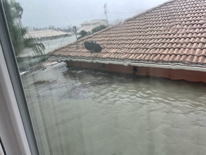
Storm surge outside of my moms house on Fort Myers Beach. I’m so sick.


1:23 PM · Sep 28, 2022·Twitter for iPhone

https://www.orlandosentinel.com/weat...cqe-story.html
 
Deadly Tropical Storm Ian still plaguing Central Florida as statewide toll uncertain

By Richard Tribou, Jeffrey Schweers, Roger Simmons and Jeff Weiner
Orlando Sentinel • Sep 29, 2022 at 8:27 am

Deadly Hurricane Ian was downgraded to Tropical Storm Ian on Thursday morning but was still dumping record amounts of rain to bring “catastrophic flooding” across Florida while still packing damaging winds across a 415-mile swath of the state.

Rising floodwaters stranded vehicles across Central Florida and law enforcement in Volusia County reported the area’s first death while the statewide toll has yet to be determined after hurricane’s storm surge devastated the Gulf Coast.

“While I don’t have confirmed numbers, I know the fatalities are in the hundreds,” said Lee County Sheriff Carmine Marceno on Good Morning America this morning. Lee County was ground zero for Hurricane Ian’s landfall on Wednesday afternoon.

...
https://www.orlandosentinel.com/wea...tropical-storm-ian-florida-thursday-20220929-
 
https://www.wesh.com/article/tony-atkinds-orlando-reporter-floodwaters-rescue/41467030
'My knight in shining armor': WESH 2 reporter reunites with woman he rescued from floodwaters
Updated: 6:21 PM EDT Sep 30, 2022

Meredith McDonough
Anchor

ORLANDO, Fla. —
It's the video being shared around the world — the heroic rescue of a woman stranded in waist-high flood waters in Downtown Orlando.

WESH 2 News reporter Tony Atkins made the courageous move to wade through the water and make the daring rescue. On Friday, he got to meet the woman who he carried on his back to safety, Tonya McCullough...
 
Back
Top