• FluTrackers.com Inc. does not provide medical advice. Information on this web site is collected from various internet resources, and the FluTrackers board of directors makes no warranty to the safety, efficacy, correctness or completeness of the information posted on this site by any author or poster. The information collated here is for instructional and/or discussion purposes only and is NOT intended to diagnose or treat any disease, illness, or other medical condition. Every individual reader or poster should seek advice from their personal physician/healthcare practitioner before considering or using any interventions that are discussed on this website. By continuing to access this website you agree to consult your personal physican before using any interventions posted on this website, and you agree to hold harmless FluTrackers.com Inc., the board of directors, the members, and all authors and posters for any effects from use of any medication, supplement, vitamin or other substance, device, intervention, etc. mentioned in posts on this website, or other internet venues referenced in posts on this website.
  • We are not asking for any donations. Do not donate to any entity who says they are raising funds for us.

El Nino Weather Pattern 2026 - 2027

sharon sanders

Editor-in-Chief & President
Noah Bergren
@NbergWX

Nobody alive has ever experienced an El Niño event this strong.

By this fall, we are tracking a system that easily eclipses the historic events of 2015 and 1997.

On its own, this El Niño could make 2027 extraordinarily hotter than normal for most of the planet—and by a massive margin.

We measure El Niño by the peak water temperature anomaly in a specific area of the equatorial Pacific.

This year, the heat isn't just baking the surface; it is deeply rooted in the ocean.

Top 4 El Niños Ever Observed: 1. 1877-1878: +2.8°C (Estimated reconstructed ONI index; contributed to global famine) 2. 2015-2016: +2.6°C 3. 1997-1998: +2.4°C 4. 1982-1983: +2.3°C

The Late 2026 Projection: Consensus models are currently averaging a +3.0°C to +3.4°C index by November and December, with extreme outliers approaching +4.0°C. If these averages hold, this system will blow every historical event out of the water.

The strongest El Niño on record likely occurred about 150 years ago in 1877, just after the end of a regional cool period known as the "Little Ice Age" and before human carbon emissions began rapidly impacted warming the planet. That event shows just how destructive these cycles can be even without the added heat trapped in today's atmosphere.

While that historical context gives us a baseline, the immediate focus is what this means for us locally as we head into winter. I will dive deeper into the Florida forecast once summer winds down, but historically, similar years have produced multiple significant winter tornado outbreaks. For example, the winters of 1982, 1997, and 2015 all produced EF3 tornadoes (133-165 MPH)—including the deadly "Night of the Tornadoes" that devastated parts of Central Florida in February 1998.

Looking at the broader picture, this system will trigger distinct weather extremes across the globe—to name just a few impacts: The Pacific Ocean: A dramatically higher number of hurricanes for the rest of the year. Florida and the Southern U.S.: Potentially one of the wettest winters on record. Europe: Extreme amounts of localized, heavy rain. Long story short, different parts of the globe experience major El Niño impacts at different times.

This is a globally significant, strengthening weather event that will have clear, undeniable consequences later this year and throughout 2027.

7:45 AM · Aug 18, 2026
·
536
Views
 
We have received a lot of action from the below tweet. 16k views.....

Everyone needs to stay tuned to their local weather stations to get some opinions from their local meteorologists about the impact of this super El Nino in their area.

Screenshot 2026-08-19 091247.webp


We can not offer a global set of advice or suggestions because there will be different impacts depending on your location. No one really knows the impacts except to look at a few past strong El Nino years and guess what this year will be.
 
3 September 2026
Fuelled by exceptionally warm Pacific waters, the El Niño climate pattern is intensifying and has yet to peak. Forecasters are almost certain it will persist through February 2027 – with unusually warm conditions expected across much of the world in the coming months.
-snip-

A supersize problem

And beneath the surface of the tropical Pacific lies another cause for concern. An enormous reservoir of unusually warm water that could continue feeding El Niño in the months ahead.

In some parts of the Pacific, subsurface temperatures in July and early August were more than eight degrees Celsius (around 14 degrees Fahrenheit) above normal.

The combination points toward an unusually powerful climate event unfolding on a planet already significantly warmer because of greenhouse gas emissions.

El Niño is being supersized before our eyes,” UN Secretary-General António Guterres said in a press release on Thursday. “The science leaves no room for doubt: the planet is in uncharted waters, and those waters are heating up.”
-snip-

Scientists have not established that man-made climate change is increasing or intensifying El Niño
.
-snip-

A global pattern, uneven consequences

A very strong El Niño does not mean that every region will experience disasters of the same magnitude.

From September through November, however, forecasters expect above-normal temperatures across nearly the entire Earth’s surface.
Rainfall patterns are also taking on the characteristic signature of El Niño, with greater chances of heavy rain and flooding in some places and drought in others...

Continued: https://news.un.org/en/story/2026/09/1168265
 

#NPM26: Preparing For An El Niño Winter


AVvXsEhSJd90jIQnUWlqqsGKlRemCr--dGr5XhWE7YETIU0a2-teUZ3pOvrHsdb1NlYYgRgl8Hdk8TOx5KNPTvp2JqzULrG_N8nD50UzQxVH1tyPeoFjijjzsX9GUYJ561HBAczFjIlmcIuGVqc8rK_VjdQm2XF1xK4ah4oUBq0Y-9P0RnkheId2cm5AlQ=w320-h203

Credit NOAA

Note: This is the 5th day of National Preparedness Month. Follow this year’s campaign on Twitter by searching for the #NatlPrep #BeReady or #PrepMonth hashtags.
This month, as part of NPM26, I’ll be rerunning some updated preparedness essays, along with some new ones.
#19,324

Two years ago I was forced to evacuate (for the 3rd time in 10 years) from my west-central Florida home due to the approach of hurricane Milton, which passed 50-60 miles to my south.

While I live roughly 40 miles inland, and at a high (for Florida) elevation, we saw prolonged hurricane force winds, massive tree damage, and - thanks to 14" of rain in a few hours - a 500 year-flood.
It took 4 days for the water to recede enough for me to return home. Luckily I had a `disaster buddy' who took me and my cat in for the duration. I was lucky, my home wasn't flooded, although some only a hundred yards away were.
It took 4 days to get power back on, and a week to get internet (see Signs of Life). While my home took substantial wind damage, it was inland flooding that caused the worst damage to my community.
Now, imagine that sort of rain dump happening - perhaps repeatedly - this winter in California. That's the growing concern for state officials (see ABC-7 News 'Super El Niño' strengthens, triggering preparations for possible flooding in LA County).


Depending on the intensity, duration, and frequency of such storms, it could even lead to an ARkStorm event, which we first looked at 15 years ago in ARkStorm: California’s other "Big One".


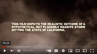
While it sounds like the plot from a bad made-for-cable Sci Fi film, this actually comes from the USGS Multi Hazards Demonstration Project(MHDP) analysis of a winter storm scenario with historical precedence.
From the USGS website:

Experts have designed a large, scientifically realistic meteorological event followed by an examination of the secondary hazards (for example, landslides and flooding), physical damages to the built environment, and social and economic consequences. The hypothetical storm depicted here would strike the U.S. West Coast and be similar to the intense California winter storms of 1861 and 1862 that left the central valley of California impassible. The storm is estimated to produce precipitation that in many places exceeds levels only experienced on average once every 500 to 1,000 years.


USGS Video On ARkStorm
We returned to this topic in 2022's California's ARkStorm Scenario Revisited, after the USGS released an updated assessment; one that suggested that as the climate grows hotter and dryer, it increases the odds of seeing another catastrophic ARkStorm event.

Despite the recent prevalence of severe drought, California faces a broadly underappreciated risk of severe floods. Here, we investigate the physical characteristics of “plausible worst case scenario” extreme storm sequences capable of giving rise to “megaflood” conditions using a combination of climate model data and high-resolution weather modeling.

Using the data from the Community Earth System Model Large Ensemble, we find that climate change has already doubled the likelihood of an event capable of producing catastrophic flooding, but larger future increases are likely due to continued warming. We further find that runoff in the future extreme storm scenario is 200 to 400% greater than historical values in the Sierra Nevada because of increased precipitation rates and decreased snow fraction. These findings have direct implications for flood and emergency management, as well as broader implications for hazard mitigation and climate adaptation activities.
(Continue . . . )

This is an extreme scenario - and remains a low probability event despite this winter's El Niño - but even something less severe could cause considerable damage, and potentially loss of life.

So, the question is, how ready are you and your family for severe weather this winter? The LA County website advises:

LA County is preparing its flood control and emergency response systems now. Crews are inspecting and maintaining dams, debris basins, channels, storm drains, and pump stations; monitoring burn areas, hillsides, and other areas at risk of flooding and debris flows; and preparing for evacuations, emergency shelter, and other storm response. County teams are also preparing to assist people experiencing homelessness, older adults, and others who may need additional help during severe weather.

Here’s what residents can do now:
  • Sign up for emergency alerts: Go to alert.lacounty.gov to receive emergency notifications, including evacuation warnings and orders.
  • Know the risks where you live: If you are near a hillside, canyon, recent burn area, or area that can flood, learn your flood and mudflow risk before a storm.
  • Make an evacuation plan: Know where you will go and how you will get there if you need to leave quickly.
  • Have supplies ready: Keep enough food, water, medications, and other essentials for up to 10 days.
  • Prepare your home: Clear gutters, downspouts, and storm drains, fix roof leaks, and get sandbags before heavy rain is in the forecast.
  • Consider flood insurance: Standard homeowners insurance does not cover flood damage. Flood insurance is separate and can take at least 30 days to go into effect.
  • Need help with mud or debris flow risk? Call LA County Public Works at 1-800-933-0930 to speak with an engineer.
  • Know someone experiencing homelessness who needs help? Visit homeless.lacounty.gov/get-help/


But it isn't just California that could be impacted by a strong El Niño.

Here in Florida - where we are enjoying the quietest Atlantic Hurricane Season in recent memory - we've a history of seeing strong winter storms during El Niño years, including the tornado outbreak of 1998 which killed 42 people.
Predicting exactly where unusual or severe weather will occur this winter due to El Niño is impossible, but generally, the jet stream across the United States shifts storm tracks to the southern tier of states.


While this doesn't guarantee that other areas will get a free ride this winter, it does suggest that California may be unusually wet, and ice storms and blizzards may be more likely to develop across the deep south this coming winter.


Exactly where that may happen is unknowable, but five years ago (Feb 2021) 3 successive winter storms swept across Texas, Louisiana, and Oklahoma, causing the worst collapse of the Texas energy grid on record (see Texas: The Latest - But Not The Last - Grid Down Crisis).
At least 4.5 million homes were without power during a week of bitter winter temperatures, resulting in hundreds of deaths and tens of billions of dollars of damage (see City of Austin & Travis County 2021 WINTER STORM URI AFTER-ACTION REVIEW).


AVvXsEji_bcJVvkjCZlYywwM4By8OCA4K2QRLyBsTAwnC2g0FDAKr-rHf4V-QVItnmPvEojdWE_cOOScV4UKv6exKmlnjn0QUNyBlwJn27FLkXOTxd2Anet8WScaXQgb65T-9EuoD2TWNXLCb_gqlnQdJlu7I6GK6cq6QbVudmuW8ZgBz5vE0Zc-XRI=w343-h400


While I can't tell you where the next natural disaster will strike, or how bad it will be, being prepared for whatever comes is your best defense.


So, if the grid goes down, or flood waters rise, or the ground begins to shake . . . do you already have?
  • A battery operated NWS Emergency Radio to find out what was going on, and to get vital instructions from emergency officials
  • A decent first-aid kit, so that you can treat injuries
  • Enough non-perishable food and water on hand to feed and hydrate your family (including pets) for the duration
  • A way to provide light when the grid is down.
  • A way to cook safely without electricity
  • A way to purify or filter water
  • A way to handle basic sanitation and waste disposal.
  • A way to stay cool (fans) or warm when the power is out.
  • A small supply of cash to use in case credit/debit machines are not working
  • An emergency plan, including meeting places, emergency out-of-state contact numbers, a disaster buddy, and in case you must evacuate, a bug-out bag
  • Spare supply of essential prescription medicines that you or your family may need
  • A way to entertain yourself, or your kids, during a prolonged blackout
If not, you've got some important work to do. A good place to get started is by visiting Ready.gov.


https://afludiary.blogspot.com/2026/09/npm26-preparing-for-el-nino-winter.html
 
Sep 21, 2026

Governor Newsom proclaims state of emergency to bolster statewide El Nino preparedness, protect California​

Proclaims states of emergency in several counties to support recovery from earlier storm activity and other events

What you need to know: Governor Newsom is taking early action to prepare California for what is shaping up to be a historic El Niño season, which is forecast to be very strong, even the strongest on record. The state of emergency helps California move faster to protect communities, stage critical resources, and strengthen readiness before severe weather intensifies.
SACRAMENTO – As a historic El Niño storm season develops, Governor Newsom is proclaiming a state of emergency today, mobilizing state resources ahead of potential winter storms and other impacts. The emerging El Niño event is already breaking records, and forecasters expect it to continue to strengthen, potentially becoming the strongest in recorded history. Today’s emergency proclamation streamlines measures to help California prepare for this historic event.

The Governor’s action puts California in a stronger position before winter weather intensifies. It directs state agencies to begin protecting vulnerable communities, prepare roads and critical infrastructure, stage emergency supplies, and help local partners reduce flood, landslide, and coastal risks.

Read the full proclamation here.
California is strongest when we look out for one another. That is what this action is about. Giving communities the support they need, giving first responders the tools to do their jobs, and giving families the confidence that their state is ready.

We are preparing for this El Niño early because every Californian deserves to be safe in their home, connected to their community, and protected when severe weather comes.

Governor Gavin Newsom
El Niño is a natural climate pattern marked by warmer-than-average ocean temperatures in the tropical eastern Pacific, which can shift weather patterns and bring wetter, more intense winters to California. Climate change can supercharge this natural climate pattern. A study published in the journal Science last month found El Niño events are now more than 36% stronger than before the industrial era, with this trend accelerating over the last 40 years as the planet warms.

Today’s emergency proclamation mobilizes state resources and streamlines procurement to prepare for El Niño’s anticipated impacts, like strong storms and coastal flooding. Among the actions ordered, the emergency proclamation directs state agencies to lead the state’s flood-risk-reduction efforts, stage flood-fighting supplies such as sandbags and pumps, and pre-position other critical equipment. Caltrans will stage traffic-control, road-closure, and snow-removal equipment along the highways most at risk. The proclamation also prepares the California National Guard to support flood response, search-and-rescue, engineering, and logistics missions when needed. State environmental and natural resources agencies will support local efforts to prepare for flooding, landslides, and debris flows, by fast-tracking permitting and identifying other ways to cut red tape.

“We are not waiting for this season’s storms to be on our doorstep,” said Cal OES Director Caroline Thomas Jacobs. “Cal OES is leading California’s statewide efforts by bringing state and local partners together, conducting advance planning efforts, and identifying potential needs before impacts occur. By planning early and coordinating resources ahead of El Niño, we are working to ensure communities and first responders have the personnel, equipment, and support they need to prepare for severe weather, respond quickly when conditions change, and protect lives and property across California.”

“California is already taking steps now to protect communities from a potentially historic El Niño because we know how serious these weather extremes driven by climate change can be,” said California Natural Resources Secretary Wade Crowfoot. “Through the Governor’s state of emergency, we’re cutting red tape and fast‑tracking the flood‑protection and broader preparedness work communities need now. We’re mobilizing with our partners to safeguard people, infrastructure, and natural resources before the worst storms arrive.”

The proclamation also directs the Governor’s Office of Emergency Services, in consultation with relevant state agencies, to expand accessible, multilingual public preparedness communications related to severe weather, flooding, emergency alerts, evacuation readiness, power outages, and more.

A Growing Threat

This fall and winter could be dangerous, and Californians should take it seriously. Federal forecasters say El Niño is strengthening, with a greater than 90% chance of a very strong event this fall and winter and a 75% chance it could reach historic strength. In plain terms, the Pacific is unusually warm, and that warmth can shift storm tracks and load the atmosphere with more energy over the months ahead.

For California, that can mean repeated rounds of heavy rain, strong winds, mountain snow, flooding, landslides, debris flows, large waves, and coastal flooding, especially when storms hit during very high tides. For families, that can mean roads closed by flooding or rockslides, power outages, neighborhoods cut off, damage to homes and businesses, and fast-changing conditions that leave little time to react.

That is why Governor Newsom is acting early, and why residents and homeowners should act now too: know their flood risk, clear drains and gutters, sign up for alerts, and make a plan before severe weather arrives.

Additional Emergency Actions​

In addition, Governor Newsom today proclaimed states of emergency to support recovery efforts for three severe weather events that previously caused significant damage in Glenn, Humboldt, Kern, Mendocino, and Santa Barbara Counties, and a major sewage spill that caused significant damage in Lake County.

A copy of the proclamation for the Glenn, Humboldt, and Mendocino storms event can be found here.

A copy of the proclamation for the Kern County storm event can be found here.

A copy of the proclamation for the Santa Barbara storm event can be found here.

A copy of the proclamation for the Lake County Sewage Spill can be found here.

Further, after consultation with the affected counties, Governor Newsom also signed a proclamation terminating 34 open states of emergency for various fires, storms, and other events in 2023 and 2024 for which a proclaimed state of emergency is no longer necessary to facilitate response and recovery efforts.

A copy of the proclamation terminating these states of emergency can be found here.

What is El Niño?

El Niño refers to the periodic warming of sea surface temperatures in the eastern Pacific Ocean. Usually, the tropical western Pacific is warmer than the tropical eastern Pacific; in El Niño, however, this pattern reverses, and the eastern Pacific warms significantly. This changes circulation and precipitation patterns around the world. Although specific, localized impacts are unpredictable, El Niño often produces more frequent and intense storms over California. These storms can produce dangerous flooding, landslides, debris flows, erosion, and other dangerous impacts. This year, California has already experienced coastal flooding attributed to El Niño—as “Kelvin waves” raise sea levels and offshore Pacific hurricanes (fueled by warm water in the eastern Pacific) drive strong waves battering the California coast.

How Californians can prepare

El Niño does not guarantee a wet winter or any particular storm, but it heightens the risk of strong storms in California. Californians should prepare now for the possibility of heavy rain, snow, and flooding:

  • Sign up for alerts. Get local emergency alerts here and follow trusted sources.
  • Know your flood risk. Find out whether your home or workplace is in a flood-prone area or downslope of an area recently affected by wildfire, where heavy rain can increase the risk of flooding, debris flows, and mudslides.
  • Stay informed. Pay attention to weather forecasts and sign up for emergency alerts from your city or county. Conditions can change quickly during major storms, so follow instructions from local emergency officials.
  • Have an evacuation plan. Know where you would go and how you would get there if you need to leave quickly. Keep an emergency kit ready, including plans, medications, and supplies for pets and other animals.
  • Never drive through floodwater. Water on flooded roads can be deeper and faster-moving than it appears, and roadways may be damaged or washed out beneath the water. Turn around and find another route.
 
Back
Top Bottom