• FluTrackers.com Inc. does not provide medical advice. Information on this web site is collected from various internet resources, and the FluTrackers board of directors makes no warranty to the safety, efficacy, correctness or completeness of the information posted on this site by any author or poster. The information collated here is for instructional and/or discussion purposes only and is NOT intended to diagnose or treat any disease, illness, or other medical condition. Every individual reader or poster should seek advice from their personal physician/healthcare practitioner before considering or using any interventions that are discussed on this website. By continuing to access this website you agree to consult your personal physican before using any interventions posted on this website, and you agree to hold harmless FluTrackers.com Inc., the board of directors, the members, and all authors and posters for any effects from use of any medication, supplement, vitamin or other substance, device, intervention, etc. mentioned in posts on this website, or other internet venues referenced in posts on this website.
  • We are not asking for any donations. Do not donate to any entity who says they are raising funds for us.

​Hurricane Michael Public Advisory - Hurricane warning issued for the Gulf Coast of Florida

Pathfinder

Editor, Senior Moderator
Hurricane Michael Public Advisory
...

000
WTNT34 KNHC 081740
TCPAT4

BULLETIN
Hurricane Michael Intermediate Advisory Number 8A
NWS National Hurricane Center Miami FL AL142018
200 PM EDT Mon Oct 08 2018

...CENTER OF MICHAEL PASSING NEAR THE WESTERN TIP OF CUBA...
...HEAVY RAINFALL AND STRONG WINDS SPREADING ACROSS WESTERN CUBA...
...RISK OF LIFE-THREATENING STORM SURGE...HEAVY RAINFALL...AND
DANGEROUS WINDS INCREASING FOR THE NORTHEASTERN GULF COAST...


SUMMARY OF 200 PM EDT...1800 UTC...INFORMATION
----------------------------------------------
LOCATION...21.7N 85.1W
ABOUT 20 MI...30 KM SW OF THE WESTERN TIP OF CUBA
ABOUT 145 MI...230 KM NE OF COZUMEL MEXICO
MAXIMUM SUSTAINED WINDS...75 MPH...120 KM/H
PRESENT MOVEMENT...N OR 360 DEGREES AT 7 MPH...11 KM/H
MINIMUM CENTRAL PRESSURE...978 MB...28.88 INCHES


WATCHES AND WARNINGS
--------------------
CHANGES WITH THIS ADVISORY:

None

SUMMARY OF WATCHES AND WARNINGS IN EFFECT:

A Hurricane Warning is in effect for...
* The Cuban province of Pinar del Rio

A Tropical Storm Warning is in effect for...
* The Cuban province of the Isle of Youth
* The coast of Mexico from Tulum to Cabo Catoche, including Cozumel

A Storm Surge Watch is in effect for...
* Navarre Florida to Anna Maria Island Florida, including Tampa Bay

A Hurricane Watch is in effect for...
* Alabama-Florida border to Suwannee River Florida

A Tropical Storm Watch is in effect for...
* Suwannee River to Anna Maria Island Florida, including Tampa Bay
* Alabama-Florida border to the Mississippi-Alabama border

A Hurricane Warning means that hurricane conditions are expected
somewhere within the warning area.

A Tropical Storm Warning means that tropical storm conditions are
expected somewhere within the warning.

A Storm Surge Watch means there is a possibility of life-
threatening inundation, from rising water moving inland from the
coastline, in the indicated locations during the next 48 hours.
For a depiction of areas at risk, please see the National Weather
Service Storm Surge Watch/Warning Graphic, available at
hurricanes.gov.

A Hurricane Watch means that hurricane conditions are possible
within the watch area. A watch is typically issued 48 hours
before the anticipated first occurrence of tropical-storm-force
winds, conditions that make outside preparations difficult or
dangerous.

A Tropical Storm Watch means that tropical storm conditions are
possible within the watch area, generally within 48 hours.

Interests elsewhere across the southeastern United States should
monitor the progress of Michael.

For storm information specific to your area in the United
States, including possible inland watches and warnings, please
monitor products issued by your local National Weather Service
forecast office. For storm information specific to your area outside
the United States, please monitor products issued by your national
meteorological service.


DISCUSSION AND OUTLOOK
----------------------
At 200 PM EDT (1800 UTC), the center of Hurricane Michael was
located near latitude 21.7 North, longitude 85.1 West. Michael is
moving toward the north near 7 mph (11 km/h). A northward to
north-northwestward motion at a slightly faster forward speed is
expected through Tuesday night, followed by a northeastward motion
on Wednesday and Thursday. On the forecast track, the center of
Michael will pass near the western tip of Cuba within the next
couple of hours and move into the southeastern Gulf of Mexico by
tonight. Michael will move across the eastern Gulf of Mexico Tuesday
and Tuesday night, is expected to move inland over the Florida
Panhandle or Florida Big Bend area on Wednesday, and then move
northeastward across the southeastern United States Wednesday night
and Thursday.


Maximum sustained winds are near 75 mph (120 km/h) with higher
gusts. Steady to rapid strengthening is forecast during the next day
or so, and Michael is forecast to become a major hurricane by
Tuesday or Tuesday night.


Hurricane-force winds extend outward up to 30 miles (45 km) from
the center and tropical-storm-force winds extend outward up to 175
miles (280 km).

The latest minimum central pressure reported by an Air Force Reserve
reconnaissance aircraft is 978 mb (28.88 inches).


HAZARDS AFFECTING LAND
----------------------
STORM SURGE: The combination of a dangerous storm surge and the
tide will cause normally dry areas near the coast to be flooded by
rising waters moving inland from the shoreline. The water has the
potential to reach the following heights above ground if peak surge
occurs at the time of high tide...

Indian Pass FL to Crystal River FL...8-12 ft
Okaloosa/Walton County Line FL to Indian Pass FL...5-8 ft
Crystal River FL to Anclote River FL...4-6 ft
Anclote River to Anna Maria Island FL including Tampa Bay...2-4 ft
Navarre FL to Okaloosa/Walton County Line FL...2-4 ft

WIND: Hurricane conditions will spread across the far western part
of the Cuban province of Pinar del Rio this afternoon and evening.
Tropical storm conditions are expected across the remainder of the
warning areas in Cuba and the Yucatan Peninsula later today.

Hurricane conditions are possible within the hurricane watch area
along the U.S. Gulf Coast by Wednesday, with tropical storm
conditions possible by Tuesday night or early Wednesday. Tropical
storm conditions are possible within the tropical storm watch area
by Tuesday night or early Wednesday.


RAINFALL: Michael is expected to produce the following rainfall
amounts through the weekend...

Western Cuba...4 to 8 inches, with isolated maximum amounts of 12
inches. This rainfall could lead to life-threatening flash floods
and mudslides.

Florida Panhandle and Big Bend into the Carolinas...4 to 8
inches, with isolated maximum amounts of 12 inches. This rainfall
could lead to life threatening flash floods.

Florida Peninsula, Florida Keys, portions of the Mid-Atlantic
States, and the southern New England coast...2 to 4 inches with
local amounts of 6 inches. This rainfall could lead to life-
threatening flash floods.

Yucatan Peninsula...1 to 2 inches.

SURF: Swells generated by Michael are affecting the south coast of
Cuba and the east coast of the Yucatan Peninsula. Swells are
expected to begin affecting the coast of the eastern and northern
Gulf of Mexico during the next day or so. These swells are likely
to cause life-threatening surf and rip current conditions. Please
consult products from your local weather office.


NEXT ADVISORY
-------------
Next complete advisory at 500 PM EDT.

$$
Forecaster Brown

https://www.nhc.noaa.gov/text/refres.../081740.shtml?


--------------------------------------
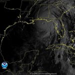
1000x1000.jpg


https://cdn.star.nesdis.noaa.gov/GOE.../1000x1000.jpg
 
000
WTNT34 KNHC 082041
TCPAT4

BULLETIN
Hurricane Michael Advisory Number 9
NWS National Hurricane Center Miami FL AL142018
400 PM CDT Mon Oct 08 2018

...MICHAEL BRINGING HURRICANE-FORCE WINDS AND HEAVY RAINFALL TO
WESTERN CUBA...
...STORM SURGE AND HURRICANE WARNINGS ISSUED FOR THE NORTHEASTERN
GULF COAST...


SUMMARY OF 400 PM CDT...2100 UTC...INFORMATION
----------------------------------------------
LOCATION...22.2N 85.2W
ABOUT 30 MI...45 KM NW OF THE WESTERN TIP OF CUBA
ABOUT 520 MI...835 KM S OF APALACHICOLA FLORIDA
MAXIMUM SUSTAINED WINDS...80 MPH...130 KM/H
PRESENT MOVEMENT...N OR 355 DEGREES AT 9 MPH...15 KM/H
MINIMUM CENTRAL PRESSURE...978 MB...28.88 INCHES


WATCHES AND WARNINGS
--------------------
CHANGES WITH THIS ADVISORY:

A Storm Surge Warning has been issued for the Gulf Coast of Florida
from the Okaloosa/Walton County Line to Anclote River.

The Storm Surge Watch has been extended west of Navarre Florida to
the Alabama/Florida border.

A Hurricane Warning has been issued for the Gulf Coast of Florida
from the Alabama/Florida border eastward to Suwannee River.

A Hurricane Watch has been issued from the Alabama/Florida border
westward to the Mississippi/Alabama border.

A Tropical Storm Warning has been issued from the Alabama/Florida
border westward to the Mississippi/Alabama border and from Suwannee
River Florida southward to Chassahowitzka Florida.

A Tropical Storm Watch has been issued from the Mississippi/Alabama
border westward to the Mouth of the Pearl River.

SUMMARY OF WATCHES AND WARNINGS IN EFFECT:

A Storm Surge Warning is in effect for...
* Okaloosa/Walton County Line Florida to Anclote River Florida

A Storm Surge Watch is in effect for...
* Anclote River Florida to Anna Maria Island Florida, including
Tampa Bay
* Alabama/Florida border to Okaloosa/Walton County Line Florida

A Hurricane Warning is in effect for...
* Alabama/Florida border to Suwannee River Florida
* The Cuban province of Pinar del Rio

A Hurricane Watch is in effect for...
* Alabama/Florida border to the Mississippi/Alabama border

A Tropical Storm Warning is in effect for...
* Alabama/Florida border to the Mississippi/Alabama border
* Suwanee River Florida to Chassahowitzka Florida
* The Cuban province of the Isle of Youth
* The coast of Mexico from Tulum to Cabo Catoche, including Cozumel

A Tropical Storm Watch is in effect for...
* Chassahowitzka to Anna Maria Island Florida, including Tampa Bay
* Mississippi/Alabama border to the Mouth of the Pearl River

A Storm Surge Warning means there is a danger of life-threatening
inundation, from rising water moving inland from the coastline,
during the next 36 hours in the indicated locations. For a depiction
of areas at risk, please see the National Weather Service Storm
Surge Watch/Warning Graphic, available at hurricanes.gov. This is a
life-threatening situation. Persons located within these areas
should take all necessary actions to protect life and property from
rising water and the potential for other dangerous conditions.
Promptly follow evacuation and other instructions from local
officials.

A Hurricane Warning means that hurricane conditions are expected
somewhere within the warning area. A warning is typically issued
36 hours before the anticipated first occurrence of tropical-storm-
force winds, conditions that make outside preparations difficult or
dangerous. Preparations to protect life and property should be
rushed to completion.

A Tropical Storm Warning means that tropical storm conditions are
expected somewhere within the warning area within 36 hours.

A Storm Surge Watch means there is a possibility of life-
threatening inundation, from rising water moving inland from the
coastline, in the indicated locations during the next 48 hours.

A Hurricane Watch means that hurricane conditions are possible
within the watch area. A watch is typically issued 48 hours
before the anticipated first occurrence of tropical-storm-force
winds, conditions that make outside preparations difficult or
dangerous.

A Tropical Storm Watch means that tropical storm conditions are
possible within the watch area, generally within 48 hours.

Interests elsewhere across the southeastern United States should
monitor the progress of Michael.

For storm information specific to your area in the United States,
including possible inland watches and warnings, please monitor
products issued by your local National Weather Service forecast
office. For storm information specific to your area outside the
United States, please monitor products issued by your national
meteorological service.


DISCUSSION AND OUTLOOK
----------------------
At 400 PM CDT (2100 UTC), the center of Hurricane Michael was
located near latitude 22.2 North, longitude 85.2 West. Michael is
moving toward the north near 9 mph (15 km/h). A northward to
north-northwestward motion at a slightly faster forward speed is
expected through Tuesday night, followed by a northeastward motion
on Wednesday and Thursday. On the forecast track, the center of
Michael will move into the southeastern Gulf of Mexico this evening,
then move across the eastern Gulf of Mexico Tuesday and Tuesday
night. The center of Michael is expected to move inland over the
Florida Panhandle or Florida Big Bend area on Wednesday, and then
move northeastward across the southeastern United States Wednesday
night and Thursday.

Maximum sustained winds have increased to near 80 mph (130 km/h)
with higher gusts. Steady to rapid strengthening is forecast during
the next day or so, and Michael is forecast to become a major
hurricane by Tuesday or Tuesday night.

Hurricane-force winds extend outward up to 35 miles (55 km) from the
center and tropical-storm-force winds extend outward up to 175 miles
(280 km). A wind gust to 75 mph (120 km/h) was reported at an
observing site in Isabel Rubio in the Cuban province of Pinar del
Rio earlier this afternoon.

The estimated minimum central pressure is 978 mb (28.88 inches).


HAZARDS AFFECTING LAND
----------------------
STORM SURGE: The combination of a dangerous storm surge and the
tide will cause normally dry areas near the coast to be flooded by
rising waters moving inland from the shoreline. The water has the
potential to reach the following heights above ground if peak surge
occurs at the time of high tide...

Indian Pass FL to Cedar Key FL...8-12 ft
Cedar Key FL to Crystal River FL...6-8 ft
Okaloosa/Walton County Line FL to Indian Pass FL...5-8 ft
Crystal River FL to Anclote River FL...4-6 ft
Anclote River to Anna Maria Island FL including Tampa Bay...2-4 ft
Alabama/Florida border to Okaloosa/Walton County Line FL...2-4 ft

WIND: Hurricane conditions will continue over portions of the
far western Cuban province of Pinar del Rio through this evening.
Tropical storm conditions are expected across the remainder of the
warning areas in Cuba and the Yucatan Peninsula through tonight.

Hurricane conditions are expected within the hurricane warning
area along the U.S. Gulf Coast by Wednesday, with tropical storm
conditions expected by Tuesday night or early Wednesday. Tropical
storm conditions are expected in the tropical storm warning area by
Tuesday night or early Wednesday, and are possible within the
tropical storm watch area by that time. Hurricane conditions
are possible within the hurricane watch area by Wednesday.

RAINFALL: Michael is expected to produce the following rainfall
amounts through Friday...

Western Cuba...4 to 8 inches, with isolated maximum amounts of 12
inches. This rainfall could lead to life-threatening flash floods
and mudslides.

Florida Panhandle and Big Bend across Georgia into South Carolina...
4 to 8 inches, with isolated maximum amounts of 12 inches. This
rainfall could lead to life threatening flash floods.

Florida Peninsula, Florida Keys, North Carolina, portions of the
Mid-Atlantic States, and the southern New England coast...2 to 4
inches with isolated maximum amounts of 6 inches. This rainfall
could lead to life-threatening flash floods.

Yucatan Peninsula...1 to 2 inches.

SURF: Swells generated by Michael are affecting the south coast of
Cuba and the east coast of the Yucatan Peninsula. Swells are
expected to begin affecting the coast of the eastern and northern
Gulf of Mexico during the next day or so. These swells are likely
to cause life-threatening surf and rip current conditions. Please
consult products from your local weather office.


NEXT ADVISORY
-------------
Next intermediate advisory at 700 PM CDT.
Next complete advisory at 1000 PM CDT.

$$
Forecaster Brown

https://www.nhc.noaa.gov/text/refresh/MIATCPAT4+shtml/082041.shtml?
 
000
WTNT34 KNHC 091147
TCPAT4

BULLETIN
Hurricane Michael Intermediate Advisory Number 11A
NWS National Hurricane Center Miami FL AL142018
700 AM CDT Tue Oct 09 2018

...MICHAEL STRENGTHENING WHILE MOVING NORTH-NORTHWESTWARD OVER THE
SOUTHEASTERN GULF OF MEXICO...
...LIFE-THREATENING STORM SURGE...HURRICANE FORCE WINDS...AND HEAVY
RAINFALL EXPECTED ALONG THE NORTHEASTERN GULF COAST...


SUMMARY OF 700 AM CDT...1200 UTC...INFORMATION
----------------------------------------------
LOCATION...24.5N 86.1W
ABOUT 395 MI...635 KM S OF PANAMA CITY FLORIDA
ABOUT 365 MI...590 KM S OF APALACHICOLA FLORIDA
MAXIMUM SUSTAINED WINDS...100 MPH...155 KM/H
PRESENT MOVEMENT...NNW OR 345 DEGREES AT 12 MPH...19 KM/H
MINIMUM CENTRAL PRESSURE...968 MB...28.58 INCHES


WATCHES AND WARNINGS
--------------------
CHANGES WITH THIS ADVISORY:

The Tropical Storm Warning for the Cuban province of Pinar del Rio
has been discontinued.

SUMMARY OF WATCHES AND WARNINGS IN EFFECT:

A Storm Surge Warning is in effect for...
* Okaloosa/Walton County Line Florida to Anclote River Florida

A Storm Surge Watch is in effect for...
* Anclote River Florida to Anna Maria Island Florida, including
Tampa Bay
* Alabama/Florida border to Okaloosa/Walton County Line Florida

A Hurricane Warning is in effect for...
* Alabama/Florida border to Suwannee River Florida

A Hurricane Watch is in effect for...
* Alabama/Florida border to the Mississippi/Alabama border

A Tropical Storm Warning is in effect for...
* Alabama/Florida border to the Mississippi/Alabama border
* Suwanee River Florida to Chassahowitzka Florida

A Tropical Storm Watch is in effect for...
* Chassahowitzka to Anna Maria Island Florida, including Tampa Bay
* Mississippi/Alabama border to the Mouth of the Pearl River
* Fernandina Beach Florida to South Santee River South Carolina

A Storm Surge Warning means there is a danger of life-threatening
inundation, from rising water moving inland from the coastline,
during the next 36 hours in the indicated locations. For a depiction
of areas at risk, please see the National Weather Service Storm
Surge Watch/Warning Graphic, available at hurricanes.gov. This is a
life-threatening situation. Persons located within these areas
should take all necessary actions to protect life and property from
rising water and the potential for other dangerous conditions.
Promptly follow evacuation and other instructions from local
officials.


A Hurricane Warning means that hurricane conditions are expected
somewhere within the warning area. A warning is typically issued
36 hours before the anticipated first occurrence of tropical-storm-
force winds, conditions that make outside preparations difficult or
dangerous. Preparations to protect life and property should be
rushed to completion.

A Tropical Storm Warning means that tropical storm conditions are
expected somewhere within the warning area within 36 hours.

A Storm Surge Watch means there is a possibility of life-
threatening inundation, from rising water moving inland from the
coastline, in the indicated locations during the next 48 hours.

A Hurricane Watch means that hurricane conditions are possible
within the watch area. A watch is typically issued 48 hours
before the anticipated first occurrence of tropical-storm-force
winds, conditions that make outside preparations difficult or
dangerous.

A Tropical Storm Watch means that tropical storm conditions are
possible within the watch area, generally within 48 hours.

Interests elsewhere across the southeastern United States should
monitor the progress of Michael.

For storm information specific to your area in the United States,
including possible inland watches and warnings, please monitor
products issued by your local National Weather Service forecast
office.


DISCUSSION AND OUTLOOK
----------------------
At 700 AM CDT (1200 UTC), the eye of Hurricane Michael was located
near latitude 24.5 North, longitude 86.1 West. Michael is moving
toward the north-northwest near 12 mph (19 km/h). A north-
northwestward to northward motion is expected through tonight,
followed by a northeastward motion on Wednesday and Thursday. On
the forecast track, the center of Michael will move across the
eastern Gulf of Mexico through tonight. The center of Michael is
expected to move inland over the Florida Panhandle or Florida Big
Bend area on Wednesday, and then move northeastward across the
southeastern United States Wednesday night and Thursday.

Data from a NOAA Hurricane Hunter aircraft indicate that the maximum
sustained winds have increased to near 100 mph (155 km/h) with
higher gusts. Additional strengthening is expected, and Michael is
forecast to be a major hurricane at landfall in Florida.
Weakening
is expected after landfall as Michael moves through the southeastern
United States.

Hurricane-force winds extend outward up to 40 miles (65 km) from
the center and tropical-storm-force winds extend outward up to 195
miles (315 km). NOAA buoy 42003 recently reported 1-minute mean
winds of 47 mph (76 km/h) and a wind gust of 54 mph (87 km/h).

The latest minimum central pressure reported by the NOAA aircraft is
968 mb (28.58 inches).


HAZARDS AFFECTING LAND
----------------------
STORM SURGE: The combination of a dangerous storm surge and the
tide will cause normally dry areas near the coast to be flooded by
rising waters moving inland from the shoreline. The water has the
potential to reach the following heights above ground if peak surge
occurs at the time of high tide...

Indian Pass FL to Cedar Key FL...8-12 ft
Cedar Key FL to Crystal River FL...6-8 ft
Okaloosa/Walton County Line FL to Indian Pass FL...6-9 ft
Crystal River FL to Anclote River FL...4-6 ft
Anclote River to Anna Maria Island FL including Tampa Bay...2-4 ft
Alabama/Florida border to Okaloosa/Walton County Line FL...2-4 ft

WIND: Hurricane conditions are expected within the hurricane
warning area along the U.S. Gulf Coast by Wednesday, with tropical
storm conditions expected by tonight or early Wednesday. Hurricane
conditions will also spread well inland across portions of the
Florida Panhandle, southeastern Alabama and southwestern Georgia.

Tropical storm conditions are expected in the tropical storm warning
area by tonight or early Wednesday, and are possible within the
tropical storm watch area by that time. Hurricane conditions are
possible within the hurricane watch area by Wednesday.

Tropical storm conditions are possible in the watch area along the
southeast U.S. coast Wednesday night and Thursday.

RAINFALL: Michael is expected to produce the following rainfall
amounts through Friday...

Western Cuba...4 to 8 inches, with isolated maximum amounts of 12
inches. This rainfall could lead to life-threatening flash floods
and mudslides.

Florida Panhandle and Big Bend, southeast Alabama, and southern
Georgia...4 to 8 inches, with isolated maximum amounts of 12 inches.
This rainfall could lead to life threatening flash floods.

Eastern Georgia, the Carolinas, and southern Virginia...3 to 6
inches. This rainfall could lead to life-threatening flash floods.

Florida Peninsula, eastern Mid Atlantic, southern New England
coast...1-3 inches.

SURF: Swells generated by Michael are beginning to affect the
coasts of the eastern and northern Gulf of Mexico. These swells
will spread to portions of the northwestern and western Gulf of
Mexico coast during the next day or so. These swells are likely
to cause life-threatening surf and rip current conditions. Please
consult products from your local weather office.

TORNADOES: The threat for tornadoes will increase late tonight into
Wednesday over parts of the Florida Panhandle, the northern Florida
Peninsula, and southern Georgia.


NEXT ADVISORY
-------------
Next complete advisory at 1000 AM CDT.

$$
Forecaster Brown

https://www.nhc.noaa.gov/text/refresh/MIATCPAT4+shtml/091147.shtml?
 
096
FXUS62 KTAE 091257
AFDTAE

Area Forecast Discussion
National Weather Service Tallahassee FL
857 AM EDT Tue Oct 9 2018

...POTENTIALLY CATASTROPHIC HURRICANE MICHAEL CONTINUES TO MOVE
NORTH TOWARDS THE NORTHEAST GULF COAST...


...HURRICANE PREPARATIONS NEED TO BE COMPLETED TODAY...

.UPDATE...

No significant changes to the previous forecast appear necessary.

&&

.PREV DISCUSSION [635 AM EDT]...

.NEAR TERM [Through Today]...

Showers and isolated thunderstorms will be possible through the day
under mostly cloudy skies. Highs will be in the mid to upper 80s.


.SHORT TERM [Tonight Through Thursday]...

Key Points...

1. Hurricane Michael is expected to make landfall as a major
hurricane along the Florida Panhandle or western Big Bend on
Wednesday. Conditions will begin to deteriorate late tonight into
early Wednesday.

2. The greatest threats include the danger of life threatening storm
surge along the Florida Panhandle and Big Bend coastlines and
damaging winds that will result in widespread power outages that may
last days to even more than a week in some areas. In
addition, localized flash flooding and a few tornadoes are possible.

3. With evacuation orders in effect, follow the guidance of local
emergency management and evacuate if told to do so.

This timeframe is when the greatest impacts (potentially
catastrophic) from Hurricane Michael will be felt across the area.
Michael continues to strengthen as it moves northward and enters the
southern Gulf of Mexico and is forecast to become a major hurricane
before landfall. Since yesterday, the global models are in better
agreement with the overall speed and track of Michael which
increases confidence in an eventual landfall across the Florida
Panhandle or western Big Bend Wednesday. Significant impacts will
occur as early as Tuesday evening to early Wednesday. Life
threatening storm surge, downed trees and powerlines causing
widespread and long lasting power outages, structural damage
impacting homes and businesses, isolated tornadoes, and flash
flooding are all expected. Your hurricane preparations should be
completed early today.


.LONG TERM [Thursday Night Through Tuesday]...

The current NHC forecast takes Michael into the Carolinas as a
tropical storm on Thursday. By that time, direct impacts from
Michael should be subsiding. As recovery efforts get underway,
expect rain showers and breezy conditions on Thursday. High
temperatures in the mid 80s combined with dew points in the
mid 70s will make for uncomfortable heat indices in the middle
90s, especially for those without air conditioning.

A dry stretch of weather is forecast Thursday night through
Saturday night, along with a cooler and drier air mass.
Temperatures will be more seasonable with highs in the low
to mid 80s and lows in the mid 50s to mid 60s.

For Sunday through Tuesday, a complex pattern sets up which
leads to uncertainty in the sensible weather details. The
area will reside between a cold front approaching from the
west, high pressure nosing down the eastern seaboard, and
greater subtropical moisture to the east. This leads to the
potential for increased shower activity during this period.


.AVIATION [Through 12Z Wednesday]...

MVFR CIGs will develop this morning. Showers are expected in the
afternoon and evening as Hurricane Michael moves closer to the
Panhandle and Big Bend coasts. Winds will be breezy with gusts of 25
to 30 knots expected. Outer rain bands could move into the region
as early as this evening or tonight.


.MARINE...

Hurricane Michael is expected to have a major impact
on the area. Hurricane conditions are looking increasingly
likely with the worst conditions expected on Wednesday.


.FIRE WEATHER...

Red Flag conditions are not expected.


.HYDROLOGY...

Given the track and intensity of Hurricane Michael, widespread
rainfall totals of 4 to 8 inches with isolated 12 inch amounts are
possible. The highest of these totals will be in the Florida
panhandle and western Big Bend counties along and to the east of the
track of Michael. These rainfall amounts will result in flash
flooding.

Current river conditions are below normal levels. With the
anticipated rainfall, expect some of our river basins to rise above
flood stage. This appears most likely in the Ochlockonee River
basin, where there`s potential that a couple of sites reach moderate
flood levels.


.SPOTTER INFORMATION STATEMENT...

Spotter activation is not requested. However, spotters are always
encouraged to safely report significant weather conditions when they
occur by calling the office or tweeting us @NWSTallahassee.

&&

.PRELIMINARY POINT TEMPS/POPS...

Tallahassee 87 77 84 76 88 / 50 50 100 90 50
Panama City 88 77 84 75 86 / 40 80 100 70 40
Dothan 86 75 80 73 84 / 50 30 100 80 50
Albany 87 76 85 76 86 / 50 30 90 90 60
Valdosta 85 75 86 75 87 / 60 30 80 90 60
Cross City 88 78 87 79 89 / 60 30 80 80 60
Apalachicola 86 79 84 77 86 / 40 80 100 70 50

&&

.TAE WATCHES/WARNINGS/ADVISORIES...
FL...Hurricane Warning for Calhoun-Central Walton-Coastal Bay-Coastal
Dixie-Coastal Franklin-Coastal Gulf-Coastal Jefferson-
Coastal Taylor-Coastal Wakulla-Gadsden-Holmes-Inland Bay-
Inland Franklin-Inland Gulf-Inland Jefferson-Inland Wakulla-
Jackson-Leon-Liberty-North Walton-South Walton-Washington.

Tropical Storm Warning for Inland Dixie-Inland Taylor-Lafayette-
Madison.

Flash Flood Watch from 8 PM EDT /7 PM CDT/ this evening through
Thursday morning for Calhoun-Central Walton-Coastal Bay-
Coastal Franklin-Coastal Gulf-Coastal Jefferson-Coastal
Wakulla-Gadsden-Holmes-Inland Bay-Inland Franklin-Inland
Gulf-Inland Jefferson-Inland Wakulla-Jackson-Leon-Liberty-
North Walton-South Walton-Washington.

High Rip Current Risk through late Thursday night for Coastal
Bay-Coastal Franklin-Coastal Gulf-South Walton.

High Surf Warning from 2 PM EDT /1 PM CDT/ this afternoon to 2
AM EDT /1 AM CDT/ Thursday for Coastal Bay-Coastal Franklin-
Coastal Gulf-South Walton.

GA...Hurricane Warning for Baker-Brooks-Calhoun-Colquitt-Decatur-
Dougherty-Early-Grady-Miller-Mitchell-Seminole-Thomas-
Worth.

Tropical Storm Warning for Ben Hill-Berrien-Clay-Cook-Irwin-
Lanier-Lee-Lowndes-Quitman-Randolph-Terrell-Tift-Turner.

Flash Flood Watch from 8 PM EDT this evening through Thursday
morning for Baker-Ben Hill-Brooks-Calhoun-Clay-Colquitt-
Decatur-Dougherty-Early-Grady-Irwin-Lee-Miller-Mitchell-
Quitman-Randolph-Seminole-Terrell-Thomas-Tift-Turner-Worth.

Hurricane Watch for Clay-Lee-Quitman-Randolph-Terrell.

AL...Hurricane Warning for Geneva-Houston.

Tropical Storm Warning for Coffee-Dale-Henry.

Flash Flood Watch from 7 PM CDT this evening through Thursday
morning for Coffee-Dale-Geneva-Henry-Houston.

Hurricane Watch for Coffee-Dale-Henry.

GM...Hurricane Warning for Apalachee Bay or Coastal Waters From
Keaton Beach to Ochlockonee River FL out to 20 Nm-Coastal
Waters From Ochlockonee River to Apalachicola Fl out to 20
Nm-Coastal waters from Suwannee River to Keaton Beach FL
out 20 NM-Coastal waters from Mexico Beach to Apalachicola
FL out 20 NM-Coastal waters from Mexico Beach to Okaloosa
Walton County Line FL out 20 NM-Waters from Suwannee River
to Apalachicola FL from 20 to 60 NM-Waters from
Apalachicola to Mexico Beach FL from 20 to 60 NM-Waters
from Mexico Beach to Okaloosa Walton County Line FL from 20
to 60 NM.

&&

$$

UPDATE...DVD
NEAR TERM...McD
SHORT TERM...Scholl
LONG TERM...LF
AVIATION...McD
MARINE...Scholl
FIRE WEATHER...McD
HYDROLOGY...Scholl

https://forecast.weather.gov/produc...AE&product=AFD&format=CI&version=1&glossary=1
 
000
WTNT34 KNHC 101145
TCPAT4

BULLETIN
Hurricane Michael Intermediate Advisory Number 15A
NWS National Hurricane Center Miami FL AL142018
700 AM CDT Wed Oct 10 2018

...POTENTIALLY CATASTROPHIC HURRICANE MICHAEL HEADING TOWARD THE
FLORIDA PANHANDLE...

...LIFE-THREATENING STORM SURGE...HURRICANE FORCE WINDS...AND HEAVY
RAINFALL IMMINENT...


SUMMARY OF 700 AM CDT...1200 UTC...INFORMATION
----------------------------------------------
LOCATION...29.0N 86.3W
ABOUT 90 MI...145 KM SW OF PANAMA CITY FLORIDA
ABOUT 90 MI...145 KM WSW OF APALACHICOLA FLORIDA
MAXIMUM SUSTAINED WINDS...145 MPH...230 KM/H
PRESENT MOVEMENT...N OR 10 DEGREES AT 13 MPH...20 KM/H
MINIMUM CENTRAL PRESSURE...933 MB...27.55 INCHES


WATCHES AND WARNINGS
--------------------
CHANGES WITH THIS ADVISORY:

None

SUMMARY OF WATCHES AND WARNINGS IN EFFECT:

A Storm Surge Warning is in effect for...
* Okaloosa/Walton County Line Florida to Anclote River Florida

A Storm Surge Watch is in effect for...
* Anclote River Florida to Anna Maria Island Florida, including
Tampa Bay

A Hurricane Warning is in effect for...
* Alabama/Florida border to Suwannee River Florida

A Tropical Storm Warning is in effect for...
* Alabama/Florida border to the Mississippi/Alabama border
* Suwanee River Florida to Chassahowitzka Florida
* North of Fernandina Beach Florida to Surf City North Carolina

A Tropical Storm Watch is in effect for...
* Chassahowitzka to Anna Maria Island Florida, including Tampa Bay
* Mississippi/Alabama border to the Mouth of the Pearl River
* Surf City North Carolina to Duck North Carolina
* Pamlico and Albemarle Sounds

A Storm Surge Warning means there is a danger of life-threatening
inundation, from rising water moving inland from the coastline. For
a depiction of areas at risk, please see the National Weather
Service Storm Surge Watch/Warning Graphic, available at
hurricanes.gov.

A Hurricane Warning means that hurricane conditions are expected
somewhere within the warning area.

A Tropical Storm Warning means that tropical storm conditions are
expected somewhere within the warning area.

A Storm Surge Watch means there is a possibility of life-
threatening inundation, from rising water moving inland from the
coastline.

A Tropical Storm Watch means that tropical storm conditions are
possible within the watch area.

Interests elsewhere across the southeastern United States should
monitor the progress of Michael.

For storm information specific to your area, including possible
inland watches and warnings, please monitor products issued by your
local National Weather Service forecast office.


DISCUSSION AND OUTLOOK
----------------------
At 700 AM CDT (1200 UTC), the eye of Hurricane Michael was located
near latitude 29.0 North, longitude 86.3 West. Michael is moving
toward the north near 13 mph (20 km/h). A turn toward the north-
northeast is expected later this morning, with a turn toward the
northeast expected this afternoon or tonight. A motion toward the
northeast at a faster forward speed is forecast on Thursday and
Friday. On the forecast track, the eye of Michael is expected to
move ashore over the Florida Panhandle later today, move
northeastward across the southeastern United States tonight and
Thursday, and then move off the Mid-Atlantic coast away from the
United States on Friday.

Reports from an Air Force Reserve Hurricane Hunter aircraft
indicate that maximum sustained winds have increased to near 145 mph
(230 km/h) with higher gusts. Michael is an extremely dangerous
category 4 hurricane on the Saffir-Simpson Hurricane Wind Scale.
Some additional strengthening is possible before landfall.
After
landfall, Michael should weaken as it crosses the southeastern
United States.

Hurricane-force winds extend outward up to 45 miles (75 km) from
the center and tropical-storm-force winds extend outward up to 185
miles (295 km). A wind gust to 56 mph (91 km/h) was recently
reported at Apalachicola Regional Airport.

The estimated minimum central pressure based on NOAA and Air Force
Reserve Hunter aircraft data is 933 mb (27.55 inches).


HAZARDS AFFECTING LAND
----------------------
STORM SURGE: The combination of a dangerous storm surge and the
tide will cause normally dry areas near the coast to be flooded by
rising waters moving inland from the shoreline. The water has the
potential to reach the following heights above ground if peak surge
occurs at the time of high tide...

Tyndall Air Force Base FL to Aucilla River FL...9-14 ft
Okaloosa/Walton County Line FL to Tyndall Air Force Base FL...6-9 ft
Aucilla River FL to Cedar Key FL...6-9 ft
Cedar Key FL to Chassahowitzka FL...4-6 ft
Chassahowitzka to Anna Maria Island FL including Tampa Bay...2-4 ft

WIND: Tropical storm conditions are spreading onshore along the
U.S. Gulf Coast within the warning area, with hurricane conditions
spreading onshore later this morning within the hurricane warning
area. Hurricane conditions will also spread well inland across
portions of the Florida Panhandle, southeastern Alabama and
southwestern Georgia later today and tonight.

Tropical storm conditions are expected to spread northward within
the warning area along the southeast U.S. coast beginning tonight,
and are possible in the watch area by late Thursday and Thursday
night.

RAINFALL: Michael is expected to produce the following rainfall
amounts through Friday...

Florida Panhandle and Big Bend, southeast Alabama, and portions of
southwest and central Georgia...4 to 8 inches, with isolated maximum
amounts of 12 inches. This rainfall could lead to life-threatening
flash floods.

The remainder of Georgia, the Carolinas, and southern Virginia...3
to 6 inches, with isolated maximum amounts of 8 inches. This
rainfall could lead to life-threatening flash floods.

Florida Peninsula, eastern Mid Atlantic, southern New England
coast...1-3 inches.

SURF: Swells generated by Michael will affect the coasts of the
eastern, northern, and western Gulf of Mexico during the next day
or so. These swells are likely to cause life-threatening surf
and rip current conditions. Please consult products from your local
weather office.

TORNADOES: A few tornadoes will be possible across parts of the
Florida Panhandle and the northern Florida Peninsula through this
afternoon. This risk will spread into parts of central and southern
Georgia and southern South Carolina this afternoon and tonight.


NEXT ADVISORY
-------------
Next complete advisory at 1000 AM CDT.

$$
Forecaster Brown


https://www.nhc.noaa.gov/text/refres.../101145.shtml?


--------------------------

1000x1000.jpg
 
000
FXUS62 KTAE 101053
AFDTAE

Area Forecast Discussion
National Weather Service Tallahassee FL
653 AM EDT Wed Oct 10 2018

.AVIATION [Through 12Z Thursday]...

Conditions will continue to deteriorate from south to north
across area terminals this morning into the afternoon as
Hurricane Michael moves closer and eventually inland across the
Florida panhandle. Winds will increase with lowering ceilings as
bands of convection move through the region. We will see gradual
improvement late tonight into Thursday morning.


&&

.PREV DISCUSSION [439 AM EDT]...

.NEAR TERM [Today through Tonight]...

Key Points...

1. Hurricane Michael is expected to make landfall as a Category 4
Hurricane along the Florida Panhandle or western Big Bend today as a
storm of unprecedented strength for this area.
Conditions will
continue deteriorating through this afternoon and evening.

2. The greatest threats include the danger of life threatening storm
surge along the Florida Panhandle and Big Bend coastlines and
damaging winds that will result in widespread power outages that may
last days to even more than a week in some areas. In addition,
river flooding and flash flooding and a few tornadoes are expected.

3. The time to prepare is ending. Be prepared to shelter in place
for a long duration of time. As winds increase or a Tornado Warning
is issued be prepared to get to a small interior room away from
outside walls.


Today and tonight is when the greatest, catastrophic impacts from
Hurricane Michael will be felt across the area.
Michael is forecast
to be a category 4 hurricane when it makes landfall along the
Florida Panhandle or western Big Bend this afternoon. Based on
historical data, a hurricane of this strength has NEVER made
landfall in this region and thus this is an event that will have
unprecedented impacts. Bands from Hurricane Michael are already
moving onshore. Be prepared for tornadoes in these
and have a safe interior room to go when when either a Tornado
Warning is issued or the devestating winds from Michael move
onshore.


Life threatening storm surge, downed trees and power lines causing
widespread and long lasting power outages, structural damage impacting
homes and businesses, river flooding and flash flooding, and a few
tornadoes are all expected.


.SHORT TERM [Thursday Through Friday]...

In the wake of the departing hurricane, Thursday will be hot and
very humid with heat indices approaching 100 degrees, especially
over the Florida zones. This will be very uncomfortable
particularly for those residents who are without power due to
Hurricane Michael. Some relief will arrive Thursday night and
Friday as a the first cold front of this fall season sweeps
through the region. Highs on Thursday will be in the mid 80s to
around 90 with highs on Friday ranging from the upper 70s
northwest to mid 80s southeast. Lows Thursday night will range
from the mid 50s northwest to mid 60s southeast.


.LONG TERM [Friday Night Through Wednesday]...

A dry stretch of weather with seasonal temperatures for mid
October is forecast to continue at least through the weekend. For
Monday through Tuesday, a complex pattern sets up which leads to
uncertainty in the sensible weather details. The area will reside
between a cold front approaching from the west, high pressure
nosing down the eastern seaboard, and greater subtropical moisture
to the east. This leads to the potential for increased shower
activity during this period.


.MARINE...

Hurricane Michael is expected to have a major impact on the area.
Hurricane conditions are expected with the worst conditions today
and tonight.


.FIRE WEATHER...

Aside from high dispersion values today, there are no other fire
weather concerns.


.HYDROLOGY...

Given the track and intensity of Hurricane Michael, widespread rainfall
totals of 4 to 8 inches with isolated 12 inch amounts are
possible. The highest of these totals will be in the Florida
panhandle and western Big Bend counties along and to the east of
the track of Michael. These rainfall amounts will result in flash
flooding.

At this time, flood warnings are in effect for portions of the Chipola,
Choctawhatchee, Ochlockonee, and St. Marks Rivers. Despite
current river conditions below normal levels, with the forecast
rainfall, expect additional river basins to rise above flood
stage.


.SPOTTER INFORMATION STATEMENT...

Spotter activation is requested. Spotters should safely report
significant weather conditions and/or damage by calling the office or
tweeting us @NWSTallahassee.

&&

.PRELIMINARY POINT TEMPS/POPS...

Tallahassee 79 76 89 59 82 / 100 100 20 10 0
Panama City 79 74 89 61 81 / 100 70 20 10 0
Dothan 78 73 86 54 78 / 100 100 20 0 0
Albany 83 73 87 55 79 / 100 100 50 10 0
Valdosta 84 76 88 60 82 / 90 100 30 10 0
Cross City 83 78 90 65 86 / 90 90 20 10 0
Apalachicola 81 77 87 64 81 / 100 70 20 10 0

&&

.TAE WATCHES/WARNINGS/ADVISORIES...
FL...Hurricane Warning for Calhoun-Central Walton-Coastal Bay-Coastal
Dixie-Coastal Franklin-Coastal Gulf-Coastal Jefferson-
Coastal Taylor-Coastal Wakulla-Gadsden-Holmes-Inland Bay-
Inland Franklin-Inland Gulf-Inland Jefferson-Inland Wakulla-
Jackson-Leon-Liberty-North Walton-South Walton-Washington.

Flash Flood Watch through Thursday morning for Calhoun-Central
Walton-Coastal Bay-Coastal Franklin-Coastal Gulf-Coastal
Jefferson-Coastal Wakulla-Gadsden-Holmes-Inland Bay-Inland
Franklin-Inland Gulf-Inland Jefferson-Inland Wakulla-
Jackson-Leon-Liberty-North Walton-South Walton-Washington.

Tropical Storm Warning for Inland Dixie-Inland Taylor-Lafayette-
Madison.

High Rip Current Risk through late Thursday night for Coastal
Bay-Coastal Franklin-Coastal Gulf-South Walton.

High Surf Warning until 2 AM EDT /1 AM CDT/ Thursday for Coastal
Bay-Coastal Franklin-Coastal Gulf-South Walton.

GA...Hurricane Warning for Baker-Brooks-Calhoun-Clay-Colquitt-Decatur-
Dougherty-Early-Grady-Lee-Miller-Mitchell-Quitman-Randolph-
Seminole-Terrell-Thomas-Tift-Turner-Worth.

Flash Flood Watch through Thursday morning for Baker-Ben Hill-
Berrien-Brooks-Calhoun-Clay-Colquitt-Cook-Decatur-Dougherty-
Early-Grady-Irwin-Lee-Miller-Mitchell-Quitman-Randolph-
Seminole-Terrell-Thomas-Tift-Turner-Worth.

Tropical Storm Warning for Ben Hill-Berrien-Cook-Irwin-Lanier-
Lowndes.

AL...Hurricane Warning for Dale-Geneva-Henry-Houston.

Flash Flood Watch through Thursday morning for Coffee-Dale-
Geneva-Henry-Houston.

Tropical Storm Warning for Coffee.

GM...Hurricane Warning for Apalachee Bay or Coastal Waters From
Keaton Beach to Ochlockonee River FL out to 20 Nm-Coastal
Waters From Ochlockonee River to Apalachicola Fl out to 20
Nm-Coastal waters from Suwannee River to Keaton Beach FL
out 20 NM-Coastal waters from Mexico Beach to Apalachicola
FL out 20 NM-Coastal waters from Mexico Beach to Okaloosa
Walton County Line FL out 20 NM-Waters from Suwannee River
to Apalachicola FL from 20 to 60 NM-Waters from
Apalachicola to Mexico Beach FL from 20 to 60 NM-Waters
from Mexico Beach to Okaloosa Walton County Line FL from 20
to 60 NM.

&&

$$

NEAR TERM...LF
SHORT TERM...Barry
LONG TERM...Barry
AVIATION...Barry
MARINE...Barry
FIRE WEATHER...Barry
HYDROLOGY...LF

https://forecast.weather.gov/product.php?site=TAE&issuedby=TAE&product=AFD&form at=CI&version=1&glossary=1

-----------------------------------------------------------


southeast_loop.gif


https://radar.weather.gov/Conus/southeast_loop.php
 
[FONT=&quot]FEMAVerified account @fema 2h2 hours ago More


[/FONT]

[FONT=&quot] As Hurricane #Michael nears land, take shelter & stay safe.
1f4f1.png
Follow weather updates on your phone or radio.
1f539.png
In a tornado WARNING, go to an interior, windowless room.
1f539.png
If water comes in, go to the highest floor that?s not flooded but do NOT enter a closed attic.
[/FONT]

[FONT=&quot]
DpJUH4aV4AEl-CK.jpg


[/FONT]

[FONT=&quot] NWS and NOAA
[/FONT]
 
000
WTNT34 KNHC 101450
TCPAT4

BULLETIN
Hurricane Michael Advisory Number 16
NWS National Hurricane Center Miami FL AL142018
1000 AM CDT Wed Oct 10 2018

...CORE OF EXTREMELY DANGEROUS HURRICANE MICHAEL CLOSING IN ON THE
COAST OF THE FLORIDA PANHANDLE...
...LIFE-THREATENING STORM SURGE...HURRICANE FORCE WINDS...AND HEAVY
RAINFALL IMMINENT...


SUMMARY OF 1000 AM CDT...1500 UTC...INFORMATION
-----------------------------------------------
LOCATION...29.4N 86.0W
ABOUT 60 MI...95 KM SSW OF PANAMA CITY FLORIDA
ABOUT 65 MI...100 KM WSW OF APALACHICOLA FLORIDA
MAXIMUM SUSTAINED WINDS...145 MPH...230 KM/H
PRESENT MOVEMENT...NNE OR 15 DEGREES AT 14 MPH...22 KM/H
MINIMUM CENTRAL PRESSURE...928 MB...27.41 INCHES


WATCHES AND WARNINGS
--------------------
CHANGES WITH THIS ADVISORY:

A Tropical Storm Warning has been issued for the coast of North
Carolina from Surf City to Duck including the Pamlico and Albemarle
Sounds.

A Storm Surge Watch has been issued for the coast of North Carolina
from Ocracoke Inlet to Duck.

The Tropical Storm Watch for the Gulf coast west of the Mississippi/
Alabama border has been discontinued.

SUMMARY OF WATCHES AND WARNINGS IN EFFECT:

A Storm Surge Warning is in effect for...
* Okaloosa/Walton County Line Florida to Anclote River Florida

A Storm Surge Watch is in effect for...
* Anclote River Florida to Anna Maria Island Florida, including
Tampa Bay
* Ocracoke Inlet North Carolina to Duck North Carolina

A Hurricane Warning is in effect for...
* Alabama/Florida border to Suwannee River Florida

A Tropical Storm Warning is in effect for...
* Alabama/Florida border to the Mississippi/Alabama border
* Suwanee River Florida to Chassahowitzka Florida
* North of Fernandina Beach Florida to Duck North Carolina
* Pamlico and Albemarle Sounds

A Tropical Storm Watch is in effect for...
* Chassahowitzka to Anna Maria Island Florida, including Tampa Bay

A Storm Surge Warning means there is a danger of life-threatening
inundation, from rising water moving inland from the coastline. For
a depiction of areas at risk, please see the National Weather
Service Storm Surge Watch/Warning Graphic, available at
hurricanes.gov.

A Hurricane Warning means that hurricane conditions are expected
somewhere within the warning area.

A Tropical Storm Warning means that tropical storm conditions are
expected somewhere within the warning area.

A Storm Surge Watch means there is a possibility of life-
threatening inundation, from rising water moving inland from the
coastline.

A Tropical Storm Watch means that tropical storm conditions are
possible within the watch area.

Interests elsewhere across the southeastern United States should
monitor the progress of Michael.

For storm information specific to your area, including possible
inland watches and warnings, please monitor products issued by your
local National Weather Service forecast office.


DISCUSSION AND OUTLOOK
----------------------
At 1000 AM CDT (1500 UTC), the eye of Hurricane Michael was located
near latitude 29.4 North, longitude 86.0 West. Michael is moving
toward the north-northeast near 14 mph (22 km/h). A turn toward the
northeast is expected this afternoon or tonight. A motion toward
the northeast at a faster forward speed is forecast on Thursday
through Friday night. On the forecast track, the core of Michael is
expected to move ashore along the Florida Panhandle early this
afternoon, move northeastward across the southeastern United States
tonight and Thursday, and then move off the Mid-Atlantic coast away
from the United States on Friday.

Data from NOAA and Air Force Reserve Hurricane Hunter aircraft
indicate that maximum sustained winds are near 145 mph (230 km/h)
with higher gusts. Michael is an extremely dangerous category 4
hurricane on the Saffir-Simpson Hurricane Wind Scale. Some
strengthening is still possible before landfall.
After landfall,
Michael should weaken as it crosses the southeastern United States.
Michael is forecast to become a post-tropical cyclone on Friday, and
strengthening is forecast as the system moves over the western
Atlantic.

Hurricane-force winds extend outward up to 45 miles (75 km) from the
center and tropical-storm-force winds extend outward up to 175 miles
(280 km). A private weather station at Bald Point, Florida,
recently reported a sustained wind of 54 mph (87 km/h) with a gust
to 61 mph (98 km/h). A wind gust to 46 mph (74 km/h) was recently
reported inland at Tallahassee, Florida.

The latest minimum central pressure based on data from the
reconnaissance aircraft is 928 mb (27.41 inches).


HAZARDS AFFECTING LAND
----------------------
STORM SURGE: The combination of a dangerous storm surge and the
tide will cause normally dry areas near the coast to be flooded by
rising waters moving inland from the shoreline. The water has the
potential to reach the following heights above ground if peak surge
occurs at the time of high tide...

Tyndall Air Force Base FL to Aucilla River FL...9-14 ft
Okaloosa/Walton County Line FL to Tyndall Air Force Base FL...6-9 ft
Aucilla River FL to Cedar Key FL...6-9 ft
Cedar Key FL to Chassahowitzka FL...4-6 ft
Chassahowitzka to Anna Maria Island FL including Tampa Bay...2-4 ft
Sound side of the North Carolina Outer Banks from Ocracoke Inlet to
Duck...2-4 ft

WIND: Tropical storm and hurricane conditions are spreading
onshore along the U.S. Gulf Coast within the warning areas.
Hurricane conditions will also spread well inland across portions of
the Florida Panhandle, southeastern Alabama and southwestern Georgia
later today and tonight.

Tropical storm conditions are expected to spread northward within
the warning area along the southeast U.S. coast beginning tonight
through Friday.

RAINFALL: Michael is expected to produce the following rainfall
amounts through Friday...

Florida Panhandle and Big Bend, southeast Alabama, and portions of
southwest and central Georgia...4 to 8 inches, with isolated maximum
amounts of 12 inches. This rainfall could lead to life-threatening
flash floods.

The remainder of Georgia, the Carolinas, and southern Virginia...3
to 6 inches, with isolated maximum amounts of 8 inches. This
rainfall could lead to life-threatening flash floods.

Florida Peninsula, eastern Mid Atlantic, southern New England
coast...1-3 inches.

SURF: Swells generated by Michael will affect the coasts of the
eastern, northern, and western Gulf of Mexico during the next day
or so. These swells are likely to cause life-threatening surf
and rip current conditions. Please consult products from your local
weather office.

TORNADOES: Tornadoes are possible across parts of the Florida
Panhandle and the northern Florida Peninsula through this afternoon.
This risk will spread northward into parts of Georgia and southern
South Carolina this afternoon and tonight.


NEXT ADVISORY
-------------
Next intermediate advisory at 100 PM CDT.
Next complete advisory at 400 PM CDT.

$$
Forecaster Brown

https://www.nhc.noaa.gov/text/refresh/MIATCPAT4+shtml/101450.shtml
 
Chopper 2 over Mexico Beach

--------------------
Officials expect more dead as rescuers probe Florida hurricane debris


by Reuters
Friday, 12 October 2018 15:13 GMT

By Devika Krishna Kumar

PORT ST. JOE, Fla., Oct 12 (Reuters) - Rescuers used heavy equipment and search dogs on Friday to look for people trapped or killed in the Florida Panhandle towns devastated by Hurricane Michael, amid expectations the death toll of 12 from the powerful storm will climb.

So far, counties along the hard-hit northwest Florida coast have reported no deaths related to the storm. That could change, as efforts to assess damage and look for casualties in the worst-hit communities have been hampered by downed utility lines and roads blocked by debris and fallen trees.

The concern was for people who ignored evacuation orders ahead of the storm and stayed put in communities that were demolished by Michael's ferocity on Wednesday.
...
About 1.5 million homes and businesses were without power from Florida to Virginia early on Friday, according to utility companies.

It could be weeks before power is restored to the most damaged parts of Florida, such as Panama City.
...
By Friday morning the remnants of Michael had moved into the Atlantic Ocean northeast of Norfolk, Virginia, but still could bring up to 5 inches (13 cm) of rain to parts of New England, the National Hurricane Center said.
...
http://news.trust.org//item/20181012151318-rd99n/
 
[FONT=proxima_nova]Hurricane Michael upgraded to a Category 5 at time of U.S. landfall

Post-storm analysis estimates sustained winds of 160 mph
[/FONT]


[FONT=proxima_nova]April 19, 2019


PHOTO%20-%20Hurricane%20Michael%20makes%20landfall%20at%20Mexico%20Beach%2C%20Fla.%20at%20130%20p.m.%20on%20Oct%2010th%20EDT%20-%20NOAA%20-%201125x534%20-%20Landscape.png
[/FONT]


Scientists at NOAA’s National Hurricane Center conducted a detailed post-storm analysis on all the data available for Hurricane Michael and have determined that the storm’s estimated intensity at landfall was 140 knots (160 mph). This final wind intensity is a 5 knot (5 mph) increase over the operational estimate and makes Michael a category 5 storm on the Saffir-Simpson Hurricane Wind Scale at the time of landfall on October 10, 2018, near Mexico Beach and Tyndall Air Force Base, Florida.

Michael is the first hurricane to make landfall in the United States as a category 5 since Hurricane Andrew in 1992, and only the fourth on record. The others are the Labor Day Hurricane in 1935 and Hurricane Camille in 1969. Michael is also the strongest hurricane landfall on record in the Florida Panhandle and only the second known category 5 landfall on the northern Gulf coast.

PHOTO%20-%20Post-Hurricane%20Micahel%20in%20Mexico%20Beach%2C%20Florida%2C%20Oct.%2014%2C%202018%20-%20U.S.%20Coast%20Guard%20photo%20by%20Petty%20Officer%203rd%20Class%20Hunter%20Medley%20-%20700x420%20-%20Landscape.png

Hurricane Michael devasted Mexico Beach, Florida on Oct. 10, 2018. (U.S. Coast Guard)
Download Image


The real-time operational intensity estimate was 135 knots (155 mph). The final best track intensity estimate of 140 knots (160 mph) was determined by a review of the available aircraft winds, surface winds, surface pressures, satellite intensity estimates and Doppler radar velocities – including data and analyses that were not available in real time. The 5 knot (5 mph) increase in the estimated maximum sustained wind speed from the operational estimate is small and well within the normal range of uncertainty.

Category 5 winds were likely experienced over a very small area at and near the coast, and the change in estimated wind speeds is of little practical significance in terms of the impacts associated with the storm. Michael produced devastating winds and storm surge and was directly responsible for 16 deaths and about $25 billion in damage in the United States. Before hitting the United States, the cyclone brought hurricane-force winds to the western tip of Cuba when it was a category 2 Hurricane.

Along with wind speed, atmospheric pressure is a measure of storm intensity. In general, the lower a storm’s central pressure, the higher the winds. Michael’s central pressure of 919 millibars (mb) at landfall is the third lowest on record for a landfalling U. S. hurricane since reliable records began in 1900, trailing only the Labor Day Hurricane of 1935 (892 mb) and Hurricane Camille of 1969 (900 mb).

https://www.noaa.gov/media-release/h...of-us-landfall
 
Back
Top Bottom