

Pathfinder
Editor, Senior Moderator
Re: Canary Islands Government Raises El Hierro Volcanic Risk Level - PEVOLCA confirms subsea eruption - Red Alert issued for La Restinga
El Hierro Submarine Volcano Eruption
February 16, 2012
 acquired
February 10, 2012 download large image (523 KB, JPEG, 1663x1663)
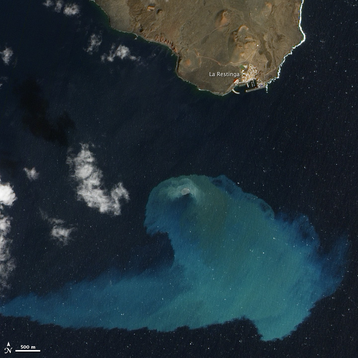
Four months after it began, the underwater volcanic eruption off El Hierro Island persists. This natural-color satellite image, collected on February 10, 2012, shows the site of the eruption, near the fishing village of La Restinga.
Bright aquamarine water indicates high concentrations of volcanic material. Immediately above the vent, a patch of brown water resembles a turbulent hot tub and indicates when and where the eruption is strongest. Video of the eruption shows the activity in more detail.
This image was acquired by the Advanced Land Imager (ALI) aboard the Earth Observing-1 (EO-1) satellite. The eruption is just off the southern coast of El Hierro, the youngest of the Canary Islands. El Hierro is about 460 kilometers (290 miles) west of Morocco and Western Sahara.
According to El Hierro Digital, measurements of the sea floor by the Instituto Oceanogr?fico Espa?ol found that the volcano?s summit is now only 120 meters (390 feet) beneath the ocean surface?10 meters (30 feet) higher than it was in mid-January. The height of the erupting cone is about 210 meters (690 feet) above the former ocean bottom, with a total volume over 145 million cubic meters (5.12 billion cubic feet) of new material.
<DL><DT>Instrument: <DD>EO-1 - ALI</DD></DL>http://earthobservatory.nasa.gov/IOTD/view.php?id=77171
El Hierro Submarine Volcano Eruption
February 16, 2012
 acquired
 February 10, 2012 download large image (523 KB, JPEG, 1663x1663)
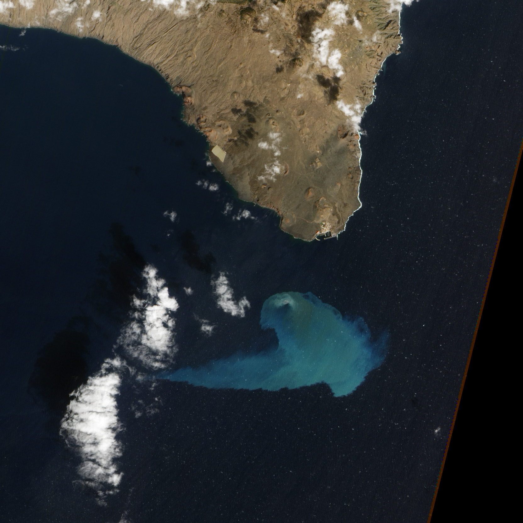
Four months after it began, the underwater volcanic eruption off El Hierro Island persists. This natural-color satellite image, collected on February 10, 2012, shows the site of the eruption, near the fishing village of La Restinga.
Bright aquamarine water indicates high concentrations of volcanic material. Immediately above the vent, a patch of brown water resembles a turbulent hot tub and indicates when and where the eruption is strongest. Video of the eruption shows the activity in more detail.
This image was acquired by the Advanced Land Imager (ALI) aboard the Earth Observing-1 (EO-1) satellite. The eruption is just off the southern coast of El Hierro, the youngest of the Canary Islands. El Hierro is about 460 kilometers (290 miles) west of Morocco and Western Sahara.
According to El Hierro Digital, measurements of the sea floor by the Instituto Oceanogr?fico Espa?ol found that the volcano?s summit is now only 120 meters (390 feet) beneath the ocean surface?10 meters (30 feet) higher than it was in mid-January. The height of the erupting cone is about 210 meters (690 feet) above the former ocean bottom, with a total volume over 145 million cubic meters (5.12 billion cubic feet) of new material.
- References
- El Hierro Digital. (2012, February 14). El IEO ha establecido la profundidad de la cima del cono principal de la erupci?n submarina en 120 metros Accessed February 14, 2012.
- Instituto Oceanogr?fico Espa?ol. (2012, January 20). El cono volc?nico de El Hierro se encuentra a unos 130 metros de profundidad. Accessed February 14, 2012.
- Related Reading
- Instituto Volcanol?gico de Canarias
<DL><DT>Instrument: <DD>EO-1 - ALI</DD></DL>http://earthobservatory.nasa.gov/IOTD/view.php?id=77171
